
Hadrian’s Wall Path
An 85-mile National Trail in the north of England following the route of the 2nd-century Roman wall built to maintain security in occupied Britain and keep out northern raiders. With map, statistics, and GPX route file.
Statistics and Files
Distance: 85 miles (137 km)
Summary
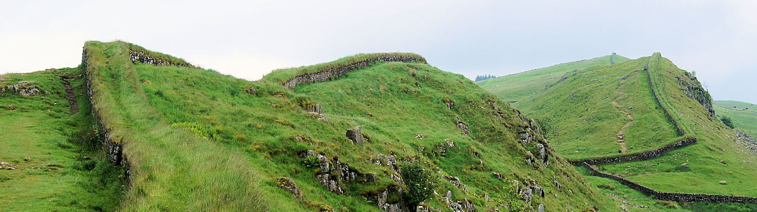
The Hadrian’s Wall Path follows a riverside route along the Tyne before giving way to arable farmland above Tynedale. This opens out into a rough grazing upland section dominated by the Whin Sill escarpment, before gradually descending to the richer pastures of Cumbria and finally the open salt marshes of the Solway Estuary. Highlights along the route include the Roman forts of Segedunum (Wallsend), Chesters, Housesteads, and Birdoswald, as well as the River Tyne bridges, the dramatic Whin Sill crags, and the Solway salt marshes.
Planning & Information Directory
General Information and Planning:
• National Trails Official Guide – Comprehensive route details, accommodation guides, and map requirements.
• Traileasy – Interactive map displaying accommodation along the route for stage planning.
Guided Walking:
None available at present.
Accommodation and Baggage Transfer:
• Lake District Baggage Transfer – Reliable baggage transfer between hotels, hostels, B&Bs, and campsites.
• Absolute Escapes – Self-guided walking packages including accommodation and baggage transfer.
• The Walking Holiday Company – Itineraries and route options with full support packages.
• Contours – Self-guided walking services offering multiple itinerary alternatives.
• Hillwalk Tours – Specialised long-distance walking services across the UK.
• Wandering Aengus Treks – Lake District-based self-guided walking service.
• Macs Adventure – Specialised self-guided walking holidays.
• Discovery Travel – Full self-guided walking holiday service.
• Celtic Trails – Self-guided walking holiday packages.
• Mickledore – Full support service with leisurely walking itineraries.
• Sherpa Van – Renowned baggage transfer and accommodation booking service.
• Walkers Baggage Transfer – Local provider of baggage transfer services.
Accommodation Planning:
• S H Systems – Searchable accommodation directory sorted by price, postcode, or rating.
• Independent Hostels Guide – Independent hostels and bunkhouses along the trail.
• Tantallon House – Recommended B&B near Brampton close to the wall.
Personal Journals:
• Mike Brockhurst’s 2012 Walk Journal – Comprehensive journal including statistics, tracklogs, and stage photographs.
• Peter Donaghy’s Photographic Journal – A photo journal of a walk with family and friends.
Safety Advice & Emergency Services:
• Ramblers Association Safety Advice – Practical guidance on map reading, navigation, and essential gear.
• Mountain Rescue UK – Vital mountain safety and rescue resources.
Feedback and Suggestions
I am always pleased to receive feedback on the structure and content of the website, as well as suggestions for improvements, new routes, or trail alterations. Please get in touch via social media.
(Note: Walking without proper preparation can be dangerous. Information and downloads on this website are provided free of charge; it is each walker’s responsibility to check the material and use accordingly. My walk reports are personal reflections and should not be treated as official route guides.)