Speyside Way
An 84-mile long-distance path and National Trail in Scotland exploring the River Spey from where it enters the Moray Firth at Buckie to Aviemore on the edge of the Cairngorm mountains. With map, statistics, and GPX route file.
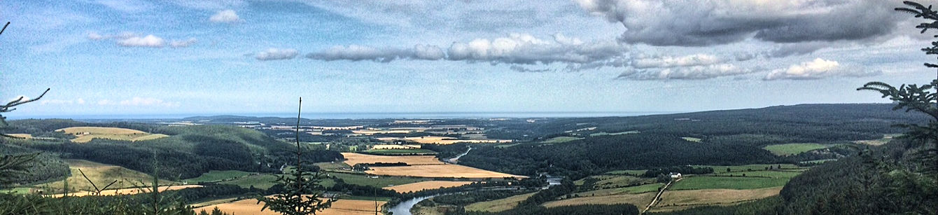
Looking down on the River Spey from a high position on the trail
Statistics and Files
Finish: Aviemore
Distance: 84 miles (135 km) including spurs
Time: 32–42 hours
Duration: 5–7 days
Summary & Route Overview
The Speyside Way runs from Buckie on the shore of the Moray Firth to the famous winter resort of Aviemore. There are two spurs on the walk, one to Dufftown and the other to Tomintoul, bringing the total distance (including spurs) to 84 miles.
The route follows the River Spey south from the Grampian coast through forests, past famous whisky distilleries, and along an old railway track to the renowned Highland resort. The Spey is widely considered to be the fastest-flowing and cleanest river in Britain.
Speyside Way Directory & Planning
General Information and Planning
• Speyside Way Official Site: Dedicated official resource providing all you need when planning the walk.
• Undiscovered Scotland: Introduction to the walk with useful resource links.
Guided Walking
• Lomond: Company specializing in guided walks across Scotland.
Accommodation and Baggage Transfer
• Absolute Escapes: Comprehensive dedicated site providing accommodation and booking services.
• Celtic Trails: Full self-guided walking holiday service.
• Make Tracks: Full range of walking services provided for the Speyside Way.
• Contours: Full range of self-guided walking services with excellent navigation.
• S H Systems: Excellent range of accommodation searchable by location, price, rating, or postcode.
Safety Advice and Emergency Services
• Ramblers Association: Practical walking safety advice, map reading guides, and essential gear lists.
• Mountain Rescue UK: Emergency services and safety guidelines.
Feedback and Suggestions
I am always pleased to receive feedback on the structure and content of the website. I also welcome suggestions on how I can improve the site, which may include new areas to cover, new walks, or route alterations. Please get in touch via social media. Thank you.
(Note: Walking without proper preparation can be dangerous. Information and downloads on this website are provided free of charge; it is each walker’s responsibility to check the material and use accordingly. Postscript: My walk reports are personal reflections and should not be treated as official route guides.)