Llangoed, where the walk begins, has an activities and study centre and a 17th-century church. You cross the bridge at the north end of the village and head off along a pleasant path through woods beside the Afon Lleiniog, a small river. For much of the way the ground on either side is thickly carpeted with wildflowers: yellow primroses and daffodils cluster at the feet of oaks and birches in spring, and flag irises grub beside the water.
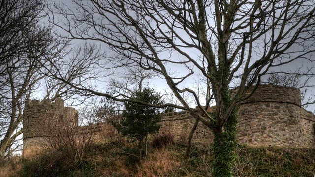
Castell Aberlleiniog, a symmetrical wooded hill just north of the path, is easy to miss when the trees are in full leaf. This man-made earth mound stands 30 feet high and once supported a timber castle built by the Earl of Chester in 1088; the ruined stone bailey now visible on top was built later. The mound is a sanctuary for wildflowers, with aconites, primroses, violets, campions, wood anemones, and daisies thick on the ground in springtime, well displayed in their tiers on the sloping ground.
After this botanical delight, the walk continues for some way along the road, following the shoreline of the Menai Strait. At low tide, you can take a shortcut across the sand and shingle beach. Virtually the whole length of the Snowdonia range is visible across the strait; you may just discern the peak of Yr Wyddfa (Snowdon) itself, though this is best seen at dawn when the sun looms up from behind the mountain, or at sunset when the mountains are warmly lit from the front.
The expansive views also take in Great Ormes Head. The scene is magnificent, both at high tide looking across ten miles of water and at low tide when much of that distance is covered by glistening wet sand. Those who love to watch boats sailing to and fro should take this walk on a summer's weekend or in the first week of August, when the Menai Strait Regatta takes place.
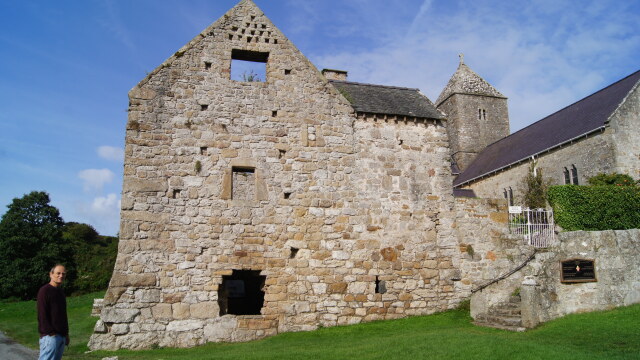
Leaving the beach and moving inland, the route reaches the cluster of ancient buildings around Penmon Priory, which St Cynlas founded in the 6th century and later gave to his brother St Seiriol. It was largely destroyed by the Vikings and rebuilt in the Norman style between 1120 and 1170. The church was massive for such a small building, and the interior, lit by tiny windows, is dark and mysterious.
A roofless, ruined 13th-century refectory with a first-floor dormitory occupies one side of the cloister with later buildings attached. The Church of St Seiriol, which sits in the grounds above the priory, was also rebuilt in the 12th century and is in good repair, with the nave and transepts being fine examples of Norman architecture. An elaborately carved stone cross in the church was brought in from nearby fields; it shows Scandinavian and Irish influences, and the main carving depicts the Temptation of St Anthony.
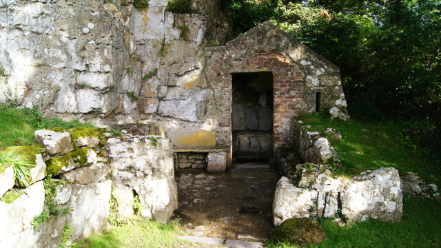
The prior's house is still lived in, which helps to bring this religious site to life. Nearby, at the base of a rocky outcrop and well hidden by trees and bushes, is St Seiriol's Well in a cell with stone benches — probably St Seiriol's tiny church — while an oval cell in the rock close by is believed to have been where he lived.
Being a monastic community, that at Penmon was self-sufficient. The monks had a fish pond near St Seiriol's Well, and there are elaborate pigsties and a deer park. The large domed dovecote was built around 1600, probably by Sir Richard Bulkeley, and is well worth a look. Entered by a low doorway, it features a central stone pillar rising almost to the roof with corbelled steps to reach any of the 1,000 nests lining the wall where a monk would have rested his ladder.
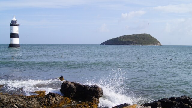
From the priory site, a private toll road (a right of way to pedestrians) runs out to Penmon Point, where lighthouse keepers' and coastguards' cottages overlook Puffin Island (Ynys Seiriol). This is a popular place for picnics to the accompaniment of the sea swishing over a bright white limestone shingle beach as it races in and out of the narrows of Puffin Sound, along with the melancholy note of the fog bell which tolls in fair weather and foul in the lighthouse a short way off the point.
The return walk to Llangoed is mostly along narrow lanes. You pass many attractive whitewashed cottages with pretty gardens, and there are fine views over the strait. At Pentir there is an example of a 'croglofft' house — a two-room, single-storey cottage converted to a two-storey building by inserting a wooden platform (this upper storey is reached by means of a removable ladder level with the eaves). The name is derived from the Welsh word 'crog', meaning to hang; in medieval times crogloffts were formed by boards placed across the top of cupboards to provide sleeping places.
Acknowledgment: Text derived from the Out and Out Series; Discovering the Countryside on Foot. Pictures courtesy of Wikipedia.