Flatts Lane Country Park, Eston Moor and Eston Nab
The hollow hill, above Eston Moor's old iron mine, woodland and wildlife thrive
Google Maps Open Source Maps| Statistics and Files | ||
|---|---|---|
| Start: Flatts Lane Country Park | Distance: 4.4 miles (7.0 km) | Climbing: 220 metres |
| Grid Ref: NZ 55127 16991 | Time: 2=3 hours | Rating: Easy |
| GPX Route File | Google Earth File | About Eston |
| Statistics | |
|---|---|
| Start: Flatts Lane Country Park | Distance: 4.4 miles (7.0 km) |
| Climbing: 220 metres | Grid Ref: NZ 55127 16991 |
| Time: 2-3 hours | Rating: Easy |
| GPX Route File | Google Earth File |
Ordnance Survey Explorer Map (1:25,000)
The Walk:
 Monument on Eston Nab
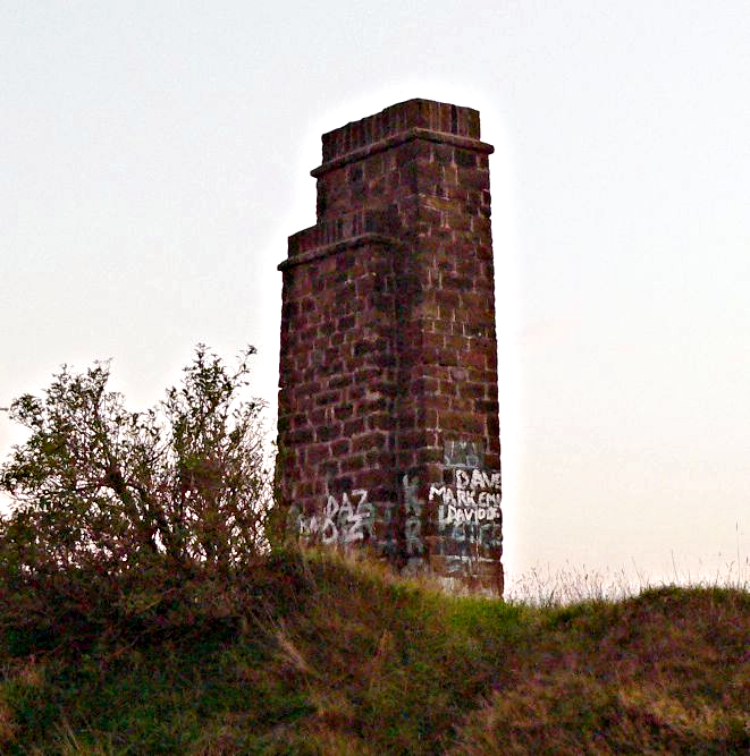
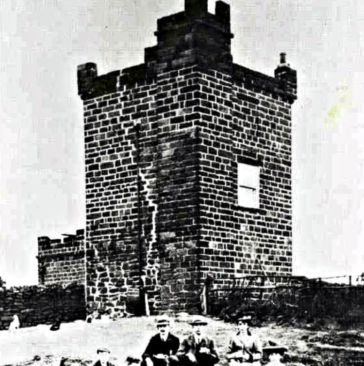 The Beacon on Eston Nab
To the east of Middlesbrough lies Eston Moor, rising from the Cleveland plain to a height of around 800 feet (280 metres). The steady climb to the moor from Flatts Lane Country Park offers spectacular views over middlesbrough and the plateau is an area rich with wildlife. The view from the summit at Eston Nab extends far into Durham and southwards to the North York Moors. Mining ceased here in 1950 and nature has reclaimed the land. In the deciduous woodland you may find a variety of woodland birds. with luck there may be a Nuthatch or Treecreeper.
The plateau of Eston Moor is a mixture of grass and moorland with downy birch trees and gorse bushes. The mixed habitat may have Yellowhammers, Whinchat and Skylarks singing overhead. You may also see Kestrels soaring on the breeze looking for small rodents and other mammals moving in the undergrowth. There are also Pheasants and Red Grouse while Curlew and Redshank may move onto the hill from the rich mud flats of the Tees Estuary.
At the summit of Eston Nab is a monument set within the site of an ancient hill fort. The site, built in the late Bronze Age was abandoned when the romans arrived. The site is believed to have been for lookout purposes only as there is little evidence of a settlement. A Beacon, see picture, used to stand on the hilltop. It was one of a series built to warn of a possible sea invasion by the Spanish Armada.
From Eston Nab there are extensive views to the distinctive pointed Roseberry Topping and to the Captain Cook monument on Easby Moor. In the same direction the line of Cleveland Hills traversed on the Cleveland Way are also in view.
In 1850 two mining engineers discovered a thick seam of ironstone on Eston Moor. A mine was created and the ironstone was transported through the hill with the railway below the beacon site. A community lived near the mine in two rows of terraced houses, served by a small chapel. On occasions food from the hamlet was brought through the mine and raised up the mine shaft to the workers. The seam has long been used up and the mine is now disused. The mining activites took 6.3 milliuon tonnes of ironstone, thus the common name for Eston Nab being the Hollow Hill.
Acknowledgments: Text derived from the Out and Out Series; Discovering the Countryside on Foot. Pictures courtesy of Wikipedia


