Offa's Dyke Path National Trail
A personal record of my walk of Offa's Dyke Path National Trail with written journal and photographs. Tracklogs for GPS units and for use with Google Earth are available for download for each stage.
Journal, Photographs and Download Files
Stage 1: Prestatyn to Bodfari
Google Maps Open Source Maps| Statistics and Files | ||
|---|---|---|
| Start: Prestatyn | Finish: Bodfari | Distance: 11.5 miles (18.5 km) |
| Time: 5-6 hours | Climbing: 759 metres | Rating: Moderate |
| GPX Route File | Google Earth File | About Offa's Dyke |
| Statistics | |
|---|---|
| Start: Prestatyn | Finish: Bodfari |
| Distance: 11.5 miles (18.5 km) | Time: 5-6 hours |
| Climbing: 759 metres | Rating: Moderate |
| GPX Route File | Google Earth File |
Ordnance Survey Explorer Map (1:25,000)
The Walk:
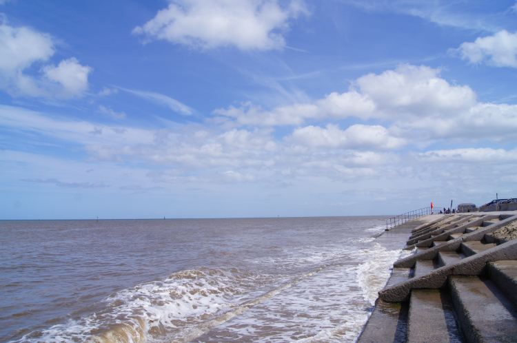 The Irish Sea at Prestatyn
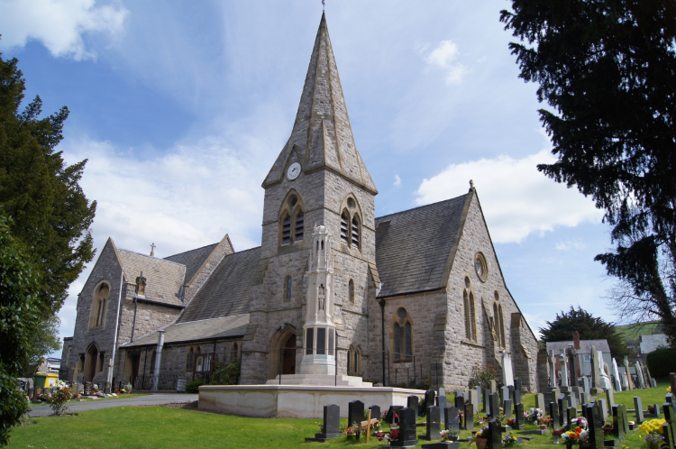 The Parish Of Prestatyn
The thing about Coast to Coast walks, such as Offa's Dyke Path, is that the walk begins at zero meters altitude and that you are climbing from step one. No way to warm up before the climb.... usually. However the beginning of my 180 mile walk north to south on the line of the ancient 1,200 year old earthwork separating Anglian Mercia and the Welsh kingdom of Powys was on a flat start along the length of Bastion Road, all 800 meters of it which I did both ways. First from Prestatyn train station to the official start/ end of the walk at Prestatyn Nova Centre. After standing on Prestatyn Sands Breakwater and then touching the stone memorial marking the starting point of the National Trail I was on my way. Heading south towards Chepstow. After passing holidaymakers and day trippers with their plastic buckets and spades and beach inflatables on Bastion Road I passed the railway station and made my way into town. Plastic toys were now replaced by plastic bags as I passed the Tesco Supermarket and reaching the High Street I headed along it, dead straight and to my first uphill ascent. After picking up a pasty, sandwich and drink from a local deli I continued walking past the grey stone Parish Of Prestatyn church and then past the red brick Rehoboth Welsh Presbyterian Chapel. Climbing still and on a steepening gradient I crossed the A547 and walked on Fforddlas through a housing estate to reach Roman Helmet Park. I was now out of the town and climbing ever steeper up a hill.
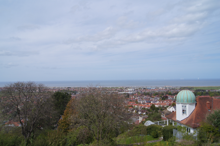 View to Prestatyn from the hillside
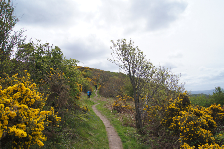 On the steep climb from Prestatyn
I paused at a seating area near Roman Helmet Park and took in the view. I looked across the rooftops of Prestatyn at the scene and then I turned to look at my path ahead a little disappointedly as the early day sunshine which still shined over the Irish Sea had deserted the inland. Cloud was building and I guessed it meant to stay the day. Still it was dry and the cloud cover of the sun meant I did not perspire too much on the steep climb of Prestatyn Hill. There was no sign of Offa's Dyke here I thought. "Why bother when you have a blooming great big hill to keep the undesired out". While the lack of sunshine had dulled the inland cover the lovely yellow and vibrant blossom of Gorse lit up the pathside on the first climb of the trail. As I climbed I met other people on the hill. none I spoke to were doing the trail, all were day walkers on local walks.
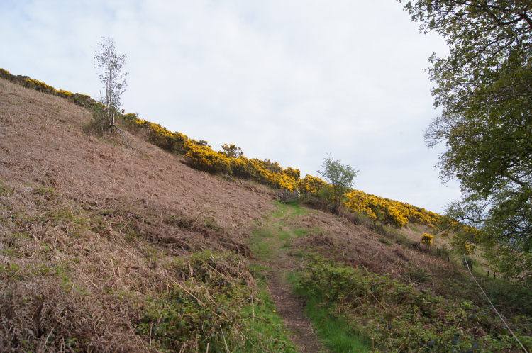
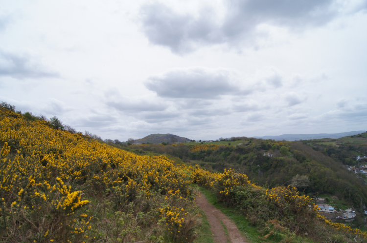 Flowering gorse alongside Offa's Dyke Path
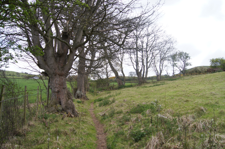 Following a tree line
A hour and half after setting off from the seafront in Prestatyn I arrived at Prestatyn Hillside Nature Reserve and rounded the top of the hill, losing sight of the town and focusing on the inland route ahead of me. Two isolated hills captured my attention, both rounded humps not dissimilar in appearance to man-made formed Silbury Hill in Wiltshire. These are entirely natural though. Graig Fawr and Y Foel are reef knolls standing above the floor of a rift valley. My eyes were drawn to them constantly as I continued southwards on a undulating walk set between 100 meters and 200 meters elevation as I cleared the gorse covered hillside and as I continued over high farmlands on field-side paths and rural lanes. I passed the site of a derelict mill and met a number of inquisitive farm animals. Some cows, none of them any bother, and some sheep, none of them particularly timid. I was enjoying myself now, loving my long distance walking and looking forward to my twelve days of wonder.
 North Wales countryside
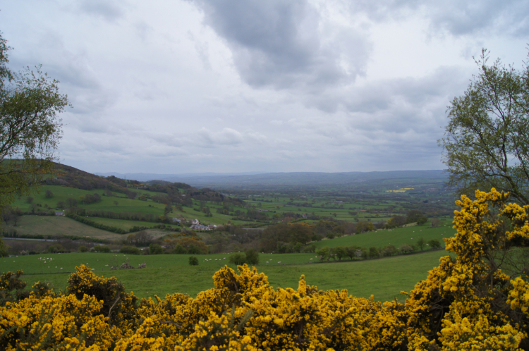 View north from Marian Ffrith
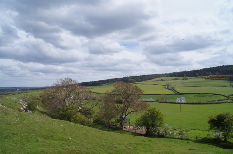
I continued on my merry way, across lush green and extremely quiet North Wales countryside. I passed Henfryn Hall, Marian Mill Farm, more disused works and Byrn Cnewyllyn. I ambled across fields to cross a minor road at Morwylfa with not a car in sight. The world seemed temporarily stopped here. It felt like I was the only one on the move. Quite surreal, quite haunting and yet amazing. I passed thorough the farmyard of Tyddyn-y-cyll where at least I was paid some attention. A pack of guard dogs came out and warned of my presence. I will rephrase that. Four little toy dogs ran to me barking as they approached but none of them posed any threat at all. They were friendly whippersnappers. I paid the the complement of saying hello to each and everyone before leaving the yard by a gate and crossing another field. now on a climb to Marian Ffrith a low hill with the site of a prehistoric hillfort on the summit. There are lots of hillforts to look forward to on my Offa's Dyke Path walk but this first one had me stumped. Apart from a full scattered rocks and a raised grass hump which is common of lots of fields I could not make anything out. The view from the 240 meters high hilltop was sufficient compensation for the short climb for me.
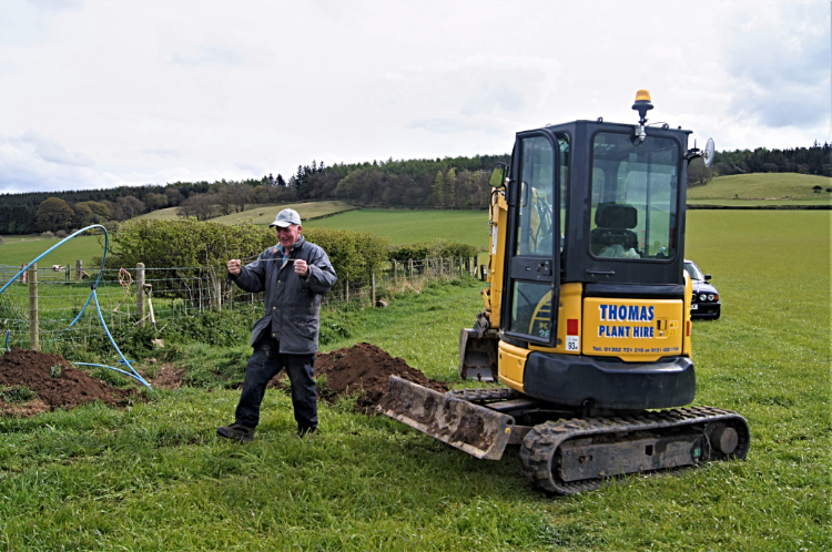 Dowsing for water
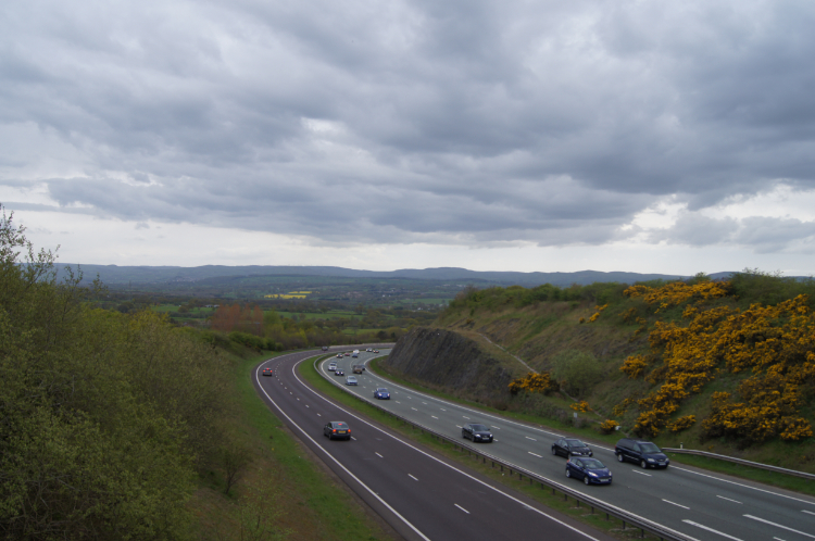 Crossing the A55 near Rhuallt
Next in line of significant walk points after Marian Ffrith was my walk through the village of Rhuallt and the crossing of the A55. Before I the village though I met a chap in a field who was doing something very familiar to me. Crossing from Pen-y-mynydd to Bryn Llithrig Hall I saw he was using a mini-digger to excavate holes in the corner of a field which were randomly spread. Leaving the path which was 100 meters away from him I went for a chat. He told me he was looking for a leak on pipework feeding water troughs and that he was not having much luck. I knew how he felt, I too had spent days looking for the most elusive leaking pipes. So where modern technology in the form of electronic pipe detectors failed the art of water divining/ dowsing for water came into its own. It had worked for me in the past and I wished him well hoping it would work for him too before I resumed my walk. Continuing past Bryn Llithrig Hall and through Rhuallt led me to the familiar hum of major road noise from the A55. I crossed the road bridge while under increasingly leaden skies which thankfully had not burst.
 Climbing the northern extremity of the Clwydian Range
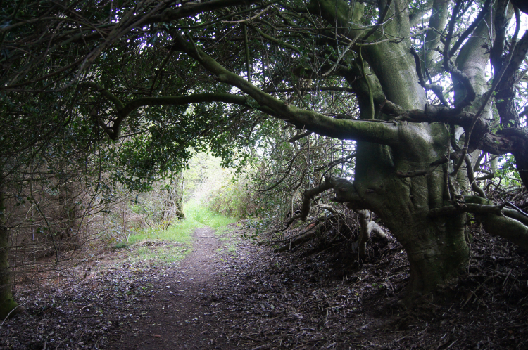 Woodland path near Bodfari
I had descended 150 meters from Bryn Llithrig Hall to the A55 crossing, a loss which had to be regained over the following mile of my walk. My feet were warmed to the task now and the 150 meter climb was not as noticeable as the first of the day up Prestatyn Hill. This climb to also introduced me to the Clwydian Range, an AONB, Area of Outstanding Natural Beauty which is renowned for its purple, heather-clad hills, dramatically situated hillforts and wonderful views. I was not in the season of purple heather, instead being compensated with the yellow gorse and the brilliant colour of Bluebells anticipated ahead. Still the promise of wonderful views applied. Once up at height again at on Cefn Du, at 258 meters my highest point of the walk so far, I could see back to Prestatyn and the Irish Sea, now over 10 miles distant. From Cefn Du I had just over a mile to go to reach Bodfari, the end of stage one of my Offa's Dyke Path walk. Along country lanes and minor roads I went on a constant descent of 100 meters to my destination at. During this last stage I constantly had an elevated view to the upright pole of Moel-y-Parc transmitting station. The pole is 235 metres high making it the tallest structure in North Wales and it stands on Moel Y Parc which I will cross early tomorrow. For now though I set my attention on finding Llety'r Eos Ucha, Mold Road, Bodfari which took a little doing but I made it to my accommodation. Day one of twelve was done, a great start. "Now for some sleep. There are big hills tomorrow" I thought. I looked forward to that.


