Offa's Dyke Path National Trail
A personal record of my walk of Offa's Dyke Path National Trail with written journal and photographs. Tracklogs for GPS units and for use with Google Earth are available for download for each stage.
Journal, Photographs and Download Files
Stage 5: Llanymynech to Kingswood
Google Maps Open Source Maps| Statistics and Files | ||
|---|---|---|
| Start: Llanymynech | Finish: Kingswood | Distance: 16.2 miles (26.0 km) |
| Time: 7-8 hours | Climbing: 495 metres | Rating: Hard |
| GPX Route File | Google Earth File | About Offa's Dyke |
| Statistics | |
|---|---|
| Start: Llanymynech | Finish: Kingswood |
| Distance: 16.2 miles (26.0 km) | Time: 7-8 hours |
| Climbing: 495 metres | Rating: Hard |
| GPX Route File | Google Earth File |
Ordnance Survey Explorer Map (1:25,000)
The Walk:
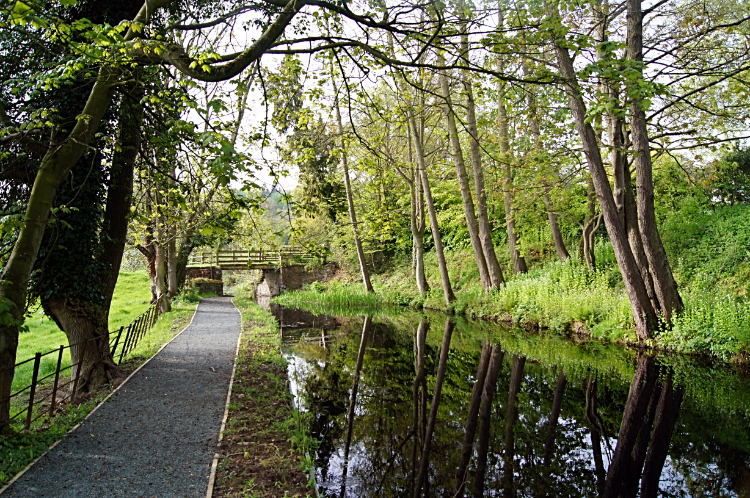
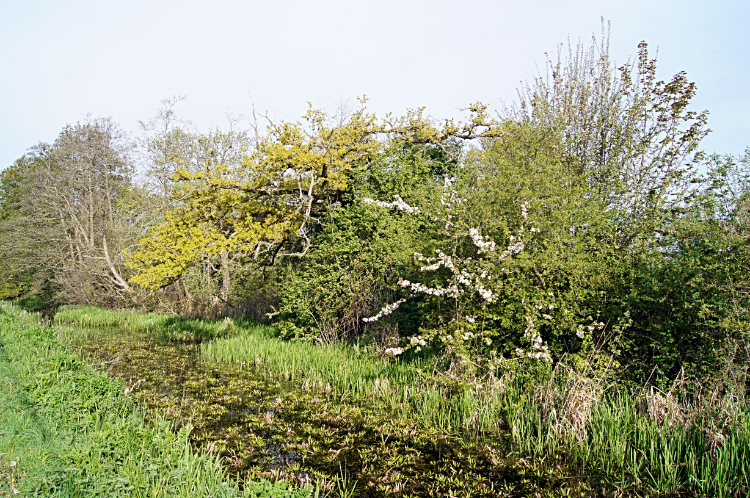 Unnavigable Montgomery Canal near Llanymynech
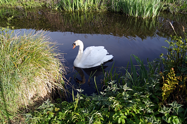 The friendly Swan
At last, a sunny morning, the first of my walk. Seeing the good weather I was keen to be on my way and after th earliest breakfast possible at the Cross Keys I was out and walking. The first part of my walk today was following the Montgomery Canal for two and a half miles on a semi circular route to Llandysilio. I could have saved one and a quarter miles by walking due south on the edge of the A483 but why would I do that. At the canal and before I set off on my way I read an information board indicating the way to go on three separate paths. My route, Offa's Dyke Path pointed west along the canal. Heading in the opposite way pointed to the Shropshire Way and also to Wat's Dyke Path. I never knew of Wat's Dyke, a similar earthwork to Offa's and running parallel to it three miles apart, for a length of around 40 miles. I do now. As well as being good for health and well being walking is a great educator. On my way along the canal I went, watching the wildlife enjoying this unnavigable stretch of water. Reeds and other plants stretch out well towards the center of the cut near Llanymynech. Swans, Ducks and Moorhens appreciated the disuse. Indeed a friendly Swan followed me for about one hundred meters as I ambled along. I was in no hurry yet. The sun was shining, the surroundings charming.
 Montgomery Canal at Walls Bridge
 Aqueduct carrying Montgomery Canal over the River Vyrnwy
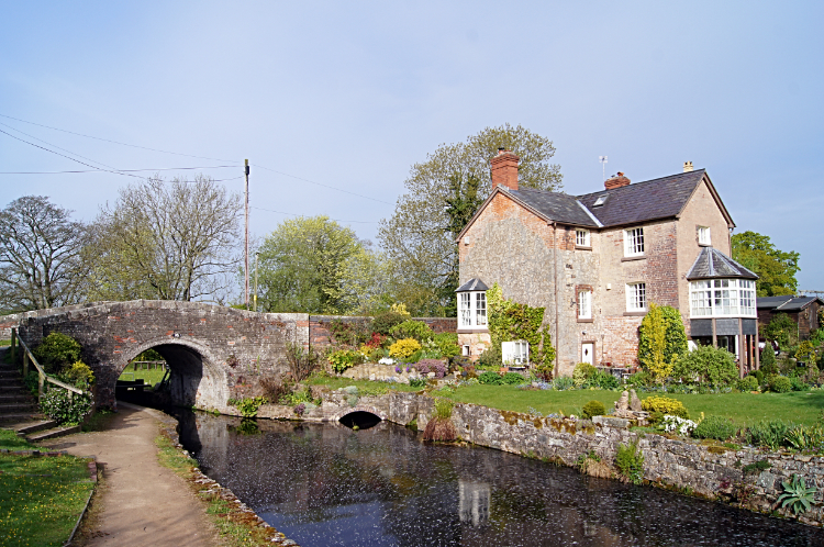
After my first quarter mile of the day I came to Walls Bridge where the scene completely changed. All the plant life in the canal was now cleared and there were working canal locks. I was now walking a navigable stretch of water though I never saw a narrowboat. I continued to enjoy my amble on the towpath through the waterfowl which were plentiful during the untended stretch of canal were now absent from the scene. They had plenty of food and reassuring cover further back so I understood why they preferred to stay there. While I did not see much wildlife after the locks at Walls Bridge, the towpath walk to Wern and on past Carreghofa Locks was very pleasant. Soon after passing Carreghofa Locks I came to an impressive aqueduct which carried Montgomery Canal across the River Vyrnwy. The aqueduct is a five-arched clay-lined aqueduct designed by John Dadford, canal engineer of Cardiff, between 1794 and 1796 and built by J Simpson and W Haseldine of Shrewsbury. It is a grade II listed structure.
 Montgomery Canal at Four Crosses
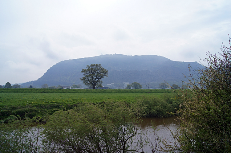 River Severn and Breidden Hill
Still with the canal by my right hand side I passed Pentreheylin Hall and soon after the calm of my towpath walk was disturbed by the hum of traffic noise. A low hum at first but getting noisier as I continued on walking towards Llandysilio. I was at the 7.00pm hand of my anti-clockwise half circle walk of the canal when I eventually left its side to follow Parsons Lane to the A483 highway. At the road I dog legged from eastwards to southwards and followed the traffic for about 500 meters to Four Crosses. After the village I left the noise of road traffic behind to begin a section of walking lowland/ flood plains of the young and meandering River Severn. At 220 miles long it is the longest river in Britain and when I meet it at the Severn Estuary at the end of the walk it is a massive watercourse. Here, just forty miles in, it is a tiddler and wandering about the plain like a chap who had drunk a few pints too many. Sections of Offa's Dyke Path merged with the Severn Way long distance footpath in the plains, particularly near the point I passed close by Breidden Hill.
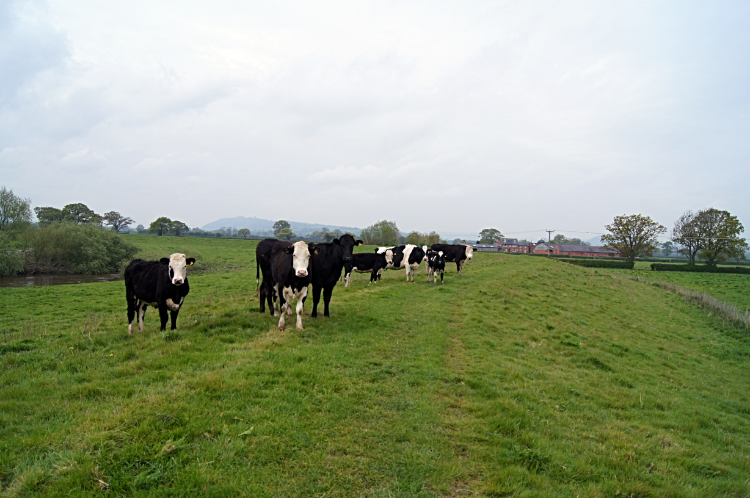 Not a friendly bunch at all
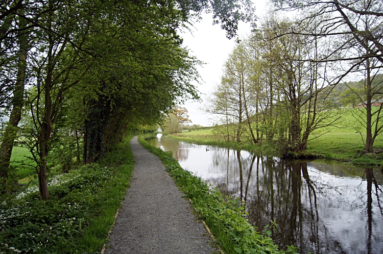 Back along the Montgomery Canal at Pool Quay
A feature of the River Severn plains crossing was big fields. There were plenty of big fields between Rhyd-esgyn and Pool Quay, a boring stretch of walking lasting for two and a half miles. Despite the benign nature of the walking on pan flat ground I had to stick to the path. Mainly because the fields were thick grassed for cows to graze themselves. It was not grass to walk over. In some fields there were herds of dairy cows which I crossed without a problem. But in others there were young Bullocks and in one particular field I came across a feisty bunch. I am used to cows; I was born in the countryside and I have worked with them. And that includes working with Bulls and Bullocks. I knew this group of Bullocks had a show off though as soon as I crossed the stile to enter their field. First, they headed from near waterside of the river to stand directly on the path as I approached them. They wanted attention. And the one with a black patch under the right eye of his otherwise white face wanted to show off. As I walked up to them, walking poles at the ready for a nose bop, he stomped his hooves. A sign of wanting a set to. Difficult though it was, I took my eyes off him and looked straight ahead. Past the group. I made sure eye contact was not made and I kept walking on through the lot of them. I felt the snorting and I knew if I ran they would chase so I just walked on by. I was so pleased they just stood and watched. No nose bop thank goodness. Phew. More fields with cows, some with sheep too, no big deal though. Yet I was pleased to reach Pool Quay and get back to the Montgomery Canal.
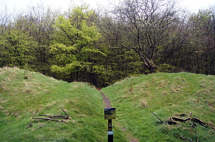 Beacon Ring Fort
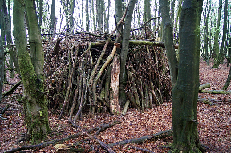 Woodcraft in Beacon Ring Fort
The sunshine of the early morning had now been covered by cloud and the day had cooled a little as I walked on the towpath of the Montgomery Canal again, this time for a mile between Pool Quay and the site of Strata Marcella Abbey, of the Cistercian Order and built around 1170. While on the towpath walk I watched a group of young lambs feeding in the shallow waters of the canal edge, preferring the lush water-soaked reed grass to that of the green field adjoining the canal. After leaving the canal side I crossed a field to Buttington Bridge and after the village of Buttington I entered a field and stopped in the corner of it for lunch. It was twelve noon and it had just started to rain. Four and three quarter hours into my walk. Lunching on the site of a battle between an alliance of Anglo-Saxons and Welsh against the Vikings I was suitably refreshed for the walk ahead which began with a climb to Beacon Ring and now in the shadow of threatening rain. It had stopped for the time being but by the look of the darkening sky it promised to be back. I had walked eleven pan flat miles from Llanymynech to my first and only climb of the day to Beacon Ring, all of 340 meters. It was a nice and easy climb across fields. At one field boundary I came to a stile with an inscription reading "There was a crooked man, and he went a crooked mile, He found a crooked sixpence against a crooked stile". The climb to Beacon Ring Fort which occupies the top of the hill which is also known as Long Mountain took one hour. To cover two miles. It was steady away.
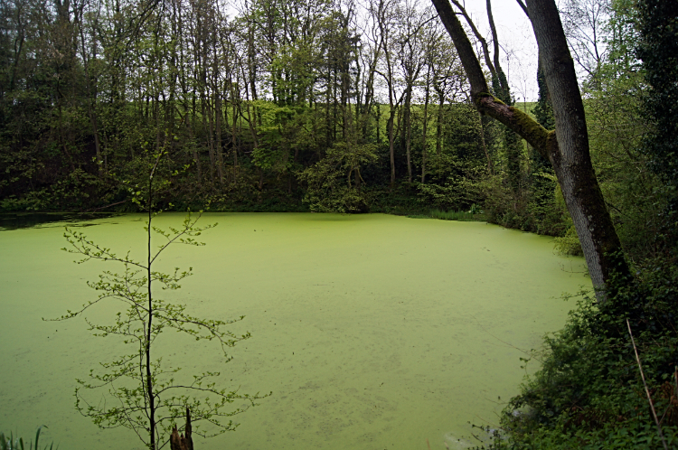 Stagnant pool at Chimney Piece
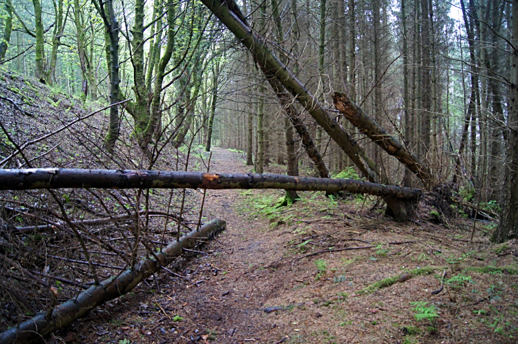 Pole Plantation
From Beacon Ring Fort I had only three more miles to go to complete my day walk and with time on my hands I started to amble once more. It was all downhill any, or much of it after spending a bit of time walking at around the 300 meter altitude level. Much of the remaining walk was in woodland, or more like plantation. Conifers dominated the woods of Phillip's Gorse and Roundabout Plantation. At a couple of places, one in particular which was called Chimney Piece, I came to a stagnant pool, fully covered in pea green algae. And on several occasions during the woodland walk I had to hurdle or clamber over fallen trees. sometimes I chose to limbo dance under them. Not easy with a backpack. I did appreciate being in the part shelter of the woods now though. It was belting down with rain. Occasionally I sought shelter under the thickest areas of trees and stood, or sat, it out.
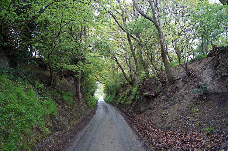 Road to Kingswood
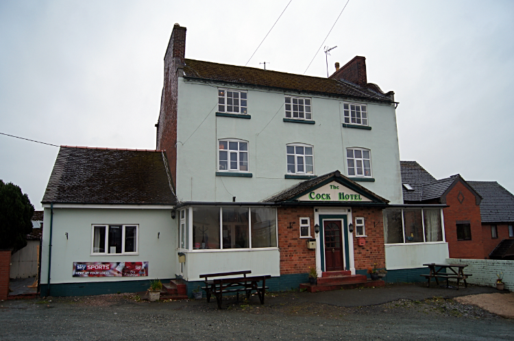 The Cock Hotel
After Roundabout Plantation came Pole Plantation and after that came Green Wood. Then, after an half hour of walking through the woods I emerged at the end of unmade track to follow tarmac road downhill into Kingswood where my nights stay was arranged. Downhill I went, into the village and past the Cock Hotel where I would enjoy my regular couple of drinks and meal in the evening. I checked in at my accommodation and retired to my room to dry off. In the evening, before going to the pub I spoke with my hosts who were a little downcast. Why I asked? It turned out they were Liberal Party members and their party had been devastated at the general election held while I was walking from Llangollen to Llanymynech. I missed that then. Jolly good.


