Cape Wrath Trail
A challenging walk of 222 miles (357 kilometres) and at with nearly 10,000 metres of ascent, climbing more than the height of Mount Everest in 18 days
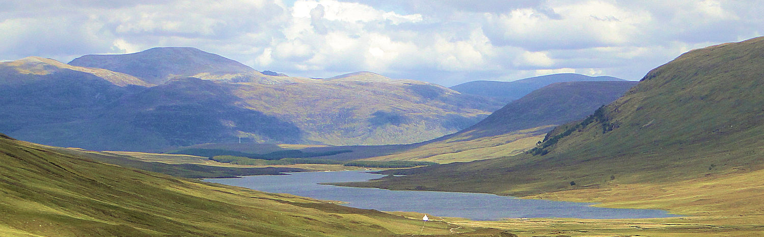
Wide open spaces and Loch Bhraoin
The Cape Wrath Trail is generally regarded as the hardest walking challenge in Great Britain. There is no official route, nor any defined path but the overriding premise is to walk in the remote and wild north west of Scotland from Cape Wrath to Fort William. I planned the walk in the winter of 2010/2011 as part of my Great British Walk. It was the part of the long walk which I anticipated more than any other, the romantic thoughts of walking in wilderness and solitude thrilling me before I embarked on the journey.
One of the challenges of the walk is getting to Cape Wrath in the first place as if you walk the Cape Wrath Trail from north to south you will have to reach the cape by means of the Durness Ferry. Unfortunately for me the weather was bad on my arrival and so I had to make my start from Faraid Head on the northern tip of the Scottish coast near Durness. Despite the setback I enjoyed the first stage alternative with the annual Cape Wrath marathon runners!
There were many highlights on my version of the Cape Wrath Trail. Amongst them were the views to Foinaven and Arkle on the walk from Rhiconich to Loch Stack. Fringing the west side of Ben Stack was also great and afterwards the thrilling sight of bays, inlets and lochs near Kylesku. Then there was the majestic mountain that is Quinag, Eas a Chual Aluinn waterfall, Inchanadamph and the Bone Caves and then Knockan Crag. There was exciting views of Suilven from the foothills near Stac Pollaidh. Inverpolly was simply wondrous. After the interlude in Ullapool I enjoyed more mountain majesty beside An Teallach and then through the remote mountain pass to Loch an Nid before heading to Kinlochewe and more marvellous views to the white mountains of Beinn Eighe and Siloch. After Kinlochewe there was Strathcarron and Loch Carron and then the brilliant walk from Killian to Loch na Leitreach and the Falls of Glomach. After coming down to earth after the fantastic waterfall it was onto Invershiel and Shiel Bridge from where I should have tackled the Five Sisters of Kintail instead of taking the road pass to Loch Cluanie and more road followed to Invergarry before I followed the Great Glen Way on the final two days to Fort William. A breathtaking journey.
| Stage | Miles | Kilometres | Ascent (m) |
|---|---|---|---|
| Faraid Head to Kyle of Durness | 4.5 | 7.1 | 90 |
| Kyle of Durness to Rhiconich | 13.0 | 21.0 | 353 |
| Rhiconich to Loch Stack | 8.0 | 12.8 | 441 |
| Lock Stack to Unapool | 11.0 | 17.8 | 668 |
| Unapool to Inchnadamph | 13.2 | 21.3 | 1,085 |
| Inchnadamph to Knockan | 12.9 | 20.8 | 493 |
| Knockan to Drumrunie | 11.8 | 19.0 | 660 |
| Drumrunie to Morefield | 8.1 | 12.9 | 270 |
| Morefield to Ullapool | 2.8 | 4.4 | 95 |
| Ullapool to Corrie Hallie | 14.3 | 23.2 | 810 |
| Corrie Hallie to Kinlochewe | 19.6 | 31.5 | 1,038 |
| Kinlochewe to Strathcarron | 17.1 | 27.5 | 684 |
| Strathcarron to Loch na Leitreach | 15.9 | 25.6 | 768 |
| Loch na Leitreach to Invershiel | 8.9 | 14.3 | 645 |
| Invershiel to Cluanie Inn | 12.4 | 20.0 | 538 |
| Cluanie Inn to Invergarry | 23.1 | 37.2 | 706 |
| Invergarry to Strone | 19.1 | 30.7 | 312 |
| Strone to Fort William | 6.6 | 10.6 | 78 |
Feedback and Suggestions:
I am always pleased to received feedback on the structure and content of the website. I also welcome suggestions on how I can improve the website which may include new areas to cover, new walks or route alterations to existing walks. To get in touch with feedback and/ or suggestions please contact me on one of my social media links. Thank you.
(Note: Walking without proper preparation can be dangerous. Information and downloads on this website are provided free of charge; it is each walker's responsibility to check the material and use accordingly. Postscript: My walk reports are not route guides and should not be treated as such. They are written with personal reflections of my walks)


