The Great British Walk
A personal record of my three month walk of the full length of Great Britain from north to south with written journal and photographs. Tracklogs for GPS units and for use with Google Earth are available for download for each stage.
Stage 6: Inchnadamph to Knockan
Google Maps Open Source Maps| Statistics and Files | ||
|---|---|---|
| Start: Inchnadamph | Finish: Knockan | Distance: 12.9 miles (20.8 km) |
| Time: 6-7 hours | Climbing: 493 metres | Total Distance: 62.6 miles |
| GPX Route File | Google Earth File | About Inchnadamph |
| Statistics | |
|---|---|
| Start: Inchnadamph | Finish: Knockan |
| Distance: 12.9 miles (20.8 km) | Time: 6-7 hours |
| Climbing: 493 metres | Total Distance: 62.6 miles |
| GPX Route File | Google Earth File |
Ordnance Survey Explorer Map (1:25,000)
Summary
After three tough stages crossing remote and harsh Scottish highland I had got myself a day ahead of schedule and therefore I took a welcome days break in Inchnadamph. During the day I conversed with fellow adventurers who were sharing the Inchnadamph Lodge cottage with me; Carol and Ron Ashman from Malvern who were cycling down the west coast after starting out from Mucklefugga, Shetland on a three month cycling adventure to Lands End and David Bagshaw from Woodley, Reading who was taking a week out cycling in the Inchnadamph/ NW Scotland area. I enjoyed their company during the day off and after a convivial evening I woke the next day refreshed to continue my own walking adventure. Today the walking took me from Inchnadamph to Knockan via the road except for a detour to visit famous Bone Caves.(Note: My walk of the Cape Wrath Trail was a part of my Great British Walk from the north coast of Scotland to the south coast of England)
Stage Report
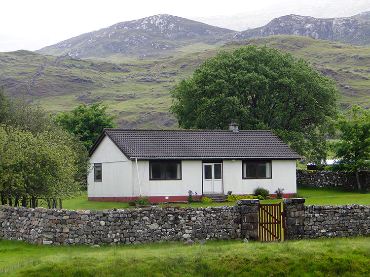 My accommodation in Inchnadamph
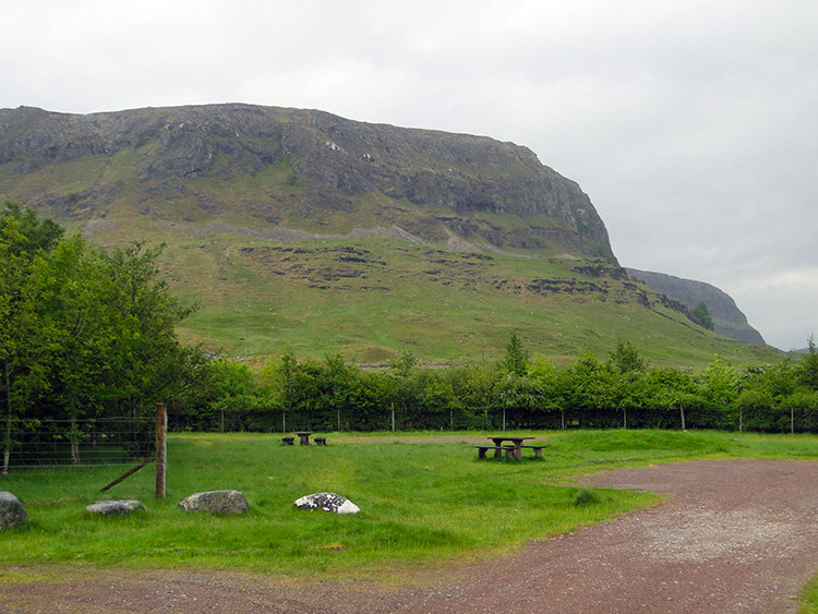 Creag Sron Chrubaidh
After the ordeal that was Kylesku to Inchnadamph this stage was a blessing. By mainly following the A837 road south (with a fantastic diversion to some isolated Bone Caves) and with the weather staying dry until the last mile I kept my feet dry while walking for the first time since leaving the north Scotland coast. What a relief that was. The first two miles from Inchnadamph were due south by the roadside with distractions aplenty. The first one was immediately on leaving Inchnadamph by looking back over my right shoulder to Loch Assynt, a Mecca for geologists for over a century. Walking along the road I was continuing my journey on the North West Scotland Rock Route and I could see the result of eras of much change and from the shaping of the landscape by the last ice age with mountains, crags, lochs and watercourses all around. I felt at one with myself as I walked along the A837, traffic was virtually non existent, I thought of roads in England and around Harrogate where I live teeming with traffic and was glad I was out of it, walking along in quiet contemplation. The only noise audible was the slight wind and the cackling of rooks congregating on the crags of Inchnadamph National Nature Reserve. The ambiance of my local surroundings was superb and I continued to walk without haste taking in all the magic.
 Once this was all under ice
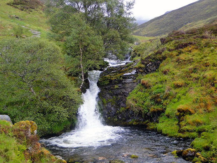 Waterfall on Fuaran Allt nan Uamh
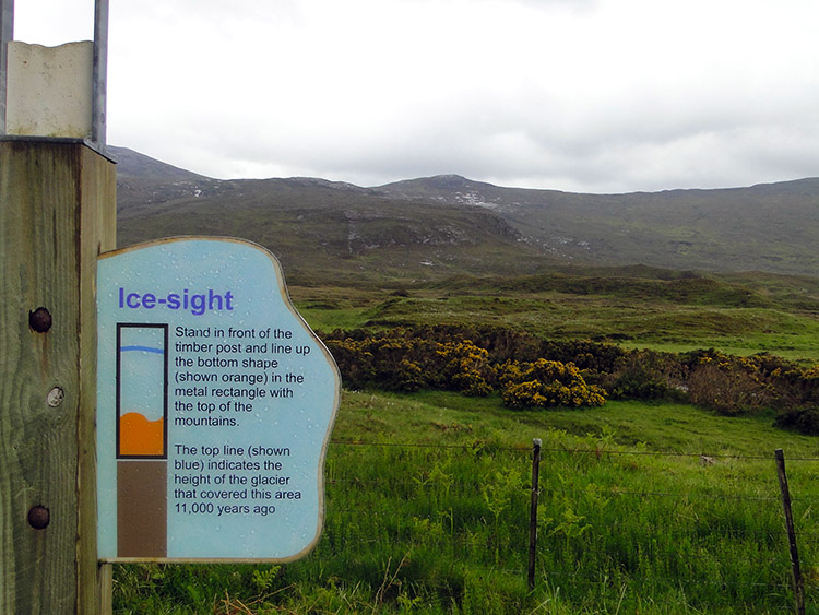
From time to time as I walked I came across information boards about the rock route. I read them attentively, one just south of Inchnadamph reading 'Ice-sheets started it - shaping the valley and carving away much of the rock that was here before. The River Loanan in front of you is shaping the land as surely as they did. After heavy rain, streams carry small stones to the river and eventually they end up in the sea'. Another board headed Ice-sight read 'Stand in front of the timber post and line up the bottom shape (shown orange) in the metal rectangle with the top of the mountains. The top line (shown blue) indicates the height of the glacier that covered this area 11,000 years ago'. I stopped by the information boards for a good time lining up the mountain as instructed and imagining the height of the ice sheet. It was remarkable to think back of such a time. I continued on educated and to more revelations of the past at the Bone Caves.
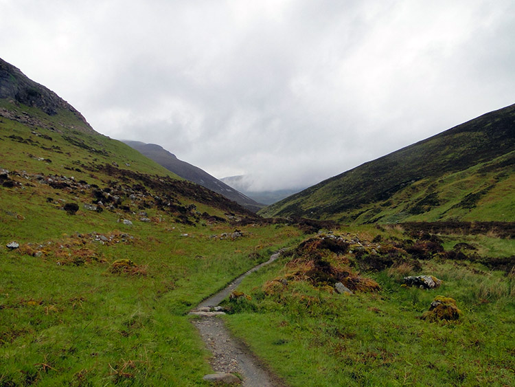 Walking up the valley to the Bone Caves
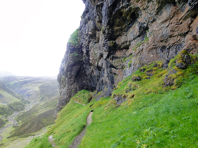 Climbing the narrow path to the Bone Caves
I carried on walking in Wimbledon tennis spectator mode, rotating my eyesight to left and right at frequent intervals. By looking right to the lower levels of Canisp mountain and by looking left to Buzzards and Rooks settling and surveying over the cliffs and crags of Inchnadamph National Nature Reserve the two miles to the point of my detour to the Inchnadamph Bone Caves went quickly by. The walk from the road to the Bone Caves was just over one mile in and one mile out. I followed the track to the caves by tracking the Alt nan Uamb upstream into a very scenic and interesting valley. The walking was good throughout despite a few wet hurdles.
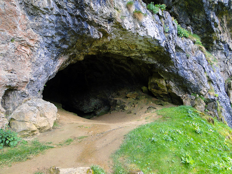
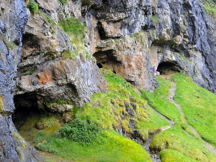 Creag nan Uamh Bone Caves
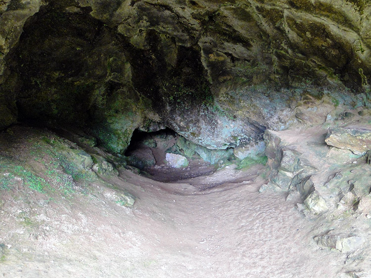 A cave of remarkable finds
The final path to the caves was steep and exposed so care was needed to reach the mouths of them. The caves, four of them, are side by side in a high protected cliff face. They looked impressive from first sight at a distance and continued to be so drawing me in. From left to right they are named Fox's Den, Bone Cave, Reindeer Cave and Badger Cave. Finds in them included remains of Northern Lynx, Arctic Fox, Reindeer, Otter and even Polar Bear. The caves shed a fascinating insight into the history of Scotland and my education day continued for I know more about Scotland's early animal species for visiting them.
 Bone Cave
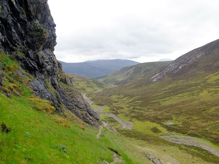 My route back
While I was exploring the caves I took a break for refreshments and contemplated the incredible views of the valley head and mountains of Inchnadamph National Nature Reserve. Apart from more rooks cawing on the heights of Creag nan Uamh there was utter silence. It was remarkably still for such a wild place but I appreciated the lull. I looked into each cave in turn but decided not to venture into any thinking it would be sacrilege to do so. After the ownership of past times they will have remained silent for centuries and I let them be so.
 Once home to Bears, Wolves and Reindeer
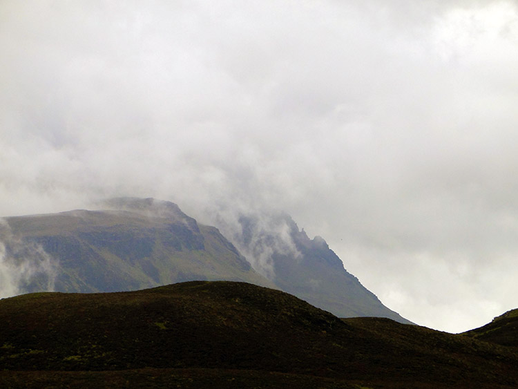 Cloud over Canisp
Another delight of the area around the Bone Caves was when I came across a lovely White and yellow centered Primrose in full and glorious flower clinging to the rock edge high up on the crag and level with the entrances to the Bone Caves. They were thriving in their position and I was delighted to capture their beauty and share some time admiring the fulsome flowers. Seen in gardens en masse I might not appreciate them as I did here, stood proud and showy in their far north position. Rock route with glacial forces and ancient rocks, caves and wildness. Now flora in beautiful abound, I was truly enjoying my walk today.
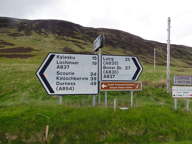 Ledmore Junction
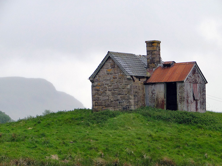 Old shepherds cottage in Elphin
After my exciting cave adventure I returned to the road and continued south to the A835 and A837 junction, taking the former toward Elphin. I passed a number of cars parked in a lay-by with an access track to Lochinver. The car travellers were either scaling Canisp or Suilven. A shame for them that at around 400 metres height they would be in cloud and barred from the extensive wonderful views they deserved. Today the sun had not even tried. I reached Elphin and took myself to the lovely welcoming Elphin Tea Rooms to revive. Excellent hosts served me refreshing tea and food which revived a waning walker. Still tired from my previous stage in the fierce gales I was in want of rest.
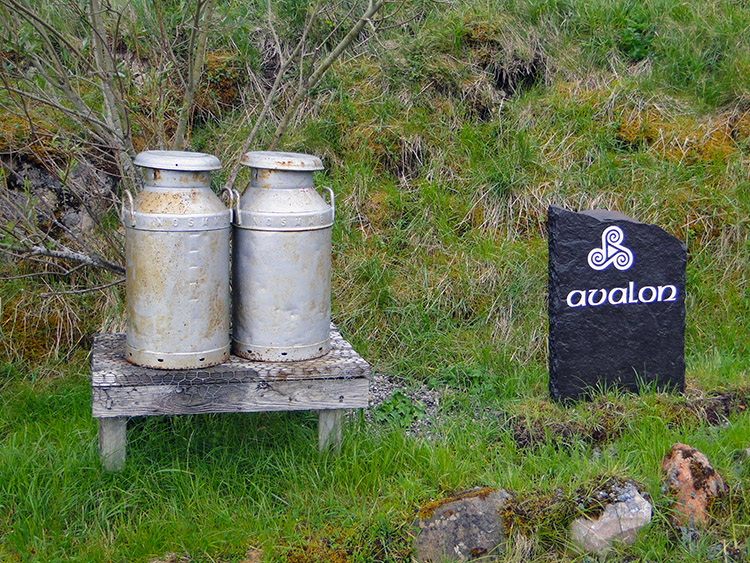 Seeing the milk churns reminded me of my childhood
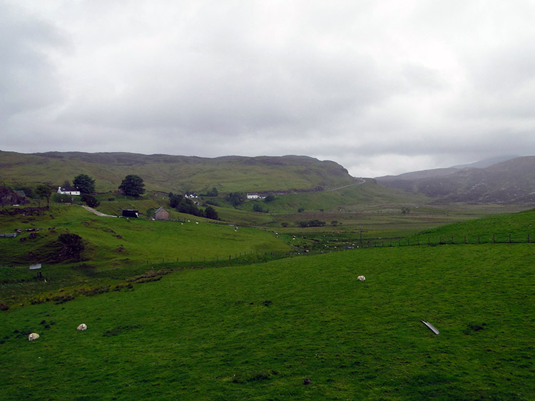 Knockan Crag as seen from Elphin
Fortunately the last house on the left through the village provided it, the brilliant Greenside Bed and Breakfast. Although todays leg was predominantly roadside the traffic was virtually absent and the views were more than adequate compensation. A pity I could not see to Suilven or the higher levels of Canisp but there were brilliant compensations and the Bone Caves were something else. Tomorrow I leave the roadside to venture on a track of my own making, no track to follow but I course I wish to take. I do it to reach the lower slopes of Stac Pollaidh and I cannot wait.


