St Cuthbert's Way
A personal record of my St Cuthbert's Way walk with a written journal and with photographs. Tracklogs for GPS units and for use with Google Earth are available for download for each stage.
Journal, Photographs and Download Files
Stage 1: Melrose to Jedburgh
Google Maps Open Source Maps| Statistics and Files | ||
|---|---|---|
| Start: Melrose | Finish: Jedburgh | Distance: 20.0 miles (32.2 km) |
| Time: 8-10 hours | Climbing: 805 metres | Rating: Strenuous |
| GPX Route File | Google Earth File | About St Cuthbert's Way |
| Statistics | |
|---|---|
| Start: Melrose | Finish: Jedburgh |
| Distance: 20.0 miles (32.2 km) | Time: 8-10 hours |
| Climbing: 805 metres | Rating: Strenuous |
| GPX Route File | Google Earth File |
Ordnance Survey Explorer Map (1:25,000)
The Walk: Early March 2016, one month before my 60th birthday. The first signs of spring were evident, Crocus blooming in my local park and the Daffodil's set to follow. The result of all this, impending big birthday and spring awakening, was that I needed a walk. One not too short as I needed jolting out of winter lethargy and one not too long either because of family commitments. In fact, one which could be carried out in three to five days. It did not take long for me to select St Cuthbert's Way. The length of the walk is ideal and the location was just perfect. I like the Scottish Border country, having taken to it during my crossing of the Southern Uplands during my Great British Walk in 2011 and on a first visit to the area, to do a few walks, including the Grey Mare's Tail a couple of years earlier. I was also excited about crossing the Cheviot Hills, a range I had never walked in before. To end the walk on Lindisfarne/ Holy Island was the final draw. St Cuthbert's Way it was then.
 River Tweed and Eildon Hill
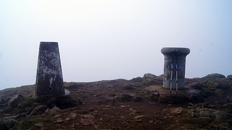 Summit of Eildon Mid Hill
After travelling by public transport from my home in Harrogate I arrived in the border town of Melrose in late afternoon. After checking into my accommodation I went for a walk from town to cross the River Tweed by way of the chain bridge. A short walk along the north bank of the river gave me an exciting view across the Tweed to Eildon Hill which I would cross in the morning on the start of my walk. After a tardy breakfast the next morning I was soon on my way, beginning the official route of St Cuthbert's Way beside Melrose Abbey at 10.00am and immediately climbing southwards from town to Eildon Hill. While it was overcast and clear in the town I could not see the top of the hill. I was climbing into cloud. Before disappearing into the clouds I passed a few dog walkers in the local woodland on the hill approach and on the lower south slopes. After that i was alone with the hill. At around 250 meters height I disappeared into the cloud and with it enveloped in the intimacy of the hill. Eildon Hill is often called the Eildon Hills because there are three distinct summits. I had decided to visit the higher two. First I left St Cuthbert's Way to climb to Eildon Hill North (404 meters) and the site of a Roman Signal Station. Could not make that out at all. Then I returned to St Cuthbert's Way and left it again to climb to Eildon Mid Hill, at 422 meters the true summit of the hill. A trig pillar and a toposcope marked the summit. It was a shame I could not see far beyond my nose, I would have enjoyed the view to the other hill ranges of this region including the Lammermuir Hills and Moorfoot Hills and to the Upper Tweeddale National Scenic Area. Still, at least my serious climbing for the day was done and at least I could now descend to extended views once under the cloud again. And I knew they would be good ones today. The milky early springtime sun had been trying to break through the clouds on top of Eildon Hill while I stood on top and had I stayed longer those views I missed would have revealed themselves. I could not have waited though, I had a job to do.
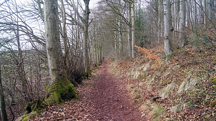 St Cuthbert's Way path through Broad Wood
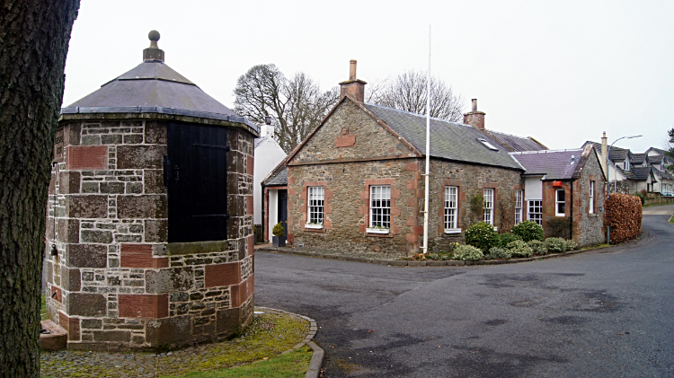 The village of Bowden
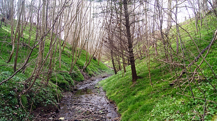
I came down from Eildon Hill to woodland. Before there I looked for a place marked on the map as Siller Stane (silver stone), a flat stone which derives its name from the supposition that money was hid below it. I saw a few flat stones by the wayside but which was it. So alas I never found any cash and thus I walked through Broad Wood no richer than I was before. Still, I was happily rich in the enjoyment of this early season walk on St Cuthbert's Way, my earliest long distance walk ever. I bounded on the paths through the woodland, passing seamlessly from Broad Wood to Greenside Plantation and then emerging into the open at the small rill of Glenburnie Burn around 12 noon, two hours into the walk. It was still overcast but the daylight was improving. I could see the faint disc of the sun fighting to break though the cloud as I walked across a pasture and wild parkland area, complemented with benches and seating tables, to reach the small village of Bowden. Walking through the village I passed the Old Smiddy and the Pant Well, a communal water source. The village was deserted as I walked though and I left it to its peace and quiet.
 Bowden Burn
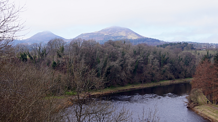 River Tweed at Newtown St Boswells
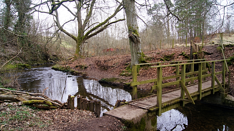
I had been walking south since leaving Melrose but at the four mile point, soon after leaving the village I turned north-eastwards to follow a path though a narrow copse shielding both banks of Bowden Burn on its course towards Whitelee. The copse was pretty even without leaf which would soon be filling the trees. Clusters of Snowdrops in full bloom cheered me up, as did the sound of Bowden Burn running in the direction I was walking towards the River Tweed at Newtown St Boswells. In the heart of the copse I met a local forester cutting up wood. We chatted a while as neither of us had a pressing timescale. He told me he worked these woods for free on behalf on the local landowner. He explained why "I get all the wood I need for fuel in return for keeping the woodland tidy. It is a symbiotic relationship between me and the land and between me and the landowner which suits all parties". I was impressed by that and we wished each other well on the resumption of my walk. Soon after I left the copse and followed a country road into Newtown St Boswells. Once through the village I passed under a viaduct carrying traffic on A68 Darlington to Edinburgh road to reach another stretch of delightful woodland where I once again walked beside Bowden Burn on its last stretch before discharging into the River Tweed. At an elevated position on the path to the river I reached a seat with a fine view to the river below me and to Eildon Hill which was now free of the cloud I had suffered earlier in the day. Sunshine was now beginning to break through the cloud more freely and Eildon Hill shimmered. I sat at the seat, breaking for midday refreshments while enjoying the view which included a Temple folly and a swing footbridge.
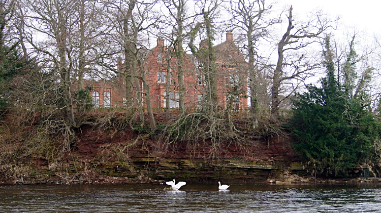 Dryburgh Abbey
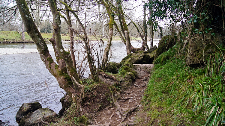 Alongside the River Tweed near St Boswells
After my break the path led me down to river level where a sweeping riverside path led me towards the village of St Boswells. The river itself provided a marvellous setting and a pair of Swans watched me as I walked along the path. As I looked across at them I noticed an imposing building behind them. I had reached the point on the River Tweed where Dryburgh Abbey was directly opposite. Only I was not looking at the site of the abbey ruins but at Dryburgh Abbey Country Hotel. The ruins of the abbey stayed hidden from my sight by a barrier of trees. Even in winter bleakness the trees disallowed me a glimpse. The delight of the riverside path and continued views of the majestic river were more than compensation for the loss of not seeing the old abbey though. Soon after passing Dryburgh Abbey I had a charming encounter with an elderly lady walking her small terrier along the footpath. As we met up the sun had come out again and this time it was staying for a good while. We remarked how lucky we were to be here at this time, on such a lovely day for early March. It was getting quite warm. Soon after parting ways with the lady I left the riverside and walked through the village of St Boswells, calling at a shop in the village for another drink and a packet of crisps which I would enjoy later.
 St Boswells Burn
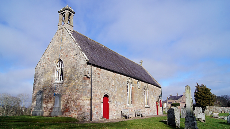 Maxton Kirk
Back on the banks of the Tweed I walked on a sweeping U shaped course from Great Stenhouse to Mertoun Bridge, an impressive red sandstone arched structure spanning the river. With the U curve of the river repeating into a sweeping S shape I walked further on the waterside path to Benrig Dean and then to where St Boswell's Burn tumbled into the Tweed. Here was the point where I left my journey with the river. While it headed in a general eastwards course to Berwick on Tweed and the North Sea I kept though woodland south to emerge intro the open by an imposing old building. I had arrived at Maxton Kirk. From the old church I walked down a lane into the village of Maxton which was no more than a single row of around twenty dwellings. Nothing stirred as I walked along the road past the houses. It was approaching 3.30pm and I still had a fair distance to walk so I picked up the pace, not wanting to arrive in my destination of Jedburgh in the dark. I was stopped in my tracks though by a remarkable sight to Eildon Hill now bathed in unbroken sunshine. Again I thought how nice it would be to be up there now. Oh well, cannot have everything.
 The Street, a long straight line
 Lilliard's Stone
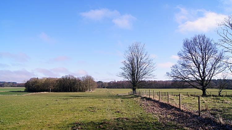
After following a quiet road from Maxton to Hiltonshill Old Tollhouse I arrived at the Street. I stood beside the dead straight Roman Road next to the A68. I had reached Dere Street. Signs pointed to Jedburgh in the south and to Edinburgh in the north. The A68 would wind about a bit but not the Roman Road of Dere Street. I now started on a three and half mile walk on a dead straight line on a south-easterly course. The terrain was not the same though. First up was a narrow woodland stretch with the A68 nearby to my right. However the modern road would soon veer away from me getting further away as I walked along Dere Street. Sections of walking across big fields with woodland tracts between was the theme for the next stretch of Dere Street until I reached the site of Lilliard's Stone, close to the site of the Battle of Ancrum Moor (1545). Lilliard's Stone is a memorial to the battle which was itself just one of the skirmishs during the War of Rough Wooing which I never knew of until this walk. Long Distance Walking, if nothing else, is a great education. I continued along Dere Street, my next break from the seemingly interminable straight line being a meeting with a sheep farmer who was rounding up some of his flock. Another lovely person, the third I had met since leaving Melrose, he chatted about life in these parts and he also pointed out the relevance of a monument on a nearby hill I had been observing while i walked Dere Street. It was Peniel Heugh Waterloo Monument, built in around 1820 to commemorate the Napoleonic Wars battle.
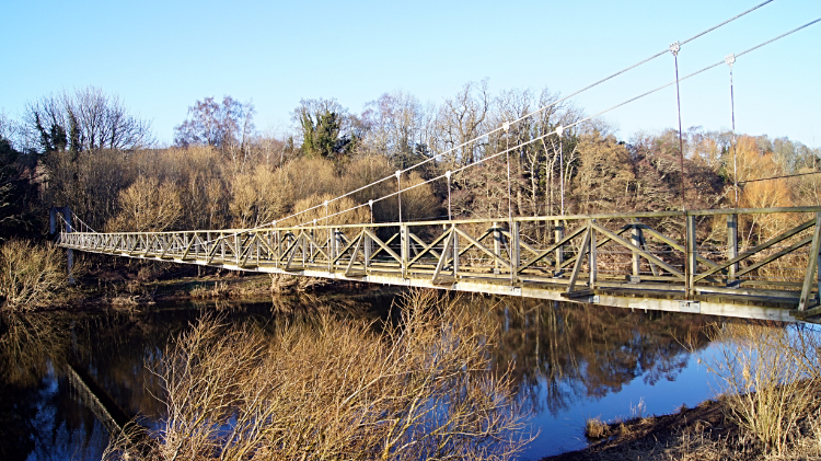 River Teviot Suspension Bridge
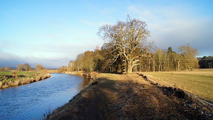 River Teviot
Two hours after setting off along Dere Street I reached the other end when reaching Teviotdale. In woodland I passed signs for Ancrum and for Harestanes before reaching the estate of Monteviot House which I walked around to reach the River Teviot, crossing to its south bank by way of an impressive suspension bridge. It was six o'clock in the evening when I crossed the river. Shadows were lengthening and I knew I had not much daylight left. Which was a shame as I was really enjoying this first early evening of my St Cuthbert's Way walk. The sun was shining, the sky was blue. What was not to like. Even the sheep I passed in the fields beside the River Teviot were not bothered by me. We were all chilled. At 6.30pm I left the River Teviot to follow Jed Water to Jedfoot Bridge and soon after walking on a lane I left St Cuthbert's Way to follow the Borders Abbeys Way into Jedburgh. An half hour later I arrived in Jedburgh with street lights already lit. It was getting dark.
From my post walk Facebook post, 17th March 2016: I have enjoyed a special day one on St Cuthbert's Way. My walk from Melrose to Jedburgh was 20 miles and I was tiring as I walked into town at dusk after just short of 10 hours on the trail. As I am unlikely to walk the local paths again I made a point of climbing the two major Eildon Hills. Even the morning cloud was not stopping me doing that. Once by the River Tweed at St Boswells the sun came out and all clouds disappeared. I enjoyed brief encounters with local walkers, local joggers, a forester and a sheep farmer. All was good. St Cuthbert's Way is well waymarked and managed. Well done to all who maintain the way and thank you. Lots of lovely small towns and villages were enjoyable to walk through. Follies, memorials, local monuments, historical sites, the lot.
I could go on but I will save more for stage two. Now it's time to freshen up, eat and enjoy a pint.


