Offa's Dyke Path National Trail
A personal record of my walk of Offa's Dyke Path National Trail with written journal and photographs. Tracklogs for GPS units and for use with Google Earth are available for download for each stage.
Journal, Photographs and Download Files
Stage 6: Kingswood to Newcastle
Google Maps Open Source Maps| Statistics and Files | ||
|---|---|---|
| Start: Kingswood | Finish: Newcastle | Distance: 13.6 miles (22.0 km) |
| Time: 6-7 hours | Climbing: 816 metres | Rating: Hard |
| GPX Route File | Google Earth File | About Offa's Dyke |
| Statistics | |
|---|---|
| Start: Kingswood | Finish: Newcastle |
| Distance: 13.6 miles (22.0 km) | Time: 6-7 hours |
| Climbing: 816 metres | Rating: Hard |
| GPX Route File | Google Earth File |
Ordnance Survey Explorer Map (1:25,000)
The Walk: From my early morning Facebook post, 9th May 2015: Good morning from Offa's Dyke. Today it's 15 miles from Kingswood to Newcastle in Clun. First I head for ominously named Devil's Hole then Rownal, Brompton Hall and Mellington Hall. All fairly easy going to there and then I hit the Clun Hills by climbing to Edenhope Hill, Churchtown Hill, Hergan, and Graig Hill before ending the day. It was stormy when I woke this morning and skies were threatening but now I can see blue patches forming as the cloud breaks. Fingers crossed.
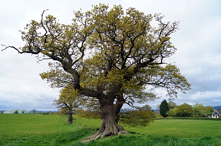 Majestic Oak near Forden
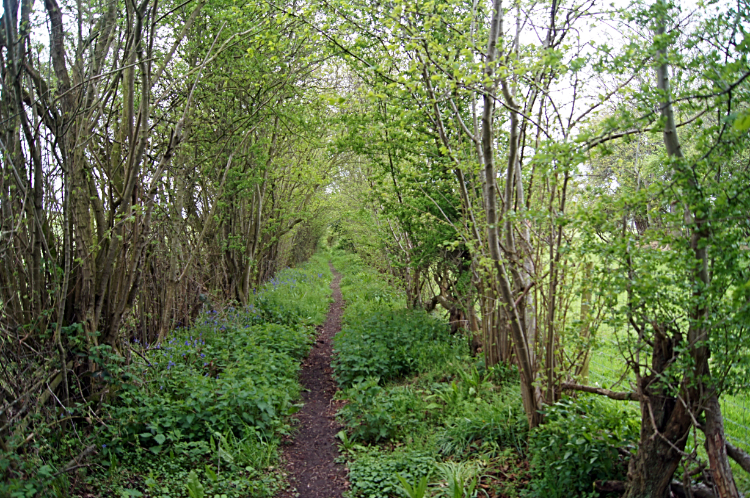 Green avenue at Lymore Park
Day six on the trail and one of two halves. The first half to Brompton Bridge almost pancake flat and the second half a series of climbs and falls across the hills of West Shropshire. I looked forward to that but first the flat part. I left my disappointed liberal hosts in Kingswood and followed Offa's Dyke Path on a southward course past the village of Forden and past the site of Nantcribba Castle, a Motte and Bailey construction which I could not make out at all. The castle was scavenged for building materials and ruined by quarrying and the site is now shielded from view by an enclosure of trees. Moving on I could see the uppermost ruins of a castle far up on a hill in the distance to my right. As I drew level with it I could make out the town of Montgomery beneath. I had been looking at the site of Montgomery Castle. I ought to have left the path briefly to explore Montgomery which was less than one mile away. But I didn't.
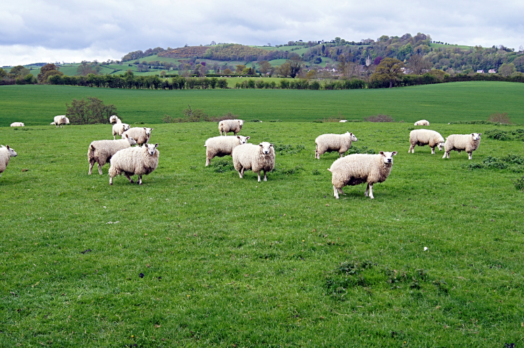 The locals meet the Walking Englishman
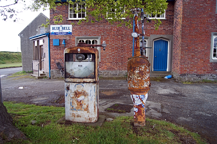 Blue Bell Hotel, Brompton Bridge
Continuing on along the path which was, in the most part, a series of narrow lanes between large agricultural fields, I entertained myself with animal encounters and by arriving at points of interest. On the animal side, I stood for five minutes watching Swallows swooping to ground level to catch their breakfasts. Our favourite migrant bird of the countryside had recently returned from Africa. And on the points of interest I arrived at a sign with the heading 'Bloodiest Battlefield'. It went on to read "The quiet fields between here and Montgomery Castle were the setting for the bloodiest Civil War battle fought on Welsh Soil. On September 18th 1644 Parliamentary forces dealt a crushing blow to the attacking Royalist troops". Fortunately all was peaceful now. Even the local sheep were the friendliest type and rather curious of me as I walked close by. Not spooked at all. Walking on alongside more fields, through Bluebell filled copses and along rural lanes took me from Wales and back into England at a sign stating 'Welcome to Shropshire'. Soon after, and at just over six miles into my day I arrived at Brompton Bridge. At the crossroads of the A489 and B4385 stood the derelict Blue Bell Hotel. Old fuel pumps were rusting on the forecourt of the neglected site. From the crossroads I walked south and crossed the River Caebitra by way of Brompton Bridge.
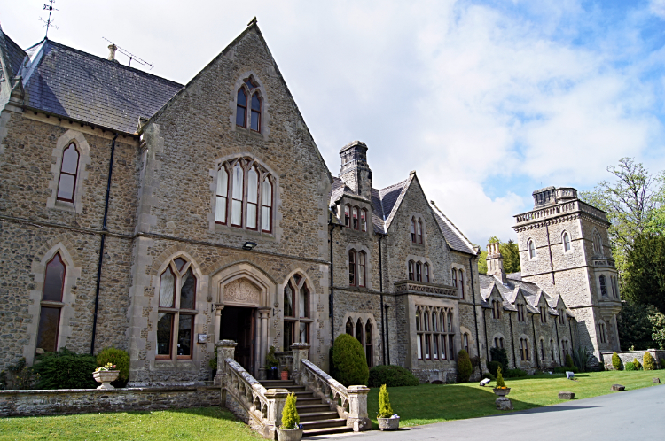 Mellington Hall Hotel
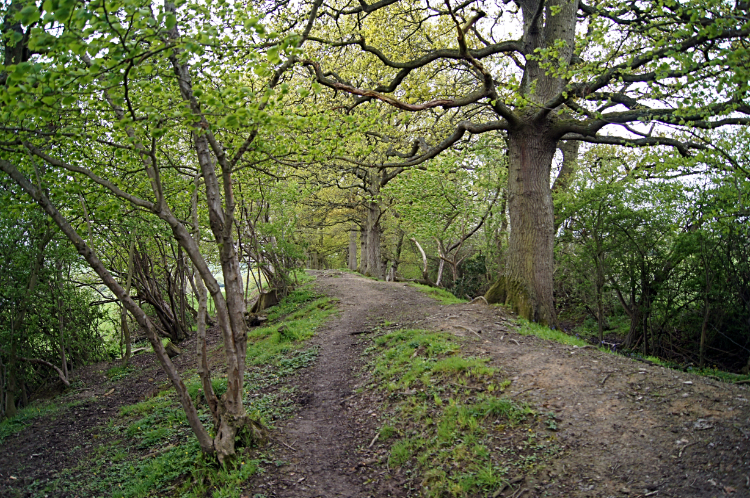 Offa's Dyke near Cwm
From Brompton Bridge I entered Wales once more. a sign welcomed me to Powys at Mellington. A few steps later Offa's Dyke Path led me through the central arch of a gatehouse into the grounds of Mellington Hall. The access road led me towards the hall itself but before reached the path diverted into Mellington Wood. The walk through the woodland was delightful. Not only was the floor of the wood bedecked in swathes of Bluebells which was good enough but I got more. The sun, which had been behind cloud all morning came out and dazzled the woodland floor. It was gorgeous. When in the woods I had another thing on my mind though. Since Llanymynech two days ago I had not seen a shop and my food reserves were getting low. Rather than deplete them could I find refreshments at Mellington Hall Hotel? I had to leave the path and sneak my way around the grounds to the front of the hotel. I did, and on getting to the entrance I noticed all the staff were bedecking the place for a wedding party. The signs were not good but I asked anyway "Any chance of refreshments". The staff smiled and one said "We have a wedding party to set up and they will be arriving en masse in a couple of hours but try in the bar. Someone will attend to you in there". To their credit I was looked after. At the bar and though food was not available I was served a lovely pot of tea and provided with a couple of packs of complimentary biscuits. Divinely Chocolatey Cookies. Refreshed I went on my way with a smile, finding the line of Offa's Dyke earthwork again and following it towards the hills.
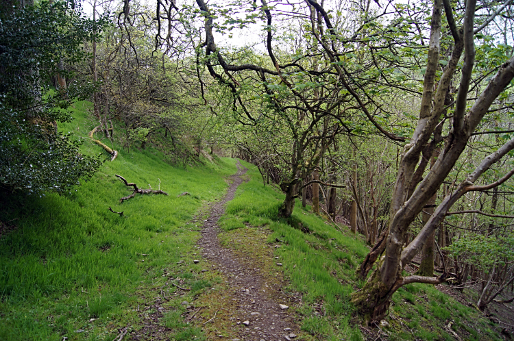
 Descending to Churchtown
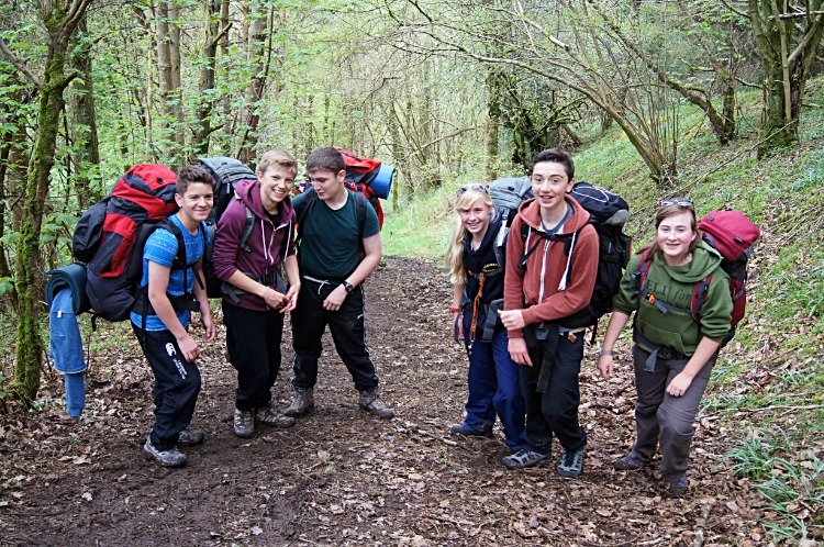 Duke of Edinburgh Award aspirants on the trail
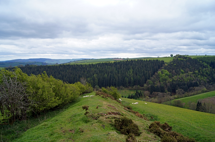
After two days of flat walking, Long Mountain excepted, it was great to be climbing again. From Mellington Hall to Lower Cwm it was a steady introduction to ascent but from the minor road crossroads at Cwm and on tarmac up to leaving the road 300 meters further on it had gradually steeped. Not too tasking though but from leaving the road to a habitation known as Crows Nest it was a steep hike. I was huffing and puffing, trying to straighten to upright when all I wanted to do was stoop hands on knees. After Crows Nest I crossed another minor road and once back on unmade track I climbed a little further to my first Shropshire Hill summit, 403 meters high. The hill of no name. Then I descended through Nut Wood to cross the River Unk before climbing steeply again to Edenhope Hill. I could have stopped at the river the go searching for Pearls. The river is one of the last refuges of Freshwater Pearl Mussel. No time for prospecting for me, even if I had known, I still had a few more ups and downs to negotiate. From Edenhope Hill I descended steeply once more, this time a short and leg arresting 120 meters to Churchtown. Here I took a rest on the bench in the grounds of the parish church. I had yet another steep climb ahead of me from Churchtown and through Churchtown Wood to Middle Knuck. Soon after beginning the climb I saw a group of around half a dozen youngsters hauling themselves up the steep bank ahead of me. They all had big backpacks on, some of the smaller youngsters probable carrying nearly their bodyweight. They were all in good spirits, chatty as they climbed. Being a single walker and with the intention to get up the bank as quickly as possible I eventually caught them up when halfway up the bank. We chatted away together. They were all doing their Duke of Edinburgh Award. I commended them on that before wishing them well and moving on to the top of the hill.
 Climbing to Hergan
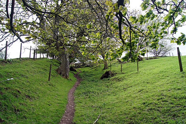 Climbing the shoulder of Graig Hill
From Middle Knuck I had just three more miles of walking to do, all but the last bit into Newcastle on Clun at the elevated height of around 300 meters high crossing the West Shropshire Hills. First hill of note was Hergan, a Bowl Barrow. These were the most numerous form of round barrow, a type of funerary monument dating from the Late Neolithic period to the Late Bronze Age. After Hergan I had to do a bit of a rescue act though the one rescued did not show much gratitude. While crossing a field before climbing to Graig Hill I spotted a young lamb next to a field boundary walkers gate which would have normally run off as I approached. Only it did not. I saw why as I got nearer because it had stuck its head though wire netting on the field boundary and had not fathomed how to get its head out. Panicking as I approached I hoped it would not do itself serious harm and fortunately when I got there it calmed down. It had to I suppose as it had no option to let me interfere. I pulled the wire netting wide to release it and it ran off bleating. Not a show of thanks at all.
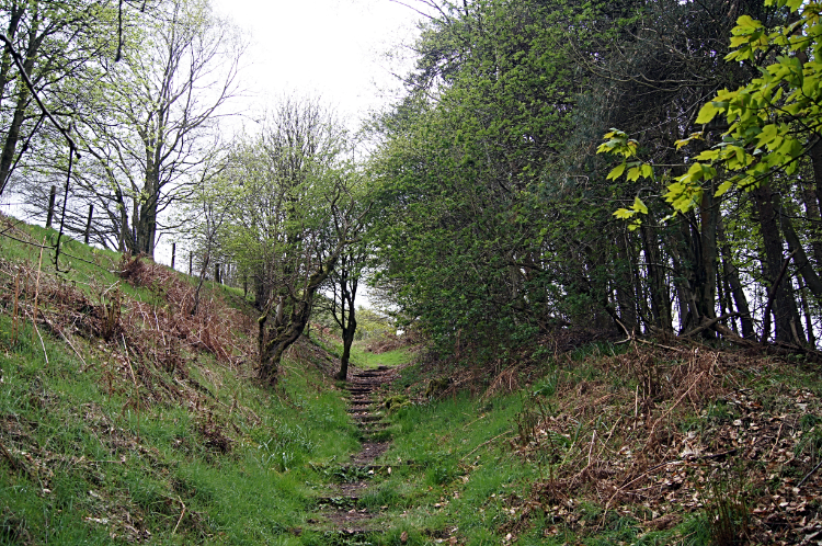
 Descending into Newcastle
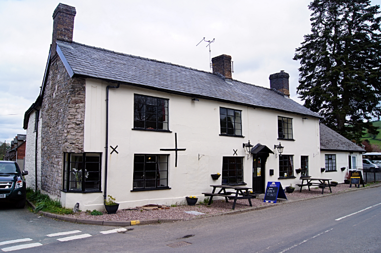 The Crown Inn, Newcastle-on-Clun
From the west shoulder of Graig Hill I followed paths through copses all the way to meet the valley road which would lead me into Newcastle on Clun. These paths must be popular as the steeper sections were stepped, wooden slats set in the ground making the ups and downs easier to manage. With their help I arrived down on Church Road safely, my first encounter with these particular Shropshire Hills done. I would resume tomorrow. For now I walked west along Church Road and past the gray stone building of St John The Evangelist Church. Soon after I arrived at the Crown Inn. Home for the night. I enjoyed my evening at the inn with the thought I was now half way on my Offa's Dyke Path journey. After another great day on the trail i did not know whether that thought made me more happy or more sad.


