Offa's Dyke Path National Trail
A personal record of my walk of Offa's Dyke Path National Trail with written journal and photographs. Tracklogs for GPS units and for use with Google Earth are available for download for each stage.
Journal, Photographs and Download Files
Stage 3: Bwlch Penbarra to Castell Dinas Bran
Google Maps Open Source Maps| Statistics and Files | ||
|---|---|---|
| Start: Bwlch Penbarra | Finish: Castell Dinas Bran | Distance: 16.5 miles (26.5 km) |
| Time: 7-8 hours | Climbing: 1,128 metres | Rating: Strenuous |
| GPX Route File | Google Earth File | About Offa's Dyke |
| Statistics | |
|---|---|
| Start: Bwlch Penbarra | Finish: Castell Dinas Bran |
| Distance: 16.5 miles (26.5 km) | Time: 7-8 hours |
| Climbing: 1,128 metres | Rating: Strenuous |
| GPX Route File | Google Earth File |
Ordnance Survey Explorer Map (1:25,000)
The Walk:
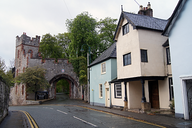 Gate to Ruthin Castle
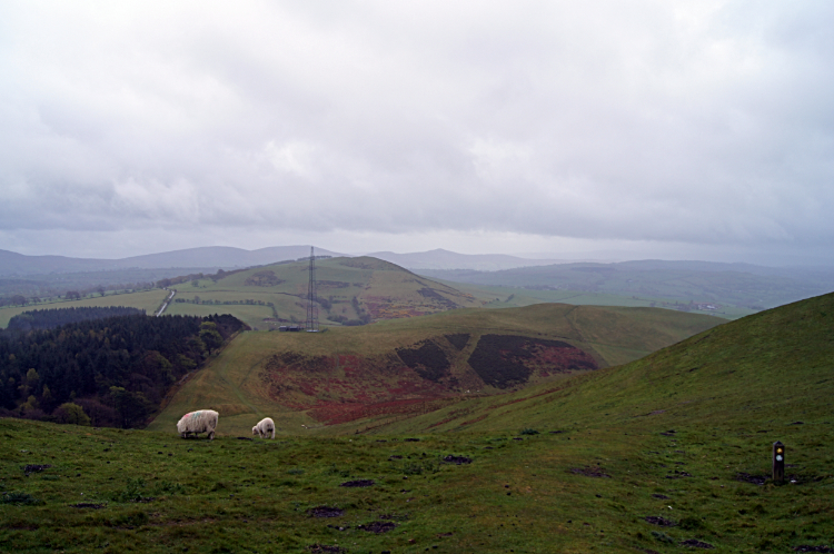 View from Moel y Plas to Moel y Gelli
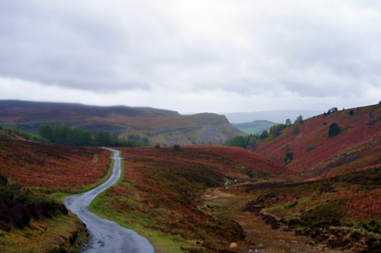
Despite the damp conditions of the early morning my spirits could not be dampened as I made my way from Ruthin back up to Offa's Dyke Path at Bwlch Penbarra. I had a quick look around the lovely market town which had been my home for a night including a stroll back to Ruthin Castle which I had walked around last night. An hour and a bit later on I was back on the national trail and climbing the steep north bank of Foel Fenlli, yet another hill of the Clwydian Range with a hillfort on the top. Foel Fenlli, at 511 meters has also the distinction of being the second highest hill of the range. Yesterday I had been on Moel Famau, the highest at 554 meters, and I could just see it through the morning mirk from the site of the hillfort. From Foel Fenlli I made a gingerly descent of the steep south side of the hill. It was wet underfoot and very slippery. Had it been later in the day when probably fatigued I imagined slipping on my backside down the slope. Safely down to Bwlch Crug-glas though I ambled the next couple of miles past Gyrn, Moel Gyw and Moel Llanfair to Moel y Plas the last of the Clwydian Range. Sadly I walked off the most north-easterly of the Welsh upland ranges but happy in the fact I now knew them and that I had walked the entire spine of these gorgeous hills.
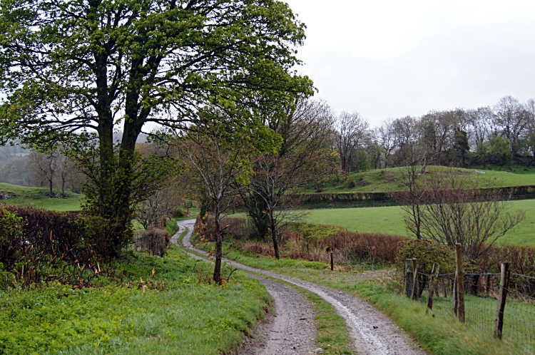 Lane to Llandegla
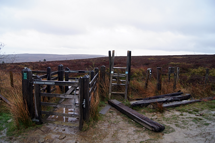 Moorland after Llandegla Forest
Drizzle turned to heavy rain as I left the Clwydian Range and headed across the valley of the River Alyn to the village of Llandegla. The walking was the usual mix of field crossings, county lanes and unmade byways which are a delight to stroll the time away on. As long as one section is not too long the scene changes now and then, paces are stepped, scenes are viewed, more paces are stepped, interesting observations are made, animals are encountered which are usually friendly and/ or inquisitive and steady progress is made. Soon enough another subtle change in scene and mood was revealed as I arrived at the low flood plains/ wetlands of the River Alyn just before I arrived in Llandegla. Springs popped up here and there and some sidestepping of puddles had to be done. All part of the long distance walking experience. Still, in all the fun I had been out in the rain all morning and despite being in good waterproofs top and bottom I was wet and getting weary from it. I hoped for a shop in Llandegla but sadly the small, one long street village had none. Fortunately they had catered for me though. A sign beckoned me into the Church dedicated to St. Tecla where free refreshments were available. Hot water, tea, coffee, home made cakes, biscuits. Enough to keep me going. I stripped off my wet gear and made myself a hot cup of tea. I enjoyed a piece of cake and a couple of biscuits while relaxing in the church. Twenty minutes later I made a donation to the church, put on my part dried wet gear and walked out into the still bad weather day. I walked all the way up the long single street of the village and saw no one. I then crossed the A5104, crossed a field, crossed the A525 and climbed on the Clwydian Way which I was also following now, into the darkness of Llandegla Forest. At least the cover of managed plantation conifers kept some of the rain off.
 Road to World's End
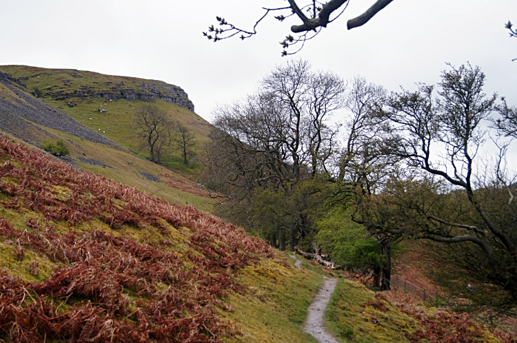 Following the path to Craig Arthur
The path through the forest had been a winding route and forever a climb but at least with no interesting views, just all the same, line upon line of upright conifer trunks, I had put my head down and make the climb from 280 meters elevation in Llandegla to 500 meters elevation just east of the summit of Cyrn -y-Brain (563m). The climbing for the day was done, bar a little exciting hill for the finale... more on that soon. For now I tracked across moorland on narrow paths and on long sections of wooden planks to meet a minor road leading me down to World's End at the head of the Eglwyseg valley. As soon as I clapped eyes on the Eglwyseg Rocks within the valley I was transfixed by the beauty of their form. And I knew I was heading straight to them which excited me even more. Still damp and overcast and yet with rain relenting the weather did not matter one jot. I was too involved with the anticipation of walking down through the Eglwyseg valley.
 Crossing a scree slope at Eglwyseg Rocks
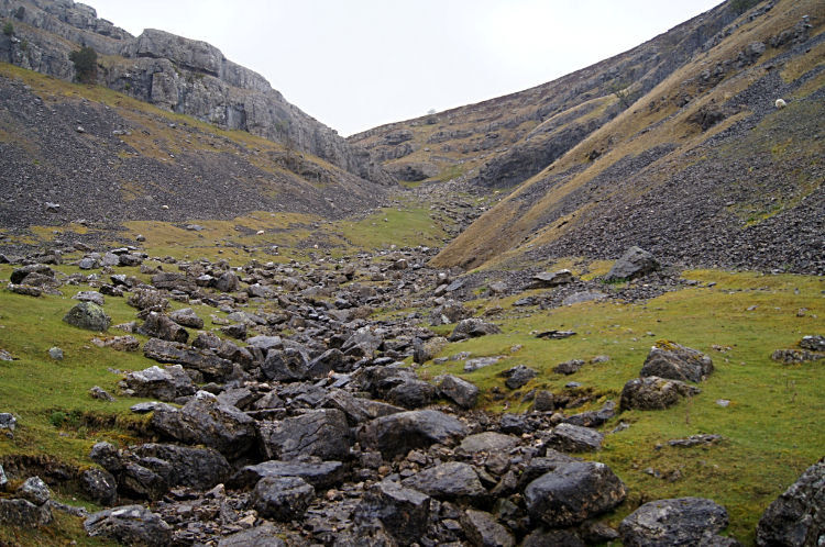 At Bryn Goleu
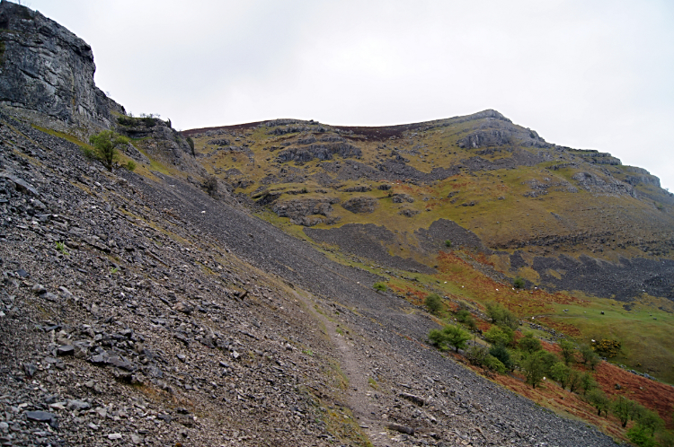
I left the tarmac road leading down to the head of the valley at World's End but not before I crossed the forming Eglwyseg River by way of wet patch crossing the road at a river ford. The first trickles will have formed on Eglwyseg Mountain which was shielded from my view by the limestone escarpment I was heading towards. First from the road I walked through a small nature reserve of immature trees. Soon after I was following the narrow path below the limestone escarpment to my right. Sometimes the path was so tight I had to cross one leg in front of the other to proceed like walking a tightrope and quite often I was waling on an angle with my right leg on a lower level than my left. Thus the lower right leg was straightened on extension while the upper left leg remained at some angle while walking. Fun it was especially when crossing scree slopes tumbling down the slope. There were quite a few scree slopes too. As i walked below the escarpment Carrion crowed above me and the wind breezed through with a whisper. Otherwise it was quiet. Another day of hardly any souls but me. The road was not far below me into the valley and running parallel but I did not see a vehicle pass. Weird it was but thrilling to me just the same. In two miles of walking on the narrow ledge I passed Craig yr Adar, Craig Arthur and Bryn Goleu before dropping to the valley road near Rock Farm.
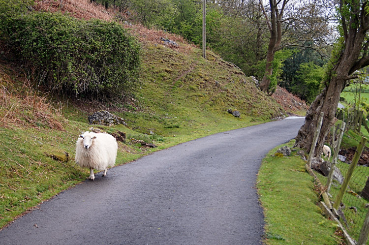 Meeting with another walker
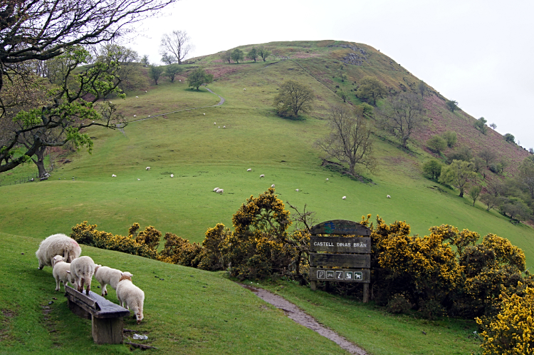 Dinas Bran
Two miles of Offa's Dyke Path walking remained, most off it keeping a parallel line to the escarpment. Only this time I was walking on a road rather than on an angled narrow path. On the road walk I passed a sign at a road junction with direction pointers to either world's End, Panorama or Llangollen. Though Llangollen was my destination for the evening Panorama was my destination for now. I continued on the road and on the way I passed a fellow walker. Only this time the walker had four legs, a fluffy fully fleeced sheep which was not bothered by me walking right past it. I said "Hello" and the sheep simply looked at me with a glance before passing me and continuing walking in the opposite direction. Not long later I came a point where I just had to extend my version of the walk from the official Offa's Dyke Path by leaving the roadside to climb Dinas Bran.
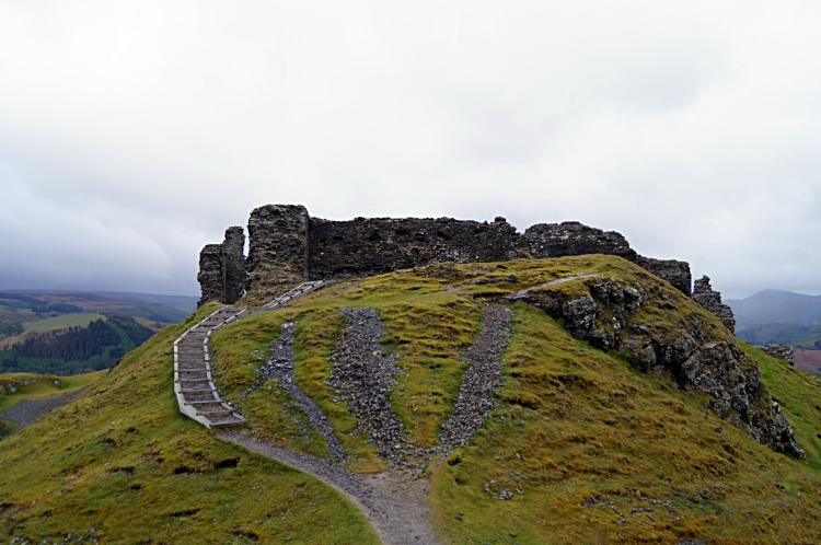 The Crow's Fortress
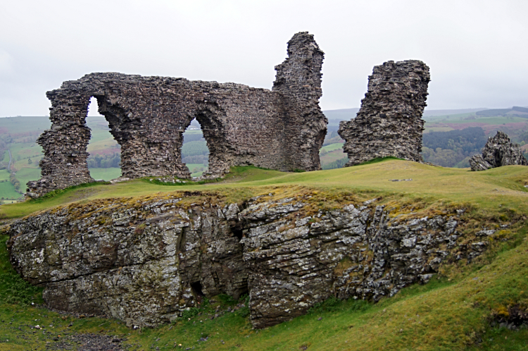 Castell Dinas Bran
The reason for my extra climb to the top of the hill was to visit Castell Dinas Bran, translated as the "crow's fortress". The site, on top of the hill which is steep on all sides is a formidable defence but judging by the overcast and cool conditions in which I arrived at the fortification I imagine it was pretty grim up here most of the time. Still, the scene which unveiled as I approached the site of the castle was gobsmacking. For pure romance this was one of the best castle ruins I had ever seen. It still is. WOW is an emotion I keep for the best of the best moments I have in life and in my walking but I have no reservations in saying my visit to Castell Dinas Bran was a WOW moment. I was taken in by the splendour of the place and in ruin it was perhaps better than when whole as a working living castle. The ruins are spectacular. I stayed for ages walking around and around, viewing the castle from all angles and viewing the scenes of the Eglwyseg valley below. as much as I could in the misty conditions. Rain may have ceased but the air was still wet and clammy.
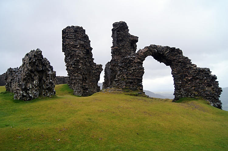 Impressive ruins of Castell Dinas Bra
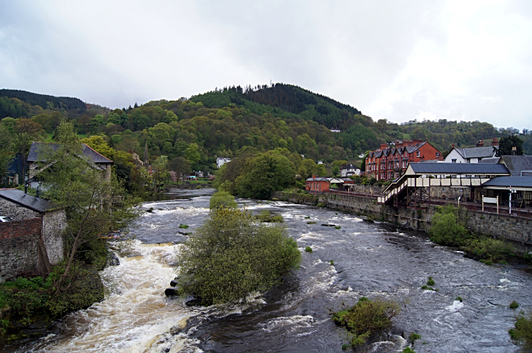 River Dee at Llangollen
I stayed at Castell Dinas Bran for a half hour before leaving my Offa's Dyke Path walk to follow a path down the west side of Dinas Bray to Llangollen. I did not really want to go but the thought of getting warm and drying out after around eight hours of walking in the rain appealed to me. While I prefer to walk in the sunshine... who doesn't... I often think a gray wet day has its character and this stage of walking in a region well known for wet weather was probably appropriate. It did not dim the enjoyment of my walk. Another fantastic day on the trail was done. As I walked into Llangollen and crossed the bridge over the River Dee I looked down to the awesome sight of the foaming and roaring river. I though "Plenty of that water dropped on me earlier. Great eh". Then I thought a little more "Let's see what tomorrow brings. I hope I have as much fun".


