Glencoe, Pap of Glencoe and Signal Rock
Through the glen, exploring the historic landscape of Glen Coe
Google Maps Open Source Maps| Statistics and Files | ||
|---|---|---|
| Start: Glencoe | Distance: 9.8 miles (15.7 km) | Climbing: 1,027 metres |
| Grid Ref: NN 09793 58741 | Time: 4-6 hours | Rating: Hard |
| GPX Route File | Google Earth File | About Glencoe |
| Statistics | |
|---|---|
| Start: Glencoe | Distance: 9.8 miles (15.7 km) |
| Climbing: 1,027 metres | Grid Ref: NN 09793 58741 |
| Time: 4-6 hours | Rating: Hard |
| GPX Route File | Google Earth File |
Ordnance Survey Explorer Map (1:25,000)
The Walk:
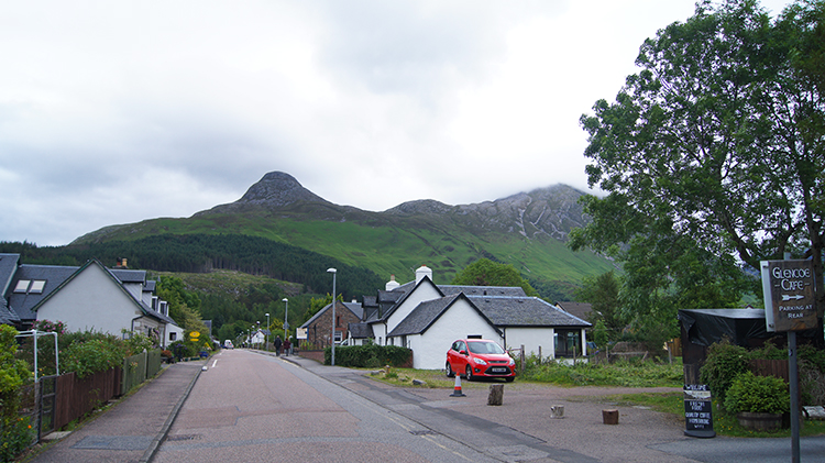 View to the Pap of Glencoe from Glencoe village
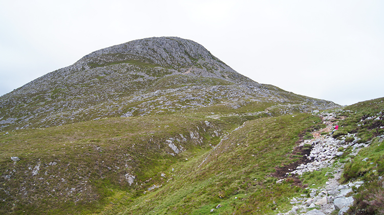 Pap of Glencoe
Glen Coe's rugged peaks, cliffs and gullies have long being popular with walkers and climbers. This walk has the double attraction of dramatic highland scenery and interesting historical sights relating to the Massacre of Glencoe in 1692. The massacre was one of the darkest deeds in Scottish history which gave the glen its alternative name "The valley of weeping".
Today Glencoe village sits comfortably at the foot of the wild and dramatic glen, with Loch Leven beside it. The village has its own museum, the North Lorne and Glencoe Folk Museum, sited in an old thatched cottage. Displays show what life was like here in the past centuries, and are extremely well laid out and described.
The main village street leads the eye along and upwards to the Pap of Glencoe, a cone-shaped hill set between the glan and the fjord like waters of the loch. The best views of the pap are from the shores of this sea loch. From the pap itself the summit of Ben Nevis can be seen to the north. From the village follow the road up towards the Pap and after turning from east bound to south-east keep going a mile or so to reach the point where a path on the left leads from the road up to the pap. Climb up to the summit and reurn via the same way.
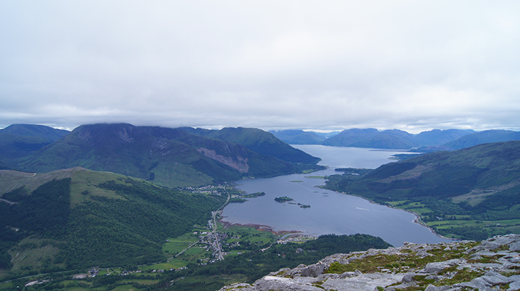 Loch Leven and Loch Linnhe
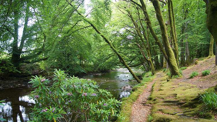 River Coe
Following the climb to the pap and on the return to the road continue following the road south-east. In the heart of the glen is the Clachaig, an old coaching inn. Running down to it is the huge cleft of Sgorr nam Fiannaidh, otherwise the Clachaig Gully, first climbed in 1938. A footbridge over the River Coe leads to the National Trust for Scotland visitor centre. Here the history of the massacre and information on the regions geology is at hand. One locality mentioned, which is near enough to visit, is Signal Rock. The rocky hillock has commanding views of the glen.
On the return trip, following the gorgeous River Coe downstream and back towards the village, is the opportunity to divert from the road and head through attractive woodland to Glencoe Hospital. There are several forest trails to follow in the impressive grounds. Also, a lochan was created in the grounds which is surrounded by rhododendrons and wild flowers.
Acknowledgment: Text derived from the Out and Out Series; Discovering the Countryside on Foot.
Feedback and Suggestions: To suggest a link for inclusion on a this page please complete the Walking Englishman Feedback Form. Thank you.


