North Arran
Enjoy a moorland and coastal walk on Arran, the Misty Isle
Google Maps Open Source Maps| Statistics and Files | ||
|---|---|---|
| Start: Lodge Farm, Lochranza | Distance: 6.6 miles (10.6 km) | Climbing: 410 metres |
| Grid Ref: NR 93973 50536 | Time: 3 hours | Rating: Moderate |
| GPX Route File | Google Earth File | About Arran |
| Statistics | |
|---|---|
| Start: Lodge Farm, Lochranza | Distance: 6.6 miles (10.6 km) |
| Climbing: 410 metres | Grid Ref: NR 93973 50536 |
| Time: 3 hours | Rating: Moderate |
| GPX Route File | Google Earth File |
Ordnance Survey Explorer Map (1:25,000)
The Walk: The Isle of Arran lies in the broad estuary of the Firth of Clyde. The northern tip of the island has magnificent mountains where herds of red deer roam. After climbing over moorland slopes this walk continues along the shore of one of Arran's raised beaches, passing over rocks millions of years old. This walk offers opportunities to observe the red deer, seals and basking sharks which patrol offshore. Ravens, buzzards, peregrines ducks, oystercatchers and sandpipers are birds on the list to tick off and maybe, just maybe, a cuckoo or even a golden eagle may be spotted.
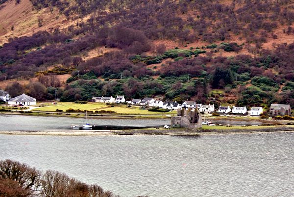 Lochranza
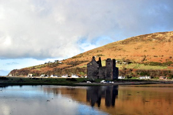 Lochranza Castle
There is a steady climb from the start of the walk to a boggy moorland pass at 240 metres high between Tor Mheadnonach and Creag Ghlas. Close to the right lies a disused slate quarry. The quarry mined Lochranza Slate which used to be taken down to the village in carts.
A steep sloping path leads down to a ruined stone house with a drystone wall. It would have been thatched when in use. The small windows were intentional to keep out thew wind and driving winter snow. Next door was a cow barn and there was a covered passage between house and shed to keep out the cold when the farmer did his daily milking. Further on, larger Cock Farm, also now a ruin, was home to a wealthier family. It was the ancestral home of the MacMillan family. The most famous son was Harold MacMillan, Prime Minister from 1957 to 1963.
The shore path passes over the 80 meter high raised beach. The sea level was much higher years ago because of the massive weight of the ice sheet. As the ice melted the land rose leaving raised beaches, backed up with stranded sea cliffs. Ossian's Cave, founded at the base of one of the stranded sea cliffs has faint carvings of ships and dates on its walls, said to be the work of sheltering quarrymen. The Cock of Arran, a huge boulder of sandstone, once looked like a cockerel crowing. It was used to guide fishermen home but over time the cock has lost its head to erosion. There are more wonders on the return to the start including An Scriodan rockfall and Hutton's Unconformity, an unusual formation of rocks named after local geologist James Hutton.
Acknowledgments: Text derived from the Out and Out Series; Discovering the Countryside on Foot. Pictures courtesy of Wikipedia.
Feedback and Suggestions: To suggest a link for inclusion on a this page please complete the Walking Englishman Feedback Form. Thank you.


