Tillicoultry, Ochil Hills and Blackford
Crossing the Ochil Hills in the footsteps of the early weaver pioneers
Google Maps Open Source Maps| Statistics and Files | ||
|---|---|---|
| Start: Tillicoultry | Distance: 9.7 miles (15.6 km) | Climbing: 738 metres |
| Grid Ref: NS 91423 97481 | Time: 4-6 hours | Rating: Hard |
| GPX Route File | Google Earth File | About the Ochil Hills |
| Statistics | |
|---|---|
| Start: Tillicoultry | Distance: 9.7 miles (15.6 km) |
| Climbing: 738 metres | Grid Ref: NS 91423 97481 |
| Time: 4-6 hours | Rating: Hard |
| GPX Route File | Google Earth File |
Ordnance Survey Explorer Map (1:25,000)
The Walk: This is a linear walk along an old trade route through a range of 2,000 foot (610 metre) hills. The walk has a wonderful open aspect, with more of a moorland than mountain character. Naturally, with such a gain in height, the walk offers spectacular views. This route would have been used by Tillicoultry weavers of the early to mid 1800's as they went to trade their wares with the leather workers of Blackford, 7 miles away on the far side of the hills.
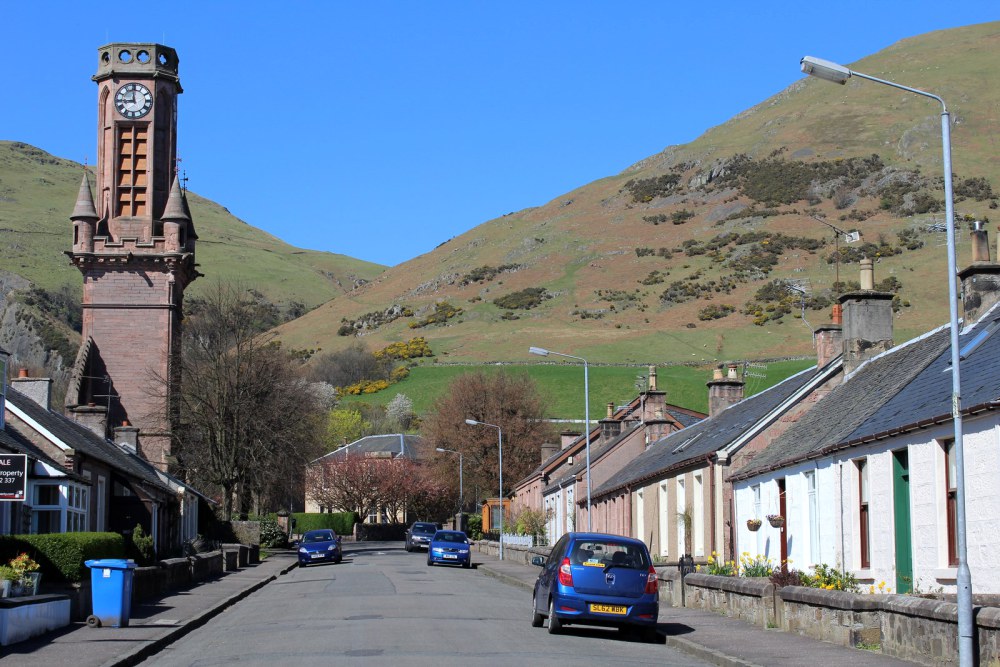 Clock tower in Ochil Street, Tillicoultry
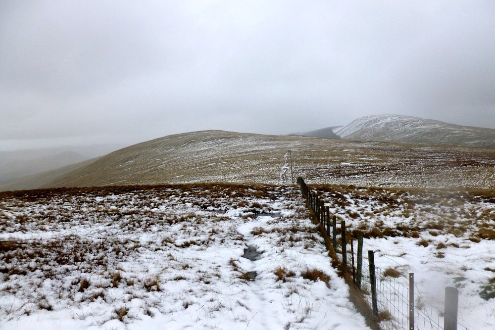 Skythorn Hill
The Clock Mill Heritage Centre, on Ochil Street in Tillicoultry, at the start of the walk, is a former mill building, built in 1824. Now converted to private dwellings it used to house an exhibition of information and machinery relating to the history and development of woollen production in the district of Clackmannanshire.
Leaving the town by climbing beside the tumbling waters of the burn of Mill Glen you will enjoy the sight of a series of small water cascades. The maintained path through the glen crosses over bridges and goes up steps to give high vantage points which provide fine views of the deep gorge. Also take time to look down over the town as you depart on your way northwards into the Ochil Hills.
Shortly, beyond a quarry, another bridge is reached from where there are views to the old wooden dam - another connection with the weaving industry. Water was an essential power source for the looms and this dam, an impressive piece of engineering in its day, was built to harness the flowing burn and provide a guaranteed source of natural power that would last throughout the year.
The path gradually climbs out of the gorge onto the open hillside. Much of the visual attractiveness of the Ochil Hills lies in the dramatic escarpment that plunges down to the towns and villages that have grown up in the valleys. The name 'Ochil' derives from the Celtic word 'Uchil' which means high ground. Millions of years ago, a natural break in the earth's crust occurred near where the city of Stirling now stands. The break, known as the Ochil Fault, ran east-west for twenty miles. It had the effect of throwing down all the land south of it to an original depth of 10,000 feet (3,000 metres) in the flood plain, which is now silted up.
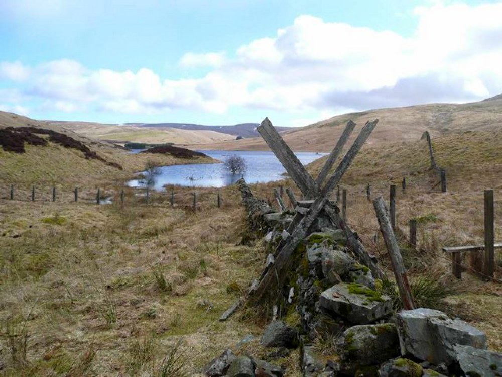 View to Upper Glendevon Reservoir
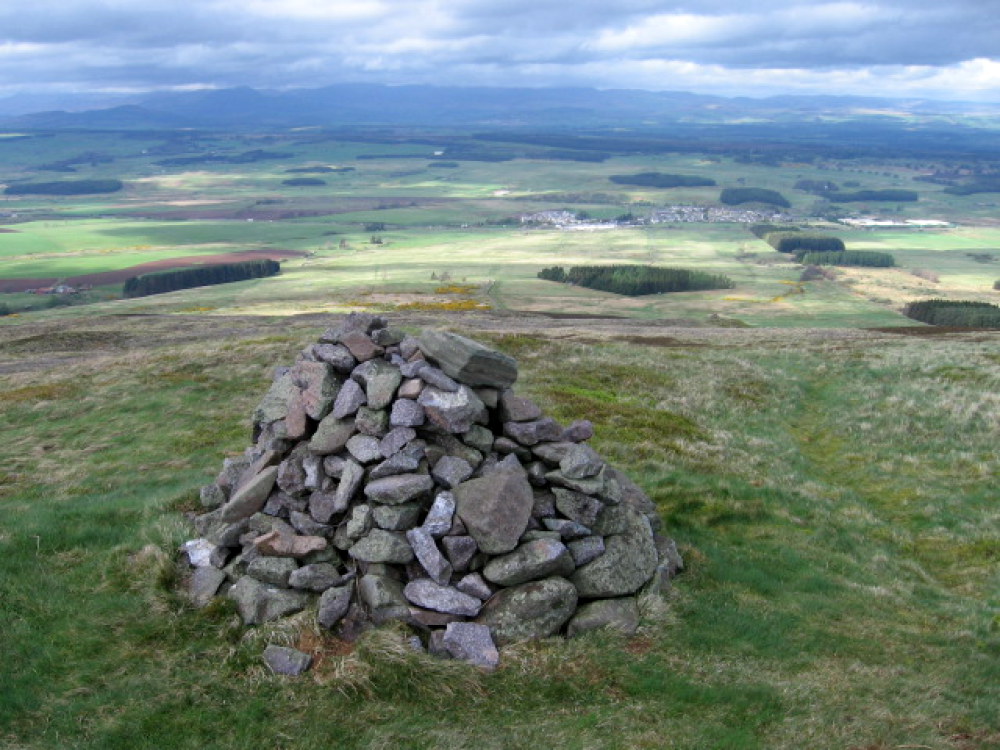 View to Blackford from Kinpauch Hill
It is this plain, containing the meandering River Forth and its surrounding farmland and industry, that you look back on as you pause on the climb towards Skythorn Hill, at 1,972 feet (601 metres), the highpoint of the walk. By the time you reach Maddy Moss, the climbing is largely behind you, and a short time later, in the vicinity of Skythorn Hill you will have reached the Ochil Hills watershed. To the left you will see the highest point in the Ochil Hills. Ben Cleuch at 2,400 feet (721 metres) is easily attainable from where you are, should you feel up to it. A mile there and a mile back along an inviting ridge with Andrew Gannel Hill as the midpoint, would do the trick.
The next stage of the walk is a pleasant romp along the northern shoulder of Skythorn Hill to Upper Glendevon Reservoir, which can be glimpsed ahead of you. Although well away from civilisation by this time, the Ochils have a friendly feel to them. This is the remotest section of the walk and you are unlikely to meet anyone else, especially if you choose a weekday for your outing.
The reservoir dam is a good place to pause for refreshments. If you have brought a pair of binoculars you can take a closer look at the ducks and waders on the water and the small islands in its midst. Mallard, curlew, oystercatcher and plover are amongst the birds to look out for. The reservoir is one of two in the glen, Lower Glendevon Reservoir being the companion to this water catchment scheme and visible from where you are on the dam, to the east.
The reservoirs, nor the recently installed wind turbines of nearby Burnfoot Hill wind farm, diminish the beauty of the surroundings. The original trade route followed by the weavers is covered by the water though, so you have to find your way back to the original route by following the path from the dam to the Glen of Kinpauch Pass. Around here, the town of Blackford appears in view, set in the flat farmland of Perthshire. The big white building of Tullibardine Distillery is prominent here and serves as a good focal point for drawing you in to the finish of the walk. Incidentally if whisky is not your tipple then the world famous Highland Spring water company is also based in Blackford.
Acknowledgments: Text derived from the Out and Out Series; Discovering the Countryside on Foot. Pictures courtesy of Wikipedia.
Feedback and Suggestions: To suggest a link for inclusion on a this page please complete the Walking Englishman Feedback Form. Thank you.


