Iona - St Columba's Isle
A walk around a beautiful island rich in Christian history
Google Maps Open Source Maps| Statistics and Files | ||
|---|---|---|
| Start: Jetty | Distance: 5.4 miles (8.7 km) | Climbing: 124 metres |
| Grid Ref: NM 28682 24022 | Time: 2-3 hours | Rating: Easy |
| GPX Route File | Google Earth File | About Iona |
| Statistics | |
|---|---|
| Start: Jetty | Distance: 5.4 miles (8.7 km) |
| Climbing: 124 metres | Grid Ref: NM 28682 24022 |
| Time: 2-3 hours | Rating: Easy |
| GPX Route File | Google Earth File |
Ordnance Survey Explorer Map (1:25,000)
The Walk: In the spring and early summer, the wealth of birds and abundant wild flowers make a walk on this tranquil island a delightful experience. Iona is a low, sandstone island, 3.5 miles long and 1.5 miles across. Within this small area lies a site of great importance for the history of Christianity. Half a million visitors embark at the jetty every year and most venture no further than the church and the abbey. Farther afield, the walker will find peace and natural beauty in abundance, with an unspoilt coastline of shady beaches, rocky cliffs, undulating moorland and fine farmland where the traditional Hebridean crofting life continues untouched by the many visitors.
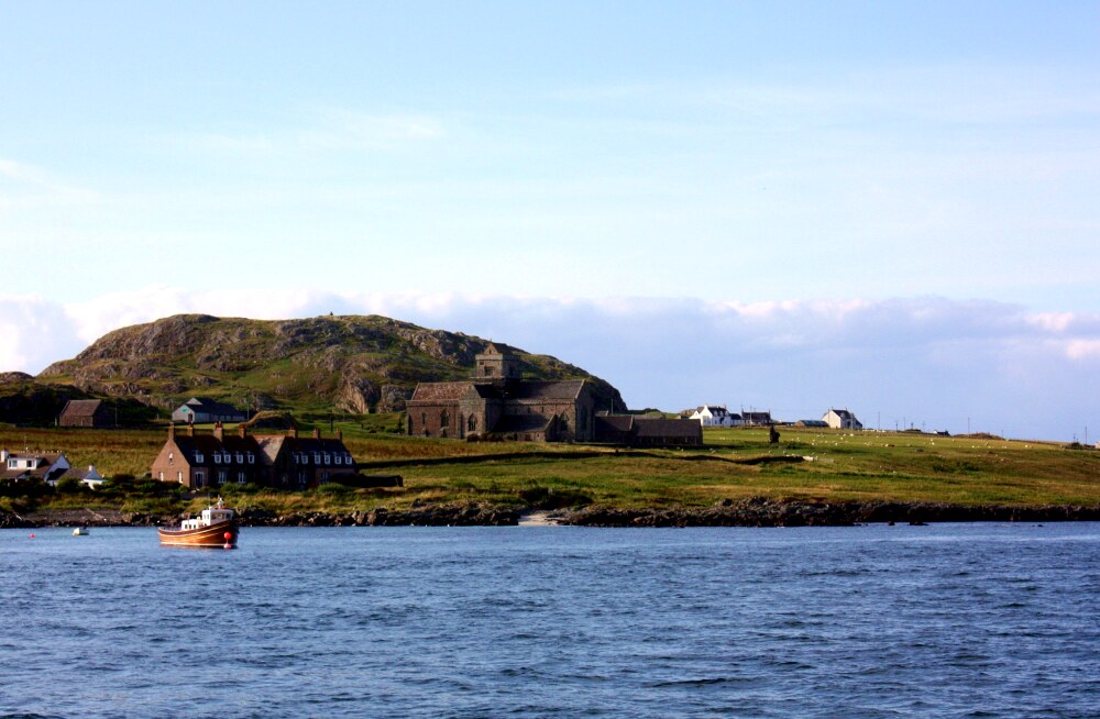 Isle of Iona
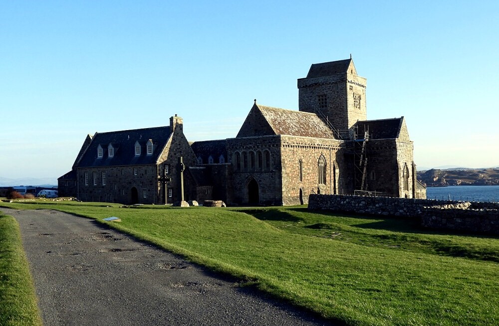 St Mary's Abbey
It is well worth taking some time to explore the abbey, probably the Hebrides most splendid building, and to absorb the atmosphere of the place. Beautiful stone crosses stand in front of it, and inside the abbey complex are the reconstructed cloister and a bookshop. There is also a museum.
The exact spot of St Columba's original monastery is not known for certain, but many believe that the present abbey stands on it. In St Columba's day, the church and the houses would have been built from wattle, and surrounded by an earthwork vallum to mark the boundary and keep out cattle. The monks went out from Iona to found more monasteries and churches among the provinces of the Picts. Such was Columba's influence that, for a thousand years after his death, the island was known as 'I-Chaluim-cille', the island of St Calum.
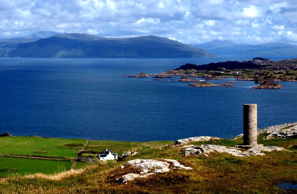
The road that the first part of this walk follows goes north, away from the area where most tourists gather, and passes several crofts, where sheep and cattle graze. Eventually the road reaches the grazing land at the north end of Iona, beyond Lagandorian, the last farm. A small rocky knoll nearby is known as the Hill of the Seat - it was reputedly a favourite spot visited by St Columba. Colourful lichens grow profusely on the rocks. Iona's geographical position ensures superb views of the scattered islands of the Inner Hebrides - east to the rugged coast of Mull, west to Coll and Tiree and north to the Treshnish Islands: Rhum, Ulva and the basalt island of Staffa. The latter is the site of Fingal's Cave, made famous by the composer Mendelssohn in his Hebrides Overture after his visit to the region in 1829.
The next stretch of the route is on machair and moorland along the north-west coast of Iona. Machair is the term given to the grassland that grows on shell sand along coasts in the Hebrides. The machair starts with the florally sterile tidal zone of shell sand. This is followed by sand dunes where marram grass grows thinly on the seaward side and begins to stabilise the dunes. Gradually a rich shell sand grassland develops which is heavily grazed by crofters stock.
The flowers of the machair, offset by the blue of sky and sea, are a delight on a fine summers day. There are dozens of species here such as harebell, primrose, wild pansy, wild thyme, birds foot trefoil, forget me not, eyebright, daisy, buttercup and many others. Although Iona cannot rival islands such as St Kilda or Handa for the sheer spectacle of of their huge sea bird colonies , there is a wide variety of birds to be seen here, as on all Hebridean islands. They range from sea birds to waders and the birds of the machair such as the golden plover and skylark.
 Dun I at 100 metres altitude
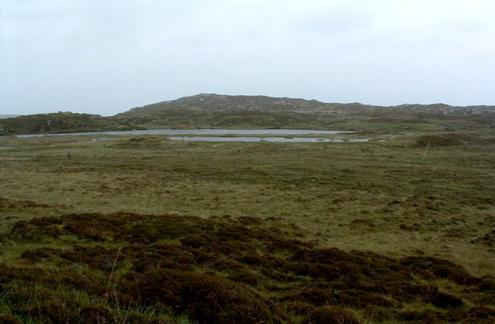 Loch Staoineag
Where the route heads west behind the sandy bay called Traigh an t-Suidhe (Strand of the Seat), the sandy beach also has many rocky outcrops and pools. The promontory of Carraig an Daimh forms a rocky hillock above an expanse of round pebbles and leads down to a small inlet known as Port Carraig an Daimh. Above, the steepness of the cliffs makes it necessary to walk inland a little way to cross the rough moorland between here and Camus Cull an t-Saimh (Bay at the Back of the Ocean). Seals may be seen on the shore, and the lucky and observant visitor may even see an otter. Occasionally it is possible to see the ferry as it runs between the islands of Coll and Tiree.
Eventually there is a beautiful view of the lush machair behind Camus Cull an t-Saimh as the path descends from the moor onto the smooth green grass sweeping around the bay. There are some fine sandy beaches tucked away between rocky headlands and islets such as Eilean Didil. At this part of the walk, the main bay curves around to the hilly moorland at the south-west end of Iona. The machair is rimmed by the storm beach of thousands of smooth pebbles and rocks thrown up to the back of the beach by winter storms.
As you cross the island back to the Sound of Iona, you pass several crofts. In the summer, corncrake may be heard - though these elusive birds are seldom seen. They skulk low in the hay meadows. Though this bird was once common it is now extremely rare in the British Isles due to loss of habitat caused by modern farming methods. It can be found here and in similar island locations where old farming practices are still widely practiced.
On returning to the eastern shore of the island, facing the Sound of Iona, the road turns northwards. It leads back to Baile Mor, passing several more crofts, scattered along the coast. A war memorial is also passed before the walk finally returns to the jetty.
Acknowledgments: Text derived from the Out and Out Series; Discovering the Countryside on Foot. Pictures courtesy of Wikipedia.
Feedback and Suggestions: To suggest a link for inclusion on a this page please complete the Walking Englishman Feedback Form. Thank you.


