Water of Leith Walkway and Colinton Dell
A country walk by canal, river and old railway in the heart of Edinburgh
Google Maps Open Source Maps| Statistics and Files | ||
|---|---|---|
| Start: Visitor Centre | Distance: 3.3 miles (5.3 km) | Climbing: 131 metres |
| Grid Ref: NT 22252 70936 | Time: 2 hours | Rating: Easy |
| GPX Route File | Google Earth File | About Water of Leith |
| Statistics | |
|---|---|
| Start: Visitor Centre | Distance: 3.3 miles (5.3 km) |
| Climbing: 131 metres | Grid Ref: NT 22252 70936 |
| Time: 2 hours | Rating: Easy |
| GPX Route File | Google Earth File |
Ordnance Survey Explorer Map (1:25,000)
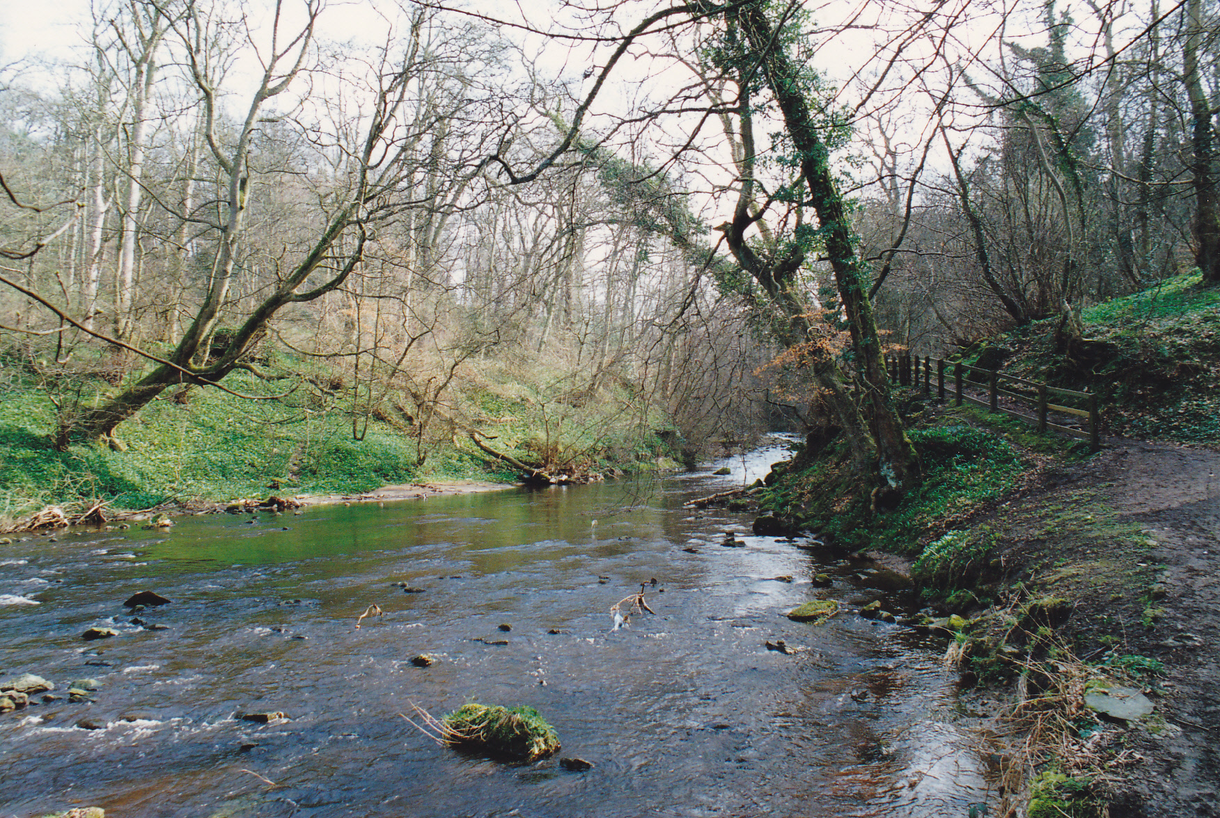
The Walk: The Water of Leith flows from the Pentland Hills through central Edinburgh to the Firth of Forth. Its walkway forms one of the finest riverside walks in Scotland. Especially beautiful are the woodland sections, where the river runs through Craiglockhart Dell and Colinton Dell. Both are features of this walk. The mostly planted woods exhibit a tremendous variety of trees. In early summer, the smell of wild garlic here can be intoxicating. In former days, the river's power was used to drive water mills such as those at Redhall and beside Spylaw House. The weir and lade (mill stream) that supplied water to Redhall Mill can still be seen above Spylaw House at at Slateford.
 Water of Leith
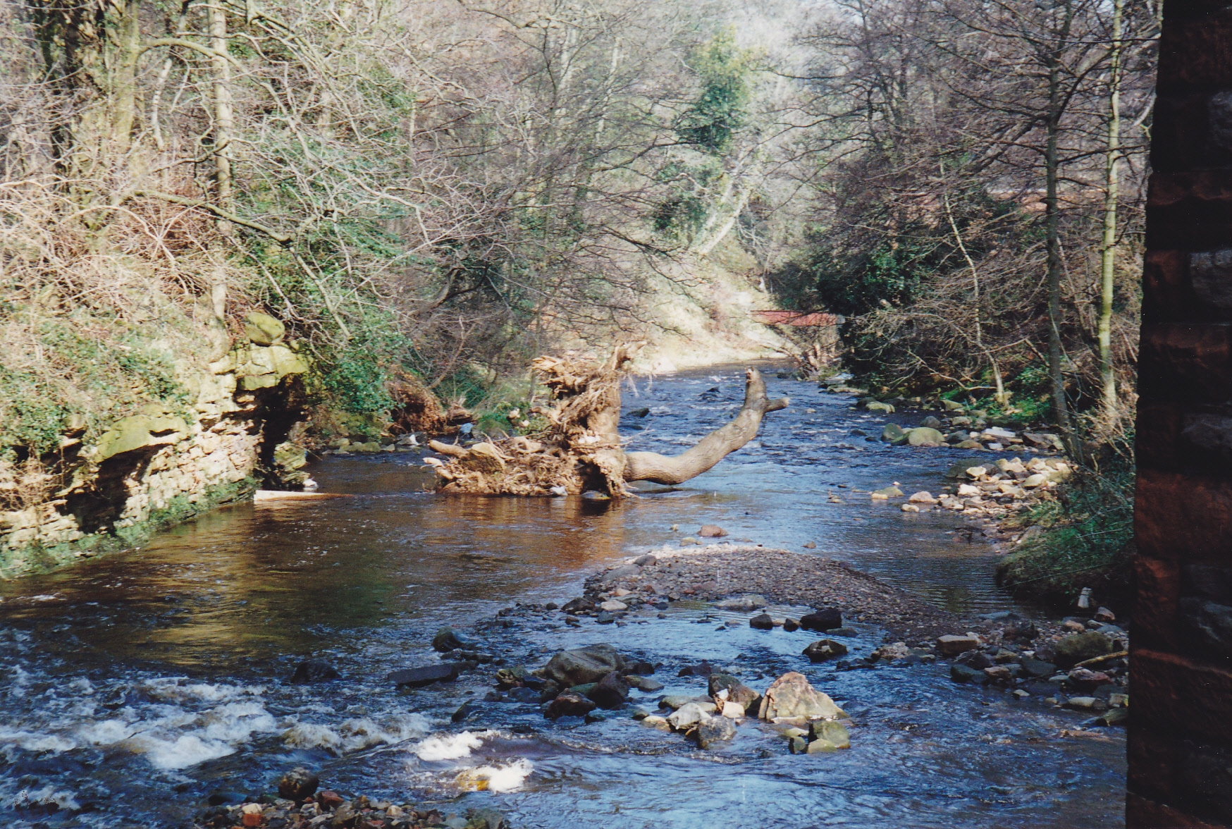 Colinton Dell
Colinton, whose name means 'the village in the wood' was originally an isolated rural community that grew up around the head of Colinton Dell at a place that was easily forded by herdsmen and other travellers. It is now part of the city of Edinburgh, but has retained an authentic village quality with a variety of buildings spanning the past four centuries. The parish church, rebuilt in 1909, stands on the site of a church dating back at least to the 11th century.
Further on is the point where an off shoot of the Edinburgh to Glasgow railway reached Colinton in 1874. The line, was closed in 1967 and now forms a fine walking route through Colinton Dell. The eerie Easter Hailes Gate Tunnel is a long, curving and dimly lit structure, with an uneven top and a constantly dripping roof. Indeed, after prolonged spells of heavy rain has eased, one is more likely to get wet within the tunnel than out in the open.
Soon after, you come to the Union Canal. The Colinton area has one of its finest stretches, with a 600 feet (183 metre) eight arched aqueduct that gives fine views over the city.
Acknowledgments: Text derived from the Out and Out Series; Discovering the Countryside on Foot. Pictures courtesy of Wikipedia.
Feedback and Suggestions: To suggest a link for inclusion on a this page please complete the Walking Englishman Feedback Form. Thank you.


