Isle of Raasay - Clachan, Dùn Caan and Inverarish
An island walk past mountain lochs to the summit of Dun Caan
Google Maps Open Source Maps| Statistics and Files | ||
|---|---|---|
| Start: Raasay Jetty | Distance: 10.1 miles (16.3 km) | Climbing: 645 metres |
| Grid Ref: NG 54515 36332 | Time: 4-5 hours | Rating: Hard |
| GPX Route File | Google Earth File | About Raasay |
| Statistics | |
|---|---|
| Start: Raasay Jetty | Distance: 10.1 miles (16.3 km) |
| Climbing: 645 metres | Grid Ref: NG 54515 36332 |
| Time: 4-5 hours | Rating: Hard |
| GPX Route File | Google Earth File |
Ordnance Survey Explorer Map (1:25,000)
The Walk: In clear weather, it is possible to see the curious shape of Dùn Caan from the mainland of Scotland, near Applecross, or from the north-east coast of the Isle of Skye. This walk takes you to the peak of this flat topped cone of a mountain, which has a peak of basalt columns. It also leads you around the landscape of the south end of Raasay, which has a rich variety of moorland, mountain gorges, forests and arable valleys.
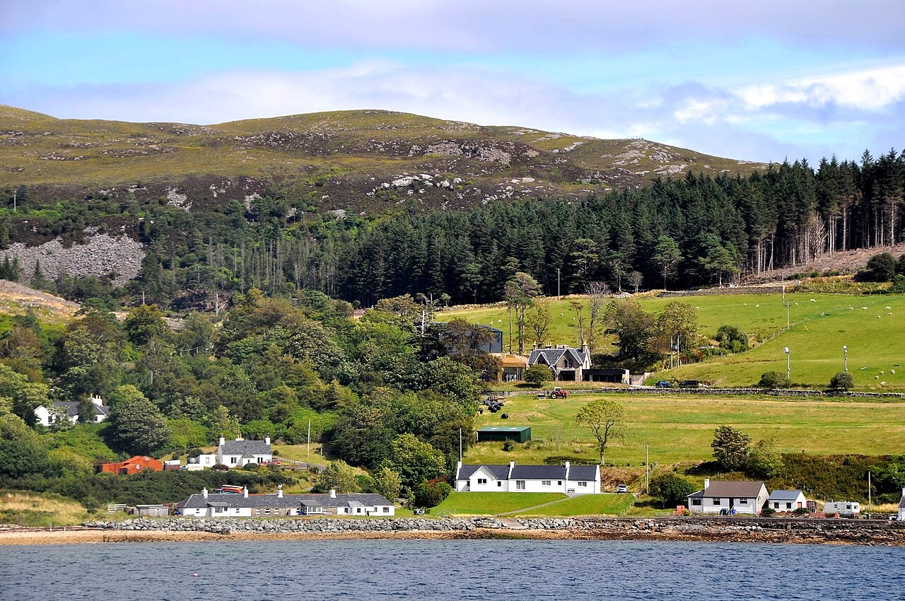 View from Narrows of Raasay
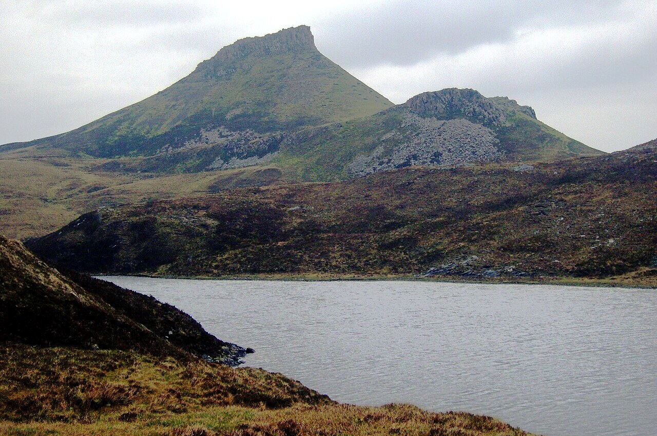 Dùn Caan
From the start the walk heads up into the forests of pine and beech, the first point of interest being the lovely little Loch a' Mhuilinn. Although it is used by Raasay House Hotel and Outdoor Activity Centre for fishing and canoeing, it remains a haven of peace, overhung by a variety of trees and rhododendron bushes.
Once you are out into the open countryside, there are marvellous views over to Skye on your left, particularly from a viewpoint on the road that overlooks the tiny hamlet of Oskaig. The lochs to the right are excellent places by which to stop and rest. During the early summer they are a haven for water lillies and dragonflies. Only the calls of gulls and oystercatchers disturb the peace. And watch out for scuttling sounds in the grass. Raasay has its own unique species of bank vole, but you would be lucky to catch a glimpse of one.
The mountain path offers a clear stony climb, but it is fairly gradual and no serious challenge until you reach the beautiful mountain lochs. The largest of these, Loch na Meilich, is Raasay's major source of drinking water. The smaller nearby loch is from where the steeper climb to the summit of Dùn Caan begins. From the summit the view back over the straits to the mainland and down along the coast to Raasay itself (a common haunt of Golden Eagles) rewards your effort.
From the summit of Dùn Caan the second half of the walk follows a less well trodden path over wild moorland with the turbulent Inverarish Burn guiding the way. As the stream descends, the flat rocks of the bed tilt at ever more rakish angles. Eventually you can hear the sound of the rushing waterfalls at the edge of the forestry land. In season, the moorlands are bathed with the beauty of heather, moths and butterflies, and the air is filled with birdsong.
A pleasant downhill walk, through the trees and over springy turf, marks the walk into Inverarish, Raasay's largest settlement. Here you will find remnants of the islands industrial past - old mills and the dismantled remains of a railway that used to serve the islands iron ore quarry. After exploring Inverarish all that remains is a short amble back to the jetty.
Acknowledgments: Text derived from the Out and Out Series; Discovering the Countryside on Foot. Pictures courtesy of Wikipedia.
Feedback and Suggestions: To suggest a link for inclusion on a this page please complete the Walking Englishman Feedback Form. Thank you.


