Isle of Bute - Kilchattan, St Blane's, Dunagoil Fort
Explore the south coast of a craggy island with visits to ancient remains
Google Maps Open Source Maps| Statistics and Files | ||
|---|---|---|
| Start: Kilchattan | Distance: 7.9 miles (12.7 km) | Climbing: 283 metres |
| Grid Ref: NS 10314 54969 | Time: 3-4 hours | Rating: Moderate |
| GPX Route File | Google Earth File | About Bute |
| Statistics | |
|---|---|
| Start: Kilchattan | Distance: 7.9 miles (12.7 km) |
| Climbing: 283 metres | Grid Ref: NS 10314 54969 |
| Time: 3-4 hours | Rating: Moderate |
| GPX Route File | Google Earth File |
Ordnance Survey Explorer Map (1:25,000)
The Walk: This walk is interesting from the start. The woods to the south end of Kilchattan Bay give way to a raised beach with shoulder high bracken and squelchy ground underfoot. On one side is a rocky shoreline, on the other, shrub and bracken covered cliff faces. As you head south towards the lighthouse at Rubh an Eun there are many geological phenomena to see. These include columnar sandstone, honeycomb eroded red sandstone and carboniferous lava flows. The expert eye may find in them linings of jasper, agate and garnet. There is a fine view here over the Firth of Clyde with yachts and commercial shipping making their way between Bute, Great Cumbrae and Little Cumbrae.
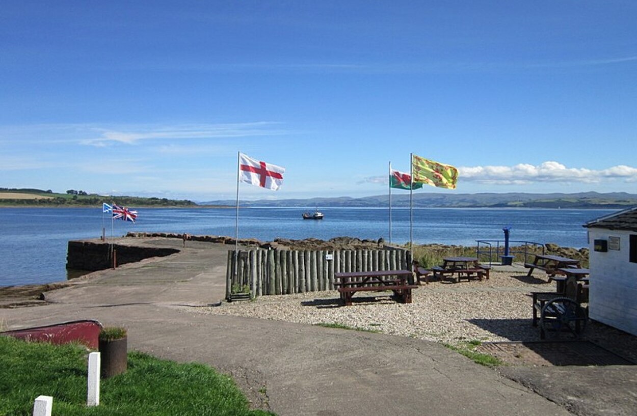 Kilchattan Bay
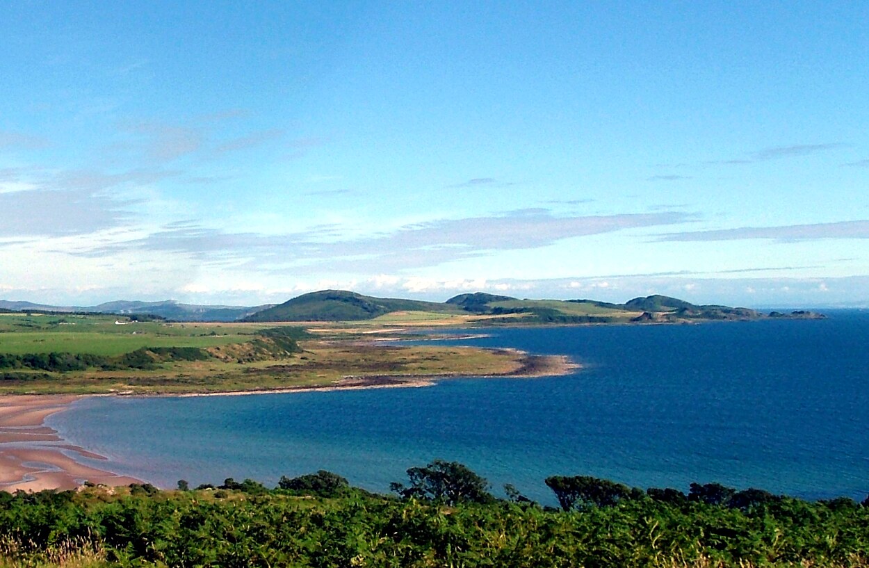 View to the southern hills
The lighthouse on the east arm of Glencallum Bay is a modest structure on a small plateau of big rounded pebbles. There is often a yacht or two anchored in the bay. Above the beach are the remains of an ale house which served the crews of craft harboured in the bay. There is no road to the bay, so supplies must have been brought in by sea.
The walk progresses along a wild remote shore and involves a bit of easy scrambling. There is a series of sharp inlets, formed by fingers of rock with black grit beaches at shoreline. The route continues to a ridge overlooking the beautiful Loch na Leighe (The Pool of Healing). The edges are broadly rimmed with bullrushes with yellow lilies covering part of the surface. The loch is a popular spot for seabirds who cruise the lochs surface while sedge warblers occupy an island made up of a mass of willow roots. Teal and tufted duck nest in the bullrushes while stonechats, whinchats, pipits and wheatears can be seen on the rocks and among the surrounding bracken. Kestrels and buzzards often soar overhead.
The next site is St Blane's Church, half hidden by trees at the top of a gentle slope. One of the most striking features is its enchanting setting. There are remains here too of a Celtic monastery founded by Saint Blane in AD 570 and a small Norman church built amongst the monastery's ruins 300 years after it had been sacked by the Vikings in AD 790. They occupy a hollow backed by a rock escarpment. Ash and elm growing around and within the walls lend the place a sylvan air. As you look south, you will see the ground slope away, making a green corridor to the sea.
The present ruins are largely 12th century, with a fine example of a Norman arch, but there are numerous signs of earlier buildings belonging to the original monastery. These include two burial grounds (one for women and one for men), a corn drying kiln, a stone basin where pilgrims washed their feet, a well, the lower remains of a tower and a long tombstone near the doorway to the burial ground traditionally believed to be that belonging to Saint Blane.
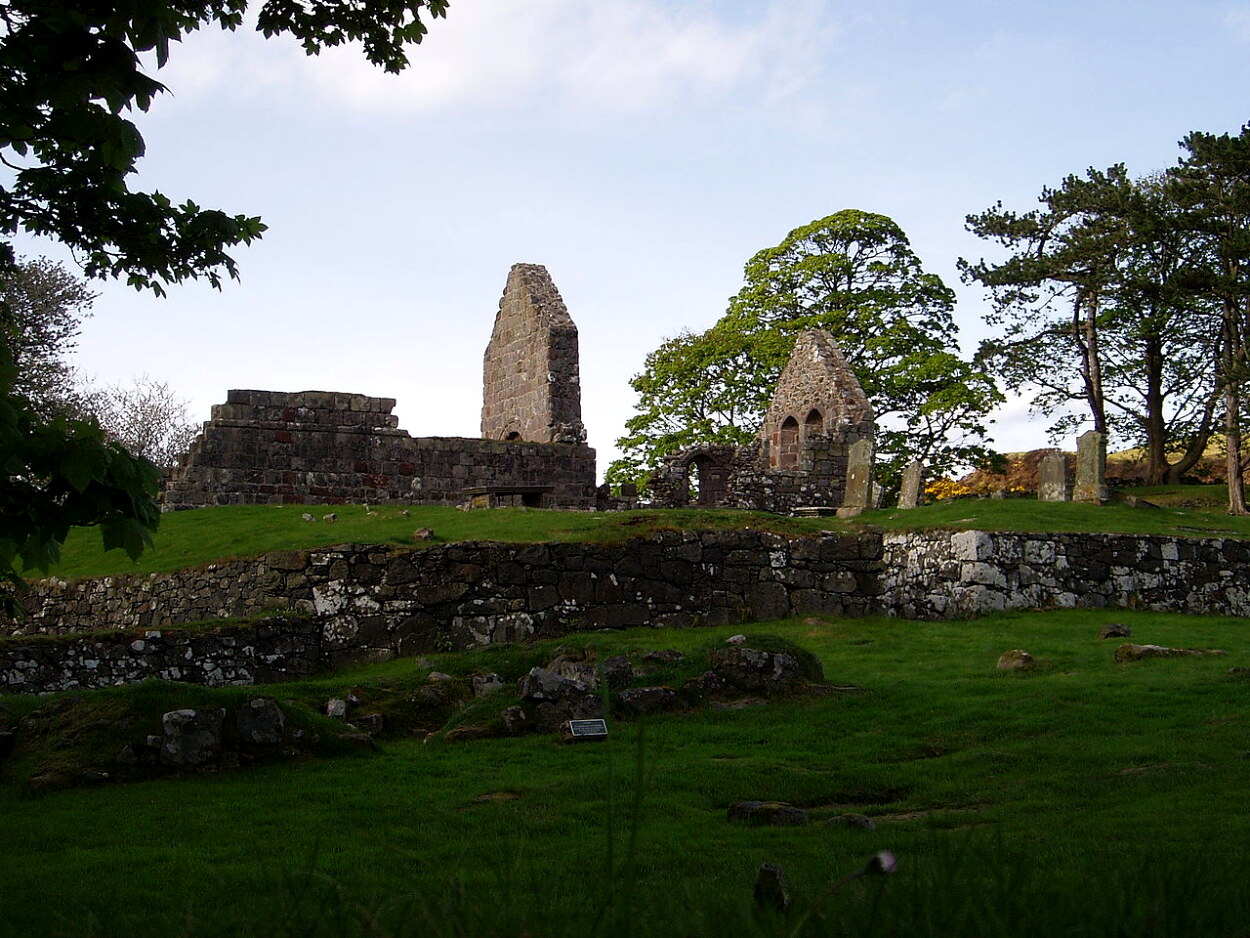 St Blane's Church
 View to the Sound of Bute on the walk back
A short way ahead is Dunagoil Bay, where there is a volcanic plug, a vitrified fort and a cave. This is an excellent example of an Iron Age site. The fortification is partly natural (the precipice of a high promontory above the beach) and partly constructed (the wall at the top, of which little remains). There is not much to see but a careful search will reveal lumps of half melted vitreous stone which resembles slag from a furnace. The fort and the cave below were occupied for 300 years - the commanding location makes it an obvious defensive site. Below it are caves, trap dykes of basalt thrusting through old red sandstone, columnar basal cliffs and pillow lava with steam cavities that give it the appearance of petrified sponge.
Further on there is a Celtic sun circle, well hidden within a clearing of larch woodland. Of the circle, only three stones, of oddly different shapes, still stand. The site is small, but awesome. The stones have been standing for over 3,000 years.
The last leg back into Kilchattan, a strung out Victorian village of red sandstone buildings, is by a pretty, but muddy, bridle path through a birch and oak wood that frames views of Kilchattan Bay. It is a pleasant end to a very enjoyable exploration of the southern tip of Bute, the oldest settled and most enigmatic part of the island.
Acknowledgments: Text derived from the Out and Out Series; Discovering the Countryside on Foot. Pictures courtesy of Wikipedia.
Feedback and Suggestions: To suggest a link for inclusion on a this page please complete the Walking Englishman Feedback Form. Thank you.


