Edinburgh Walk - Holyrood Park and Arthur's Seat
An ascent of the hill that dominates Edinburgh's skyline
Google Maps Open Source Maps| Statistics and Files | ||
|---|---|---|
| Start: Queen's Drive | Distance: 2.2 miles (3.6 km) | Climbing: 265 metres |
| Grid Ref: NT 27014 73720 | Time: 1-2 hours | Rating: Easy |
| GPX Route File | Google Earth File | About Arthur's Seat |
| Statistics | |
|---|---|
| Start: Queen's Drive | Distance: 2.2 miles (3.6 km) |
| Climbing: 265 metres | Grid Ref: NT 27014 73720 |
| Time: 1-2 hours | Rating: Easy |
| GPX Route File | Google Earth File |
Ordnance Survey Explorer Map (1:25,000)
The Walk: Arthur's Seat is one of the great landmarks of the city of Edinburgh. At 251 metres high, its summit provides an unrivalled view of Scotland's capital and its surroundings, from the Pentland Hills in the south to the Firth of Forth and beyond in the north. Few cities have such rugged hills within their boundaries, and a bracing walk up Arthur's Seat on a fine day is a superb way of escaping from the noise and bustle of the city.
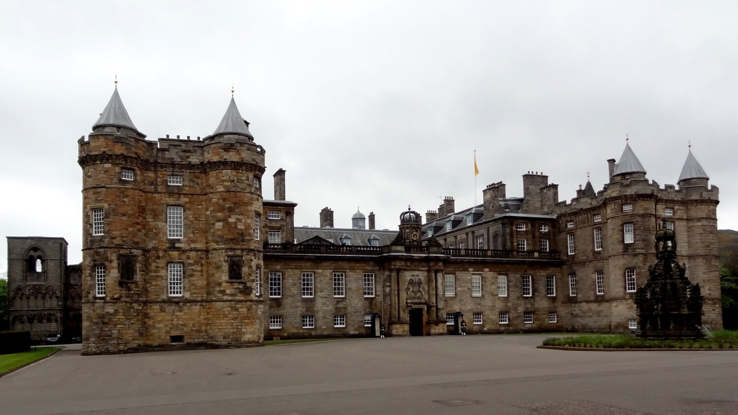 Holyrood Palace
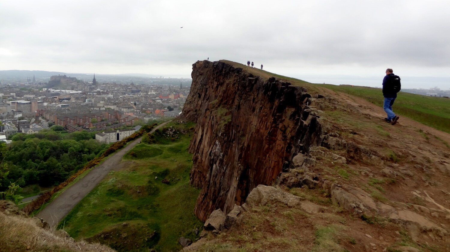 Walking across Salisbury Crags
The walk starts beside Queen's Drive and near to the Palace of Holyroodhouse, which stands impressively at the eastern end of the Royal Mile. The palace has been the scene of many turbulent events. Mary, Queen of Scots lived here for six years and, in 1558, witnessed the murder of her great favourite, the Italian secretary Rizzio, in the audience chamber. Serious fires destroyed much of the buildings in both 1543 and 1650. Many Scottish kings were married in the palace and Bonnie Prince Charlie held court here, albeit briefly, in 1745.
The name 'Holyrood' is said to originate from a 'holy rood' or cross which saved King David I of Scotland in an encounter with a stag near Salisbury Crags. The king took the 'holy rood' back to Edinburgh Castle, where he was later commanded in a dream to found an abbey. This he did in 1128.
Holyrood Abbey was partly demolished during the Reformation and fell into its current ruined state in the 18th century. It became overshadowed by the palace, which originated as a guesthouse for the Scottish monarchy. Successive generations of monarchs added to the palace and today it is the King's official residence in Scotland.
From the start of the walk, a steep path ascends the western slopes of Cat Nick, with grand views emerging over the palace. The path is flanked by Salisbuty Crags on the left and steep slopes dropping away to the right. As the path gains height, the views over Edinburgh open up. Edinburgh Castle is clearly visible, dominating the city centre. This most famous of Scottish castles dates from Norman times. The Military Tattoo is held here during the annual Edinburgh Festival in August.
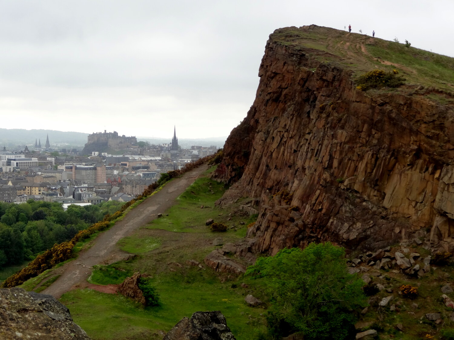 Edinburgh Castle and Salisbury Crag
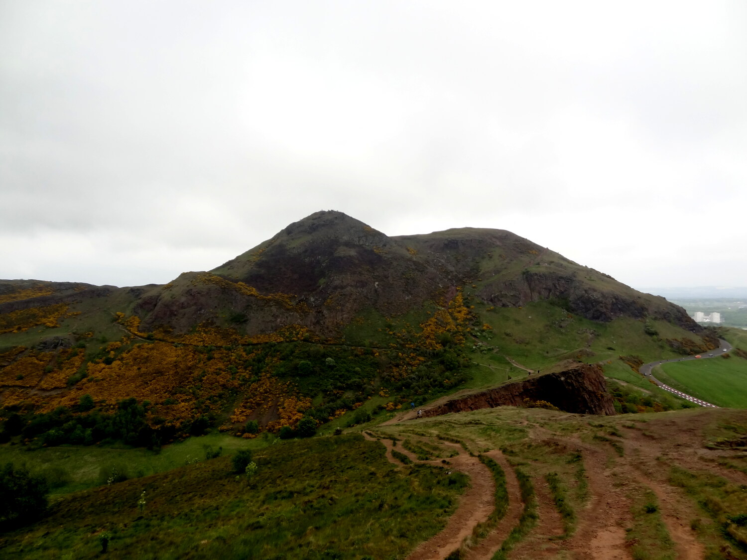 Arthur's Seat and Crow Hill
Arthur's Seat is an ancient weatherbeaten volcano. From its peak there are fine views in all directions. A view dial points out the features beyond the city boundaries. To the north are Leith Docks and the Firth of Forth, with Fife along the northern horizon. The Pentland Hills rise up in the south and the coast is clearly visible stretching away to the east. To the west is the city, with the Old Town dominated by the castle and St Giles Cathedral - Edinburgh's High Kirk.
Edinburgh began as a small settlement on the ridge leading up to the castle, and grew slowly, only being recognised as the capital of Scotland at the end of the 15th century. By the 18th century it had become very overcrowded, with 20 times more people living in the old Town than there are today.
The North Bridge was completed in 1772 and a New Town was created north of present day Princes Street. By the 19th century the Old Town had become exceedingly run down, with some of the worse slums in the country. Restoration schemes began in the 1980's continue to this day and have transformed the Old Town into an international success, drawing in visitors and tourists from all over the world.
From the summit of Arthur's Seat, the route leads down the valley of Long Row towards St Margaret's Loch. Once a boggy marshland, the loch was formed in 1856 as part of Prince Albert's improvement plans for the area surrounding the palace. The loch has been used as a boating pond but is now home to a strong population of ducks, geese, and swans. From here it is a short distance back to the beginning of the walk.
Acknowledgments: Text derived from the Out and Out Series; Discovering the Countryside on Foot. Pictures courtesy of Wikipedia.
Feedback and Suggestions: To suggest a link for inclusion on a this page please complete the Walking Englishman Feedback Form. Thank you.


