Lochmaben, Lochs and Lochmaben Castle
Exploring the streets and waters of a historic Annandale town
Google Maps Open Source Maps| Statistics and Files | ||
|---|---|---|
| Start: Lochmaben | Distance: 6.1 miles (9.8 km) | Climbing: 71 metres |
| Grid Ref: NY 08189 82602 | Time: 3 hours | Rating: Easy |
| GPX Route File | Google Earth File | About Lochmaben |
| Statistics | |
|---|---|
| Start: Lochmaben | Distance: 6.1 miles (9.8 km) |
| Climbing: 71 metres | Grid Ref: NY 08189 82602 |
| Time: 3 hours | Rating: Easy |
| GPX Route File | Google Earth File |
Ordnance Survey Explorer Map (1:25,000)
The Walk:
The valley of Annandale in south-west Scotland is gently rolling pastoral country, very different from the rugged landscapes further north. There are many attractive towns and villages in the area, though none perhaps as charming as the royal burgh of Lochmaben, which stood on the old main road that linked England and Scotland in the middle ages.
Lochmaben has five lochs surrounding it. There used to be seven, but the Grummel Loch, used for ducking witches, and the Broomhill Loch were drained long ago. This caused Robert Burns to dub it "Majorie o' the Monie Lochs". Burns frequently visited Lochmaben and wrote lovingly of the place. What is certain is that the royal Bruces had their seat at Lochmaben for over a century, and that Robert the Bruce's grandfather died in the town.
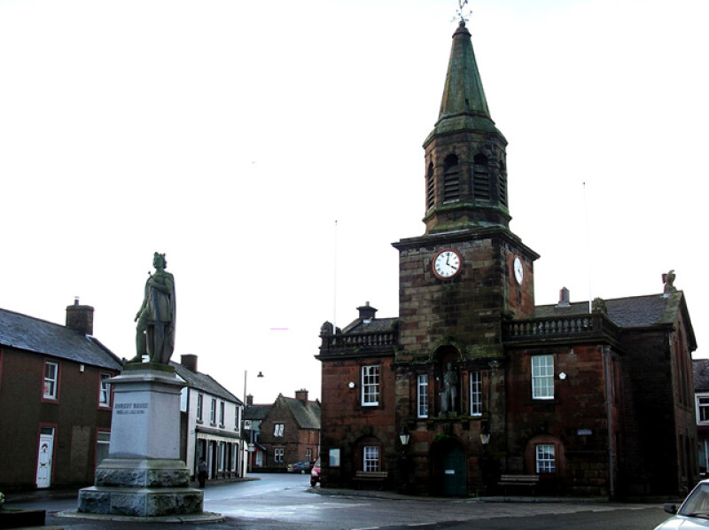 Robert the Bruce Statue in Lochmaben
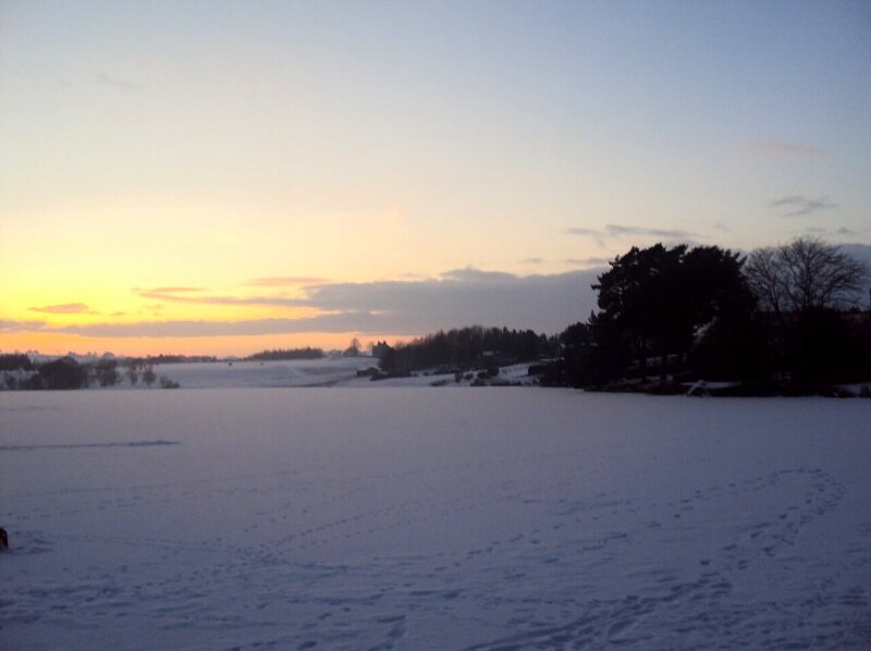 Mill Loch, Lochmaben
The walk starts beside the statue to King Robert the Bruce at the northern end of the High Street. In the town hall opposite, a glass jar contains a preserved specimen of the fish for which Lochmaben used to be celebrated, the Lochmaben Vendace. This variation of the fish were found nowhere else in the world apart from Mill Loch and Castle Loch, both lochs featuring on this walk.
Local legend has it that the fish were introduced by either Robert the Bruce or Mary, Queen of Scots, although zoologists say it swam into the Lochmaben area during the Ice Ages and as a consequence became landlocked here. The fish were considered a gourmet's delight, although King James VI thought he was being poisoned when offered a plate of them at a banquet in Dumfries.
To the north of Mill Loch, there once ran a Roman road. Although no traces remain, it supposedly took a similar route to the old Lockerbie to Dumfries railway line, which closed in 1965. Beyond the line is Woodycastle, the remains of an Iron Age hill fort. It is 63 metres in diameter and surrounded by a rampart of earth and stone. There is a tradition that it is the burial place of several warriors killed in a 9th century battle. A huge boulder supposedly marks the spot where King Constantine was slain in battle. Another fanciful legend has it that a crock of gold is buried beneath the boulder.
The walk skirts Kirk Loch, by the site of which there was a prehistoric settlement. In the Middle Ages, there was a church at the head of the loch, from which its name derives. When winters were generally colder, this was a curler's paradise, and home curling internationals were played here in the 19th century. short diversion takes you to Castle Hill, where you can take in some local Annandale scenery. To the north are the Lowther Hills, while to the east is Burnswark Hill, a flat topped extinct volcano, once the site of a Roman camp. To the west, the conical peak of Criffel dominates the distance.
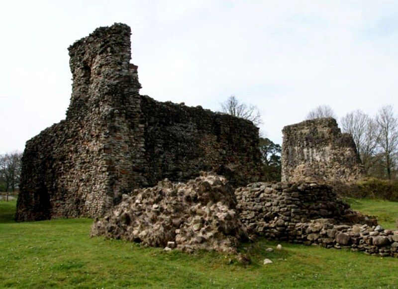 Lochmaben Castle
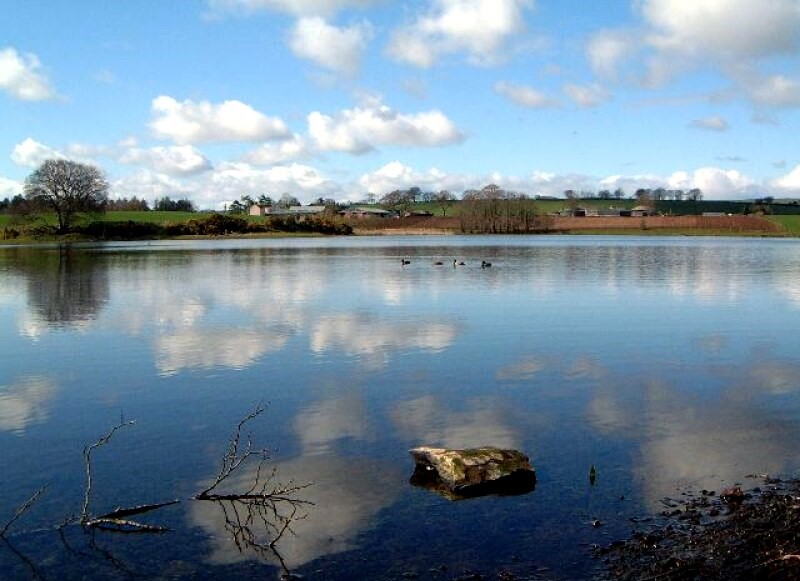 Kirk Loch, Lochmaben
A visit to the site of the Bruce's castle will leave you in no doubt that it was not Lochmaben's beauty but its strategic location, overlooking a wide swathe of Dumfriesshire, that attracted it to Robert the Bruce's forefathers, who had not one, but two castles in the town. The first, on this spot, was a typical Norman motte and bailey, with an orchard that stretched down to the loch. The castle was captured by Edward I and recaptured by William Wallace. Now long since abandoned, its motte has been put to use by the local golf course.
Less than a mile to the south is the second, Lochmaben Castle. This was actually built by Edward I on what used to be an island in what is now called the Castle Loch. The water level was lowered so that it now stands on a peninsula. The castle was captured by Robert the Bruce and an Anglo-Scottish treaty was signed there in 1323 which kept the peace for thirteen years. When hostilities resumed the castle changed hands a number of times, captured, recaptured, besieged, liberated. Once the most powerful fortress in the region it now lies in glorious ruins, given over to ivy, visitors and the local wildlife.
Castle Loch is well known for its birdlife and like Mill Loch is protected as a Site of Special Scientific Interest. n winter, geese arrive in their thousands, and roost by the loch, which is surrounded by alder and willows. The loch supports wintering goosanders and great crested grebes too. If you are lucky you may spot the odd shelduck or pochard, which breed somewhat elusively in the neighbourhood. Mute swans, coots and moorhens are more common sights.
The road back to Lochmaben goes along the loch side and as you enter the town you pass Lochmaben's church, which was built in 1819. From the left of the High Street, just opposite Bruce's statue, is the cemetery which houses some interesting monuments. One of them commemorates Dr William Jardine, the Lochmaben born ship's surgeon who was one of the founders of the colony of Hong Kong, and whose life story was the inspiration behind James Cavell's novel, Tai Pan.
Acknowledgments: Text derived from the Out and Out Series; Discovering the Countryside on Foot. Pictures courtesy of Wikipedia.
Feedback and Suggestions: To suggest a link for inclusion on a this page please complete the Walking Englishman Feedback Form. Thank you.


