Blairgowrie and Rattray and the River Ericht
Walking to a high viewpoint above a wild salmon river
Google Maps Open Source Maps| Statistics and Files | ||
|---|---|---|
| Start: Blairgowrie | Distance: 3.8 miles (6.0 km) | Climbing: 172 metres |
| Grid Ref: NO 18058 45241 | Time: 2 hours | Rating: Easy |
| GPX Route File | Google Earth File | About Blairgowrie |
| Statistics | |
|---|---|
| Start: Blairgowrie | Distance: 3.8 miles (6.0 km) |
| Climbing: 172 metres | Grid Ref: NO 18058 45241 |
| Time: 2 hours | Rating: Easy |
| GPX Route File | Google Earth File |
Ordnance Survey Explorer Map (1:25,000)
The Walk: The wide, fast flowing River Ericht tumbles down from the foothills of the Grampian Hills to empty into a tributary of the River Tay. For much of its length, it runs between banks clothed with woodlands. This walk follows its course for a way, then climbs through farmland to The Knockie, which offers fine views over the scenic region of Strathmore.
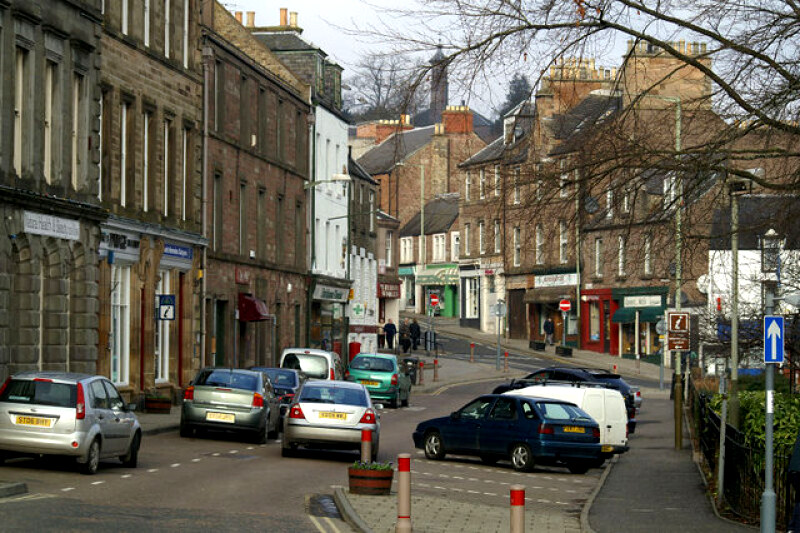 Blairgowrie
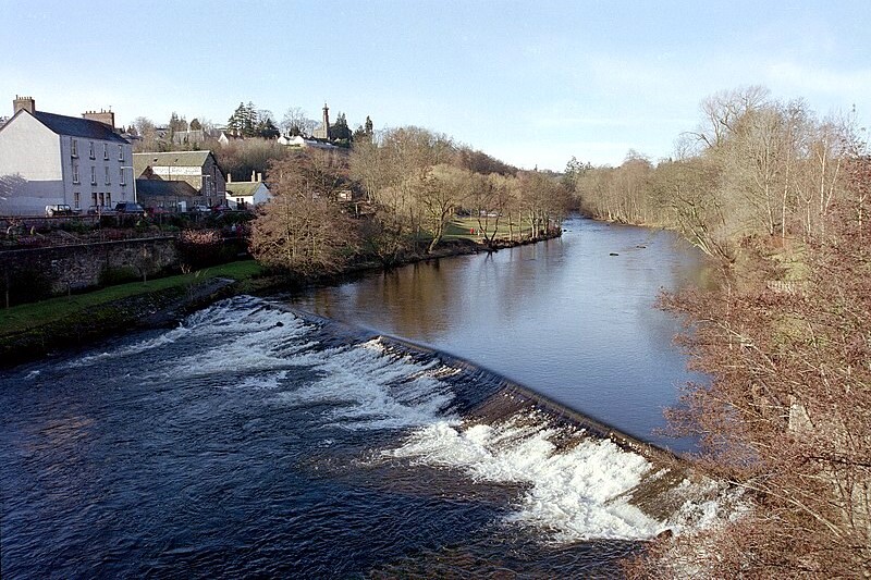 Weir on the River Ericht
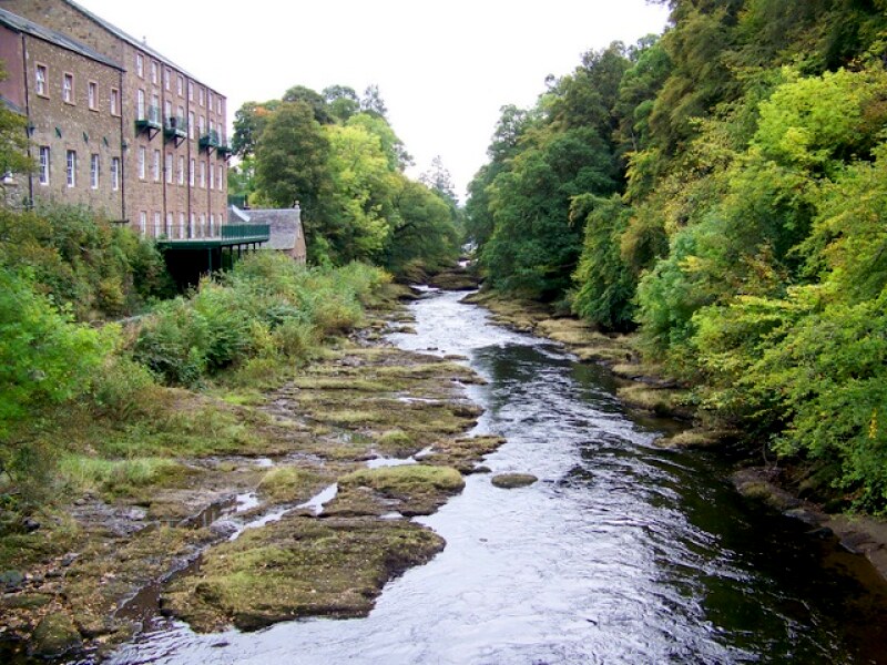
The walk begins in Blairgowrie, a pleasant market town that retains a good deal of its agricultural character. You walk through ornamental gardens to follow a path upstream beside the river, which has carved a deep gorge through the old red sandstone. The banks are bordered with broadleaved woodland, and from its waters jump huge salmon, shining silver in the sunshine. Dippers run into the shallows after insects, then bob and curtsey on boulders, while grey wagtails chase across exposed plates of sandstone to snatch up unwary flies resting in the warm sun.
The Falls of Keith are the main falls in a series of drops. The river drops 16 feet through a narrow cleft into a deep pool which is known as Donald Cargill's Leap, after a local man who was a prominent opponent of the Restoration of the Stuarts in 1660. In the following year he leapt the chasm to escape arrest. Nearby, a stone cairn with simple granite dedication stone commemorates Donald Cargill who, after his leap to freedom, was later captured and executed.
Above the Falls of Keith is a defunct jute mill with a splendid waterwheel hidden deep in the vegetation close to the footpath. Once, twelve mills crowded the river bank, making use of the river's power to bring prosperity to Blairgowrie. The mills were forced to close when cheap imports destroyed the market.
 River Ericht at Blairgowrie
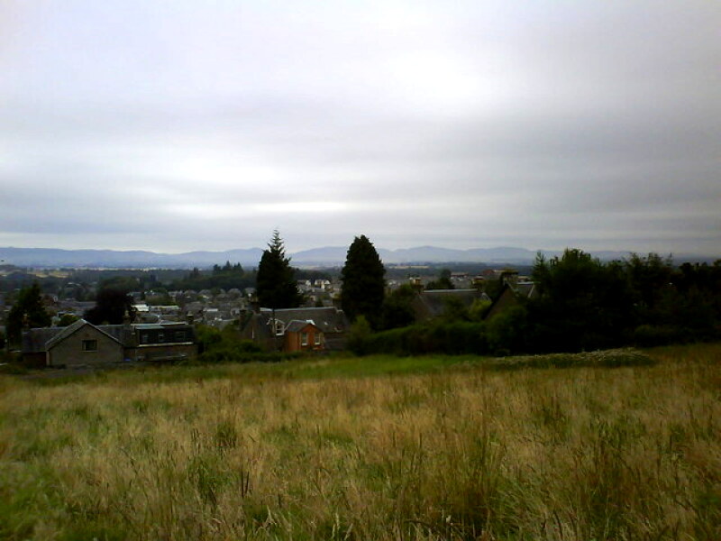 Looking down to Blairgowrie
Today it is fruit, not jute, that supports the town. In the fertile loam of the south-facing slopes above the river grow great areas of lush raspberries. In July, gangs of fruit pickers can be seen busily working their way along the rows. Blackcurrants and other soft fruit also flourish nearby.
From this site, the route leads back over The Knockie, and from a seat at the top there are lovely views over Blairgowrie and the valley of Strathmore. Tiny white pansies and downy red hemp grow nearby, and yellowhammers call continuously from the hundreds of blackcurrant bushes below.
As you walk back into the town, you pass the white painted Newton Castle, built in the 16th century with dramatic turrets. You continue through the streets of Blairgowrie, exploring as you go, all the way back to the start.
Acknowledgments: Text derived from the Out and Out Series; Discovering the Countryside on Foot. Pictures courtesy of Wikipedia.
Feedback and Suggestions: To suggest a link for inclusion on a this page please complete the Walking Englishman Feedback Form. Thank you.


