Quirang, Isle of Skye
A challenging but breathtaking mountain walk on the Isle of Skye
Google Maps Open Source Maps| Statistics and Files | ||
|---|---|---|
| Start: The Quiraing | Distance: 2.6 miles (4.2 km) | Climbing: 347 metres |
| Grid Ref: NG440679 | Time: 2 hours | Rating: Hard |
| GPX Route File | Google Earth File | About the Quiraing |
| Statistics | |
|---|---|
| Start: The Quiraing | Distance: 2.6 miles (4.2 km) |
| Grid Ref: NG440679 | Time: 2 hours |
| Climbing: 347 metres | Rating: Hard |
| GPX Route File | Google Earth File |
Ordnance Survey Explorer Map (1:25,000)
The Walk:
The Gaelic name for the Isle of Skye translates as 'The Isle of Mist', and clouds often envelop the high peaks of the island. This is certainly true of Quirang - the name means stronghold, or ringed fence - which can be reached by road from the village of Staffin or the small coastal town of Uig. Here, mists can drift down suddenly, lending an eerie aspect to a lunar landscape of shattered rocks.
Note: Though this walk is short, there is climbing throughout, some of it steep and requiring some technical ability. A head for heights is necessary.
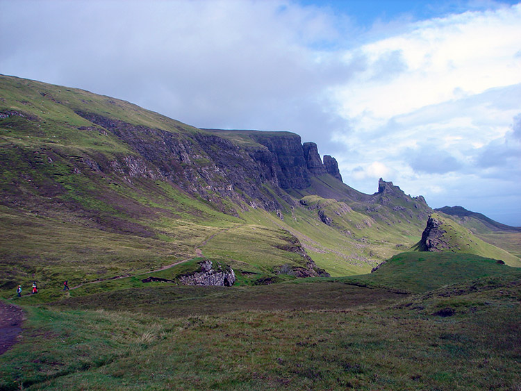 The Quirang
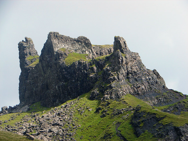 The Prison
The strange rock formations were created by volcanic activity some 70 million years ago. Huge flows of lava welled out of fissures and covered many square miles. The lava cooled into basalt; its weight proved too great for the softer, more plastic Jurassic rock below, which cracked and slipped. The Quirang landslip is the largest in Britain.
As you cross the slope from the mountain road, wheatears and meadow pipits flit overhead. A large variety of alpine and rock plants brighten the rocky slopes, including moss campion, mossy saxifrage and roseroot. Soon, you come to the Prison, a mass of castellated rocks that look like a fortress. There is a narrow path into its confines if you wish to explore the natural gaol.
Nearby is the Needle, a stack of rock some 120 feet (37 metres) high. Its sheer sides are inaccessible to all but the most skilled climbers and to ravens, whose deep, croaking calls sometimes reverberate from the crags. Scramble a short scree slope beside the Needle into a high grassy valley, with vertical rock faces to the left and huge heather clad rocky outcrops to the right.
The route climbs steadily above the cliffs of Quirang, on the moorland slopes below the summit of Meall na Suiramach. There are wonderful views from here. Dark blue lochans dot the lower slopes. Further down are the bright green fields of the crofts around Staffin, and beyond is a lovely sandy bay. In the distance are the island of South Rona and the mountains of Wester Ross.
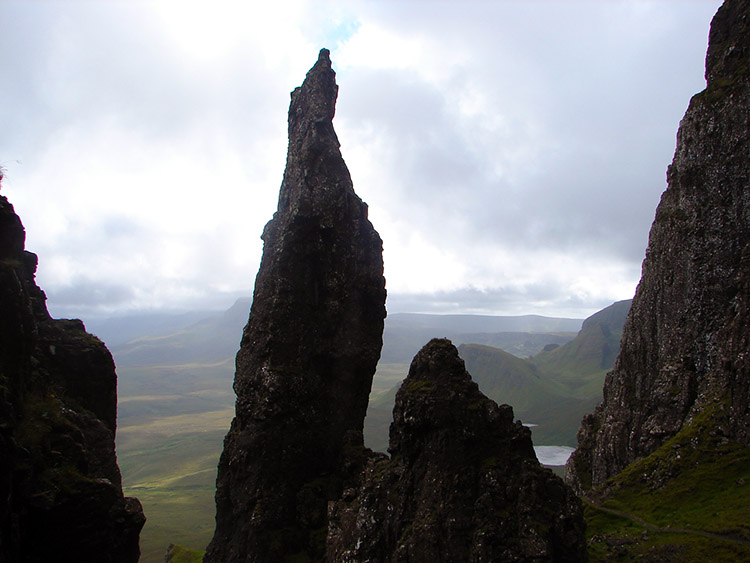 The Needle
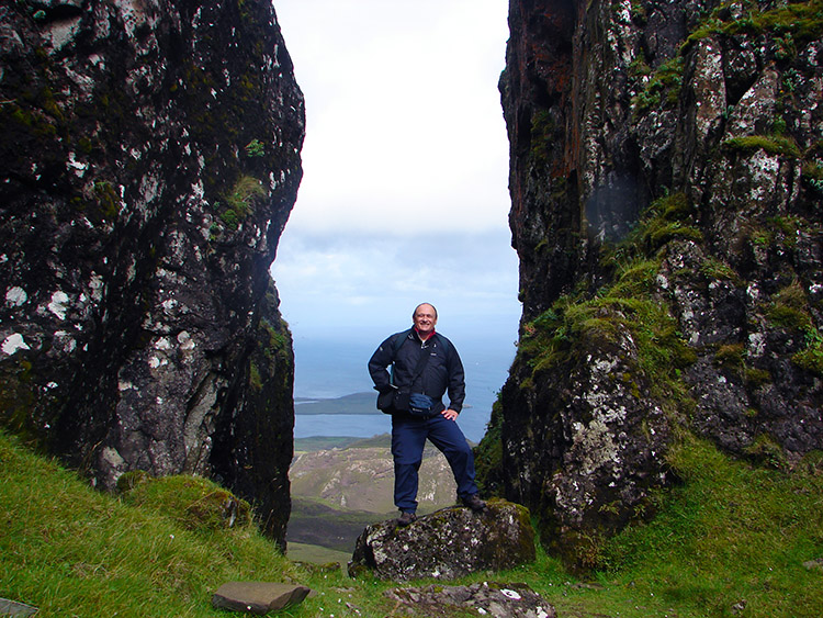 An ideal picture frame
Nearby is one of the Quirang's best known rock formations. The Table, a grassy oval field, the size of a football pitch, is surrounded by towers and pinnacles of rock. The Table was used in the past for hiding local farmsteads cattle from raiders.
In modern times, the Table has provided an excellent venue for playing shinty, a game similar to hockey. It was also used for a famous commercial - a car sits in the middle of this impossible landscape, posing the question "How did it get there?". In reality of course, it was dropped in by helicopter. And retrieved the same way on completion of the promotion work.
The final section of the walk retraces your steps back to the car parking area. Note this area can become busy in the summer and in recent years over-parking has caused serious problems so do plan your visit with consideration.
Acknowledgments: Text derived from the Out and Out Series; Discovering the Countryside on Foot. Pictures courtesy of Wikipedia.
Feedback and Suggestions: To suggest a link for inclusion on a this page please complete the Walking Englishman Feedback Form. Thank you.


