The Whangie and Auchineden Hill
From the Queen's View to the Whangie rock face
Google Maps Open Source Maps| Statistics and Files | ||
|---|---|---|
| Start: Queen's View | Distance: 4.1 miles (6.6 km) | Climbing: 219 metres |
| Grid Ref: NS 51122 80864 | Time: 2 hours | Rating: Moderate |
| GPX Route File | Google Earth File | About the Kilpatricks |
| Statistics | |
|---|---|
| Start: Queen's View | Distance: 4.1 miles (6.6 km) |
| Climbing: 219 metres | Grid Ref: NS 51122 80864 |
| Time: 2 hours | Rating: Moderate |
| GPX Route File | Google Earth File |
Ordnance Survey Explorer Map (1:25,000)
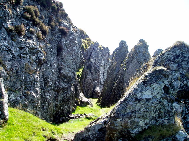
The Walk: The focus of this walk, which is north-east of Glasgow, is a 300 foot long rock face, some 50 feet in height. This rugged face, known as the Whangie, has been cleft into all the way along its length. There are two explanations of this, one legendary and one factual.
 The Whangie
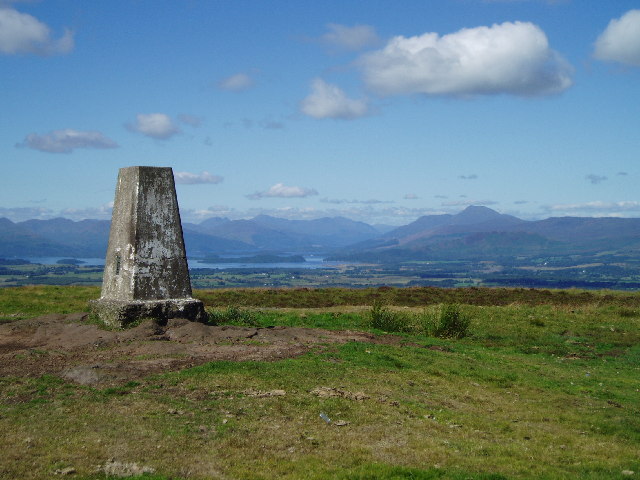 Auchineden Hill
The story goes that the Devil himself created what is a spectacular natural phenomenon. According to this legend, the Devil had been holding a meeting with local warlocks on the nearby Campsie Fells. As he flew over the area en route to another meeting with the witches of Dumbarton, he flicked his tail and cut through the solid rock face. The result was a shearing of the rock into what you see today, a long deep chasm that yawns along the line of separation. The walls, which soar to about 50 feet in places, form a jagged crest. However, the more likely, but certainly less colourful explanation of this phenomenon, is that it was created by retreating ice during the closing stages of the Ice Age. A moving glacier probably caused the volcanic rock to fracture.
The Queen's View, at the start of the walk, is on the A809 Bearsden to Drymen Road. It is a popular stopping place for locals and visitors alike, for here on the edge of the Stockie Muir, there is a view over the fields, woods and rolling hills of Lowland Scotland to where the Highland Boundary Fault marks the beginning of the Highlands.
This great geological fault which runs in a diagonal line from the Isle of Arran to Aberdeen, separates the mountains and glens of the Highlands from the gentle Lowlands, and nowhere can it be seen better than from here.
 Threading the Whangie needle
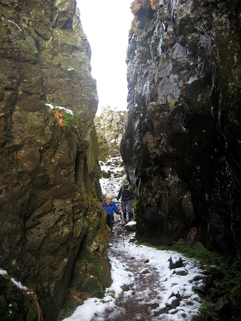
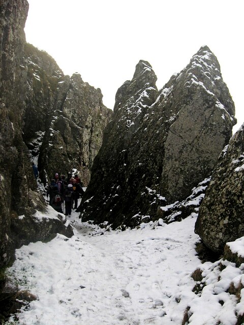 Exploring the Whangie in winter
Across the flats of the Muir, Ben Lomond, the most southerly mountain in Scotland, lifts its head from the island-dotted waters of Loch Lomond. But the scenery has more to offer. To the left of the mountain, the Luss Hills and the distant Arrochar Alps form a serrated skyline; to the right, The hills of the Trossachs dominate. This is the most southern of all the areas in Scotland which can truly be called Highland in character. The grandeur of the region has provided literally inspiration: Sir Walter Scott waxed lyrical about the Trossachs in 'The Lady of the Lake' and 'Rob Roy'.
All the way along the hillside that leads to the Whangie, the eye is drawn northwards, and the scene becomes more dramatic the higher the climb. After the inevitable exploration of the paths within the confines of the remarkable rock feature, the final of the section of the route, from the Whangie, climbs to the trig point on neighbouring Auchineden Hill. From this high point, the route crosses open moorland to Burncrooks Reservoir, then leading across country lanes and tracks, finally arriving back at the A809 road and the car park at the beginning of the walk.
Acknowledgments: Text derived from the Out and Out Series; Discovering the Countryside on Foot. Pictures courtesy of Wikipedia.
Feedback and Suggestions: To suggest a link for inclusion on a this page please complete the Walking Englishman Feedback Form. Thank you.


