Bude, Marhamchurch, Phillip's Point and Efford Beacon
Along an unusual waterway to an unspoilt coastal path
Google Maps Open Source Maps| Statistics and Files | ||
|---|---|---|
| Start: Bude | Distance: 7.5 miles (12.1 km) | Climbing: 216 metres |
| Grid Ref: SS 20713 06168 | Time: 3-4 hours | Rating: Moderate |
| GPX Route File | Google Earth File | About Bude |
| Statistics | |
|---|---|
| Start: Bude | Distance: 7.5 miles (12.1 km) |
| Climbing: 216 metres | Grid Ref: SS 20713 06168 |
| Time: 3-4 hours | Rating: Moderate |
| GPX Route File | Google Earth File |
Ordnance Survey Explorer Map (1:25,000)
The Walk:
Originally a small and rather insignificant fishing port, Bude began to develop as a holiday centre in the early 19th century. The Napoleonic Wars prevented continental travel between 1799 and 1815, and the wealthy had to look for pleasures nearer home. They soon discovered the delights of sea bathing and fresh air in Cornwall.
Even so, the town was slow to progress, hampered for a long time by having no rail connection. Today, its wide sandy bay is a popular place for surfers and there are places for seawater swimming too.
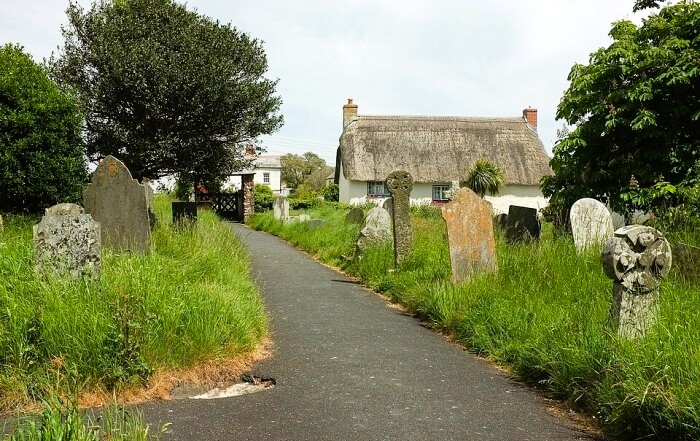 Marhamchurch Church
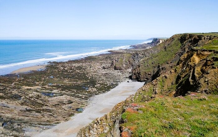 Phillip's Point
The first section of the route runs along the towpath of the disused Bude Canal. Beside the path is a public birdwatching hide overlooking a nature reserve in the reedy marshland between the canal and the River Neet (Strat). Waders and wildfowl frequent this wetland area.
The route continues along the increasingly attractive canalside. Just beyond a fine thatched farmhouse is a lock that originally had two sets of gates. One set has been removed and the remaining gates and sluices are used simply to control the water level.
Past another lock is a bridge and beyond this the canal and river converge briefly. The waters of the River Neet rush over a weir here.
At Helebridge, the river and canal split again. Beyond the main road are two attractive humpback bridges, one over each waterway. If you glance at the hills to the east, it is not difficult to see why the engineers who built the Bude Canal decided against using conventional locks on this upland section. Just before Marhamchurch is an incline, where it is possible to see how the small tub boats were hauled uphill on railed tracks.
After exploring Marhamchurch and its fine church you cross some farmland and come to the coast. At Widemouth Bay there is a magnificent stretch of sandy beach. The Atlantic rollers churn into the shore. While attractive for surfers, large parts of this bay are dangerous for swimmers, especially at low tide. Widemouth Bay has another, albeit invisible, claim to fame. Out in the sea, lies a cable linking Downing Street to the White House in Washington. It was laid in 1963.
The South West Coastal Path runs along the top of the cliffs, providing some of the finest views on the walk. The natural line of the cliffs rocks runs at right angles to the shore, forming a succession of dark spiny ribs stretching out into the sea. This can clearly be seen at Phillip's Point Nature Reserve, one of the most spectacular viewing areas on the Cornish coast.
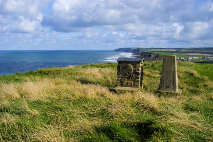 Efford Beacon
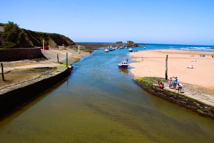 Bude Haven
The cliffs in this area are a mixture of dark shale and ochre-coloured sandstone. In places, they are shattered and fragmented, but elsewhere smooth rockfaces rise up from the beach to the clifftop.
A variety of seabirds can be seen in this dramatic landscape, and when you walk along this stretch of coastline
you might catch a sight of the enigmatic chough. This member of the crow family, with its distinctive red bill and red legs, is part of the Cornish coat of arms. It was actually lost to Cornwall during the latter part of the last century, the last pair to nest in Cornwall nested here in 1960 and the bird was only sighted 41 years later when three birds were seen on the Lizard. Since then the chough has made a remarkable recovery, and in 2025 numbers were around 300 birds.
Towards the end of the coastal route is first Efford Beacon, where a trig point stands on top of the cliff, and finally Compass Point, where you can enjoy a final spectacular clifftop view.
Heading back inland, you first pass close to the seagoers security of Bude Haven and soon after you come to the sea lock where the Bude Canal starts. The lock is still in use but only operates at high tide. One of the buildings on the wharf was a blacksmiths shop, but now houses a local history museum, with many interesting exhibits from the days when the canal was in use. Behind it are the earthworks belonging to an ancient castle at Bude. The site is now The Castle Heritage Centre, an ideal place for a visit at the end of the walk.
Acknowledgments: Text derived from the Out and Out Series; Discovering the Countryside on Foot. Pictures courtesy of Wikipedia.
Feedback and Suggestions: To suggest a link for inclusion on a this page please complete the Walking Englishman Feedback Form. Thank you.


