Merrivale, Sampford Spiney and Vixen Tor
Through a rugged landscape to Dartmoor's tallest tor
Google Maps Open Source Maps| Statistics and Files | ||
|---|---|---|
| Start: Merrivale | Distance: 5.4 miles (8.8 km) | Climbing: 256 metres |
| Grid Ref: SX 55049 75035 | Time: 3 hours | Rating: Moderate |
| GPX Route File | Google Earth File | About Dartmoor |
| Statistics | |
|---|---|
| Start: Merrivale | Distance: 5.4 miles (8.8 km) |
| Climbing: 256 metres | Grid Ref: SX 55049 75035 |
| Time: 3 hours | Rating: Moderate |
| GPX Route File | Google Earth File |
Ordnance Survey Explorer Map (1:25,000)
The Walk:
The 365 square miles (945 square kilometres) that make up Dartmoor National Park have been described as the last untamed wilderness in England. Despite this title, there is evidence of continuous human activity here from prehistoric times (in the form of standing stones) to the more recent pursuits of hill farming, mining and hiking.
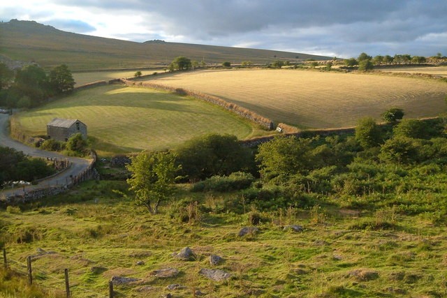
This walk explores the edges of a lovely wooded valley and several spectacular granite outcrops, or tors, without ever straying more than a mile (1.6 kilometres) from a house or a road, and there is no danger of becoming lost in the wilderness. You begin from Merrivale, near the western edge of the moor. The B3357 road, on which the small village lies, is one of only two numbered roads across the moor, an indicator of just how remote the area still is.
 Merrivale
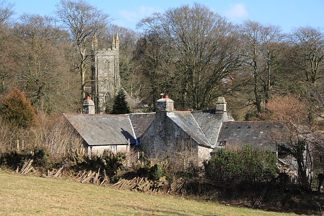 Sampford Spiney
The route leads south along a bridleway to Daveytown, passing a concentration of standing stones and a stone circle on the slopes to the left. There are more than 2,000 stone circles on Dartmoor, mainly dating back to the Bronze Age. Most are hut circles, and the stones were once the base of a dwelling, with wooden poles supporting a turf roof. This one, however, is larger than the rest and probably marked an important ritual site.
Beyond this, you enter a wooded area, mostly of dwarf oak, hazel and sallow, with rowan berries adding a splash of colour in autumn. The walk continues on a narrow surfaced lane, haunted in summer by speckled wood butterflies.
Approaching Withill, the lane crosses the stream by a double clapper bridge. These primitive bridges were built of large slabs of granite that, rather than being quarried, were simply picked off the moor. Most of them were constructed during the Middle Ages and this one, which has a stone parapet and a cutwater consisting of a single block of stone, is fairly typical.
The route continues along metalled and green lanes, winding through a valley and over rough pasture. Lapwings, meadow pipits and skylights can be seen in and over the fields, while buzzards and kestrels often hunt over the open ground.
The village of Sampford Spiney is the next stop on the route. It has a simple but lovely Norman church and makes an excellent place to take a breather.
 Heckwood Tor
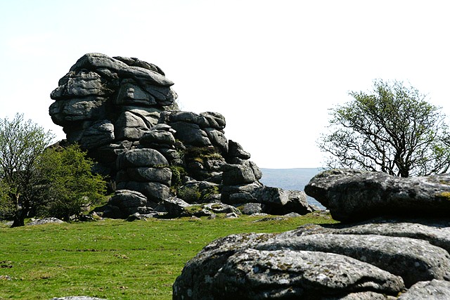 Vixen Tor
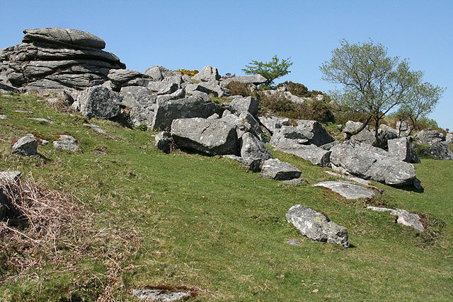
After leaving Sampford Spiney, you turn north again, past disused quarries and over some rough ground. Another bridleway climbs past Pew Tor and Heckwood Tor, which is the way to go if you are feeling adventurous. Otherwise, head on the path towards Vixen Tor.
The tors are the visible outcrops of the great mass of granite that underlies the moor. Over many years they have been weathered into striking shapes.
Vixen Tor, at around 100 feet high, is the tallest tor of them all. It is named after Vixana, a legendary witch who is said to have made her home there. She supposedly conjured up thick mists designed to disorientate travellers and entrap them in the thick mires and bogs in the area. The story goes that she was eventually tricked and pushed off the tor to her death, but her profile can still be seen in the weathered rock if it is viewed from a certain angle.
A short walk for Vixen Tor, down a bridleway, and across rough grassland, takes you to the B3357 and the comfort of the Dartmoor Inn at Merrivale.
Acknowledgments: Text derived from the Out and Out Series; Discovering the Countryside on Foot. Pictures courtesy of Wikipedia.
Feedback and Suggestions: To suggest a link for inclusion on a this page please complete the Walking Englishman Feedback Form. Thank you.


