Corton Denham, South Cadbury, Cadbury Castle and Whitcombe
Magnificent views and an archaeological treasure house
Google Maps Open Source Maps| Statistics and Files | ||
|---|---|---|
| Start: Corton Denham | Distance: 5.9 miles (9.5 km) | Climbing: 266 metres |
| Grid Ref: ST 63520 22568 | Time: 3 hours | Rating: Moderate |
| GPX Route File | Google Earth File | About Corton Denham |
| Statistics | |
|---|---|
| Start: Corton Denham | Distance: 5.9 miles (9.5 km) |
| Climbing: 266 metres | Grid Ref: ST 63520 22568 |
| Time: 3 hours | Rating: Moderate |
| GPX Route File | Google Earth File |
Ordnance Survey Explorer Map (1:25,000)
The Walk:
The walk starts in Corton Denham, a village tucked neatly into a fold of Corton Hill and overlooking a tranquil valley almost enclosed by hills. St Andrew's church at Corton Denham was founded in 1267, though most of what can be seen today dates only from the 19th century.
Beside the church is the former village school, built in 1845 and now used for general village activities, though its bell still hangs above the porch. In the late 19th century, an average of 90 pupils a year were taught in this one small building.
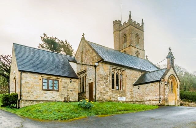 Corton Denham Church and Village Hall
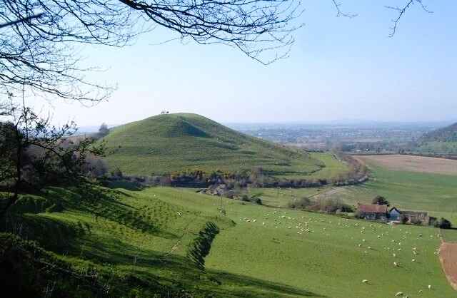 Parrock Hill
You pass a recently restored horse trough, fed by a remarkable clear spring, and wander down the main street before making a gentle but steady climb up a track to the top of Corton Ridge.
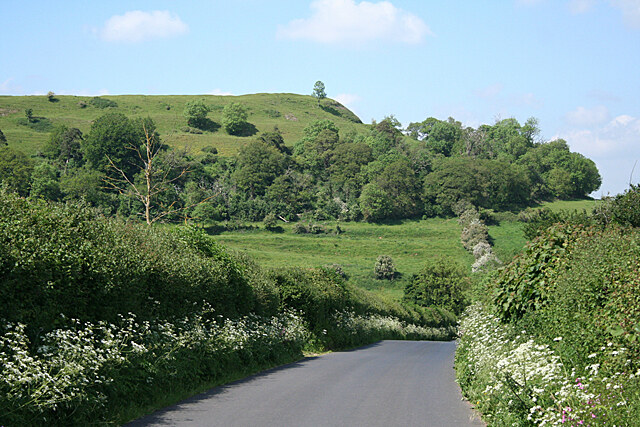
The route follows the crest of this ridge northwards. All along here are wonderful views over the Somerset Levels to the Quantock Hills and the Severn Estuary on your left, while Cadbury Castle can be seen straight ahead as the path curves around the slopes of Parrock Hill and descends to the flat fields below.
Lanes and minor roads take you to South Cadbury, with its thatched houses built of honey coloured stone. It is worth exploring if you have the time. The church, dedicated to Thomas a Becket has a fine 14th century tower, and an early wall painting of a bishop, possibly St Thomas, in the splay of a window in the south aisle.
The marvellous Cadbury Castle covers over 18 acres and is ringed by four huge banks. In places the distance from the bottom of the ditch to the top of the banks is over 40 feet. Excavations begun in 1966 uncovered much of its history.
The site was first occupied in Neolithic times, around 3000 BC. Later, successive Iron Age tribes developed the hill's natural defences into a commanding military stronghold. Within its walls grew up a thriving and sophisticated community, living in thatched round huts of timber and wattle. With trade links stretching as far as the Mediterranean, the inhabitants produced fine metalwork, some of which can be seen in the Somerset County Museum at Taunton.
Romans overcame a tribe called the Durotriges here in AD70. They garrisoned the fort, using it to keep a watchful eye on the ousted community, whom they resettled below. A hoard of Roman coins was unearthed in 1922.
 Cadbury Castle
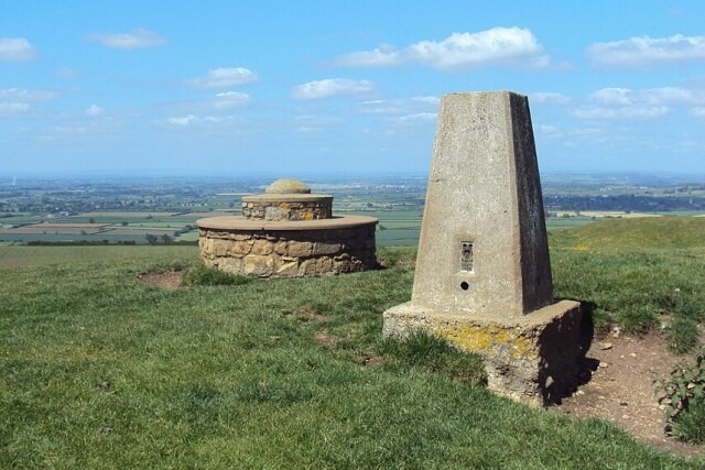 The Beacon, Corton Hill
Excavations have also revealed new defences incorporating Roman materials and pottery dating from around AD500, as well as the foundations of a rectangular aisled hall measuring 80 feet (24 metres) by 30 feet (9 metres) and the outline of a cruciform church. The hill had clearly become the headquarters of a powerful Dark Ages Christian Chieftain and was refortified against the Saxons, who invaded Britain after the departure of the Roman legions.
Early historians recorded the existence of such a leader, who defeated the Saxons at the Battle of Badon, halting their spread westwards and instituting a golden age of peace that lasted some 60 years. Later, he was named as Arthur and linked with Cadbury Castle by the historian John Leland, who, in 1545 wrote that: 'At the very south end of the Church of South Cadbyri standith Camallate, sumtyme a famous toun or castelle... the people can telle nothing but they have hard say that Arture much resortid to Camalat'.
Cadbury entered the history books again between 1009 and 1019 during the reign of Ethelred the Unready, when it was used as an emergency administrative and commercial centre during Danish attacks. Coins were minted here.
From the castle, you retrace your steps through the village before taking a path up through gently rolling farmland to the hamlet of Whitcombe. Beyond this, you take a minor road again for a stiff, but rewarding climb to The Beacon on top of Corton Hill. Just off the route is a bench by the trig point where you can rest and enjoy your view of the whole walk. Glastonbury Tor is prominent in the northwest, while the whole of Somerset seems to be spread at your feet.
Acknowledgments: Text derived from the Out and Out Series; Discovering the Countryside on Foot. Pictures courtesy of Wikipedia.
Feedback and Suggestions: To suggest a link for inclusion on a this page please complete the Walking Englishman Feedback Form. Thank you.


