Kingston Deverill, Rodmead Hill and White Sheet Hill
A walk over the Wiltshire Downs to an ancient trackway and a hilltop fort
Google Maps Open Source Maps| Statistics and Files | ||
|---|---|---|
| Start: Kingston Deverill | Distance: 9.1 miles (14.7 km) | Climbing: 156 metres |
| Grid Ref: ST 84600 37025 | Time: 4 hours | Rating: Moderate |
| GPX Route File | Google Earth File | North Wessex Downs |
| Statistics | |
|---|---|
| Start: Kingston Deverill | Distance: 9.1 miles (14.7 km) |
| Climbing: 156 metres | Grid Ref: ST 84600 37025 |
| Time: 4 hours | Rating: Moderate |
| GPX Route File | Google Earth File |
Ordnance Survey Explorer Map (1:25,000)
The Walk:
This walk begins in the delightful village of Kingston Deverill, on the River Wylye, in a fold of the Wiltshire Downs. The Church of Saint Mary the Virgin, was largely rebuilt in 1847 by Harriet, Marchioness of Bath, though the tower still contains some 14th century work and a peal of six bells installed in 1731. Inside, there is an interesting pulpit, probably Flemish in origin, and a 14th century woodcarving of the Madonna and Child.
The route climbs uphill through the fields to Court Hill Plantation, one of several small patches of mixed woodland on the downs that have been planted as shelter for pheasants. The largest of these, Truncombe Wood, is on the lower slopes below the path along the top of the escapement.
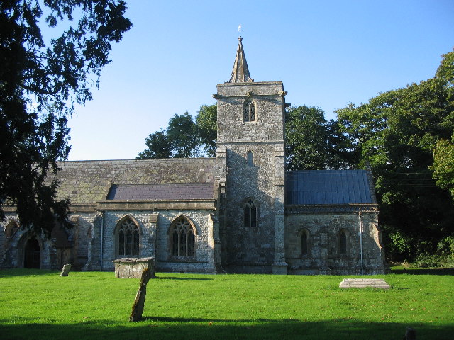 Church of St Mary the Virgin, Kingston Deverill
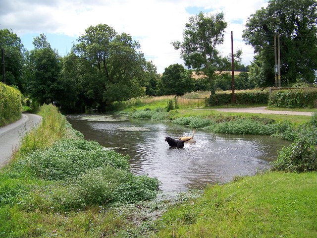 River Wylye at Kingston Deverill
Beyond this, the route turns south-west along the top of the downs. It runs above a dry valley, a typical feature of the chalk downland that was formed in the Ice Ages. Though the ice sheets did not quite reach this far south, the ground was frozen solid for much of the year. Rainwater ran off the frozen soil, carving out valleys. When the climate warmed again, the water sank through the porous chalk, and the river disappeared.
The route then follows Long Lane, part of the ancient long distance track known as Harrow Way, to reach White Sheet Hill. This gets its name from the colour of the chalk and from 'sceot', an old English word for a steep slope. This is part of the Stourhead Estate which was given to the National Trust in 1946. The hill offers excellent views of Stourhead and King Alfred's Tower over to the West.
The most dominant feature here now is a modern one, a radio mast. But there is plenty of evidence that this windswept hill was occupied in ancient times. White Sheet Castle, a roughly triangular Iron Age hill fort, dating from around 500 BC, looks out over the steep slopes to the south and west. There is just a single bank and ditch above the slopes, but three of them on the more vulnerable sides facing the level ground of the hilltop.
In the middle of the fort is a small, circular mound. This may be the remains of an 18th century animal shelter or the site of a beacon. This site is referred to as Beacon Hill on Saxton's 16th century map of England and Wales.
Just below the fort, and probably dating from the same time, is the Cross Dyke, an embankment that may have been used to control stock or as a defensive barrier. Other signs of prehistoric farming can be seen on the western slopes in the form of terraces or strip lynchets, which were once narrow crop fields.
At the end of the wall along the hilltop are the remains of a Neolithic camp that originally had a causeway. This camp, approximately 5,000 years old, has mostly disappeared and the best view of its banks is from the large round barrow on its southern boundary. The barrow, and the smaller burial mounds close by, date from the Bronze Age around 2,000 BC.
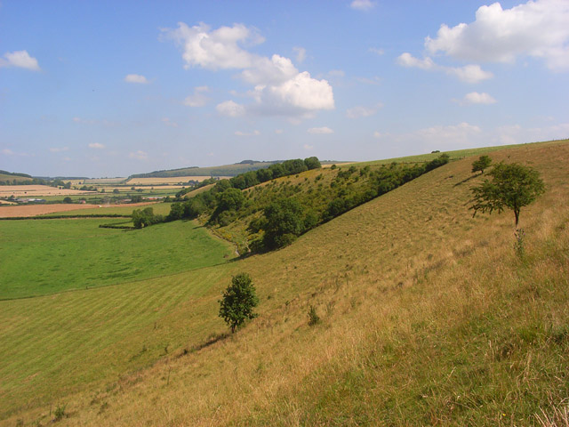 The Wiltshire Downs near Rodmead Hill
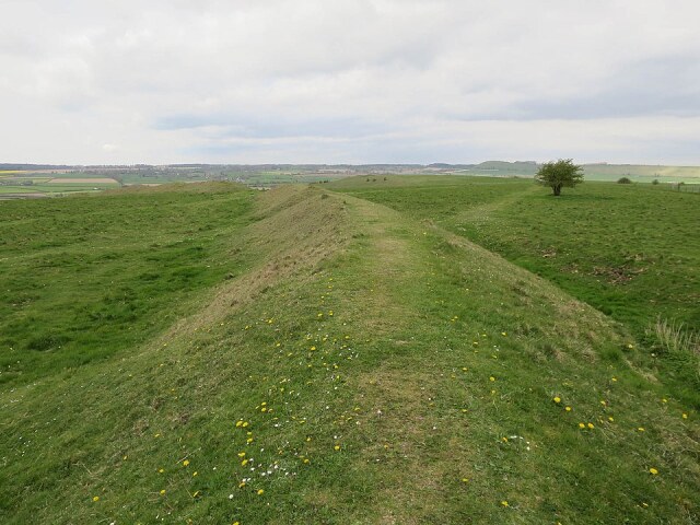 White Sheet Castle atop White Sheet Hill
A small part of the hill is leased by the Wiltshire Trust for Nature Conservation and is protected as a 'Site of Specific Scientific Interest'. The trust arranges for sheep to graze the area in winter to preserve the grassland and prevent it from being invaded by scrub. Rabbits also graze the sward and help keep the scrub at bay. A few blackthorn and hawthorn bushes provide song posts for birds such as yellowhammers, which are particularly in evidence here.
Taller grasses grow in the summer, encouraging butterflies, including the rare chalkhill blue, as well as voles and other wildlife. Among the wildflowers are cowslips, bellflowers and horseshoe vetch, the main food plant of the chalkhill blue's caterpillar.
The first part of the return walk causes the lush farmland of the Wylye valley. The site of Rodmead Farm at the foot of the downs and the steep banked Rodmead Hill, is a typical example of a downland farmhouse. Here there is a good water supply, shelter from the worst of the weather, and easy access to the arable and dairy fields in the valley bottom, and to the sheep pastures on the hillside.
The final stretch of the walk is along the minor road from Maiden Bradley. It ends with a brief tour of Kingston Deverill, which has two stone bridges over the Wylye, and a small pond where the river has been widened. There are many lovely stone cottages, including two thatched ones. But the finest building is undoubtedly Kingston House just behind the church.
Acknowledgments: Text derived from the Out and Out Series; Discovering the Countryside on Foot. Pictures courtesy of Wikipedia.
Feedback and Suggestions: To suggest a link for inclusion on a this page please complete the Walking Englishman Feedback Form. Thank you.


