Cleeve, Goblin Combe, Pot's Hole, Tap's Combe Camp and Brockley
A secluded woodland walk on the outskirts of Bristol
Google Maps Open Source Maps| Statistics and Files | ||
|---|---|---|
| Start: Cleeve | Distance: 5.8 miles (9.4 km) | Climbing: 173 metres |
| Grid Ref: ST 45929 65453 | Time: 2-3 hours | Rating: Easy |
| GPX Route File | Google Earth File | About Cleeve |
| Statistics | |
|---|---|
| Start: Cleeve | Distance: 5.8 miles (9.4 km) |
| Climbing: 173 metres | Grid Ref: ST 45929 65453 |
| Time: 2-3 hours | Rating: Easy |
| GPX Route File | Google Earth File |
Ordnance Survey Explorer Map (1:25,000)
The Walk:
Just outside Bristol, close to the city's airport, is a wooded area cut by a clefts with rocky-sided walls. This walk explores this unusual scenery and ends with a stroll across parkland and fields.
The route begins just off the busy A370, down the by-road from the village of Cleeve. It goes past the old school, now a teacher's centre with its separate entrances for boys and girls. An old stone built farmhouse, Walnut Tree Farm, hides behind a high wall and is surrounded by outbuildings, one of which has an attractive Pegasus weather vane.
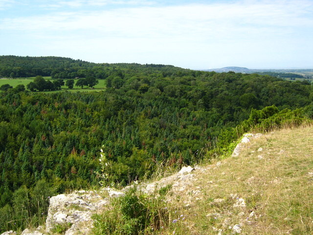 Cliffs overlooking Goblin Combe
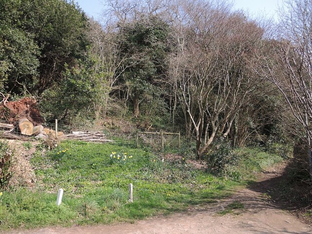 Tap's Combe
The path narrows as it plunges into dense, broadleaved woodland, through which there are glimpses of pale shining limestone. In among the slender birch and oak trees are a number of massive beech trees, whose widely spread branches create their own clearings.
The path soon becomes very stony. Cliff faces can be seen rising among the trees, and yew trees have knotted their roots into complex patterns. Among the rocks, tongues of scree can be seen licking down the slope to the left, and the cliffs become even higher.
This is Goblin Combe, a popular area with rock climbers. It has a distinctly remote air, and it is hard to believe you are just a mile away from the end of the runway at Bristol Airport. The lower part of the combe, where water drains down from the slopes, becomes very muddy in wet weather. The route climbs to higher ground, leaving the deciduous woodland for an area that contains most conifers.
The rocky combe is eventually left behind, and you join a grassy track through an avenue of majestic yew trees. The path then turns to go steeply downhill to the road at the end of Brockley Combe. At the roadway is a small quarry surrounded by woods dominated by a number of old and majestic beech trees.
Soon, you leave the road and join a stony path, an old route passing between crumbling stone walls. Underfoot, the earth has become worn away to create a pavement of limestone. The path runs partly through and partly at the edge of the woods.
The final section through the woods is downhill. Again, this is an old path bordered by banks and walls which has an intesreting past. Tap's Combe Camp, hidden away from plain sight, is an Iron Age hill fort and worth seeking out to explore.
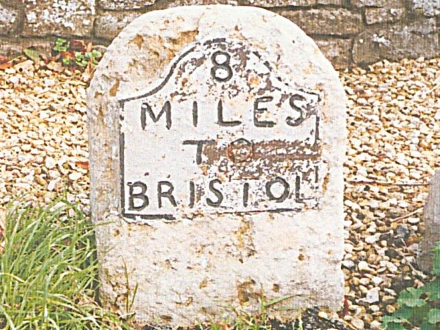 Old milepost to Bristol near Brockley
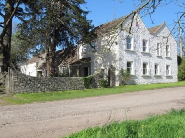 Brockley Court
Soon after Tap's Combe Camp, the walk ends up by a road. Nearby is a delightful thatched cottage with a pretty cottage garden. Ponies graze in the surrounding fields, but the peaceful walk is now briefly interrupted by the busy main road.
The other side of the road presents a contrasting scene of pastoral peace. The route, in the village of Brockley, takes you through part of the old estate of Brockley Hall, a grand house visible over to the left, while the walk itself skirts the wall. On the right is Manor farm, which raises deer for venison
The path crosses in front of Brockley Hall's imposing gateway, flanked by lions holding heraldic shields, before returning to the fields and a splendid sweet chestnut tree.
Another imposing house, Brockley Court, comes into view with a church alongside it. The route passes in front of the house to continue over fields and follows roads back to the start of the walk.
Acknowledgments: Text derived from the Out and Out Series; Discovering the Countryside on Foot. Pictures courtesy of Wikipedia.
Feedback and Suggestions: To suggest a link for inclusion on a this page please complete the Walking Englishman Feedback Form. Thank you.


