Winsham, Forde Abbey and Cricket St Thomas
A walk through beautiful gardens and countryside on the Somerset and Dorset border
Google Maps Open Source Maps| Statistics and Files | ||
|---|---|---|
| Start: Winsham | Distance: 6.8 miles (10.9 km) | Climbing: 213 metres |
| Grid Ref: ST 37483 06310 | Time: 3 hours | Rating: Easy |
| GPX Route File | Google Earth File | About Winsham |
| Statistics | |
|---|---|
| Start: Winsham | Distance: 6.8 miles (10.9 km) |
| Climbing: 213 metres | Grid Ref: ST 37483 06310 |
| Time: 3 hours | Rating: Easy |
| GPX Route File | Google Earth File |
Ordnance Survey Explorer Map (1:25,000)
The Walk:
This walk takes as its base a farming village set in the gently swelling hills of a quiet corner of Somerset. From here, you walk through farmland and along narrow, grass-grown lanes, sunk between banks of ferns and wildflowers, to two stately homes. One was once a Cistercian monastery, and the other, once a popular TV series location, and now the centre of a wildlife park.
Winsham is a working village of solid stone built houses, many of which are thatched. Its beautiful hillside setting overlooks the valley of the River Axe. The manufacture of woollen cloth made the village prosperous in the 15th century. This wealth was reflected in the work that took place in the church of St Stephen during that period, including the tower, windows, nave roof, chancel screen and font.
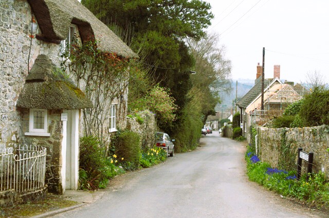 Winsham
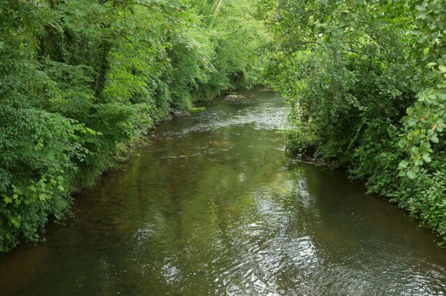 River Axe
The great treasure of the church predates all this, however. On the north wall of the tower is a picture of the Crucifixion, painted on wood. It once formed the back of the rood loft, and filled the top of the chancel arch. Only one other English church - that at Ludham in Norfolk - has a painting of this kind.
Among the old houses in the village is a row of cottages, which are traditionally known as 'The Barracks'. These were probably occupied by men from the rebel Duke of Monmouth's Peasant Army. The Duke crossed the River Axe at Winsham on his way to a crushing defeat at the Battle of Sedgemoor on the 6th of July, 1685.
The route takes you across fields and down lanes to cross the Axe into Dorset. From Whatley Lane, you get a good view of the east front of Forde Abbey, which looks like a Cisterian monastery still. The chapter house, now a chapel, stands beside the long low building that formed the monks' dormitory. Inside, though, you will discover a magnificent 17th century country house.
The award winning gardens extend over 30 acres and are charmingly informal. From the large lake that was once the monk's fish pond, now partly silted to make a bog garden, a series of lakes bordered by rare trees leads down to the south front of the house.
Unexpected delights await around every corner. There is a sunken garden full of roses, and a rock garden created in an old quarry, dotted with tiny pools and miniature waterfalls. A walled vegetable garden provides food for the family and contains a nursery with rare and unusual plants for sale. The garden is particularly lovely in spring when daffodils and crocuses carpet the ground.
From Forde Abbey, the route returns to Somerset and goes via by-roads and footpaths to Colham Lane. Grass grows down the middle of this neglected rarely used lane. Each side has banks covered with ferns and wild flowers, including ragged robin, wild strawberries and foxgloves. The lane was once the only route between Winsham and the top of Windwhistle Hill. As you go along it, you are following in the footsteps of Monmouth's ragged army walking to their doom at Sedgemoor. Progress must have been slow as the lane is barely the width of a farm wagon.
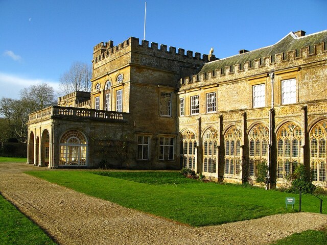 Forde Abbey
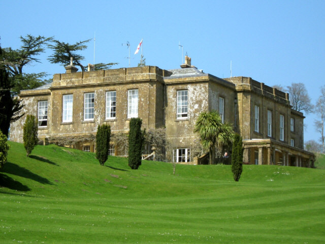 Cricket House, To The Manor Born
Not far beyond the end of the lane is the entrance to the Cricket St Thomas Estate. The buildings here form the setting for the BBC TV series To The Manor Born. Westport Lodge was Audrey's new home after she was forced to leave the Manor - the manor itself was Cricket House, built from golden biscuit stone. It dates from 1786 and was designed by John Soane, one of them foremost architects of the period, for Rear Admiral Hood.
Parklands slope down from Windwhistle Hill to a tributary of the Axe. In the early 19th century, the little stream threading the valley was dammed to make a series of lakes and cascades. The valley is now home to lovely exotic plants and native animals.
After leaving Cricket St Thomas, you return to Winsham via a bridlepath and another winding by-way, Limekiln Lane. This, and other names, Chalkway and Chalk Hill Cottages, reflect a form of cottage industry in the area. The hillside here is pitted with small quarries. Chalk was cut away and burned in kilns to form concentrated lime. This was used both as a fertiliser and in the building trade.
Acknowledgments: Text derived from the Out and Out Series; Discovering the Countryside on Foot. Pictures courtesy of Wikipedia.
Feedback and Suggestions: To suggest a link for inclusion on a this page please complete the Walking Englishman Feedback Form. Thank you.


