Week St Mary and Penhallam
Explore timeless Cornish countryside near the Devon border
Google Maps Open Source Maps| Statistics and Files | ||
|---|---|---|
| Start: Week St Mary | Distance: 4.1 miles (6.6 km) | Climbing: 193 metres |
| Grid Ref: SX 23693 97486 | Time: 2 hours | Rating: Easy |
| GPX Route File | Google Earth File | About Week St Mary |
| Statistics | |
|---|---|
| Start: Week St Mary | Distance: 4.1 miles (6.6 km) |
| Climbing: 193 metres | Grid Ref: SX 23693 97486 |
| Time: 2 hours | Rating: Easy |
| GPX Route File | Google Earth File |
Ordnance Survey Explorer Map (1:25,000)
The Walk:
The north-eastern corner of Cornwall, bordered by Bodmin Moor, the Tamar valley and the sea, is an area of gentle countryside where high-banked lanes wind between remote farms and secluded villages such as Week St Mary, where this walk begins.
The Parish Church of St Mary, near the start of the walk, has a splendid granite tower almost 100 feet (30 metres) high. The massive porch originally had a schoolroom above it, and now provides a home for the old village stocks. There is an interesting slate sundial on the wall.
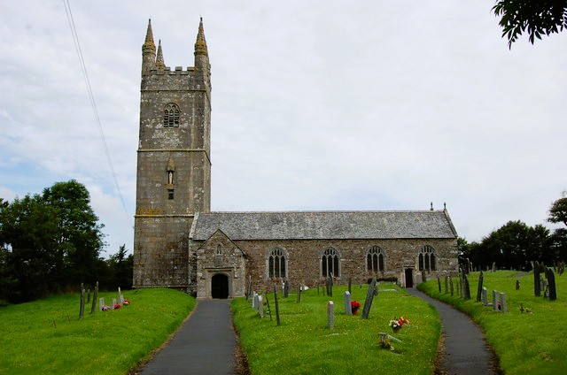 Week St Mary Church
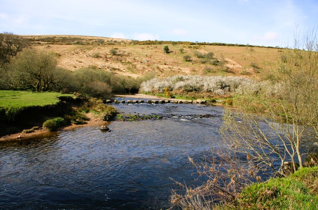 Stepping stones over a feeder stream of the River Tamar
The interior of the church was stored somewhat heavily handled by the Victorians, but fortunately, the medieval aisle roofs, with their carved bosses, have survived. Back outside in the graveyard are a number of attractively carved slate monuments. Look, for example, for the memorial to John Pethick, with its trumpeting angels in the church wall.
The route goes past The College, a building with a long history. A local shepherdess, Thomasine Bonaventure, caught the eye of a visiting merchant who married her in 1508. She purchased land for a school and chantry at her old home, and The College was established. It is now owned by the Landmark Trust.
Just beyond The College is a green, where a whitewashed house has a slate-hung wall. The route turns onto a path across fields to a little footbridge over a stream, and on again with wide views over a gently undulating landscape.
The path ends at a typical Cornish country lane with high hedges. Where there are breaks, there are views on the left down to a deep wooded valley. The hedgerows are a tangle of plants with stunted oak, beech, elder, bramble and gorse all mixed in together. As the road dips downhill, so tall banks rear up on either side, topped by mature trees. The surrounding hills are covered in a mixture of conifer and broadleaved woodland.
The road crosses a little bridge over a briskly bubbling stream that is a feeder to the River Tamar; its source springs are close by. From the road you can see a stepping stones crossing of the water, just off the route. Staying on the road, you soon turn off to follow a forest path. The rough broad track runs uphill, leading through dense conifer woodland speckled with a rich carpet of fungi, before curving round to rejoin the road.
Here there are wide views of rolling hills out beyond the tall, telecommunications tower, to the coast. At this point, the edge of the old woodland is marked by a high bank. The road continues to climb gently between hedgerows. The area is densely populated with pheasants which strut along the road, and through the grassland and crops on either side. The more distant views show a patchwork of small fields with lanes sneaking through them.
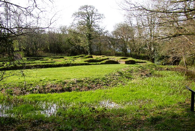 Site of Penhallam Manor
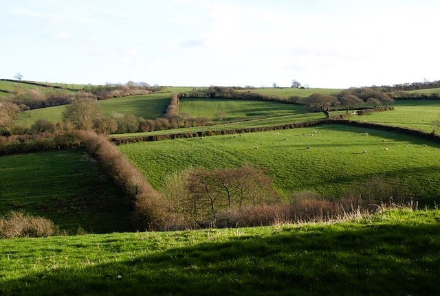 Cornish countryside near Week St Mary
Where the road swings round to the left at the hamlet of Pennhallym, bumps and stones in a field are all that remain of an old manor house. A little further on, you leave the road for a track to North Broompark Farm. The view to the south reveals an attractive countryside of hills, patched with fields of grain and grassland, and broken by hollows filled with trees. Up ahead beyond Westwood Common, the tower of Week St Mary Church appears as a prominent landmark.
The track comes to an end and the way continues through fields, past a reed fringed pond, to a little stream crossed at a ford. You go past the barn of Bury Court, and beyond this is the site of an old moated manor. This is what remains of Penhallam Manor, now under the management of English Heritage. The moat itself is still clearly defined, with two modern footbridges providing access to the remains of the manor itself. This now consists simply of low walls, no more than a few inches high, as if the floor plan was laid out in relief in the grass.
The walk turns into woodland and crosses a stream at a little rocky cutting. The path then begins to climb uphill past the edge of the woodland, through a struggle of silver birch, to the flank of a hill covered with rough grass and patches of gorse. Here there are traces of a ring of earthwork defences, marking an ancient fort or camp, probably an Iron Age one. From the top of the hill, there are fine views back over the hills and wooded combes. A broad track then leads down to the road and the outskirts of Week St Mary.
Acknowledgments: Text derived from the Out and Out Series; Discovering the Countryside on Foot. Pictures courtesy of Wikipedia.
Feedback and Suggestions: To suggest a link for inclusion on a this page please complete the Walking Englishman Feedback Form. Thank you.


