Bournemouth Pier, Central Gardens, Bourne Valley and Talbot Village
Walking from the sea through a green valley to lovely Dorset heathland
Google Maps Open Source Maps| Statistics and Files | ||
|---|---|---|
| Start: Bournemouth Pier | Distance: 3.4 miles (5.5 km) | Climbing: 76 metres |
| Grid Ref: SZ 08887 90709 | Time: 2 hours | Rating: Easy |
| GPX Route File | Google Earth File | About Bournemouth |
| Statistics | |
|---|---|
| Start: Bournemouth Pier | Distance: 3.4 miles (5.5 km) |
| Climbing: 76 metres | Grid Ref: SZ 08887 90709 |
| Time: 2 hours | Rating: Easy |
| GPX Route File | Google Earth File |
Ordnance Survey Explorer Map (1:25,000)
The Walk:
The low cliffs on the coast at Bournemouth are cut occasionally by valleys known as 'chines'. Bournemouth's first houses were built on either side of the main chine, where the River Bourne flows from watermeadows over golden sands into the sea. This walk follows the Bourne through the town and then over heathland to a 19th century model village.
The River Bourne's mouth is now in a pipe, though at low tide the water can be seen running into the sea just east of the Bournemouth Pier, where the walk begins. The valley's meadows, where boats were once washed up at very high tides, are now the Lower Gardens, with the stream serving as a natural paddling pool as it passes the bandstand.
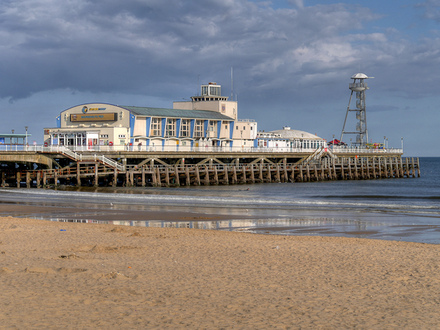 The starting point beside Bournemouth Pier
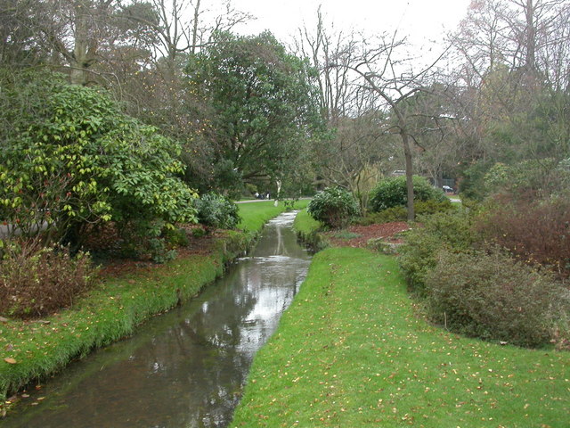 Central Gardens in Bournemouth
The seaside town of Bournemouth began in 1810 when one Louise Tregonwell built a house on the side of the valley. As a customs official, Tregonwell had patrolled the beach for smugglers and enjoyed the location. The house survives in Exeter Road as the enlarged Royal Exeter Hotel, earning its royal status when the Empress of Austria stayed there in 1888.
Nearby is the massive Bournemouth International Conference Centre, built on the site of a thatched cottage, where Charles Darwin stayed in 1862, while looking for flowers by the brook. The heroine of Thomas Hardy's Tess of the d'Urberville's lived across the valley in Westover Road, for this is his 'Sandbourne'.
Looking down on the Upper Gardens is the massive town hall. Set back here is the tower of the late 19th century Saint Stephens church, which was described by the poet John Betjeman as "the best church in Bournemouth".
Further on through the tranquil valley, you pass a red brick castellated tower, hiding in the foliage. There is a marked change where the valley opens out and enters the Borough of Poole. Here weeping willows have been planted by the water, and two streams join to form the River Bourne. The one from the north comes via a short underground channel from the Coy Pond. The pond, never a real 'decoy' for entrapping wildfowl, was created in 1886 when the northern stream was piped under a new railway embankment.
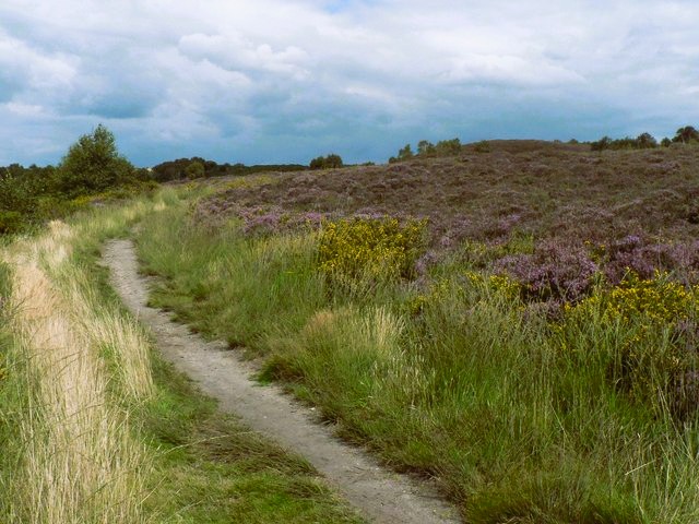 Path leading from Bourne Valley to Talbot Heath
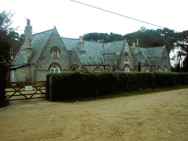 Almshouses in Talbot Village
The stream feeding the pond comes from Canford Heath, via Bourne Bottom, below Talbot Heath. This isolated segment of Dorset heathland, 160 feet above the end of a valley, is arguably amongst the finest in western Europe.
The purple heather once made beekeeping common, and the heath hosts many rare or endangered species, such as the smooth snake and the sand lizard. The nightjar and hobby are among the rare birds that may be seen here, along with the elusive Dartford warbler.
When you approach Talbot Village, a 75-foot church tower is the only clue that within the large pinewood beyond Talbot Heath lies a secret model village. It was planned in 1850 by philanthropist Georgina Talbot, who was inspired to help the poor after reading a German book, The Goldiggers Village.
Each cottage was set in an acre of land, and had a well and a pig sty. There is also a school and Gothic almshouses built of Portland stone. Each villager promised 'To love God, keep the Commandments and honour the Queen'. The church, which was completed in a 1870, had clockwork chimes. Georgina Talbot feared that if bell ringers were employed, they might spend their fees on drink.
Acknowledgments: Text derived from the Out and Out Series; Discovering the Countryside on Foot. Pictures courtesy of Wikipedia.
Feedback and Suggestions: To suggest a link for inclusion on a this page please complete the Walking Englishman Feedback Form. Thank you.


