Downton, Charlton All Saints and Trafalgar Park
Meadows and a country house by an Avon valley village
Google Maps Open Source Maps| Statistics and Files | ||
|---|---|---|
| Start: Downton | Distance: 5.7 miles (9.2 km) | Climbing: 108 metres |
| Grid Ref: SU 18210 21523 | Time: 3 hours | Rating: Easy |
| GPX Route File | Google Earth File | About Downton |
| Statistics | |
|---|---|
| Start: Downton | Distance: 5.7 miles (9.2 km) |
| Climbing: 108 metres | Grid Ref: SU 18210 21523 |
| Time: 3 hours | Rating: Easy |
| GPX Route File | Google Earth File |
Ordnance Survey Explorer Map (1:25,000)
The Walk:
Downton is a village straggling the channels of the River Avon. In 1814, a nearby country house was given to Admiral Nelson’s family as a reward for his services to the nation. This walk explores both.
Near the start is The Moot, an earthwork dating from at least the time when King Stephen's brother, the Bishop of Winchester, built a castle there in the 12th century. The site was landscaped in the 1720's to include an amphitheatre, an attractive lily pond and a viewpoint.
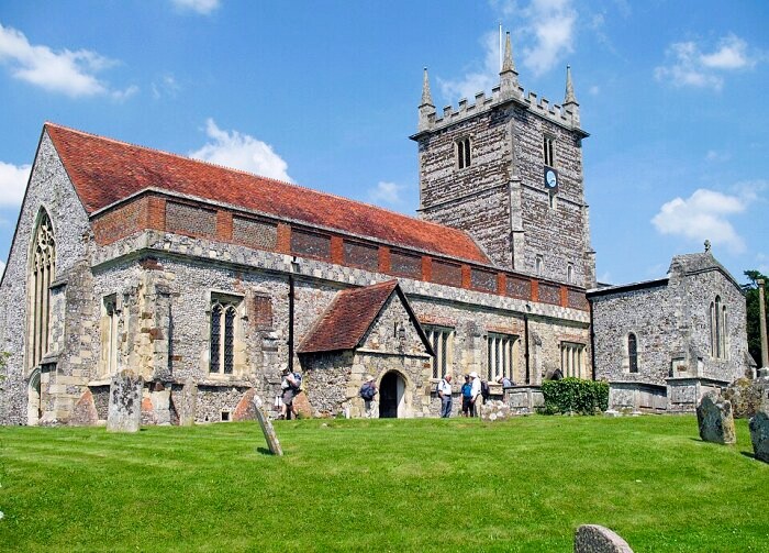 St Laurence's Church, Downton
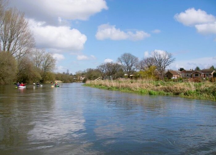 River Avon near Downton
St Laurence's Church, the Church of England parish church where the walk begins, has its origins in the 12th century; Nikolaus Pevsner describes it as "a large and interesting church".
The old chemist's shop at the centre of the village has an Egyptian style doorway dating from 1826. A mill-stream runs by a former working tannery and under a double mill; one was for grist and the other was for paper.
West of the River Avon's main channel, the village is known as 'The Borough'. This is a 'new town', founded about 1205, with a wide street lined with small houses, including thatched cottages. The Borough's focal point is the cross outside the White Horse pub, decorated with the heads of King John and Queen Isabella carved in wood.
The village unites each spring for the ancient Cuckoo Fair, said to mark the 'opening of the valley gates to let the cuckoo through'. The footpath entrance to the valley is by the iron bridge of 1820, so called because of its railings. The Riverside path, which has a fine view of the church across the water, gives access to the 'floating meadows', which are popular with wild fowl
The floating watermeadow system was an intricate form of irrigation that controlled river flooding by turning it to man’s advantage. The scheme was devised in the early 17th century and maintained until the beginning of the last century. It is thought that Dutch prisoners held in Salisbury Cathedral's cloisters at the time of the Civil War may have provided to know how.
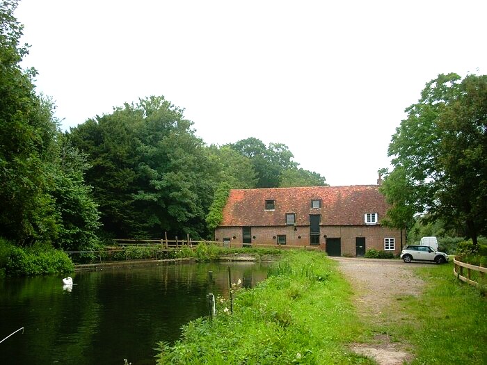 Standlynch Mill
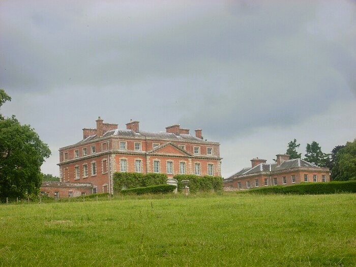 Trafalgar House
The hamlet of Charlton All Saints, on the edge of the floodplain, has sometimes been underwater and today the eastern end of the churchyard is considered too vulnerable for burials. The 1851 brick built church of All Saints is set to be converted inside to a village hall. The old Vicarage is the work of the Victorian ecclesiastical architect William Butterfield and features his distinctive decorative brickwork.
From Charlton All Saints, you cross the river channels to arrive at Standlynch Mill. The former chapel above the mill dates from 1677, when the estate was also known as Standlynch. In 1840, its name was changed to Trafalgar Park and the estate presented to Admiral Nelson’s family, who continued to live in Trafalgar House until 1948. The 18th century mansion, now privately owned, includes a Ganges room, with panelling from the ship and one of Nelson’s telescopes.
The final section of the walk follows the disused Salisbury to Wimborne railway line, which closed in 1965. As you return to Downton, which had a station for exactly a century, there are fine views including one of Salisbury Cathedral's spire, five miles away.
Acknowledgments: Text derived from the Out and Out Series; Discovering the Countryside on Foot. Pictures courtesy of Wikipedia.
Feedback and Suggestions: To suggest a link for inclusion on a this page please complete the Walking Englishman Feedback Form. Thank you.


