Lansdown, North Stoke, Pipley Wood and Hanging Hill
Walk over beautiful Downland with an isolated feel, right on Bath's doorstep
Google Maps Open Source Maps| Statistics and Files | ||
|---|---|---|
| Start: Lansdown | Distance: 6.4 miles (10.3 km) | Climbing: 171 metres |
| Grid Ref: ST 72639 68602 | Time: 3 hours | Rating: Easy |
| GPX Route File | Google Earth File | About Bath |
| Statistics | |
|---|---|
| Start: Lansdown | Distance: 6.4 miles (10.3 km) |
| Climbing: 171 metres | Grid Ref: ST 72639 68602 |
| Time: 3 hours | Rating: Easy |
| GPX Route File | Google Earth File |
Ordnance Survey Explorer Map (1:25,000)
The Walk:
This walk explores Lansdown, an exposed lowly down above the city of Bath. Along the route, you walk along part of a long distance footpath, the Cotswold Way, passing through a remote village and a Civil ar battleground. There are fine views in all directions; across the Avon and Severn valleys to the south and west, towards the Wiltshire Downs in the east, and along the Cotswold Edge to the north. A pair of binoculars are an asset, but there is plenty to see without them.
The walk begins at the Charlcombe Inn. The inn stands on the site of The Star Inn, rebuilt after World War Two and once named the Blathwayt Arms, after William Blathwayt, Secretary of State to William and Mary, who once owned much of Lansdown.
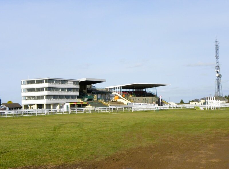 Bath Racecourse
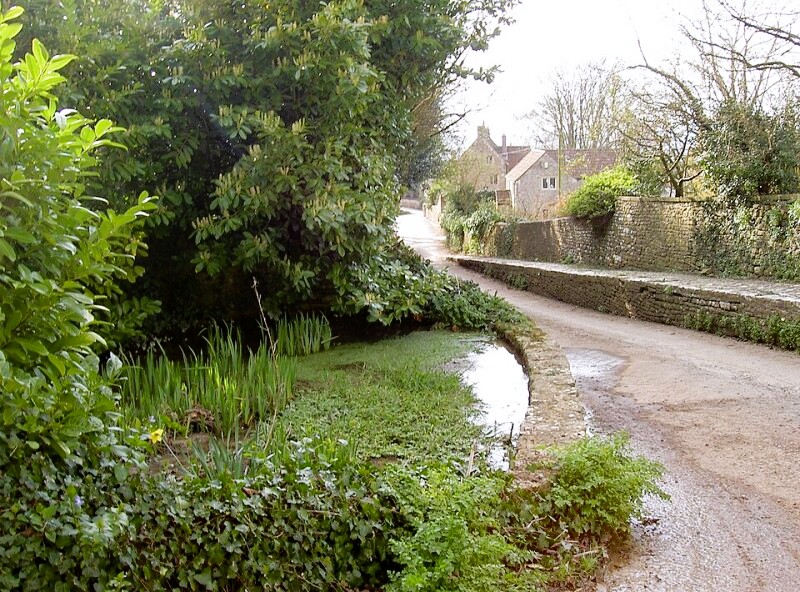 North Stoke
Behind the pub is Bath Racecourse, which moved to its present location in 1830. Previously, races were run between Beckford's Tower, a prominent landmark to the south-east, and Lansdown Lane. The Bath Races were particularly popular during the Regency (1810-1820), when the prestigious Bath Cup was worth the vast sum of 100 guineas. Nowadays, there are 20 days of flat racing a year.
At other times, part of the course are used for grazing cattle or walking dogs, and by model aeroplane enthusiasts. The liquid song of the Skylark is frequently heard over the racecourse, although the bird itself is not easy to spot.
Across the racecourse is the viewpoint of Prospect Stile. Bath is laid out to the left of the stile, with the abbey, the university and Sham Castle making good reference points. Bristol is to the right; binoculars will pick out Brunel's suspension bridge at Clifton. On the far horizon ahead, beyond the villages and towns of the Severn valley, is Beacon Batch, the highest point of the Mendip Hills.
If you descend on the Cotswold way towards the local landmark of Kelston Round Hill, the Cotswold Way is not a purpose made long distance path. It was created by linking existing rites of way and stretches almost 100 miles, 160 kilometres from Bath to Chipping Camden. I walked the route, in the opposite direction, during my Great British Walk, in the summer of 2011.
Before reaching Kelston Round Hill, you turn off along a sometimes muddy lane between fields which contours the side of the hill. There are quiet pastures above, while to the left there is far more activity. A motocross track serpentines busily across the lower slopes, and at weekends the guns of clay pigeon shoots mingle with the raucous cries of birds from the local rookery.
Gaps in the tangle of thorns and ivy covered trees that line the way reveal views over the Avon Valley. In the middle distance is the weir at Kelston Mill, a reminder of the regions once thriving brass industry. This made use of Calamine, a zinc ore, from the Mendip Hills, and coal ore from the mines of Kingswood Forest to the west. The talk truncated pyramids that you can see are annealing ovens, all that is left of William Champion's brass foundry, built around 1760. Champion's brassworks at nearby Warmley were the largest in the world at the time.
At the end of the lane is the secluded village of North Stoke. This ancient place is thought to have been continuously occupied for approximately 2,500 years. The site of the original Celtic village is on a high, sheltered spot, on the shoulder of a hill. Today it is a place of mellow stone decorated with lichen and red pantile roofs. Particularly noteworthy is Manor Farm's Georgian shell-hood over its front door.
At the top of the village is St Martin's Church. The inside is unassuming, though there are interesting wall tablets. Outside, a spring drops through pools, and there are fine views from the churchyard.
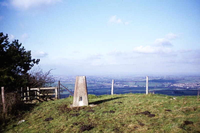 Trig point on Hanging Hill
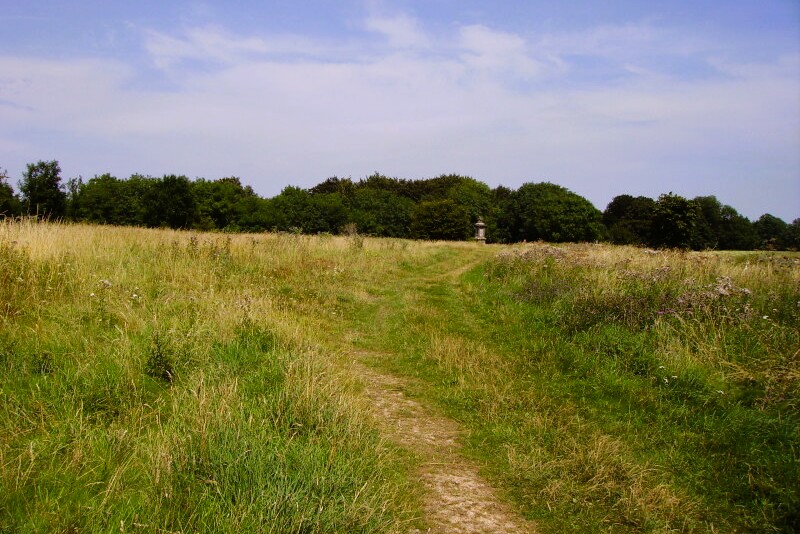 Site of Battle of Lansdown, fought in 1643
Back on the Cotswold Way, you embark on a long, steady climb, up a path lined with mossy oaks supporting straggles of wild clematis. Rabbits are abundant on the slopes to your left. Below are the scattered houses of Pipley Bottom. There is a real sense of remoteness from the cities of Bath and Bristol.
Back on top of Lansdown, you follow a grassy track between a golf course and Pipley Wood, which clings to the slopes behind a crumbling stone wall. The path winds on around the edge of the down to Hanging Hill. Here, there are views west across the plain, dotted with stone-built villages and country houses, to the hills of Wales. The Cotswold scarp stretches away to the north.
You pass a Ministry of Defence installation, and cross the road to the Sir Bevil Grenville's Monument. This was erected in 1720 to the memory of the Royalist general, killed very near the spot, at the Battle of Lansdowne in 1643, during the English Civil War. The column has trophies and coats of arms carved in relief, and is topped by a griffin. The monument is etched with graffiti from the 18th and 19th century.
The path skirts a large field where much of the fighting took place. The Royalists made their charge up the steep wooded slopes to your left. You leave the Cotswold Way as it drops down into a lovely bowl-like valley, with splendid views across to Charmy Down, site of a former RAF airfield, and the Wilshire Hills rolling away on the horizon. From here it is a short walk across farmland, back to the start at the Charlcombe Inn.
Acknowledgments: Text derived from the Out and Out Series; Discovering the Countryside on Foot. Pictures courtesy of Wikipedia.
Feedback and Suggestions: To suggest a link for inclusion on a this page please complete the Walking Englishman Feedback Form. Thank you.


