Broadhembury, River Tale, Hangar Hill and Stafford Barton
A stroll around one of the loveliest villages in the West Country
Google Maps Open Source Maps| Statistics and Files | ||
|---|---|---|
| Start: Broadhembury | Distance: 4.3 miles (7.0 km) | Climbing: 175 metres |
| Grid Ref: ST 10166 04690 | Time: 2 hours | Rating: Moderate |
| GPX Route File | Google Earth File | Broadhembury |
| Statistics | |
|---|---|
| Start: Broadhembury | Distance: 4.3 miles (7.0 km) |
| Climbing: 175 metres | Grid Ref: ST 10166 04690 |
| Time: 2 hours | Rating: Moderate |
| GPX Route File | Google Earth File |
Ordnance Survey Explorer Map (1:25,000)
The Walk: Broadhembury lies in a deep combe, sheltered to the north and east by a steep wooded ridge. This walk climbs along sunken lanes and green paths, bright with flowers, to the crest of the combe, and follows the hillside, with spectacular views of this quiet area of Devon countryside. Deer can sometimes be seen in the deeper woodland, while buzzards soar over the open fields.
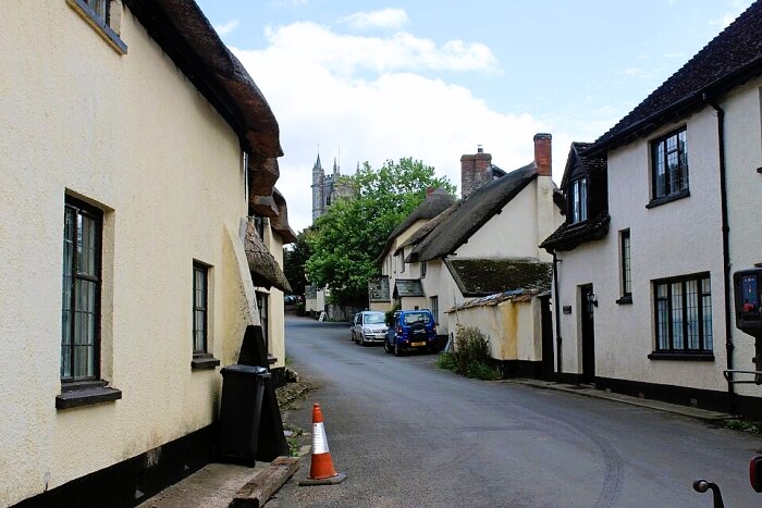 Beautiful thatched cottages in Broadhembury
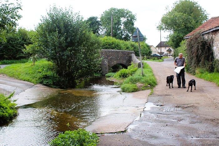 Ford over the River Tale in Broadhembury
You step back almost 400 years as you enter Broadhembury. All the rows of cottages and houses, clustered around the square and tucked up narrow lanes, date from the early 17th century. They are built low beneath deep eaves of mossy thatch, and their rough-cast walls are colour washed a soft cream.
Gardens spill over into a roadway, and mingle with the wildflowers on the verges and beside of the River Tale, the little stream that flows down from the top of the combe.
The walk begins at St Andrew's Church, which dates mainly from the 14th and 15th centuries. It has a fine tower, and a beautifully vaulted porch with a tiny statue of Saint Andrew over the doorway. The Reverend Augustus Toplady, the composer of the hymn Rock of Ages was vicar here from 1768 to 1778.
The local inn, The Drewe Arms, is named after Edward Drewe, Sergeant-at-Law to Elizabeth I. He became Lord of the Manor here in 1603, and built The Grange, the large 17th century house that the route passes on the way into the village via Colliton Cross.
The route leaves the village by Long-go Lane, which passes Marlpit Copse, a reminder of an old way of improving soil. Marl (limy clay) was dug out and spread over the land by gangs of itinerant 'marlers'.
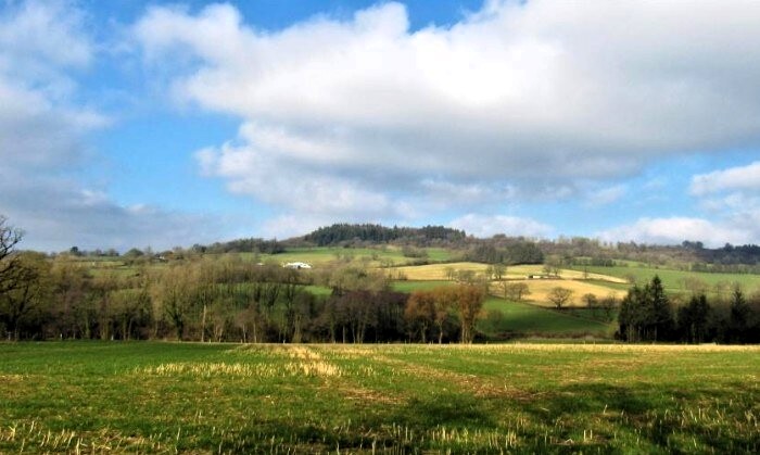 The countryside around Broadhembury
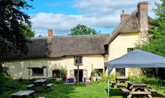 The Drewe Arms, Broadhembury
Beyond the copse, the lane becomes grassy and more deeply sunken, with wild flowers growing through tangled tree roots along the edges. It leads through small copses, where bluebells, wood anemones and wood sorrel grow and tiny streams run through deep channels, overhung with ferns.
Near the top of the hill is North Hill Airfield, one of the bases of Devon and Somerset Gliding Club. You can quite often hear the howl of the wind on the launch cable as a glider steadily climbs steeply into the sky, or see the gliders circling to gain height in the currents of rising air at the top of the combe.
A walk along the top of the combe leads you to a breathtaking viewpoint. Spread out at your feet is the typical Devon countryside of rolling green hillsides and woods. Beyond, some 20 miles to the south-west, are the Haldon Hills, while Dartmoor broods in the west. A little to the south, the ground dips then rises to Hembury Hill Fort. Originally a Neolithic causewayed camp of around 2,500 BC, this was fortified in the Iron Age to enclose about eight acres.
The return route first follows a woodland path, so thickly carpeted with bluebells in spring, that you have no choice but to walk on them, then descends another sunken, flower-fringed lane into the village.
Acknowledgments: Text derived from the Out and Out Series; Discovering the Countryside on Foot. Pictures courtesy of Wikipedia.
Feedback and Suggestions: To suggest a link for inclusion on a this page please complete the Walking Englishman Feedback Form. Thank you.


