Chawleigh, Little Dart River, Milford's Hill and West Burridge Cross
Along a wooded valley and across the grassy hills of Devon
Google Maps Open Source Maps| Statistics and Files | ||
|---|---|---|
| Start: Chawleigh | Distance: 4.6 miles (7.4 km) | Climbing: 191 metres |
| Grid Ref: SS 71113 12534 | Time: 2 hours | Rating: Moderate |
| GPX Route File | Google Earth File | About Mid Devon |
| Statistics | |
|---|---|
| Start: Chawleigh | Distance: 4.6 miles (7.4 km) |
| Climbing: 191 metres | Grid Ref: SS 71113 12534 |
| Time: 2 hours | Rating: Moderate |
| GPX Route File | Google Earth File |
Ordnance Survey Explorer Map (1:25,000)
The Walk: The farmland lying between Dartmoor and Exmoor is one of the least-known parts of Devon. This walk explores some typical scenery. It begins beside the Earl of Portsmouth pub in Chawleigh, a hilltop village whose houses are built of rough-hewn standstone, sometimes distinguished by paintwork and rendering. Near the start is an attractive thatched house finished with such birds on the ridge. A short diversion takes you past the old stone primary school, with its hexagonal-paned, cast-iron windows, to the village church.
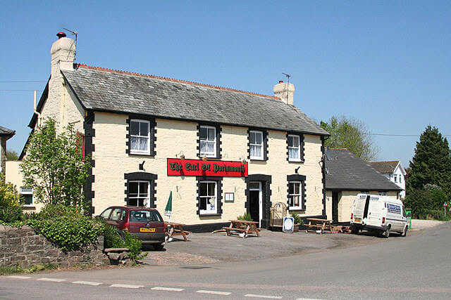 The Earl of Portsmouth, Chawleigh
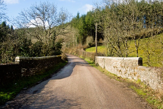 Stone Mill Bridge
The entrance to the church is through a lychgate with an unusual 'pattern' style, hinged to bring it up rather like a modern level crossing barrier. The church itself is remarkably handsome. It is basically 15th century, built in the Perpendicular style. As so often in Devon, its most striking feature is the beautifully carved rood screen, with its elaborate patterns of vaulting - though it is also worth peering behind the organ to see a magnificent Baroque monument.
You follow a stream from the village to the bottom of a valley. The road crosses the Little Dart River at Stone Mill Bridge. The stone mill still retains the remains of its overshot water-wheel. The water is brought to the mill along a wooden trough, or launder, and then falls into 'buckets' set on the rim of the wheel.
The route now turns to follow the River Little Dart. This is nothing to do with the River Dart that reaches the sea in South Devon, this is a tributary of the River Taw. At first, the valley is quite wide, with the road against the northern edge and the river meandering away to the south. The road runs between grassy banks that are especially attractive in spring, when they are covered with primroses.
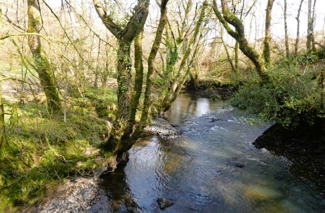 Little Dart River
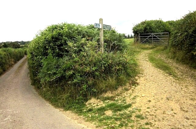 West Burridge Cross
As the road enters the wooded part of the valley, the route turns off to follow a footpath alongside the river. At first it is a broad, grassy track between the lively river and a mixed woodland that clings to the steep rocky hillside. When the valley narrows, the path enters the woods, which by now reaches down to the banks of the stream. Deer can often be glimpsed grazing in the woods, and Herons stand statue-still beside the water.
There is a final gentle climb up a grassy hill before you leave the path for another quiet country lane. The road goes deeply downhill to bridge a rocky little river gorge, and then climbs just as steeply at the opposite side of the valley. Eventually you arrive at West Burridge Cross, near to the site of a pre-Roman hill settlement.
The return half the walk is on footpaths. It begins by diving downhill along a sunken lane through the woods to a deep valley carved by several small streams. Then it climbs to a high plateau, passing East Leigh Farm and some ruined farm cottages. Here there are long views over a wide tract of countryside.
A final green lane offers an encouraging view of Chawleigh's church up ahead, but before it can be reached, there is another downhill plunge between gorse bushes and one last climb to bring the footpath back to Chawleigh.
Acknowledgments: Text derived from the Out and Out Series; Discovering the Countryside on Foot. Pictures courtesy of Wikipedia.
Feedback and Suggestions: To suggest a link for inclusion on a this page please complete the Walking Englishman Feedback Form. Thank you.


