Redcliff Bay, Walton in Gordano, Walton Common and Weston in Gordano
Ancient sites and a crusader's tomb by the Severn Estuary
Google Maps Open Source Maps| Statistics and Files | ||
|---|---|---|
| Start: Valley Road Bottom | Distance: 5.4 miles (8.7 km) | Climbing: 254 metres |
| Grid Ref: ST 44054 75236 | Time: 2-3 hours | Rating: Moderate |
| GPX Route File | Google Earth File | About Portishead |
| Statistics | |
|---|---|
| Start: Valley Road Bottom | Distance: 5.4 miles (8.7 km) |
| Climbing: 254 metres | Grid Ref: ST 44054 75236 |
| Time: 2-3 hours | Rating: Moderate |
| GPX Route File | Google Earth File |
Ordnance Survey Explorer Map (1:25,000)
The Walk:
Portishead, on a commanding position on a ridge above the Severn Estuary, is recorded in the Domesday Book as a small community of about a dozen men, its lands and buildings valued at 70 shillings. At that time it was at the head of a peninsula; the low-lying land to the south and east, part of the Somerset Levels, have not been drained.
In recent times, the town has centred on its docks and industries. The tide of Portishead rises and falls more than 40 feet (12 metres), the second largest differential in the world. Two power stations built here between the World Wars have made use of this factor in their cooling systems. This walk looks at the country to the south-west of the town, along the line of the ridge. The route winds down through the residential streets of Redcliff Bay to the clifftop coast path.
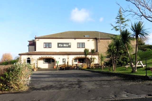 The Ship, Redcliff Bay
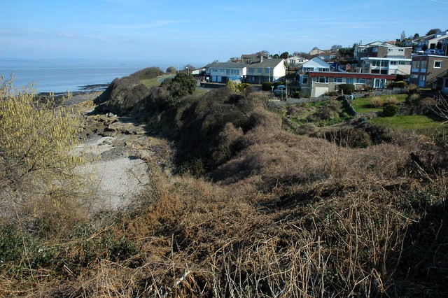 Redcliff Bay
Prevailing south-west winds sweep along the coast, and some of the trees and hedges make archways across the path. Among the many plants flowering in the shelter of the hedgerows are red and white campion and navelwort.
There are fine views across the estuary and to the Bristol Channel. At low tide, massive golden brown sandbanks are left high and dry. South Wales appears as a faint shimmering haze across the muddy waters, which are usually busy with craft both large and small.
Just beyond the signal station, the route leaves the coast to climb onto Walton Common. This rough pasture on the summit of the ridge enclosed by trees was once the common grazing land of Walton in Gordano, which lies down the hill to the south. It contains many ancient sites, hut circles, field systems and enclosures, and a tumulus, but none of these are easy to see from the ground.
It is possible to sit here unaware of the outside world, save for the noise of the nearby M5 percolating occasionally through the trees. Patience may be rewarded by the sight of a buzzard, a hovering kestrel, or a silent owl at dusk. The huge rabbit population here provides a ready source of food for these birds of prey.
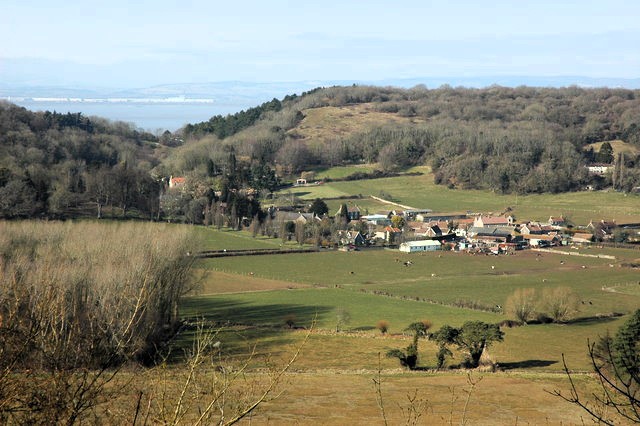 Walton in Gordano and Walton Common
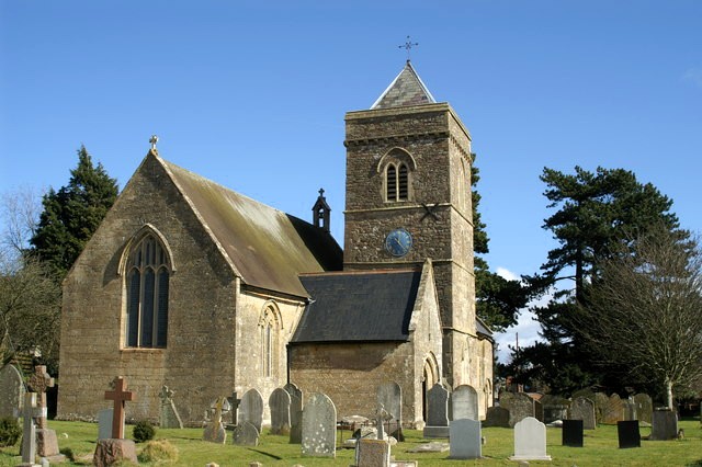 Weston in Gordano Church
After an optional visit to the village of Walton in Gordano, the route continues through woods and fields to the neighbouring village of Weston in Gordano. In the church of St Peter and St Paul, founded in the 11th century, is the tomb of Sir Richard de Perceval, who travelled with King Richard I on the Third Crusade to the Holy Land. Sir Richard lost an arm and a leg in combat, but continued to ride into battle, his sword in his hand and the reins of his horse between his teeth. Despite his handicaps, he lived to return to England.
Another member of his family is commemorated in the churchyard. A cross was erected in 1910 in memory of Spencer Perceval, Prime Minister from 1809 to 1812. In that year, he was shot dead in the House of Commons lobby by a merchant, John Bellingham, who blamed the government for his own bankruptcy. Perceval is the only British Prime Minister to have been assassinated.
From Weston, there is a climb up and over the ridge to return to the starting point of the walk.
Acknowledgments: Text derived from the Out and Out Series; Discovering the Countryside on Foot. Pictures courtesy of Wikipedia.
Feedback and Suggestions: To suggest a link for inclusion on a this page please complete the Walking Englishman Feedback Form. Thank you.


