Dulverton, River Barle, Hinam Cross, Chilcott Lane and Wilway
An Exmoor ramble through wooded valleys and high-banked lanes
Google Maps Open Source Maps| Statistics and Files | ||
|---|---|---|
| Start: Dulverton | Distance: 6.5 miles (10.5 km) | Climbing: 354 metres |
| Grid Ref: SS 91266 27956 | Time: 3 hours | Rating: Moderate |
| GPX Route File | Google Earth File | About Exmoor |
| Statistics | |
|---|---|
| Start: Dulverton | Distance: 6.5 miles (10.5 km) |
| Climbing: 354 metres | Grid Ref: SS 91266 27956 |
| Time: 3 hours | Rating: Moderate |
| GPX Route File | Google Earth File |
Ordnance Survey Explorer Map (1:25,000)
The Walk:
The southern edge of Exmoor National Park is off the beaten tourist track, but its hilly landscape, cut by steep-sided river valleys, is well worth exploring. Close to the boundary with Devon, this walk follows the wooded valley of the River Barle, then returns across high country by footpaths and lanes.
The walk starts in Dulverton, a beautiful little town of narrow streets and alleyways that clamber up the steep slopes to the east of the river. At its heart is a triangle of streets below the magnificent 13th-century tower of the Church of All Saints.
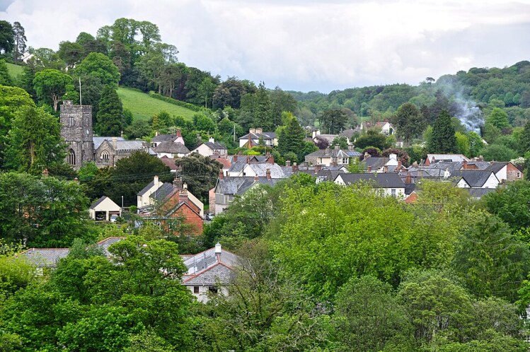 Beautiful Dulverton
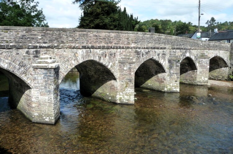 Barle Bridge in Dulverton
In the riverside car park is the bronze statue of Exmoor's literally heroine, Lorna Doone. Behind it is a building that could pass as a stately home, but was, in fact, built in 1855 as a workhouse, and is now the administrative headquarters of the Exmoor National Park.
The walk crosses the river on the towns medieval stone bridge, beyond which the densely wooded hillside rears up, the mass of greenery broken by the rich shades of copper beech, and in season, the brilliance of rhododendrons. For the next 2.5 miles (4 kilometres), the path closely follows the windings of the River Barle. The river, though generally shallow, is fast flowing, dashing along in little rapids and gurgling in eddies around the rocks.
The hills that rise steeply on either side are densely wooded, for most of the way with broadleaved trees. In summer, they are alive with the voice for songbirds, interspersed with the occasional discordant note from a jay, or a harsh quack from a mallard on the river. The gaps between the trees provide space for a rich variety of flowers.
The well maintained riverside path is never dull. At times it runs close to the water's edge, but in other places rises then falls like a switchback, giving views down to the river. Old woodland banks and ditches appear as boundaries, and just beyond the point where the hillside has been reinforced by a stone wall, a long bank climbs the hill with an array of mature trees growing from it. The occasional small tributary trickles its way down towards the river.
At Kendall Farm, the footpath briefly give his way to a short section of road walking, which ends near an attractive iron bridge over the river. The next section of riverside walking has features of its own, a line of crags marching up the slope, and the curiously named Invention Wood on the opposite bank. The scenery becomes more dramatic, breaks in the trees near the summit of a densely wooded hill show the ramparts of an Iron Age hillfort, Mounsey Castle.
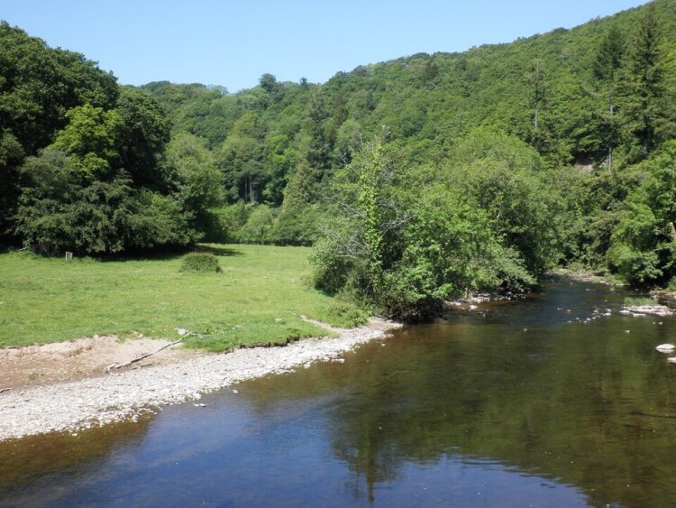 River Barle near to Mounsey Castle
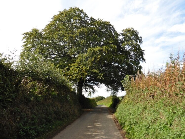 The lane to Hinam Cross
The route leaves the River Barle and runs along a deep valley, cut by a tributary stream. As it climbs steadily, there are views, often obscured by vegetation in summer, back to a grassy hill covered by a ring of trees. This marks the site of a second hill fort, Brewers Castle.
The deep lane emerges from the woods, and the climb continues through farmland on country lanes, though the view is cut off by high beech hedgerows. The old trees were layered so that what now appears to be many small trees are actually branches sprouting from a trunk bent level with the ground.
From the high point of the lane, there are splendid views out over the hills - with their patchwork of fields and caterpillar-like hedged lanes - and back across the river valley. The land here is high and open, making it an ideal hunting ground for the buzzards that soar, mewing, above the fields.
Beyond two farms, Higher Chilcott and Lower Chilcott, the road gives way to a broad track. This in turn leads to a green grassy lane that follows the rim of a lovely little valley. There is little indication now that its peace was once disturbed by iron ore mining. The path dips across a stream, then climbs a deep lane to Wilway Farm. Field paths, then another narrow lane, with banks that rise above head height, lead steeply downhill back to the start in Dulverton.
Acknowledgments: Text derived from the Out and Out Series; Discovering the Countryside on Foot. Pictures courtesy of Wikipedia.
Feedback and Suggestions: To suggest a link for inclusion on a this page please complete the Walking Englishman Feedback Form. Thank you.


