Looe, Kilminorth Wood, Porthallow, Talland Bay and South West Coast Path
Wooded valleys, high hills and clifftops paths around Looe
Google Maps Open Source Maps| Statistics and Files | ||
|---|---|---|
| Start: West Looe | Distance: 7.1 miles (11.5 km) | Climbing: 385 metres |
| Grid Ref: SX 25298 53693 | Time: 3 hours | Rating: Moderate |
| GPX Route File | Google Earth File | About Looe |
| Statistics | |
|---|---|
| Start: West Looe | Distance: 7.1 miles (11.5 km) |
| Climbing: 385 metres | Grid Ref: SX 25298 53693 |
| Time: 3 hours | Rating: Moderate |
| GPX Route File | Google Earth File |
Ordnance Survey Explorer Map (1:25,000)
The Walk:
Broadleaved woodland cloaks the valleys of both the East and West Looe Rivers. Their waters join close to Millpool, once a large sheet of water, now a car park, where you enter the thick green silence of Kilminorth Woods. Many of the trees are relatively young sessile oaks, interspersed with sweet chestnut, beech, birch and the occasional Scots pine. The thin light that filters through the dense, leafly woodland encourages a rich undergrowth.
In Spring, delicate wood anemones compete for space with ransoms and bluebells, and act as a foil to dark-green dog's mercury. Later in the year, tangles of bramble and wild honeysuckle help to weave the whole fabric of the woodland together.
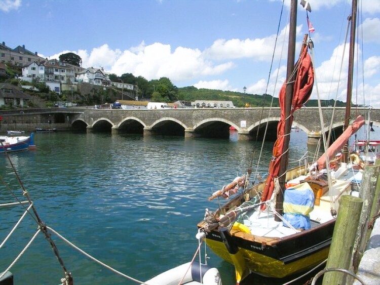 Looe Bridge
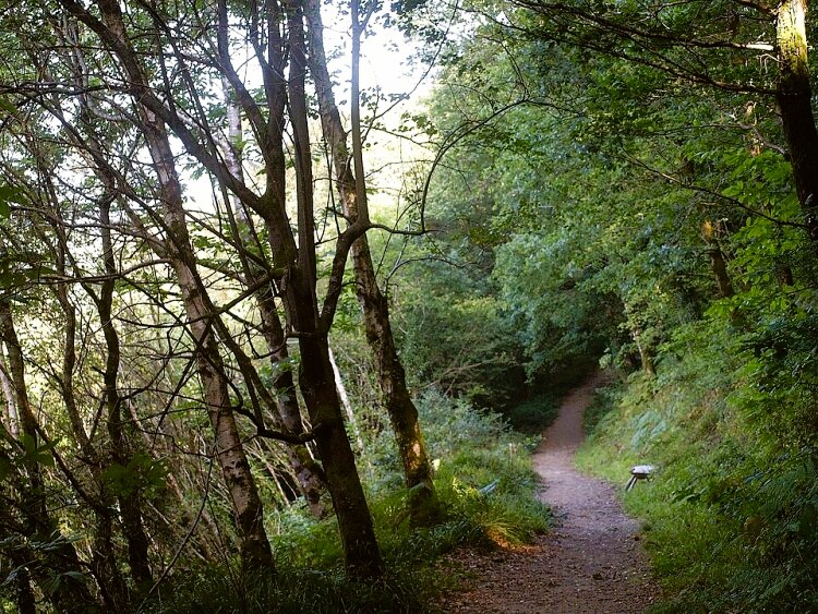 The path through Kilminorth Wood
As you walk by the water side, look out for kingfishers. Heron and redshank patrol the shallows and gulls patter in the mud, running on the spot to simulate the sensation of the incoming tide and bring invertebrates to the surface.
Beyond the boatyard, the path is crossed by traces of an ancient earthwork, the Giants Hedge. Although much of it is no longer visible, excavations have shown that it once ran in a continuous bank 3-6 feet (90cm-1.8m) high for about 9 miles (14.4 kilometres). Legend says it was built by the Devil, archaeologists and historians that it was a defensive boundary built by a local chieftain; its sinuous curve traces a line just below the shoulder of the hillsides.
From the sleepy hamlet of Watergate, you climb slowly out of the woods on a lane. Flowered hedgerows skirt the wood on the steepest section. After the route crosses the main Looe to Polperro road and passes Wayland's Farm, the countryside opens out breathtakingly after the tunnelled woodland and high-hedged lanes. Ahead is a welcome descent towards Talland's church, which overlooks a beautiful intimate cove and bay.
The way is marked by a curious structure on the hill in front. One of four towers overlooking the coast between here and Looe, it is part of a landmark system denoting one end of a measured nautical mile. Royal Naval ships from Devonport Dockyard, a little to the east, steam between them, taking timings to check their speed.
The church in the village of Talland shelters under the landward brow of the coastal hill. Its dedication to St Tallanus is unique, and the church stands on or near the site of the saints cell. Cut into solid rock., the tower is detached from the body of the church but linked to the main door by an outer porch, notable for its wagon roof. The church has old smuggling connections, as has the bay below.
 Talland Bay
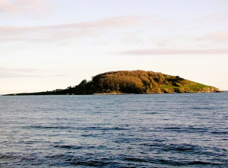 Looe Island, alternatively St George's Island
Richard Doidge, a Georgian vicar, was a renowned 'exorcist'. Nightfall frequently witnessed an unholy racket as he chased bands of unruly spirits through the graveyard and over in the bay below. His actions terrified the god-fearing and only nerveless man would dare wander uninvited into this lonely graveyard to chance upon the contraband hidden among the stones. Smugglers' graves lie in the yard, and the rhyming epitaph on a headstone just inside the church door refers to a Robert Marks, killed by a single shot, fired from a revenue cutter.
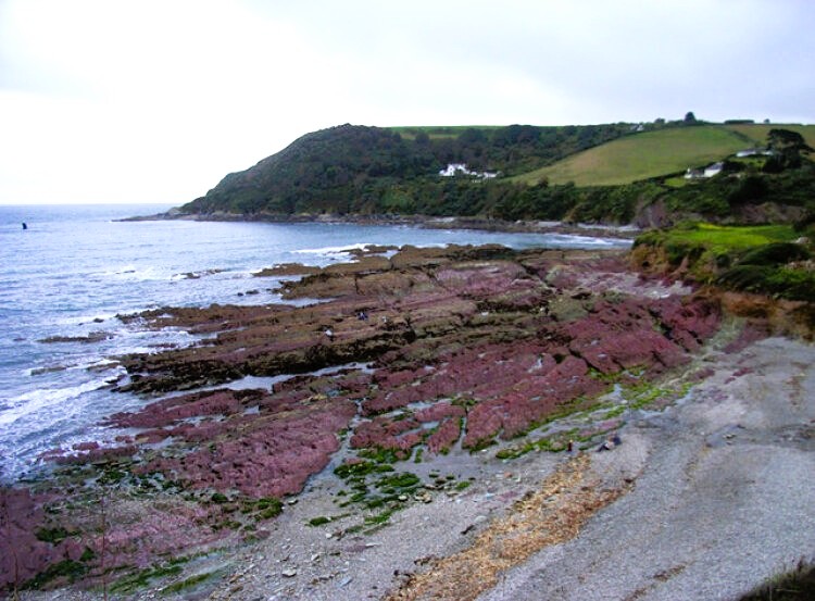
The rocky cove at Talland has been a smuggler's gateway as recently as 1975. Drug runners known as the Race Horse Set were caught red-handed by 'Operation Cyril' while trying to land more than 2 tons of cannabis here. Around Talland's stony beach, the cliffs and rocks biting into the sea are dashed with the pink, green and purple hues of the Dartmouth Slates. You can see these colours repeated in the outcrops by the coast path, which rises steeply out of Talland back towards Looe.
The path climbs through thick yellow flowered gorse, often 100 feet (30 metres) or more above the sea. Drifts of thrift can be spotted, clumped on the rocks. At eye level, fulmars wheel in front of the cliffs, alighting occasionally on their precarious nest and roost sites. Kittiwakes, and even the odd peregrine, sweep the cliff front, while behind you, inland, buzzards and ravens appear and disappear over the hills.
The path takes a left turn at a nose of rock called the Hore Stone. Pausing here, you can take in the spectacular sea views. Ahead, Looe Island rises like a humpback whale from the sea; to the north-east, beyond Looe, the great sweep of Whitsand Bay curls out to the spur of Rame Head, which hides Plymouth from view. To the west, the coast views stretch beyond St Austell to Mevagissey Bay and Dodman Point. If the day is clear, you may spot Eddystone Lighthouse, 12 miles out to sea on a treacherous reef.
The walk leads back to West Looe along the seafront and promenades to emerge by the Church of Saint Nicholas, the patron saint of sailors, in West Looe Square. It served as a guildhall, and housed as theatre, a school,, a market, a prison, and even a scold's cage, where hot-tempered women were held to cool off. It was restored to sacred use in 1852.
The walk is now done so why not cross into East Looe and explore the more commercialised half of the town. Thousands do each year, it is one of Cornwall's most popular resorts.
Acknowledgments: Text derived from the Out and Out Series; Discovering the Countryside on Foot. Pictures courtesy of Wikipedia.
Feedback and Suggestions: To suggest a link for inclusion on a this page please complete the Walking Englishman Feedback Form. Thank you.


