Stokenham, Torcross and Slapton Sands
Following leafy lanes and a coastal path round an important nature reserve
Google Maps Open Source Maps| Statistics and Files | ||
|---|---|---|
| Start: Stokenham | Distance: 6.5 miles (10.5 km) | Climbing: 290 metres |
| Grid Ref: SX 80807 42891 | Time: 3 hours | Rating: Moderate |
| GPX Route File | Google Earth File | Slapton Ley |
| Statistics | |
|---|---|
| Start: Stokenham | Distance: 6.5 miles (10.5 km) |
| Climbing: 290 metres | Grid Ref: SX 80807 42891 |
| Time: 3 hours | Rating: Moderate |
| GPX Route File | Google Earth File |
Ordnance Survey Explorer Map (1:25,000)
The Walk:
The South Hams district of Devon is a rich rural region of red earth with cob and thatch cottages. The market towns of Kingsbridge and Totnes are the only settlements of any size, but there are many small villages and prosperous farms tucked in among the rounded hills and patches of old woodland.
There are some wild and windswept headlands, but south of Torbay is a more gentle coastline of low cliffs and wide, sheltered bays. This walk combines a section of this coast with a ramble through the agricultural hinterland.
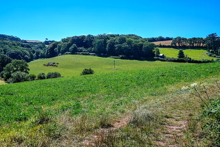 The countryside near Stokenham
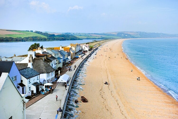 Torcross and Slapton Sands
The starting point is outside the large and handsome church of St Michael in the village of Stokenham. The best view of the church is to be had from the lane leading south out of the village. The route follows this uphill through woodland and fields to Widdicombe, a hamlet in the parkland around Widdicombe House. This two-storey mansion was built around 1700.
The path is overhung with tree fuchsias, which are at their best in late spring and summer. As the path passes Widdicombe Thatch, the last in a row of fine cottages, it narrows and descends through the centre of a strip of woodland. Widdicombe House can be glimpsed through the trees on your right.
As you emerge, you have your first view of the sea. In the foreground is patchwork of red and green fields, and a small, blue, freshwater lagoon, Widdicombe Ley. Beyond the resort of Beesands, the coast sweeps round and rises to the rocky headland of Start Point, which is topped by a gleaming white lighthouse. This acts as a landmark for migrating birds in spring and autumn, when ospreys can be seen on route to and from Scotland.
Near the end of the pasture, half hidden in the hedgerow, is a stile. A rocky, sometimes slippery path, leads down from here, then begins a long, steady ascent. This cool, ferny corridor - a tunnel in summer when the greenery arches overhead - is part of the South West Coast Path, which is followed on the next section of the walk.
You emerge into the light at the top of the climb. On your right, behind a stone wall covered with ivy and ivy-leaved toadflax, is an old quarry. Beyond this, the path goes through open pasture with long views ahead along the curve of Start Bay to Combe Point, at the mouth of the River Dart.
The route descends to the small resort of Torcross. This was once a coach stop on a toll road along Slapton Sands. The sands is actually a shingle ridge, made up mainly of flint and quartz, that runs ahead for over three miles (4.8 kilometres). It was created by tidal action since the sea level rose at the end of the last Ice Age.
The soil is thin but supports a variety of plants, including gorse, campion, the daisy-like sea mayweed, yellow horned poppy, sea radish and wild carrot. In World War Two, the beach was used for training exercises and was the scene of a major wartime disaster (Operation Tiger), commemorated by an unusual memorial.
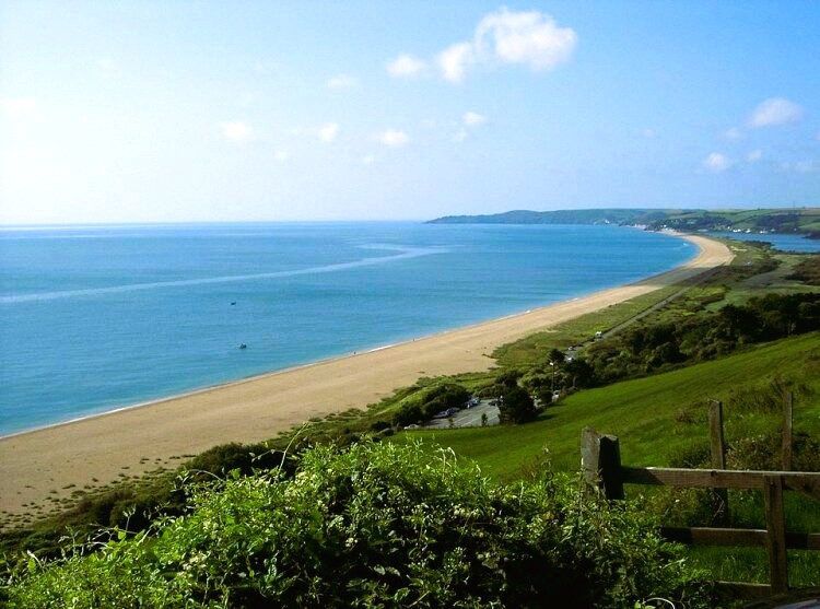 Slapton Sands
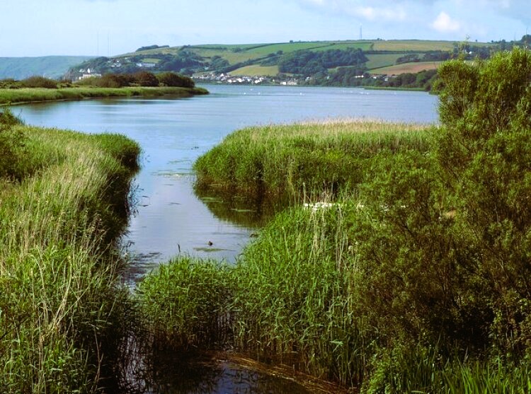 Slapton Ley Nature Reserve
The ridge has trapped a freshwater lagoon, Slapton Ley, behind it. This is an important wildfowl habitat, and unusual in Devon. Ducks, grebes, geese and moorhens breed on the Ley, and dozens of species of migrating bird make landfall here in the spring and autumn.
The walk turns inland to follow a well laid out nature trail around the shoreline. Across the water is France Wood, planted in the 19th century to provide oak for shipbuilding. A little inland, the route skirts Ireland Bay, ten acres of reed and marsh that are home to otters and shy birds such as reed warblers and water rails, as well as a roosting spot for hundreds of gulls.
The trail crosses an inlet of lush marshland on duckboards, then heads up Marsh Lane, a track lined with trees and filled with darting electric blue and green damselflies and dragonflies. On Deer Bridge, you cross one of the four trickling streams that feed the Ley.
From here there is a steep climb up to Slapton Castle, barely recognisable as a hillfort. Only a vestige of the banks that surrounded it remain. Its commanding hilltop position, however, can still be appreciated; there are long views to the north and east.
The route continues along a high banked lane, with the occasional gate, giving views back down to the sea, then turns off down through the hamlet of Frittiscombe.
There is a final climb up another quiet lane, whose flowery banks attract many species of butterfly, before the descent into Stokenham, which in 1991 was voted the best kept village in Devon. As you emerge above the church by the Tradesman's Arms, there is a lovely row of white painted cottages on your right.
Acknowledgments: Text derived from the Out and Out Series; Discovering the Countryside on Foot. Pictures courtesy of Wikipedia.
Feedback and Suggestions: To suggest a link for inclusion on a this page please complete the Walking Englishman Feedback Form. Thank you.


