Crowcombe, Hurley Beacon, Great Hill, Aisholt Common and Wills Neck
A walk up the scarp and along the spine of the Quantock Hills
Google Maps Open Source Maps| Statistics and Files | ||
|---|---|---|
| Start: Crowcombe | Distance: 9.7 miles (15.6 km) | Climbing: 680 metres |
| Grid Ref: ST 14058 36668 | Time: 4-5 hours | Rating: Hard |
| GPX Route File | Google Earth File | Quantock Hills |
| Statistics | |
|---|---|
| Start: Crowcombe | Distance: 9.7 miles (15.6 km) |
| Climbing: 680 metres | Grid Ref: ST 14058 36668 |
| Time: 4-5 hours | Rating: Hard |
| GPX Route File | Google Earth File |
Ordnance Survey Explorer Map (1:25,000)
The Walk:
The Quantock Hills do not cover a great deal of ground, but their woods and moors are justifably famous walking country, offering unparalleled views west and north over rolling hills to the sea.
This walk begins below the scarp slope in the village of Crowcombe, not far from the 15th-century, red sandstone Church House. This was the medieval equivalent of a parish hall, where parties were held on feast days, and served as a lodging for travelling salesmen. In later years, it was a school.
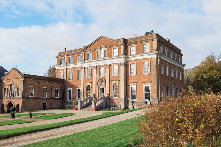 Crowcombe Court
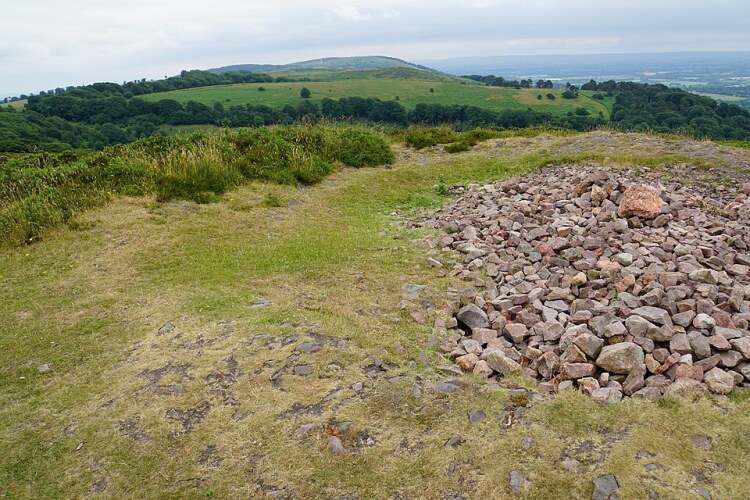 Summit of Hurley Beacon
Next to Church House is a pound for stray animals, and opposite is the Church of the Holy Ghost. This fine 14th century building has a tall sandstone tower and is richly decorated with grotesque carvings. The interior more than lives up to the promise of the churches exterior.
There is a beautiful medieval font, but the chief glory of the church is the 16th century pews, richly carved with all manner of fantastic creatures and scenes, including mermaids, two men killing a dragon, and the mythical Green Man.
Beside the church is Crowcombe Court, a handsome 18th century grand house, with a pedimented facade enlivened with pilasters and a prominent Venetian window.
The village straggles out along the road. The old market cross still stands. The local inn, the Carew Arms is named after the owners of Crowcombe Court, who also built the side chapel in the church. You pass two picturesque thatched cottages, then turn off on a footpath towards the heights of the Quantock Hills.
It begins as a narrow, shady, grassy track that is overhung in places by massive oaks. There is a surprising mixture of trees on these lower slopes, varying from stately sweet chestnut to tall, spindly pine.
At first, the path climbs gently and soon opens out into grassy fields. It crosses a broad farm track and skirts a field to meet the edge of Crowcombe Park. All the time, the hillside gradually steepens; the view behind continues to improve. The valley is a patchwork of pale green fields and dark woodland. Beyond the Brendon Hills are framed against the rising bulk of Exmoor.
Near the top, there is a clear division in the land; one side is moorland, rough grass and bracken, the other, the woods of the park. Separating them is a high, stony earth bank. It was once topped by a layer of beech hedge. Over the years, what started as shrubs have become mature trees. Their knarled roots have burst through the bank, but the trunks still show the distortions of the old process of layering.
At the end of the woods, you enter the silence of the high heather moor, broken occasionally in summer by the distant whistle of steam trains on the West Somerset Railway. The route continues to follow the edge of the park. There are a variety of bird calls from inside the wood, but the trees are generally too densely packed for any to be seen, though a woodpecker occasionally emerges as a bright green flash as it makes a foray to the open moor.
The first hill to be summited is Hurley Beacon, on the northmost point of the walk. Hurley Beacon has an ancient cairn on the summit and is occasionally visited as a spiritual meeting place. After turning to southwards at Hurley Beacon, you soon arrive at Crowcombe Park Gate. Here, a small knoll rising to the left of the path offers a view to the opposite side of the Quantocks with wide prospects of moor and woodland.
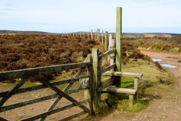 On the Quantock Ridgeway
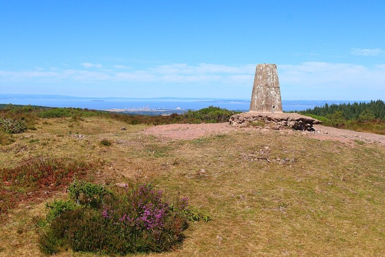 Wills Neck, summit of the Quantock Hill
You cross a road and follow a broad track through an avenue of trees, with views opening out, first to one side of the hill, then to the other. At Great Hill, which is smothered with mushrooms in the autumn, the route enters National Trust Land. From here, there are views across to the River Parratt as it snakes its way to the Bristol Channel, while on the other side the land drops away into the deep cleft of Triscombe Combe. Beyond that, the hillside has been stripped down to the soil and eaten away by a massive quarry.
A road appears from the left to end in a car park close by is the Triscombe Stone. This is not a particularly impressive chunk of rock, but is said to have diabolical associations. Those who come this way at night run the risk of being pursued by the Hounds of Hell.
The route runs alongside a conifer plantation. To the right, the land falls across Aisholt Common into a lovely remote valley, and there is a view out to the wide expanse of the Somerset Levels. You head down to an area of low trees and shrubs, heavy with honeysuckle and dog roses.
A broad track takes you through the woods with a small stream for company. At the end, an indistinct path leads steeply up to the moorland on the opposite side of the valley.
Wills Neck, the highest point of the Quantocks at 1,260 feet (384 metres), was once one of the key points in the chain of hilltop beacons across southern England that served as a warning system. The panoramic view ahead includes a great stretch of coastline from Hinckley Point along to the cliffs above Minehead.
The descent from Wills Neck is the steepest section of the walk and needs to be treated with caution. At the bottom is the hamlet of Triscombe, where you will find the attractive thatched Blue Ball Inn.
The rest of the walk back to Crowcome is a complete contrast, a gentle stroll down country lanes bordered by banks and hedges. When the bank's close in, you can enjoy the wayside flowers; When they open out, you can enjoy views across the farmland of the valley.
Acknowledgments: Text derived from the Out and Out Series; Discovering the Countryside on Foot. Pictures courtesy of Wikipedia.
Feedback and Suggestions: To suggest a link for inclusion on a this page please complete the Walking Englishman Feedback Form. Thank you.


