Hubberholme, Birks Fell, Birks Tarn, Moss Top, Horse Head, Yockenthwaite and Langstrothdale
A spectacular moorland and valley walk from Hubberholme in Upper Wharfedale cum Langstrothdale. Scenery is pleasing throughout and the upland panoramas enjoyed are some of the best in the Yorkshire Dales
Google Maps Open Source Maps| Statistics and Files | ||
|---|---|---|
| Start: Hubberholme | Distance: 9.6 miles (15.4 km) | Climbing: 480 metres |
| Grid Ref: SD 92660 78242 | Time: 4 hours | Rating: Moderate |
| GPX Route File | Google Earth File | About Langstrothdale |
| Statistics | |
|---|---|
| Start: Hubberholme | Distance: 9.6 miles (15.4 km) |
| Climbing: 480 metres | Grid Ref: SD 92660 78242 |
| Time: 4 hours | Rating: Moderate |
| GPX Route File | Google Earth File |
Ordnance Survey Explorer Map (1:25,000)
Summary: If you want a gorgeous Yorkshire Dales walk of wild open moorland and upland valley trails while avoiding the crowds then this one should fit the bill for you. The first half, from Hubberholme to the moor tops via Birks Fell is a good exercising work out which pays just reward for the effort with a stunning walk over high moor to Birks Tarn, Moss Top, Sugar Loaf and finally Horse Head where a trig pillar marks the end of the moorland phase. Pick a good day if you can, the views are brilliant, with a cracking take on the north and east faces of Plover Hill and Pen y ghent. From Horse Head the walk descends into Langstrothdale and finishes following the River Wharfe downstream from Yockenthwaite to Hubberholme.
The Walk:
 The George Inn at Hubberholme
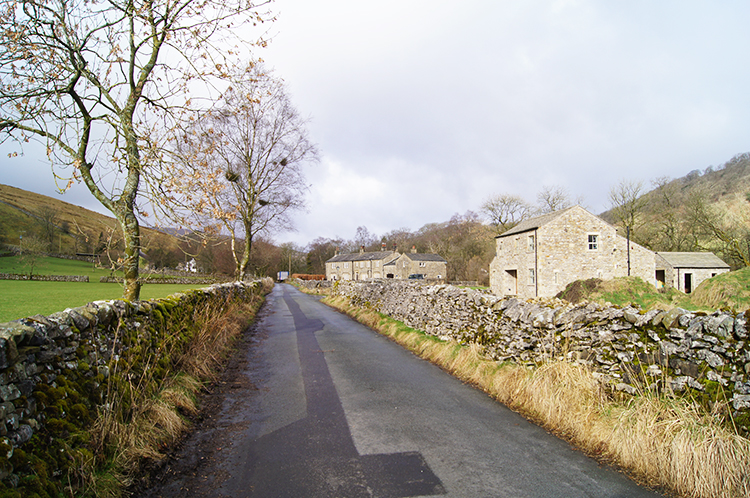 Following the road from Hubberholme
Spring had sprung, or so it seemed as I headed from my home in Harrogate to Upper Wharfedale, my favourite Yorkshire Dale on a warm and sunny morning in the first week of March. I was itching to be walking and on arriving I quickly changed into my walking gear while looking over the young River Wharfe to the whitewash George Inn at Hubberholme. It was just turned 10.00am and I was the only person around. Surely more would arrive later. I set off on my walk, passing St Michael and All Angels Church and crossing Hubberholme Bridge to follow the Langstrothdale road towards Buckden village. As I walked along the road with a spring in my step I looked across to the moor on my right, anticipating the climb which was coming up very soon. One kilometer of road and no cars later I reached my anticipated footpath sign and turned off from the tarmac strip to begin climbing Birks Fell.
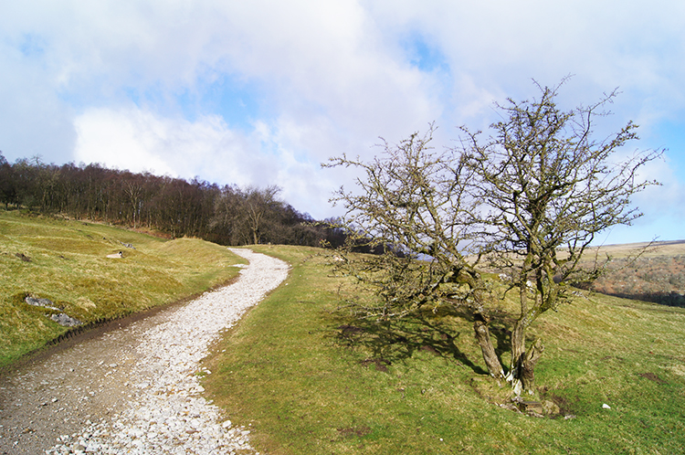 Climbing to Birks Fell
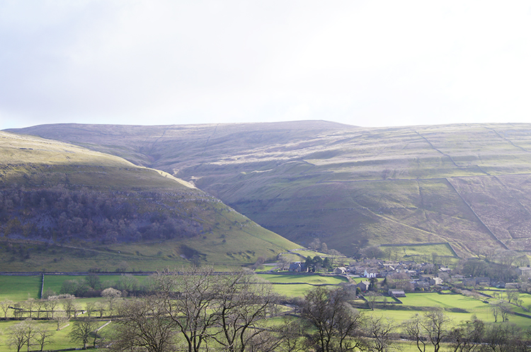 View to Buckden and Buckden Pike
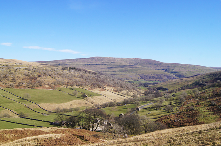
Cloud was sweeping across the sky from the south-west as I began the climb but sunshine was dominating which is was destined to do throughout the day. I was in high spirits looking forward to another fantastic Spring season of walking after having seen off the dark days of winter. I sometimes wish I could hibernate the winters of recent years, too mild which result in rain, mud and clag. Give me snow any day. I recalled the last time I was on the moor to which I was climbing. Birks Fell is a continuation of Old Cote Moor which I walked in a wonderful snow scene some winters ago. I continued climbing, slowly, relentlessly, a 400 metre non stop ascent to the top of the moor. Now in my 60's I find more occasion to stop for a breather and take in the views. On one such catch my breath moment I turned and looked across the Upper Wharfedale valley to the village of Buckden and to Buckden Pike which was shimmering in the Spring sunshine behind. Again I thought of a snow walk on a snow covered mountain. Buckden Pike holds the distinction as being the only mountain to beat me on a walk. Some 20 years ago I attempted to climb it on a winters day with then regular companions Dave and Steve. We set off just as the snow began. It quickly turned to blizzard conditions and drove us off before we had made 200 metres height. We came down the mountain with the sheep that day.
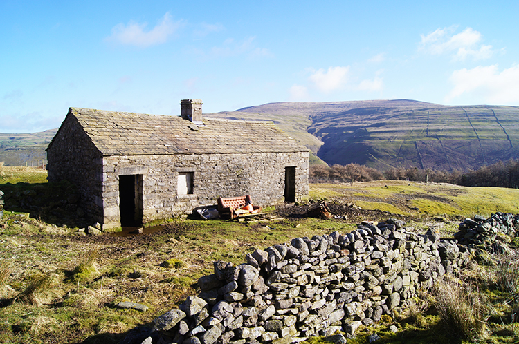 Deserted farm cottage on Birks Fell
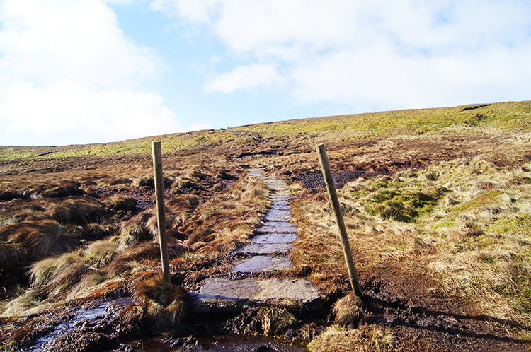 The path on Birks Fell
Steadily and relentlessly I gained height. The track up the fell began as a good well maintained vehicular track which meandered up the bank in constant sweeping turns and often between small pretty copses. It was a fine track indeed and continued to be so, even after I had passed some stock pens where understandably the track-way was muddy. At about 320 metres height and over 100 metres into the climb I came to what the map says is near the site of Birks Fell Cave. I looked a little but could not find it. My sights were set on the high ground, not underground. Soon after I climbed on the track a little further and above on the fell I spotted a deserted cottage. I left the track-way and climbed on a beeline to the cottage which commands the most gorgeous views. Set beside Water Gill the cottage had a sofa outside. I declined to sit, instead edging across moor on an even contour back to the true route up the fell. Not a track now, that went along the moor at the 350 metre line. Now I was following a path, part paved across the boggier sections and mostly unmade. Upright posts, painted white at the top and spaced at regular intervals showed the way up the fell should it be snow covered. The posts ceded to cairns just before the crest of the moor.
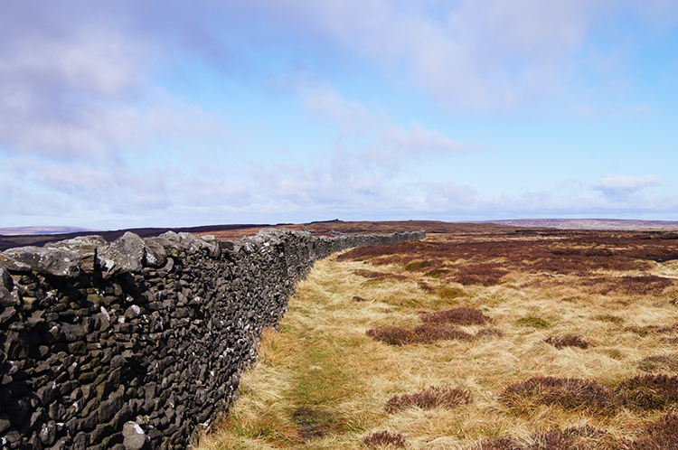 Following the long drystone wall
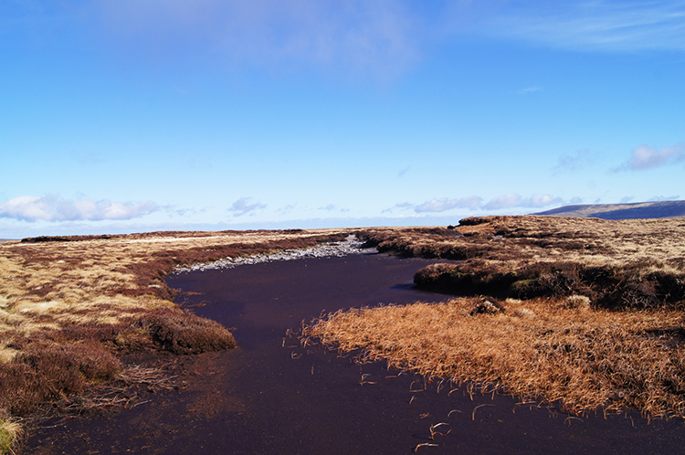 Dry peat bed on Birks Fell
I had reached the 600 metre plateau on top of Birks Fell and after a climb of just under 400 metres I felt remarkably fresh. It is great what Springtime and a bit of sunshine does for us old timers! Two and a half miles of walking and practically all the climbing of the walk done in 90 minutes. I was not just fresh, I felt great, rejuvenated even. The clouds which had been sweeping across earlier on and which could have dulled the day were all gone too. I thought to myself "What could be better". I walked across to the long drystone wall which follows south to north across the line of the fell. A good line to follow it was. This part of Birks Fell, south of Birks Tarn, is shown boggy on the Ordnance Survey Leisure maps but I found it to be firm and mostly dry. Easy to wander over, even away from the line of the drystone wall. I meandered while looking for pools and for the named tarn.
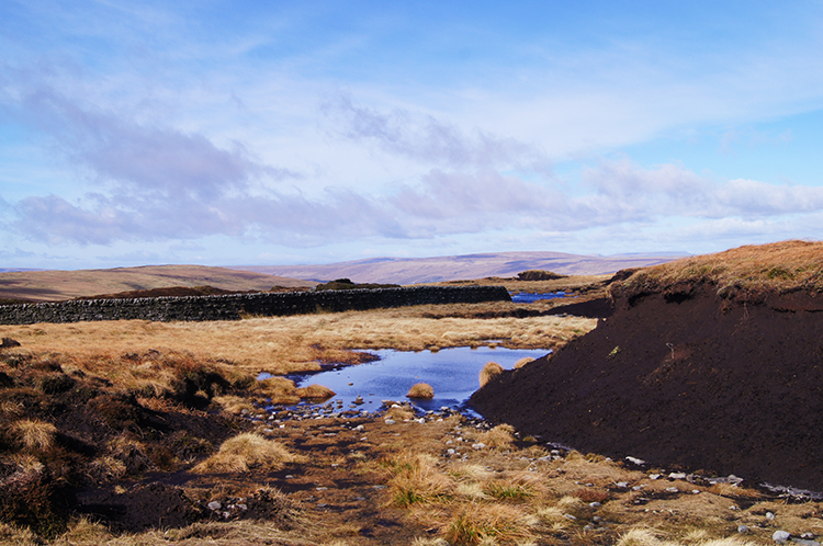
 Birks Tarn
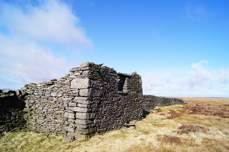 Sheep shelter on Birks Fell
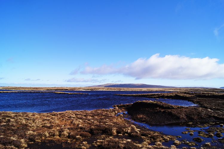
After around fifteen minutes of therapeutic wandering I reached the large body of water which is Birks Tarn. Before doing so I had inspected one or two pools and more large expanses of dry peat beds which will be pools in wetter conditions too. Birks Moor is a good reservoir for collecting rainfall and percolating it down to the Wharfe all year round. Birks Tarn was gorgeous, a shallow deep blue upland body of water surrounded by light brown grasses. The rich blue sky complemented the picture. I stayed by it for ten minutes while completing a walk around the whole circumference of the tarn. Then I tracked back to the line of the drystone wall and followed it to where a sheep shelter abuts it just north of the tarn. It was just after noon and time for lunch. Despite the sunshine it was cold up at 600 metres plus on the fell. I appreciated the warmth of my thermos flask keeping my mitts warm during my lunch break.
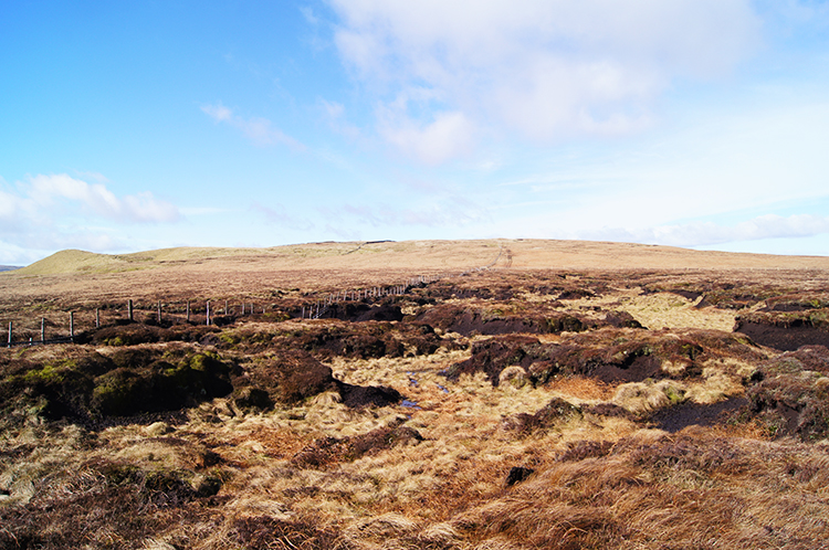
 Peat Hags on Moss Top
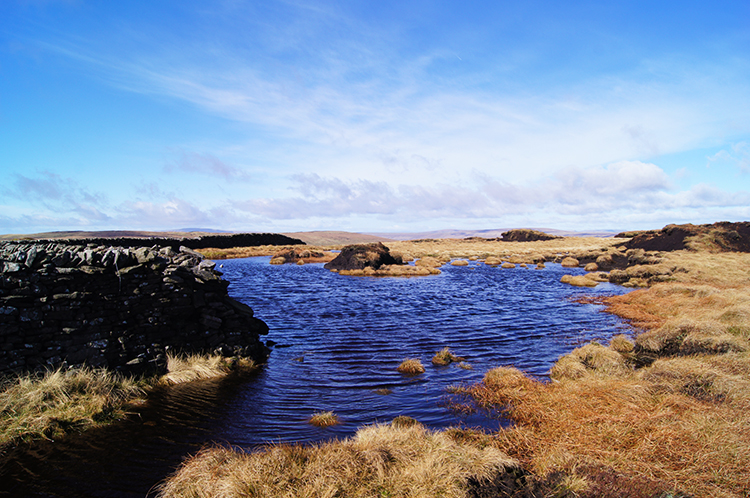 Path under water
After lunch I continued my walk from south to north across Birks Fell and the fringe of Out Moor towards Moss Top which at 610 metres height qualifies Birk Fell as a Marilyn. I found it quite ironic that the highest point on the moorland expanse that is Cote Moor, Birks Fell, Out Moor, Moss Top and Horse Head and which separates Wharfedale from Littondale is the wettest, boggiest and most difficult part of the whole moor to negotiate. The further north I walked and as I turned from northwards to westwards at Moss Top, near as dammit to the 610 metres, I was consistently forced away from the drystone wall line and on a zigzag course around water filled depressions. Peat Hags were everywhere, adding to the haphazard step as you go route determining. consistently lost the path as it went underwater and found it again it a little later on as it re-emerged from water. It was difficult but do not get me wrong. It was fun.
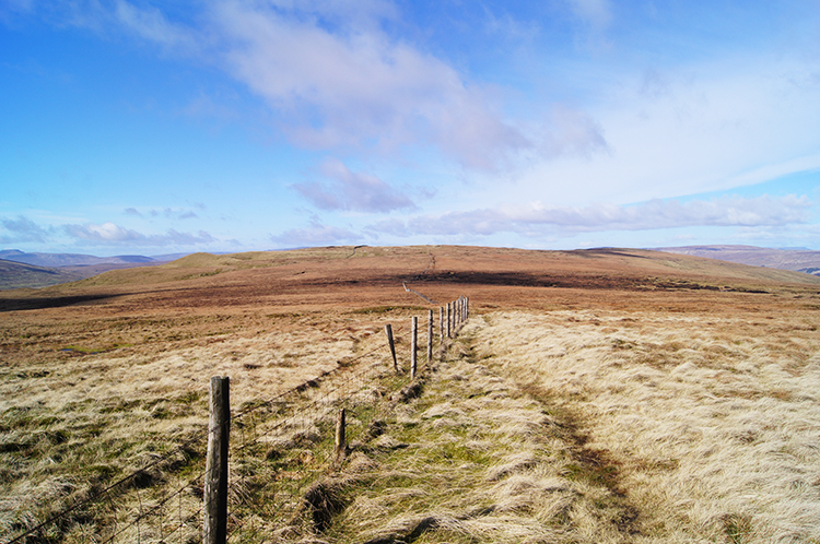 Picket fence from Moss Top to Sugar Loaf
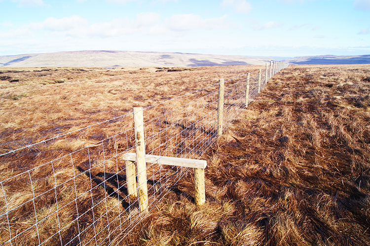 Fence crossing point
The going of path disappearing in and out of water and of ground sinking and rising at Peat Hags brought another walking memory to mind. And it was in this place, following the same route on Sunday 10th January, 1999. I have the diary record of that walk which is fortunate as I then walked in a time before I carried a camera for photographs. I was with Steve this time and the notes in the diary read "What fun it was, bouncing on the ice trampolines. It would have been impossible to cross from Birks Fell to Horse Head had the frosty ground melted as we would have sunk into the moorland bog. Yet with the benefit of thick ice we could spring across the top, bouncing our way like kids over the spongy moor". Such memories are precious and how glad I am to have captured them in words.
 Peat Hag Maze
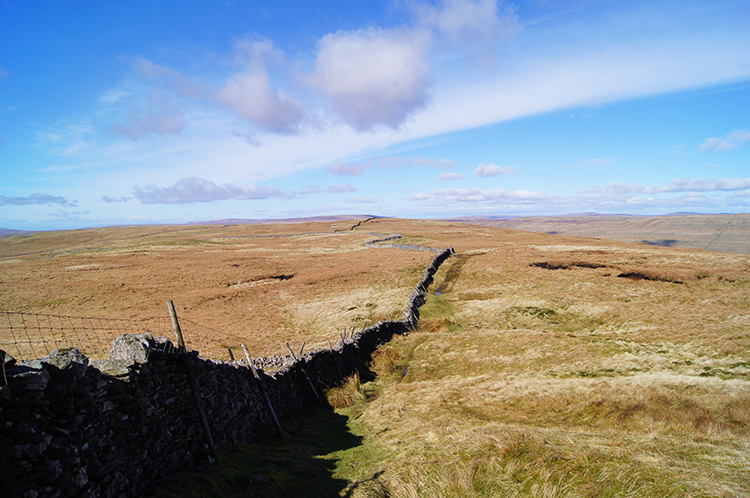 The way to Horse Head
This time, with no chance of a frost blanket to protect me I squelched my boots into the wet ground with every other step I took. There was no chance of avoiding my feet getting wet and I knew there would come that cringing moment when the boot went completely under water. I thought to myself "I should have put on my gaiters" as my boot inevitably sunk from view while tiptoeing across one of the unnavigable peat hags. Fortunately I had spare socks in my backpack though I had no intention of changing into them before I had cleared the wetland maze. During my fight with course making and avoidance of sinking the drystone wall I had followed had turned into a picket fence and then once clear of the worse wetland back to drystone. Makes sense I thought, even the wall makers knew when it was a bad move to put a heavier structure on shifting ground.
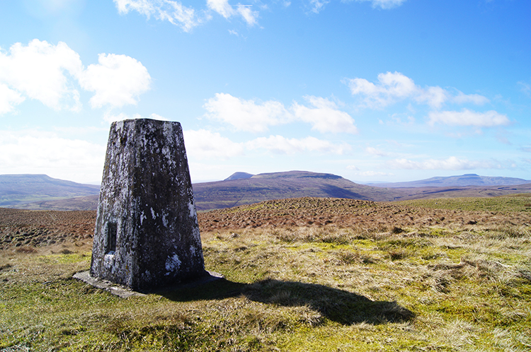 View to Pen y ghent from Horse Head
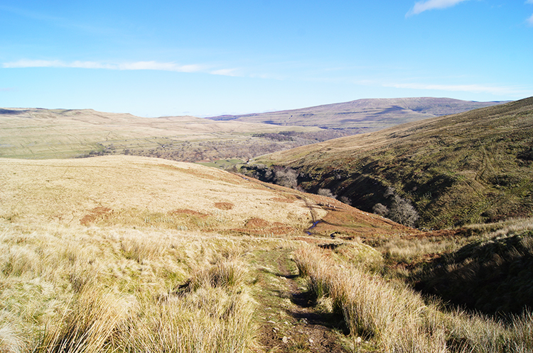 Descending to Hagg Beck
Despite the effort of course making and avoidance of soaking I had enjoyed myself. I really had, the lovely day with gratifying views could not be quelled. From here I had been joyed by the most beautiful and less common view of Pen y ghent. Most photographs of this premier Yorkshire mountain are taken from the approach from Horton in Ribblesdale, thus of the west side and of the distinctive crocodile like south face. They are magnificent profiles, Pen y ghent is a photogenic mountain but now I was looking to the south and east flanks of Pen y ghent, across Plover Hill, the rump of the mountain. I had enjoyed the sublime view most on the dry walk from sugar Loaf to the trig pillar on Horse Head where walking had become easier on dry ground, a complete contrast to that from Moss Top to Sugar Loaf. From the trig pillar I also enjoyed a great view of Fountains Fell and of both Ingleborough and Whernside too. All different than the usual ones and all fantastic. I stayed at Horse Head for fifteen minutes drinking it all in. The views all around were beguiling on a day of such super visibility. I did not want to go. But go I must, which I did by following the track down north-east by Hagg Beck. The huge bulk of Yockenthwaite Moor entertained my eyes as I descended.
 Langstrothdale
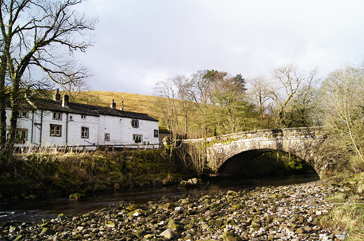
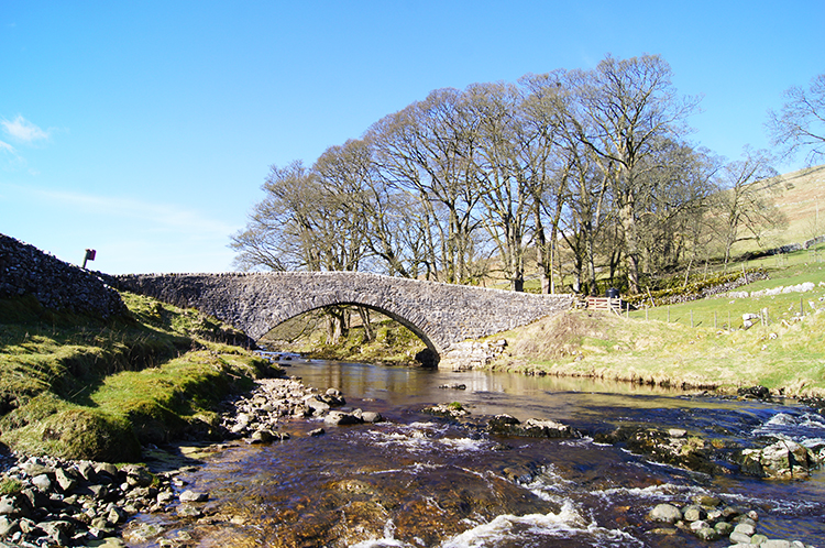 Yockenthwaite Bridge
The descent from Horse Head mirrored the ascent I had made of Birks Fell though not quite 400 metres in total as I was dropping to the higher valley of Langstrothdale. The dale has special memories for me too, first of my Dales Way walk through the valley in 2004 when an aggressive goose had barred my way on the footpath. I still recall that episode vividly. Secondly I have a photograph of the River Wharfe in Langstrothdale which my brother Dave took on one of our early walks in the dale in the 1990's. It is hung up in my hallway and I admire it every other day. And now I was walking down from Horse Head into Langstrothdale for another intimate time in the dale. The intimacy began as I walked down on a line west of Hagg Beck when the beauty of Langstothdale appeared in view. I gawped at the view looking east down the valley from Yockenthewaite to Hubberholme and with Buckden Pike performing well once again by setting the perfect background to the picture. My continuation of the walk which I looked forward to was slightly tempered by loosing that perfect view. Still, joy was lost and joy was gained as I came down to Yockenthwaite Bridge. I stepped down into the trickling waters of the young River Wharfe to enjoy another idyllic picture of the river flowing under the pretty stone bridge. Lovely it was too.
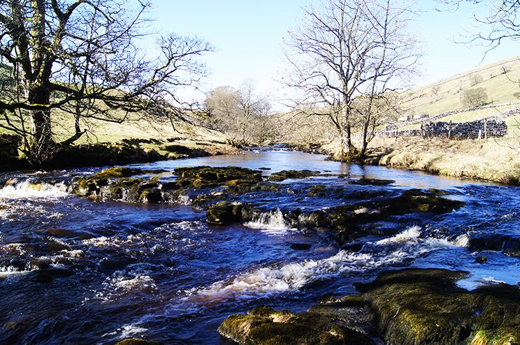 River Wharfe in Langstrothdale
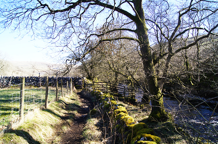 The Dales Way path through Langstrothdale
From Yockenthwaite I followed the Dales Way Footpath back towards Hubberholme. I did not stick to the path all the time though as the river enticed me into it. The stretch of the River Wharfe through Langstrothdale is one of an exciting river finding its way down from over 300 metres height to just over 200 metres height at Buckden. It makes its way down the valley by a series of small stepped cascades, all oxygenating and bubbling the river into mixtures of blue and white. Every so often the river goes from quiet brook to energised rapids. It is an entrancing stretch of river and I love it. A longer mini version of celebrated Aysgarth if you like, ideal in my opinion. And as I have mentioned, it drew me to admire it.
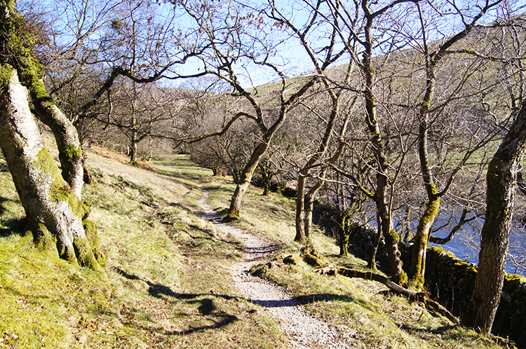 Nearly back in Hubberholme
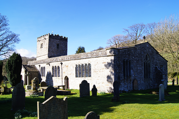 St Michael and All Angels Church, Hubberholme
The finale of my walk, the last half mile into Hubberholme, led me from the Dales Way and on a path edged by a high bank to my left and a thick riverside copse to my right. The river flowed noisily on the unseen south side of the copse and I itched to get down through the thicket to the waterside for one final time before my walk end. Others before me must have had the same thought as pathways were made through less dense wood. I got down to waterside, just 100 metres or so from Hubberholme, sat down on the bank and watched the river flow. I heard groups of walkers pass by on the nearby Dales Way Footpath as I sat, the first walkers I had heard all day. It was 3.00pm. After my 15 minute chill by the river I passed by St Michael and All Angels Church and my walk was done. The prefect walk to start my Spring walking season.