Isle of Wight Coastal Path
A personal record of my walk around the Isle of Wight Coastal Path with a written journal and with photographs. Tracklogs for GPS units and for use with Google Earth are available for download for each stage.
Journal, Photographs and Download Files
Stage 1: Cowes to Hamstead
Google Maps Open Source Maps| Statistics and Files | ||
|---|---|---|
| Start: Cowes | Finish: Hamstead | Distance: 13.5 miles (21.8 km) |
| Time: 5-6 hours | Climbing: 300 metres | Rating: Hard |
| GPX Route File | Google Earth File | Isle of Wight Coastal Path |
| Statistics | |
|---|---|
| Start: Cowes | Finish: Hamstead |
| Distance: 13.5 miles (21.8 km) | Time: 5-6 hours |
| Climbing: 300 metres | Rating: Hard |
| GPX Route File | Google Earth File |
Ordnance Survey Explorer Map (1:25,000)
The Walk: I had never seen the Isle of Wight, never mind been to the island. It had only taken me sixty-two years to get around to visiting. How best to get to know the island? By walking it of course. And so the idea of my Isle of Wight Coastal Path walk was born. After planning the stages of the 67 mile walk around the island I organised my accommodation and set the date. On Tuesday 18th September 2018 I took a flight from Leeds Bradford Airport to Southampton Airport and stayed the night in the city. Next morning, Wednesday 19th September, I took the earliest ferry possible from Southampton to Cowes on the north coast of the island. It was 9.00am on a cloudy morning when I set foot on the Isle of Wight for the first time.
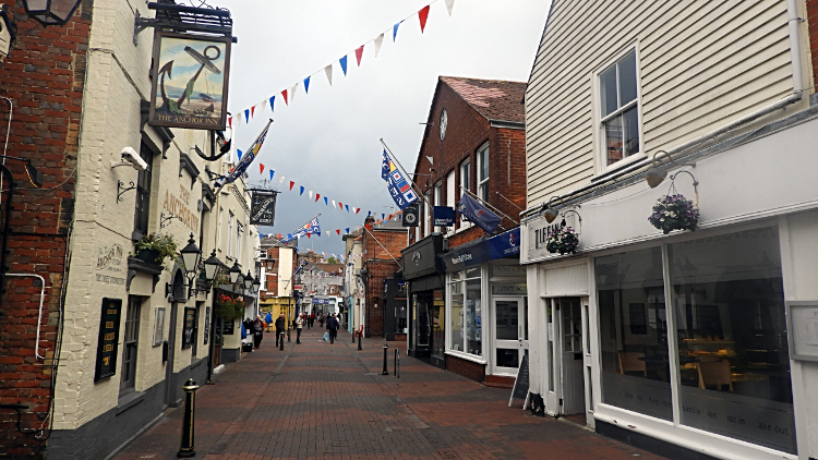 Cowes Town Center
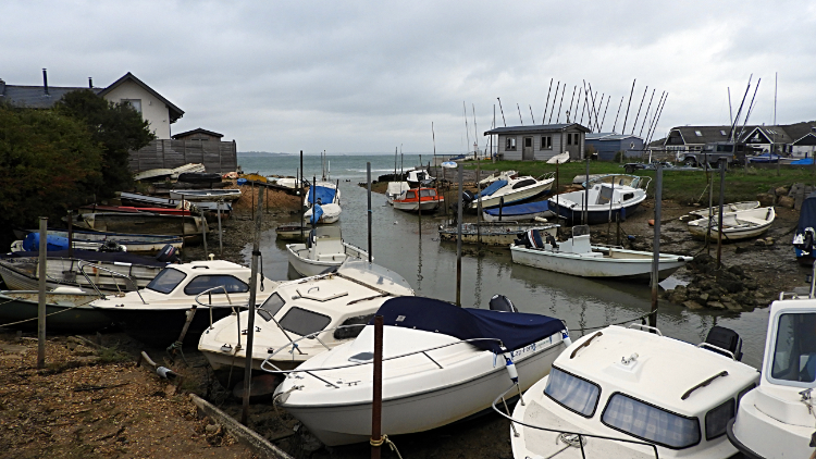 Gurnard Luck
The first steps of my Isle of Wight Coastal Path walk were those I took when stepping off the MV Red Osprey of the Red Funnel Line and when on the island I was eager to get going. But I had a problem. I was on the east bank of the River Medina which cuts through Cowes to the Solent. The wrong side. And there is no bridge in Cowes so I had to wait for the river ferry. It was frustrating and I had to wait a full half hour before the ferry took me across the river. At 9.45 I walked through the town centre of Cowes and continued on following the coast path in an anti-clockwise direction to Cowes Castle and on to Egypt Point, west of the town and the headland which gave me a first view of Gurnard Bay. The coast road, namely Egypt Esplanade became Princes Esplanade around the point a sign welcomed me to Gurnard. Around here the grand houses of Cowes seafront ceded way to beach huts and soon after, at Gurnard Sailing Club I left the seafront to make my first climb of my long distance walk by climbing up Shore Road and Worsley Road into the village of Gurnard. I asked a local with a newspaper in hand if there was a cafe in the village. "Yes, just carry on up Worsley Street for another hundred yards or so" said the kindly soul. I arrived at Gurnard Press at ten thirty and I left at eleven. Half an hour of enjoyment to enjoy coffee, crisps and cake. Suitably refreshed I then turned back down Worsley Road and then I followed Shore Road back down to sea level at Gurnard Luck. So close to Cowes and yet so different. No grand houses here, all I could see were wooden beach huts and shacks, some no grander than garden sheds. It was quite a stark comparison. There were small boats moored all around the waterside too.
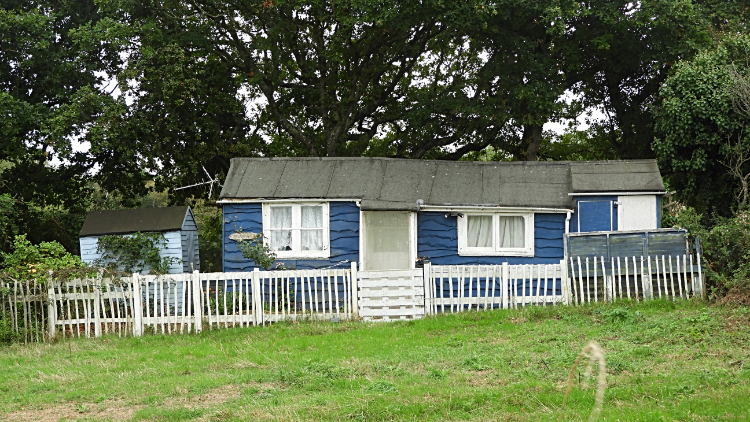 Home in a hut near to Thorness Bay
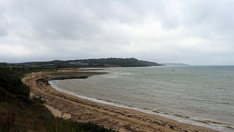 Thorness Bay
From Gurnard Luck I followed the coastal path westwards and in doing so I climbed 42 meters to a point above Gurnard Ledge. I could have looked out along the coast to the unveiling of Thorness Bay. I could have looked right to the Solent and to the mainland less than three miles away. I normally would have but a remarkable sight in the adjoining fields to my right took all my attention. There were rows of huts cum shacks in lines between the fields. Most were fenced off with little makeshift garden areas around the huts. Some were in better nick than others which had distorted roofs that I imagined could blow off any day. There were no access roads to these odd hermitage dwellings. Occupants would have to walk the lane past the other shacks or across the open field. Very strange. And yet I could see myself spending a few days or so using one as a cheap base while I explored the island. Not a lifetime though. I headed from 'Shackland' down to the shingle sands of Thorness Bay. It was so lovely and so quiet on the beach which I practically had to myself. Cloud streamed overhead, from south-west to north-east. As it had thus far all day.
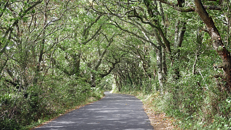 Gorgeous tree lined avenue near Newtown
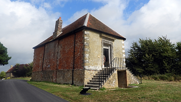 The Old Town Hall, Newtown
From Thorness Bay I left the coast again, this time for quite a while until I had completed the round of mud flats at Clamerkin Lake and Newtown River. (By the way, lake usually means river in this story. Many of the watercourses are titled lake instead of beck, brook, river, etc. Clamerkin Lake is such a watercourse and not a lake in the general meaning of the word at all). First point of call after Thorness Bay was the quite garish holiday park. I was glad to clear that place. I actually felt spots of rain while walking through the park which felt appropriate to me. As did the feeling of sunshine hitting my face immediately on clearing the site. The day was changing much definitely for the better. I followed extremely quiet country roads for the next couple of miles. Usually I moan about the impact of tarmac on my feet during a long distance walk but here I was so early into my journey that it did not matter. And even better I was getting to see a little of the interior of the island which until today had been such a mystery to me. The lanes were hedged on either side so green leaf was everywhere. Many of the lanes were avenues with trees as well which just enhanced the beauty of the setting. In fact it was just about the nicest two miles of tarmac walking I have ever done. On the way I passed the village of Porchfield and the pretty Sportsman's Rest Inn which I was very tempted by. But I kept my discipline, arriving sober, first at Walter's Copse and then at Town Copse which led me into the village of Newtown. Having a guide with me on the walk I had made notes of places I wanted to visit during the walk and here I was arriving at the first one, the historic Old Town Hall. I enjoyed a good twenty minutes in the town hall, reading about the history of the building and of the neighbourhood before I took my leave, walking gently down the road to Causeway Lake. Remember, not a lake but a brook, one of the tributaries of Newtown River which we will come to later. Anyway, I sat on the low wall of the road bridge across the Causeway for a rest and while doing so I spotted two White Egrets strolling on the mud flats. It was the first time I had seen the graceful bird in the wild and I watched them attentively. While I was paying attention to the Egrets a brilliant blue and orange streak flashed before my eyes. My eyes were immediately drawn to the flight of a Kingfisher soaring down the path of the Causeway Lake. As quick as the bird had appeared it was gone. But the fact was it had passed right by me. White Egrets and a Kingfisher moment. Fantastic.
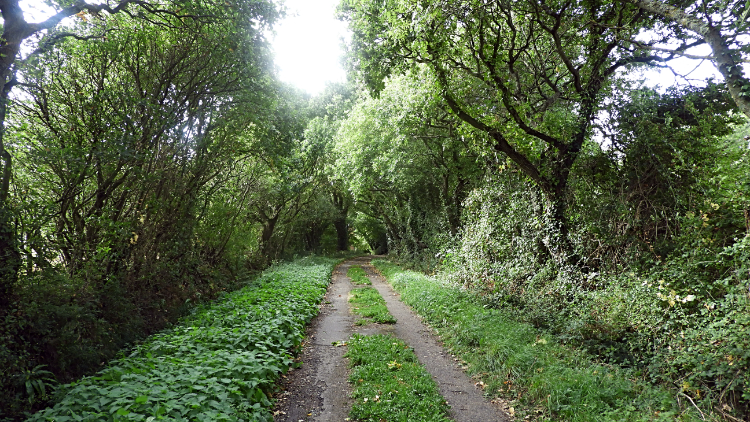 Lane near Shalfleet
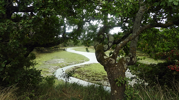 Shalfleet Lake
I was in absolute rapture from my avian encounters as I resumed my walk, first by following more near car free roadside and part country lane across Shalfleet Lake to the village of Shalfleet. Pretty as the village was I did not see too much of it, keeping on the coastal path alongside the A3054 Newport to Yarmouth road before heading across fields to Nunneys Wood and across the footbridge of Ningwood Lake to arrive on a plantation access track through woodland and past Pigeon Coo Farm, heading towards the Hamstead Trail. This trail would lead me to the west side of Newtown River though I could have followed a different path due north to Hamstead which would have helped me arrive at my accommodation much too early. I was not ready for finishing my first stage yet and so continued east along the trail to meet the river. I passed a barn with a sign reading 'Surveillance Camera In Operation'. It was so run down I could not imagine why.
 Newtown River
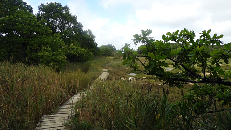 Marshes at Hamstead Dover
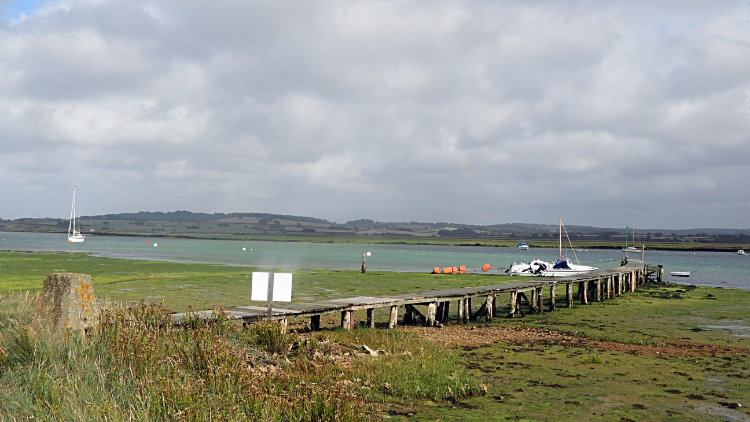
I arrived at Newtown River and I was immediately struck by its beauty. Many guides rate the estuary of the river and its tributaries, which all meet near this point, stating "The harbour is loved for its unspoilt beauty and tranquility. The River and adjoining land are regarded as one of the best examples of an undisturbed natural harbour on the south coast of England with its varied habitats ranging from woodland, ancient meadows, mudflats and marshland. It supports a number of rare species, but its primary importance is as a wintering ground for seabirds". I was mesmerised. Newton River and the tributaries of Clamerkin Lake, Causeway Lake, Shalfleet Lake and Ningwood Lake, all of which I crossed on my around to this point, combine to make the most pleasant place. I walked on to one of the wooden jetties scattered around the pea-green mudflats now exposed by receding tide and I watched a pretty seabird wading happily in the mud, no doubt looking for grub. It was not perturbed by me watching. A few motor launches were berthed at the jetties and a couple of yachts were anchored in mid river but all was still. Nobody was in any hurry and while sat down and resting with my feet swinging at one of the wooden jetties I made this Facebook post "Sat relaxing at Newtown River jetty and near what appears to be a trig point. It has the Ordnance Survey shape and construction but I did not look for markings. It is not shown on maps. However it is about 2 metres elevation! From my first day on the Isle of Wight Coastal Path. During my walk I saw lots of wildlife including White Egrets and a Kingfisher which flew close by me. Wow, I wish I had got a photograph but it was too fast. The colours of the bird were gorgeous". I never did find out about the concrete trig pillar or not. Anyway, when I did eventually draw myself away from all the gorgeousness I followed the coastal path north across more mud flats towards Hamstead Point. Much of this section of walking was on wooden boards between reed beds and washes.
 The Solent at Hamstead Point
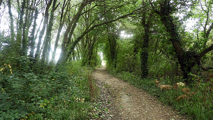 Woodland path to Hamstead
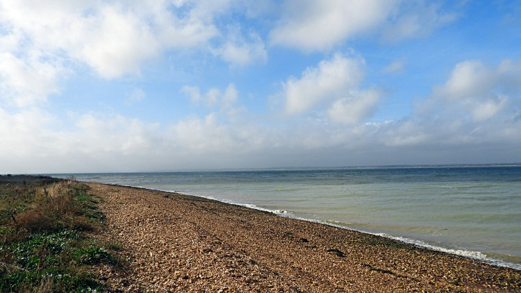
I arrived at Hamstead Point where a shingle beach stretched all the way along the edge of the Solent. Not yet at its narrowest point, that would come tomorrow, I followed the shingle beach for about a hundred meters. It was never easy walking, every step I took a sinking one to nearly the point where further sinking would allow shingle to fall into my boot. I was glad to leave the shingle and get back to harder ground by climbing on the top side of Hamstead Cliff to Hamstead and to find my accommodation at Newton Creek Retreat. Soon I was in Hamstead, a scattering of properties in woodland and not a village at all. I looked for Newton Creek Retreat and my, it took a bit of finding. Though it was the first place I had tried. Eventually though I was shepherded in by my hosts and in the evening, though we were about three miles from the nearest pub, they happily took me. In fact they insisted on buying me my dinner. So generous and what a splendid way to end my first brilliant day on the Isle of Wight Coastal Path. So beautiful, so different to what I had expected. First Cowes, typical seaside town and no surprises there. But after Gurnard there were all the shacks in the fields. And then the lovely inland villages. The country lanes, so pretty. And the birds at the creek. WOW. Newtown River. WOW again. This journey is going to be good.
Oh, by the way. I bought the drinks!