The Viking Way
A long distance path of 147 miles in Lincolnshire, Rutlandshire and Leicestershire. Maps, statistics and gpx route file for the walk are included.
Google Maps Open Source Maps| Statistics and Files | ||
|---|---|---|
| Start: Humber Bridge (south side) | Finish: Oakham, Rutland | Distance: 147 miles (237 km) |
| Grid Ref: TA028229 | Climbing: 2,047 metres | Rating: Strenuous |
| GPX Route File | Google Earth File | About the Viking Way |
| Statistics | |
|---|---|
| Start: Humber Bridge (south side) | Finish: Oakham, Rutland |
| Distance: 147 miles (237 km) | Start Grid Ref: TA028229 |
| Climbing: 2,047 metres | Rating: Strenuous |
| GPX Route File | Google Earth File |
Ordnance Survey Explorer Map (1:25,000)
247 Grantham, Bottesford and Colsterworth
272 Lincoln, Sleaford, Metheringham and Navenby
273 Lincolnshire Wolds South, Horncastle and Woodhall Spa
281 Ancholme Valley
282 Lincolnshire Wolds North, Louth and Market Rasen
284 Grimsby, Cleethorpes and Immingham
Summary: This story of a walk of the Viking Way, written by Ken Brockway, recalls his adventures during the walk in the company of his friends Jim, Di and Peter. Enjoy their walk on the Viking Way.
The Walk:
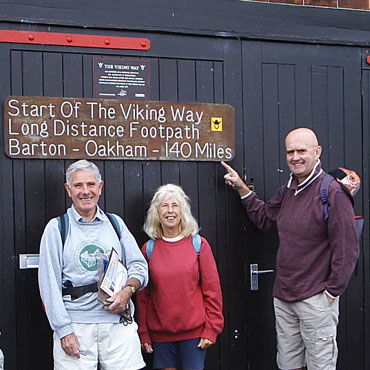 Jim, Di and Peter at Barton on Humber
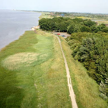 Viking Way start point from the Humber Bridge
The Viking Way proved to be a more interesting and enjoyable walk than any of the party had expected, so why did we do it if we had no expectation of a pleasant outing? Well, a small group of friends had already completed a number of recreational routes in day sections using two cars, then someone dropped out and I was invited to join them. Because Lincolnshire has a reputation for being flat and it's a good drive to the Humber Bridge this walk was never top of the list but having already done most of the promoted routes within a days drive/walk of Leicester the Viking Way was now the only one left.
 Viking Way start point from the Humber Bridge
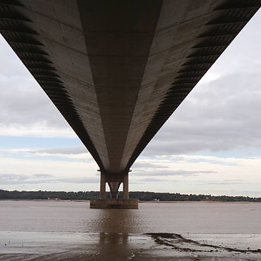 Under the Humber Bridge
Some years ago I met a chap on the Cleveland Way doing a long distance walk, he planned to continue along the Wolds Way then Viking Way to head south. It's a good link but not the most popular of stand alone routes. We knew the final days, closer to home but needed to consult the Ordnance Survey and guide book for the northern sections.
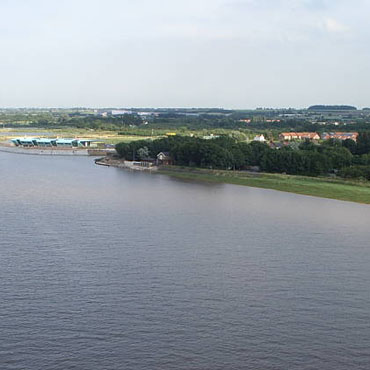
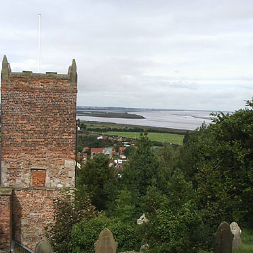 South Ferriby church and Read's Island
 Saxby Wolds chalk and clay
Starting from the Humber Bridge gives the route some status and this is marked by a board against which the party posed before setting off. If you have never walked or cycled over the Humber Bridge allow time for this four mile round trip before setting off south. It will give you a boost because most of the first day is a trudge to Barnetby le Wold along tracks around field boundaries, very much the standard for paths in Lincolnshire. Having arrived at Barnetby, a decent sized village, we were unable to find a pub for the lunch time drink but there was a shop should you need one.
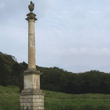 Somerby Monument
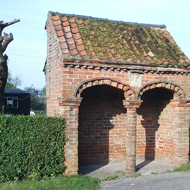 Searby shelter
The next section to Caistor was much better, our path passed through some pleasant small villages and for the most part followed along a ridge offering fine views to the west. At Somerby we passed a monument built in 1770, the original Latin inscription has thoughtfully been translated for us less learned scholars and at Searby a forward thinking vicar had provided a bus shelter in 1866. Caistor no doubt had once been a thriving market town but today it's a rather sad run down place, it retains the essential services but has lost any appeal for us to linger.
 Leaving Nettleton Beck
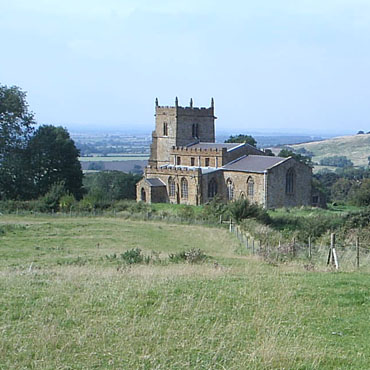 Walesby 'Ramblers Church'
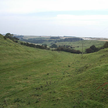
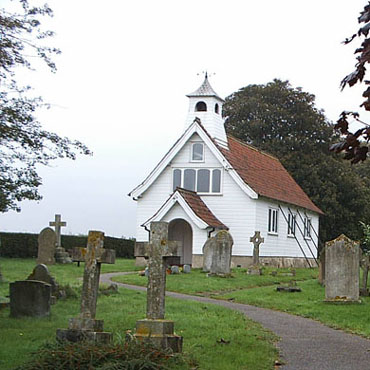
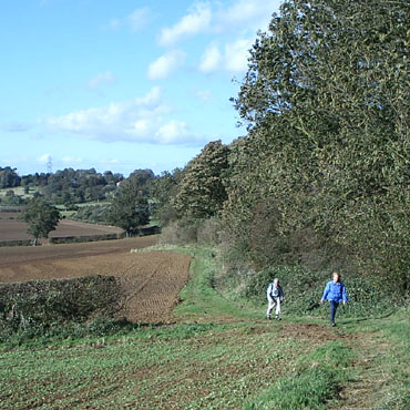
To the south of Caistor we follow the pleasant valley of the Nettleton Beck which offers the intriguing remains of underground ironstone mines in what is now shown on our map as a chalk pit. At one time the footpath went through a tunnel under an embankment, but the path now takes us up over the top. The mine closed in 1968 and the area has been designated a Site of Special Scientific Interest. These are the Lincolnshire Wolds and the rural highlight of the Viking Way, one of only forty six locations designated an Area of Outstanding Natural Beauty, did I say this county is flat? Passing through Walesby we first see the Arts and Craft style village church built in 1913 to save the congregation climbing the hill to All Saints which has become known as the Ramblers Church with its stained glass window showing walkers and cyclists.
 Tealby Village Hall
 Artists at Tealby Ford
From Walesby our next point of call was Tealby where we admire the buzz of activity around the village hall built in 1930 at the expense of the Tennyson d'Eyncourt Trust. Connections exist here with Alfred Tennyson but disputes divided the family with Alfred's branch moving to nearby Somersby. On the way to Donnington on Bain, for those inclined, there are the humps and hollows of two deserted villages to explore. (The first is the site of East Wykeham medieval village and the second is the site of the medieval village of Biscathorpe)
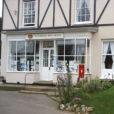 Scamblesby Post Office and Shop
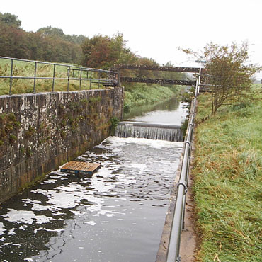 Former lock on Horncastle Canal
This being Lincolnshire we should not be surprised that a section of the path strays away from the Definitive path avoiding another section of road walking. We are close to Cadwell Park, so you may be unfortunate to have a dose of noise pollution or find the Green Man at Scamblesby heaving with men and women clad in leather. Alternatively at the next village quieter racing takes place in September each year with the Belchford Downhill Challenge Soapbox Gravity Race. Fulletby sees the end of the Wolds as we drop down on our approach to Horncastle, a Chartered Market Town since 1231.
 Southrey church
 Heavy going near Apley
Our next section uses the disused Horncastle canal, then railway line all the way to the little gem of a town, Woodhall Spa. This could have been a mining village, but instead of coal the prospector found mineral water and recognised it's potential. The Way turns north west here and continues around a large loop before finally heading south again after Lincoln. At Southrey we detoured to find a lunch stop but the only pub was out of reach on the opposite bank of the river Witham. The timber church offered shelter and made us think of New England not Old England.
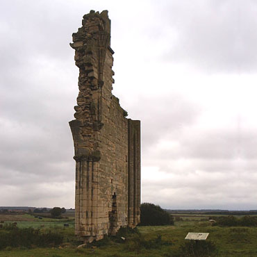 The stark remains of Barlings Abbey
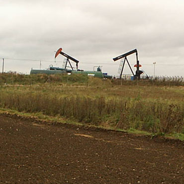 Nodding Donkeys extracting oil near Fiskerton
Little now remains of Barlings Abbey but the surrounding ground and an interpretation board tell us this was an important site before the dissolution. From the start of the flood bank walk at Fiskerton we can clearly see our next destination, Lincoln Cathedral, some five miles away. The Viking Way takes us right up close to this urban highlight, even without entering this building cannot fail to impress so it's worth planning the walk to take time out here and explore the delights of the high town.
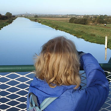 View of Lincoln from a bridge at Fiskerton
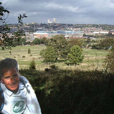 Lincoln from Bracebridge Heath
Dropping down Steep Hill we pass through the shopping centre. Watch carefully for the bridge crossing over the river Witham, it's easy to miss. Traffic on High Street is still frequently held up as trains arrive and depart from the station. At one time this was the only road and there were two level crossings competing to cause a jam for families off to the coast for the day. We climb again then turn right along the brow of the hill and wow, the view back across the city is stunning with the Cathedral dominating the horizon. The path remains in this advantageous position for mile after mile until soon after Boothby Graffoe, what an address almost on a par with Mavis Enderby and Edith Weston, we join Ermine Street.
 Along the ridge near Boothby Graffoe
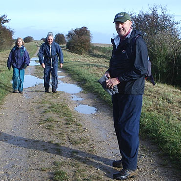 Jim, Di and Peter on Ermine Street
Nearly six miles in a straight line along the High Dike, all we need do is get our heads down across this flat and open ground before we turn west and pass villages to the north of Grantham. The original route passed though Allington where resided Mr Palin who made a commemorative stile located on the Way at Stenwith. The stile is a memorial to John Hedley Lewis Chairman of Lincolnshire County Council and President of the Lincolnshire and South Humberside group of the Ramblers' Association until his death in 1976. Unfortunately the route through Allington involved a walk of a good half mile along the verge of the Great North Road where the occasional lorry shed sections of tyre or load as could be seen from the debris when I risked my life to use this ill throughout perambulation. The route now skirts Long Bennington where services are available but at the opposite end of the village. We now join Sewstern Lane, an old Drove road, perhaps the original route of the Great North Road and eventually pass the impressive gates on the drive to Belvoir Castle. From here the lane becomes the boundary with Leicestershire.
 Memorial Stile from the guide cover (1983)
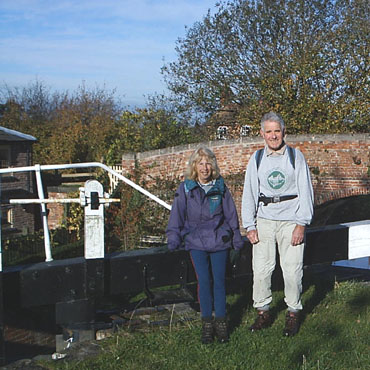 Grantham canal at Woolsthorpe by Belvoir
On into Rutland and the estate village of Exton where a minor diversion from the route takes us to the Fox and Hounds which tells us more about the area than any words could. Exton Park was extensively mined for ironstone leaving the ground with large but gentle humps and hollows. Now restored to grass and with a good network of public paths, mostly on tracks or field headlands, this is a popular walking destination. The final bit of grass field edge takes us to Whitwell from where the Way shares the popular Rutland Water perimeter track. Here walkers, cycles, prams, joggers and dogs, strut, shuffle, prance, stop, or diverge, intent it would appear on causing those with a destination in mind to take avoiding action at frequent intervals.
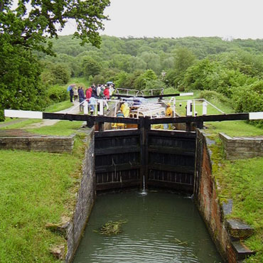 Boats in lock 18 Grantham canal
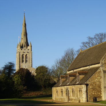 Oakham Castle
Our guide ends the walk at Oakham library, not the best town landmark. We do a quick tour of the heritage sites including a must for railway modellers who constructed the Airfix signal box. This was an exact scale replica of the box at Oakham Level Crossing, which stands guard today, little changed in over fifty years. By chance or excellent planning we were able to celebrate completion of the walk with a pint in The Grainstore next door to the station.
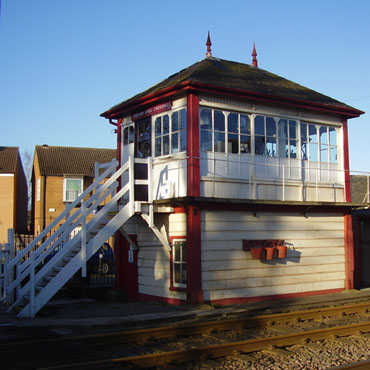 Oakham Signal Box
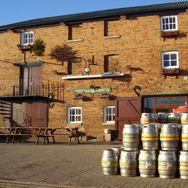 Grainstore Brewery Tap
My bookshelf has three guides to the Viking Way. A set of eight leaflets, perhaps produced at the launch of the route in 1976. There are six published by Lincolnshire County Council at 5p each, while the section from the Humber Bridge to Bigby was published by Humberside County Council and the final Rutland section by Leicestershire County Council. These constant boundary and name changes are a real challenge to the geographer. A composite book issued in 1983 still has the hazardous section along the verge of the A1 and I see the final section did not join the Rutland Water path at Whitwell, instead it used metalled roads all the way from Exton to Oakham, perhaps that's why I never bothered with this trail. When we did the walk in 2004 we used the guide published in 1997 which had reduced the drag along the River Witham into Lincoln from the original nine miles and took in Barlings Abbey. My recollection of the walk was that of too much road but study of the original guide shows a staggering amount of conflict with traffic. What's the point of a walk if most can be achieved by car?
Oakham is a convenient end to the walk and the pleasant small County Town of Rutland but not a place with any significance to either our starting point or the route we have followed. Stamford would make a far better end as it would maintain the direction of travel south towards London. With this in mind Brett Collier devised the Danelaw Way a 60 mile walk from Lincoln to Stamford and this was our next challenge.
Report and pictures by Ken Brockway.


