Walks in Shropshire
I first discovered the Shropshire Hills during a four day visit to Church Stretton in September 2014. That first visit involved walks of Brown Clee, the Long Mynd and Stiperstones. I was hooked. While the Shropshire Hills, which are appropriately designated as an Area of Outstanding Natural Beauty, are not the highest, they are beautiful hills. Brown Clee is the county top at 540 meters and some others attain heights of over 400 meters. What they lack in height they make up for in shape and style. The Shropshire Hills Area of Outstanding Natural Beauty covers an area of just over 300 square miles and is found in the south west of the county. The north and east of Shropshire is lower lying but here too there are beautiful places to walk. The north west and north-east of the county is predominantly rural. However the center and south-east of Shropshire includes the area significantly responsible for the birth of the Industrial Revolution with Ironbridge Gorge the crucible of that birth. Near to Ironbridge Gorge and the new town of Telford is the Wrekin, a remarkable isolated hill which dominates the immediate landscape. Add all these factors together and the result is that Shropshire holds lots of pleasant surprises. So, enjoy my Shropshire walks which includes stories of my walk of the Shropshire Way.
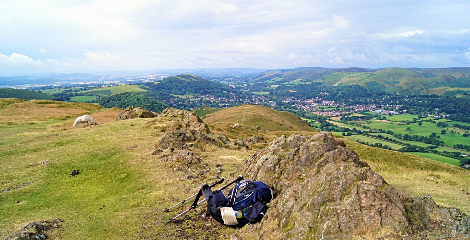
The view from Caer Caradoc to Ragleth Hill, Church Stretton and the Long Mynd
Interactive map of the walks
| Walk | Miles | Description |
|---|---|---|
| Cardington, Caer Caradoc Hill and Church Stretton | 4.5 | From my Shropshire Way walk. Includes Cardington, Willstone, The Lawley, Caer Caradoc Hill, Three Fingers Rock and Church Stretton. |
| Church Stretton. Long Mynd and Wentnor | 6.0 | Church Stretton, Carding Mill Valley, Light Spout Waterfall, Long Mynd, Pole Bank, Wentnor. |
| Long Mynd from Church Stretton | 7.7 | Possibly the finest heather moorland walk in Shropshire. It certainly beguiled me with its beauty. And watch out for the wild horses. |
| Brown Clee Hill and Clee Burf | 8.1 | A walk to the highest point in Shropshire in which I and old friends meet new ones who teach us some bushcraft skills |
| Stiperstones and Green Hill | 8.3 | The Stiperstones is a ridge with a unique rugged outline. There are also superb views on the walk. |
| The Wrekin and the Ercall | 8.6 | A spectacular Shropshire walk with fantastic woodland and views to rival those of many higher mountains. |
| Shropshire Way: Grindley Brook to Wem | 10.6 | Includes Grindley Brook, Whitchurch, Hadley, Hollinwood, Whixall, Edstaston and Wem. |
| Shropshire Way: Hopesay, Craven Arms, Stokesay Castle and Ludlow | 13.9 | Includes Hopesay, Craven Arms, Stokesay Castle, Onibury and Ludlow. |
| Ironbridge, Much Wenlock and Wenlock Edge | 15.1 | Includes Ironbridge Gorge, River Severn, St Milburga's Priory, Much Wenlock, Wenlock Edge and Longville in the Dale. |
| Shropshire Way: Wem to Shrewsbury | 15.6 | Includes Wem, Grinshill, Hadnall, Astley, Ebury Hillfort, Haughmond Abbey, River Severn and Shrewsbury. |
| Shropshire Way: Wentnor, Bishop's Castle and Hopesay | 16.0 | Includes Wentnor, Norbury, More, Lydham, Bishop's Castle, Colebatch, Brockton, Kempton and Hopesay. |
| Severn Way: Shrewsbury to Ironbridge Gorge | 17.1 | Includes Shrewsbury, River Severn, Atcham, Attingham Park, Wroxeter, Viroconivm, Cressage, Sheinton, Buildwas Abbey and Ironbridge Gorge. |
| Church Stretton to Shrewsbury | 18.0 | A wonderful eighteen mile linear walk through the delights of the Shropshire countryside. |
| The Longmynd Hike | 50.0 | Adam Gallimore treks 50 Shropshire miles in the Long Mynd and Welsh Marches on this epic challenge walk. |
Feedback and Suggestions:
I am always pleased to received feedback on the structure and content of the website. I also welcome suggestions on how I can improve the website which may include new areas to cover, new walks or route alterations to existing walks. To get in touch with feedback and/ or suggestions please contact me on one of my social media links. Thank you.
(Note: Walking without proper preparation can be dangerous. Information and downloads on this website are provided free of charge; it is each walker's responsibility to check the material and use accordingly. Postscript: My walk reports are not route guides and should not be treated as such. They are written with personal reflections of my walks)


