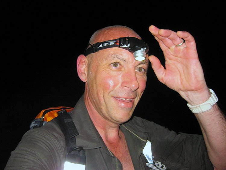
The Longmynd Hike
Reet then fellow ramblers who has heard of 'The Longmynd Hike'? Not so many of you I bet? I first heard of it in 2010 from my good friend Andy Musson who then cajoled me in to taking part the following year. So that kind of begs the question. If I had put myself through it in 2011 why would I go back for more the following year? Well as a wise man once said "Stupid is as stupid does" so work out for yourselves what that makes me. Seriously though it is one hell of a little adventure and with the right friends by your side to help you through the lows and the pain it is quite enjoyable and a good laugh to boot. So take a seat, strap yourselves in and get ready for the story of 'The Long Mynd Hike 2012'.
Walk and story, courtesy of Adam Gallimore
Google Maps
Open Source Maps
| Statistics and Files | ||
|---|---|---|
| Start: Church Stretton | Distance: 50 miles (80 km) | Climbing: 2,900 metres |
| Grid Ref: SO463940 | Time: 24 hours | Rating: Strenuous |
| GPX Route File | Google Earth File | About Church Stretton |
| Statistics | |
|---|---|
| Start: Church Stretton | Distance: 50 miles (80 km) |
| Grid Ref: SO463940 | Time: 24 hours |
| Climbing: 2,900 metres | Rating: Strenuous |
| GPX Route File | Google Earth File |
Ordnance Survey Explorer Map (1:25,000)
The Walk:
For those of you who don't know what all the commotion is about here is the low down on what is about to happen. The Long Mynd Hike (which in Welsh means Long Mountain) is a 50 mile competition hike open to anyone aged 18 or over which takes place over the first weekend of October every year. The hike follows a set figure-of-eight route over the rugged countryside of South Shropshire and the Welsh Marches, with about 8,000 feet (3,000 metres) of climbing and covering eight summits:
1) Caer Caradoc (S0478954) - 469m
2) The Lawley (SO495975) - 377m
3) The Long Mynd (SO415944) - 516m
4) The Stiperstones (SO367986) - 536m
5) Earls Hill (SO409048) - 320m
6) Corndon Hill (SO305969) - 513m
7) Black Rhadley Hill (SO343956) - 402m
8) Ragleth Hill (SO451917 ) - 393m
And visiting 17 checkpoints:
1) Caer Caradoc (S0478954) - 1.875 miles
2) The Lawley (SO495975) - 3.750 miles
3) High Park (SO449970) - 6.875 miles
4) Pole Bank (SO415944) - 10 miles
5) Bridges (SO393965) - 11.875 miles
6) Stiperstones (SO367986) - 15 miles
7) Earls Hill (SO409048) - 20 miles
8) Bank Farm (SO389040) - 21.875 miles
9) Shelve (SO333959) - 26.875 miles
10) Corndon Hill (SO305969) - 30 miles
11) Woodgate Farm (SO311953) - 31.875 miles
12) Black Rhadley Hill (SO343956) - 35 miles
13) Stiperstones Car Park (SO369977) - 38.125 miles
14) Pole Cottage (SO413938) - 41.875 miles
15) Minton (SO430908) - 46.250 miles
16) Ragleth Hill (SO451917) - 48.125 miles
17) Church Stretton Hill (SO455944) - 50 miles
The start is at 13:00 hours on the Saturday from Church Stretton and the object is to visit all 17 checkpoints in order to have your tally card clipped and complete the course in under 24 hours - Doddle? So here we go see you all in just under 24 hours time (hopefully).
 On route to The Lawley
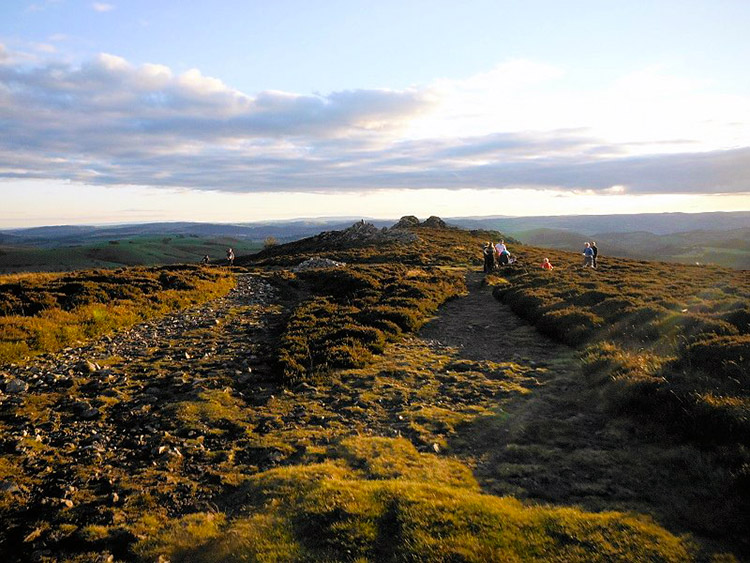 Stiperstones
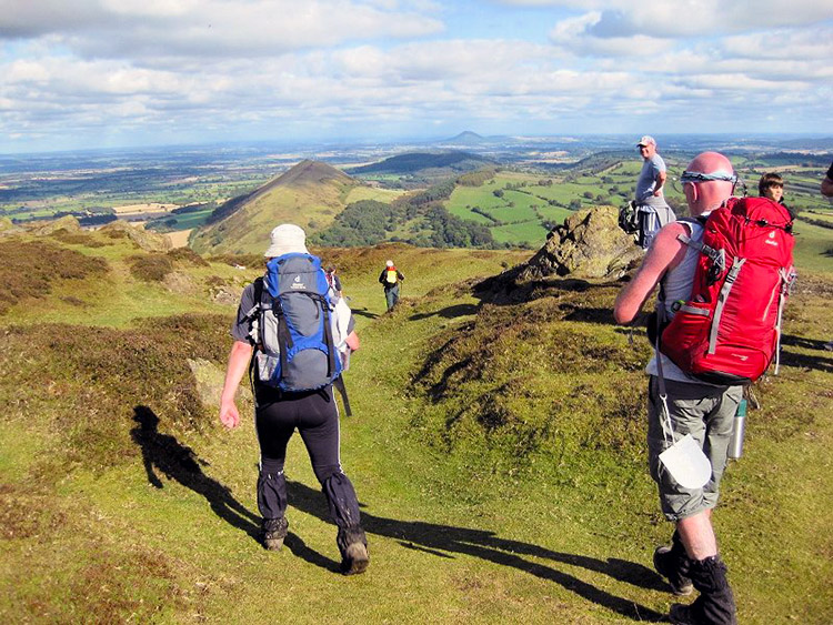
With the sound of the claxons the challenge event was underway. 500 plus hardened extreme ramblers including me, Muss, Roger and Poddy headed off, destination check point 1 on top of a BIG hill. Now then I am not sure wether it's just me, but when I set off on one of these long walk thingy-ma-jigs it takes a while to get into a rhythm and feel comfortable and it certainly does not help to have a 260 metre clamber to the top of Caer Carodoc as a taster of things to come. Oh yes I said it last year and no doubt will say it again for many a year to come "Right then, so remind me again, why am I doing this?"
Fifteen minutes in, heading up Biggus Hillus (renamed thus as I was struggling with the Welsh pronunciation) and those strangely insane people I believe they call themselves, Fell runners? were already way out in front. Honestly how those guys do it is beyond me. In fact why they do it is beyond me. As we neared half way up Biggus Hillus, we said our first goodbye of the event. Roger was keen for a good time in this year's event as serious foot issues at Minton last year saw him retire with only 4 miles left to go. We had already chatted about Roger "Going for it" and where more than happy as he strode out leaving us in his dust. Hopefully this year he would not suffer the same injuries and would beat his previous times hands down. Should I tell you now how he fared? Nah, you will have to read on and find out at the end.
Soon we had reached check point 1, Muss a little in front of me and Poddy because I am not the best on grassy hills. Wow the view from here were amazing. It was such a clear day you could see for miles. In front of us was The Lawley with the first of the fell runners making their ascent to check point 2 and a glimpse behind saw the mighty Ragleth Hill, hmmm, lets forget that one till much, much later.
Check Point 1 (Caer Caradoc) - 1.875 miles: A quick clip on the tally card from the marshal who recorded number and time then it was down hill. I think it was at this point that me and Muss first realised how tightly Poddy's lycra trousers fitted him. Muss commented on how wrong it looked, something he would reiterate more than once on our adventure. Myself I was a tad intrigued as to what manner of under garments Mr Podmore was wearing, who's outline was becoming more and more visible by the minute.
As check point 2 was at the top of the Lawley; another hill. Yes you guessed it we had another climb. And believe you me it was just as steep if not steeper than the first. As we approached the entrance gate to the Lawley the first of the fell runners were already down. Keeping up this pace they should be on for an 8 hour finish and as they approached we made way and wished them good luck.
Up we went, up and up, up, up, up and up and up some more. "Blooming Heck, are we not at the top yet I moaned to my self" or did I say it out loud? I am not sure. Muss again was ahead of me and Poddy and hey, look who was coming towards us on his way to check point 3. Its only bloomin Roger Musson. Looking like a gazelle with a big beaming smile he was having fun the lad was. Just time for a quick word of good luck and he was gone.
We caught up with Muss about a minute from check point 2 as he was making his decent. "I'll see you on the road at the bottom" he said as we passed on our way to our next tally clip.
Check Point 2 (The Lawley) - 3.75 miles: Tally clip taken care of we were now on route to join Muss on the road at the bottom of the hill. As me and the Podmeister skipped down The Lawley we passed another old friend Mr Luiz Broz on his way to the top. Deciding that the guys he was with where to slow he had better speed up, to which he did and by Pole Bank he had passed us heading for a quick time. I commented to Poddy that I wondered how many of those taking part would finish as at around 4 miles in some where looking decidedly knackered to say the least. True to form Muss was waiting on the road near to Comley Farm where we headed across the fields, through Heath Coppice to Heath Farm and on to the A49. Shortly after crossing the A49 we crossed the railway where I believe I also showed Muss and Poddy the correct way to negotiate a style. In return as we walked along the side of Gogbatch on route to High Park Poddy showed us once again why wearing tight fitting lycra trousers is not the best look. Soon we where back on tarmac again and the painful trek to checkpoint 3.
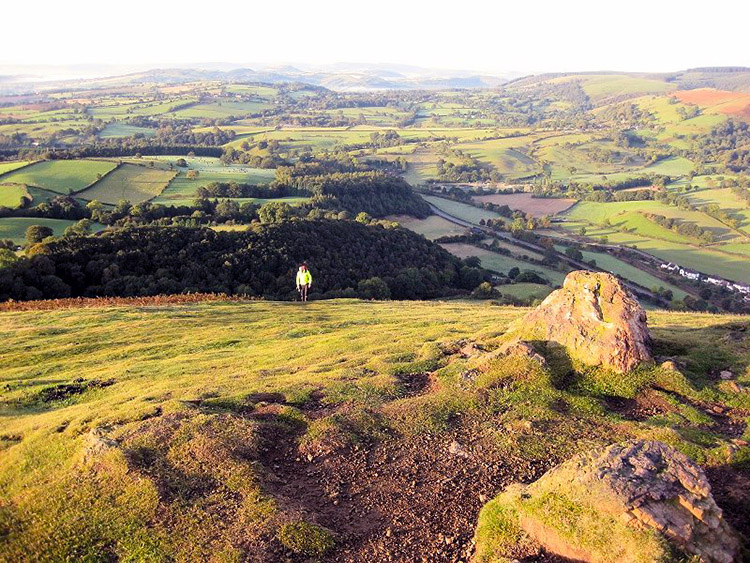
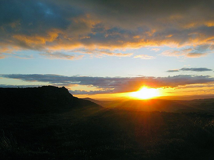 Sun setting on Stiperstones
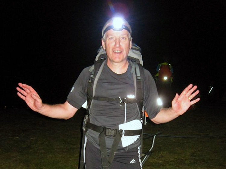 Dave 'Jazz Hands' Podmore
Check Point 3 (High Park) - 6.875 miles: High Park check point, not one of my favourite as it is neither at the top nor the bottom of a hill. It is kind of like in the middle so there is nothing to look forward too except another 3 mile slog up hill. Oh never mind me, I wouldn't be me if I weren't moaning about hills. Anyway things were looking decidedly better this year as I was offered some Haribo jelly sweets from two young girls who were helping out on the hike. Its people like these two young girls, the marshals and all the other helpers at the refreshment points that make the hike what it is (bloody marvellous). So for once in a limbo situation I was feeling happy and if I was not then I just chomped on another Haribo. With Haddon Hill on our left we continued along The Port Way, past The Jack Mytton way, Calf Ridge and some of the most spectacular scenery you could ever hope to see until we finally reached Pole Bank. A small tent and a humungous radio antenna.
Check Point 4 (Pole Bank) - 10 miles: Leaving Pole Bank it was all down hill to Bridges and as Muss stretched his legs I chatted with Poddy as we made our way through the sodden grass towards Priory Cottage. Now then what you don't realise is that Young David Podmore to give him his Sunday name is a well known chef rivalled only by the likes of Heston Blumen whatsit. So as we strolled slightly faster than leisurely the topic of conversation soon came round to Poddy's world famous water melon curry. Now I can't say much about it as the recipe is a closely guarded secret but be rest assured guys its one of the tastiest around. Now then Muss would have joined in our little tete a tete however, declined due to bleeding ears. As we approached Priory Cottage the conversation changed to that of greyhounds and we reformed our little threesome for our stroll through Coates Farm and on to Bridges and maybe even an appearance from Wild Tracker himself Nick Davenport.
Check Point 5 (Bridges) - 11.875 miles: What can I say almost 12 miles in and greeted by this jewel in the Shropshire crown. Just a pity we cant stay for a few beers. We relieved our selves of our ruckys and set about foraging for food. Wild Tracker would have been proud (If he had been there). I found a tea fountain to quench our thirst and Poddy found a cake tree whilst Muss fended off groupies who had recognised him from his YouTube movies. And then like a contestant emerging from the smoke on Stars in Their Eyes he appeared (Fanfare please) Mr Nick Davenport yayyyyyyyyyyyy. What a pleasant sight, he had come to wish us well and spur us on. The reason he was not waiting for us as we arrived was because he had just walked up to Stiperstones with Roger and apparently he was doing real well. Nick is a top fella and runs his own bushcraft business called FarAFoot which is based in Shropshire amongst the scenic and unique uplands of the Clee Hills in the Welsh Marches. So taking time out from his busy schedule was a real big gesture. Thanks Wild Tracker. Nick walked with us up the tarmac road towards Stiperstone car park where we then said our goodbyes and headed on to the stoney ankle wrecking path and check point 6
Check Point 6 (Stiperstones) - 15 miles: Five miles to Earls Hill, with a little climb at the end, fan flippin tasttic. Continuing along the ankle wrecking path on the Stiperstones past Devils Chair and down to Blakemoorgate we all knew what was coming. The only saving grace would be that it would be dark by the time we got there so there was no fear of being intimidated before hand. However we had all done it last year and new that this year would not be any easier. By the time we reached Blakemoorgate the path was much kinder to our ankles and was now grassy and dusty. As we approached the edge of Eastridge wood we had our first route change. To be honest I can't remember what the reason for this was. However, instead of traipsing across the crop fields of Marsley Farm to Hebberley we were now required to stay on the track. Due to extensive flooding and bad weather only days before the event there was plenty of mud and deep puddles this year the biggest being at the edge of the wood. We all managed to negotiate it unscathed by clinging on to barbed wire and branches. Unfortunately an earlier competitor was not so lucky when he came a cropper by grabbing hold of a dead branch. A loud crack was heard followed by a splodoosh as the poor fellow fell backwards in to the deep muddy puddle. I wish I had seen that.
By the time we reached the Pub at the start of the drag up to Earls Hill it had gone dark so out came the torches. I am not joking as we passed Lower Farm and made our way along the track to the base of Earls Hill, you've never seen mud like it. I have been to music Festivals that weren't a patch on this. Not to be deterred on we trudged, very slowly indeed until eventually we reached the woods. A quick negotiation of some rather large trees and other athletes like me, Muss and Poddy, boddies toned to perfection (I am not kidding having a torch shone in your eyes plays havoc with seeing clearly) and we where on the Hill at last. Now then a bit of History for you Earls Hill is actually man made. Bet you did not know that did you? Constructed in 1491 under instruction from Perkin Warbeck it was intended as an early birthday present for The Grand Inquisitor himself, Tomas de Torquemada. Along with this Hill and the new torture chamber that can still be seen to this day at a secret location under a daffodil at the summit was to be the flag ship of all torturous devices of the time.
Anyway this is a walking journal not a history lesson so lets get back on track. All I can tell you about the climb to the top of Earls Hill is; Its bloomin hard going, head down and go for it. So after what seemed like ages we finally arrived at the summit and got duly clipped.
Check Point 7 (Earls Hill) - 20 miles: As the age old saying "What goes up must come down". And it was not long until we where through the woods negotiating the muddy paths on our way back past the pub spurred on by the locals who had ventured out show their support (Thanks guys. It means a lot). Exiting the lane where the pub was it was just a case of right then left and a little slog up the road to Bank Farm. And just like last year we could hear those generators signalling we where here at the check point.
Check Point 8 (Bank Farm) - 21.875 miles: Bank Farm at last; what a welcome sight. Time for a sit down, a change of socks and a well earned drink of tea. Things weren't going too badly at all I thought; the only exception was that Dicky Dark had come out to play and we where reminded that our legs must now be covered. Major bummer dudes as I only usually cover my legs up when it's mid winter.
So fed and watered we left Bank Farm and headed into the night through Eastridge Wood and Maddox Coppice with me bleating like a little bern about covering my legs up. Phew I was finding it hard going now and with no air to my legs I was sweating like sweaty man. However, Poddy and Muss were in great spirits laughing and joking as we rambled. Eventually we exited the wooded area into Snailbeach and as we wandered down the lane that would bring us on to the road to Tankerville we met up with another group of loons out for a night time stroll. These guys where first timers to the Mynd and were struggling to find the footpath to the road. Muss took charge though and in typical Lord Fabulous fashion navigated a slightly longer but quicker route on to the road. Sometimes walking an extra 200 yards is quicker than spending fifteen minutes searching for a footpath. Back on track again we walked along the tarmac road and chatted to our new found friends. Well I thought that us three were mad but these guys where hardcore nutters. They were doing The Long Mynd for points. I had no idea what they where on about so I asked and the answer I got was; that they had their sights set on the Ultra-Trail du Mont Blanc, a 102-mile test of endurance around the stunningly beautiful Mont Blanc Massif near Chamonix, France. They needed a total of seven points to be accepted into the event and completing The Long Mynd Hike would secure them two valuable points. Hmmm, mental note to get Muss drunk and signed up for this little leg tickler. The walk along the road was pleasant and in no time at all we reached The Stiperstones Inn. Not an official refreshment stop but the land lord always stays open and supplies the competitors with a well needed drink of water or cordial. It was soon after this pre refreshment stop, refreshment stop that things started to go wrong and Poddy was beginning to feel ill; and Muss being the top fella he is strapped Poddy's rucky to his chest and on we continued. Remember what I said earlier about having friends to help you through the lows and the pain? Well this is exactly what I am talking about. I kid you not Muss would have carried Poddy's rucky all the way to the finish if it ment getting him to the end. Soon we reached Tankerville and taking a footpath through the fields we arrived at Shelve.
 Muss aka the You Tube Guy
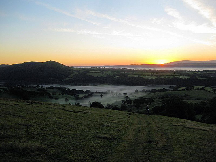 Early Morning on the Shropshire Hills
Check Point 9 (Shelve) - 26.875 miles: Finally a sit down for poor Poddy (it was only after watching Muss's video we saw how shattered he looked) and the rest of us. Well after Muss had rolled his pants down (Hahaha getting told off at his age). Trying to keep Poddys spirits up the usual jolly banter carried on inside the refreshment tent and as I chatted to another competitor I heard this strange noise coming from the other side of me. Wondering what it was I turned round at the same time as Muss to see Poddy puking up. Unfortunately for Poddy this was as far as he was going on this adventure, but bloody hell what an effort and I am proud of the guy and will no doubt be walking the hills of Shropshire and Wales with him on many occasions to come. So with Poddys retirement came another problem; there was now only two in our team, me and Muss and the rules state that at night you must be grouped in to three or more. We needed a new team and fast. Ladies and Gentlemen may I now introduce you to Charlotte (The Machine), James and Declan our new walking buddies for the night time stage. These guys along with a few others had all set off together but had become separated early on and where now ahead of their team members. Keeping in touch by phone it would seem that the others where miles behind so waiting for them would have been disastrous for them.
So off we went again out into the night in search of the next check point. Our route to Corndon Hill would see us firstly walk along the side of the wooded Shelve Hill, through some fields and then cross the A488 to a lane heading towards Priest Weston. However as we were chatting and generally having so much fun we walked straight past the lane leading to the start of Corndon Hill. Infact we only realised our error after about half a mile when we noticed the head torches of the other groups already on the hill so back we trotted down the lane. James feet by now where in a bit of a state and he was unsure of how far he would be able to continue before having to pull out. Reaching the foot of Corndon Hill, Charlotte and Muss took the lead followed by Declan and I thought I would keep James company. Not the best of ideas as I am rubbish on grassy hills so by the time I got to the top the others had been waiting for a while.
Check Point 10 (Corndon Hill) - 30 miles: Tally card clipped, no refreshments though this time and we where off again. This has got to be my favourite stage as its all down hill to Woodgate. The only hitch is that it is very steep and with the rain of the previous month the decent was a little dicey at times to say the least and did not half batter your feet. Needless to say in no time at all we arrived at Woodgate Farm.
Check Point 11 (Woodgate Farm) - 31.875 miles: Woodgate Farm and another sit down. Don't mind if I do. Unfortunately for James this was going to be time to wave us goodbye as his feet had decided that at almost 32 miles they were not going any further. So after a very short stop off at Woodgate we shook James hand, wished him all the best and then we, the four intrepid adventurers headed on our way.
Apart from the little stroll through the fields from Woodgate Farm to Welsh Lodge the majority of the next stage was all road work up to the foot of The Black Rhadley.
As I am writing this next part I have a smirk on my face as it was probably the highlight of the whole adventure. Not long after leaving Woodgate, Muss was up front with Charlotte and I was talking to Declan. As I looked up to see what Charlotte was laughing about Muss could be seen balancing with one hand on a fence legs up in the air with his head only inches away from a full water trough. Apparently as he tried to negotiate the fence with muddy boots he had slipped and this was his attempt to keep himself and his camera dry and in one piece. I have been asked to state the following "It was an amazing act of self preservation at stupid o'clock when feeling a bit kn*****ed". For anyone wishing to visit the area where this incident happened please note the following - Map OL216, G'Ref 320950.
Composed and laughing now faded to a controllable level we made our way along the road to The Black Rhadley. Due to damage made to farm land over the past years permission to use this land for the event was withdrawn and two extra checkpoints were introduced to make sure that this was enforced, which meant a long slog up a very steep road. By the time we reached the second of these two additional check points Declan was quite a way behind so we waited for him. This checkpoint was unlike the others. Picture; the middle of a country lane, a tarp strapped to a tree and a car lit up with fairy lights and music blaring away. And as I sat there in a camping seat as we waited for Declan I thought this is bloomin great. At long last Declan came over the brew and we all made our way towards the Black Rhadley. By now Declan was starting to feel the pain so as Muss and Charlotte headed up the hill to the checkpoint I stayed with Declan and eventually we got to the top and clipped our tallys too.
Check Point 12 (Black Rhadley Hill) - 35 miles: Right then back down the hill. Charlotte was off like a rocket and by the time me and Muss had got to the bottom she was well down the road stretch. I waited for Declan and Muss went to catch Charlotte up as to arrive in drips and drabs would have seen us disqualified for splitting our group up. As Declan and I walked along the long road he said that this next check point was as far as he could go "Theres nothing left in the tank Adam" were his exact words. It was harder than he had expected but he had bloody well enjoyed it. Turning right towards Nipstone Rock we then picked up the Stiperstone trail through a wooded area and a field and then on to a road leading to the Stiperstones car park.
Check Point 13 (Stiperstones Car Park) - 38.125 miles: After a minor reprimanding by one of the Marshalls for not arriving with Muss and Charlotte myself and Declan got ourselves a drink and sat down. For me that would be just a few moments but for Declan his adventure had ended and once again myself, Muss and Charlotte headed on our way to the next checkpoint and closer to the finish. I have got to admit trying to keep up with Charlotte was a feat. I don't know what she had been drinking but believe me Red Bull has got nowt on it. Heading away from Stiperstones we retraced our steps, past Bridges (this time it was closed and Nick Davenport had chuffed off) then past Coates Farm then Manor Farm before turning right at Medlicott Cottage and fighting our way up the boggy heather clad hill to Pole Cottage and the feeling that we were almost home.
 The Great Galleymo make his final ascent up the Ragleth
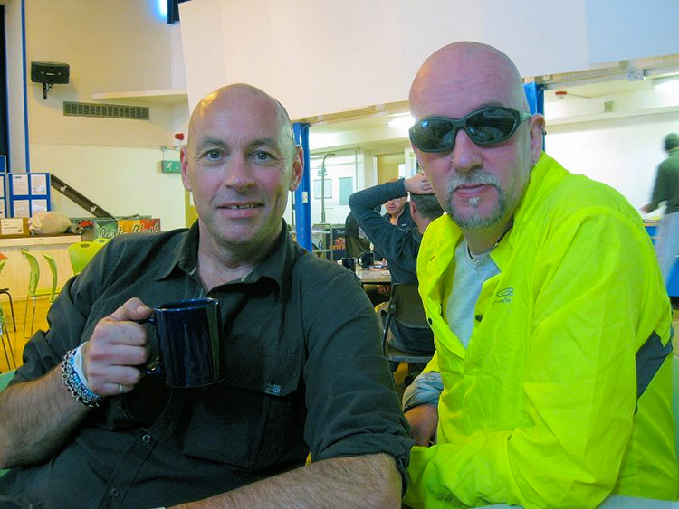 Lord Fabulous and The Great Galleymo
Check Point 14 (Pole Cottage) - 41.875 miles: On leaving Pole Cottage the dawn was starting to break and we were on our way home. With just over eight miles left to go Muss, Charlotte and I were in good spirts and hey it looked like the making of another fab dab a rooney day. As we walked the lighter it became and we could just about make out Church Stretton in the distance below the low cloud. Turning left off the path at the signpost for Minton we headed down the hill. Charlotte was already getting a bit of a step on and both me and Muss knew that she would be striding out alone when we reached Minton in thirty minutes or so. However, we weren't down hearted that we would be loosing Charlotte as there was no way we could keep up with her so we admired the scenery and the prospect of a cardiac arrest on the monstrosity that was now coming into view. But lets talk about puppy dogs and ice cream and other nice things to take our minds off the pain to come. Oh look here we are, Minton and a self clip checkpoint.
Check Point 15 (Minton) - 46.25 miles: Well guys at last the part of the adventure that both Muss and myself had been looking forward to (not). The Ragleth Hill! Firstly can I say a big thank you to the organisers of The Long Mynd Hike for including this monster. Just as you are thinking I am almost home and all the bad stuff is out of the way this thing rears its head. Even If I hadn't already walked 47miles I would still struggle getting to the summit of this one. So as me and my trusty side kick made our way down the lane from Minton Green with Charlotte getting further and further ahead we reflected on the adventure so far and wondered how Rodger had got on and had he yet finished? So here we were at last, just crossed the A49 and walking nay crawling up the Ragleth on our way to the last summit. A wise man once said "There's gunna be some free pain dished out here girls, boys, zebras and animals and all the loving creatures of the world; Theres gunna be some free pain and its all thanks to the baby Jesus and the pain pixies. "Loving your work girls". Which I kind of think typifies how we where feeling as we dragged our sorry asses to the top. Eventually after what seemed like forever we did it, the top of the Ragleth and it was all down hill from now. We could see check point 16 and we could smell the bacon and beans for breakfast. As we had our tally cards clipped for the final time we knew it was job done.
Check Point 16 (Ragleth Hill) - 48.125 miles: We were coming home, Just under 20 hours ago we set off on this adventure and all we had to do now was make our way off the hill cross the A49 again and follow a few roads back to the school. Hmm so after a slight detour when we went the wrong way that is exactly what we did and with a time of 20 hours and 19 minutes we had completed The Long Mynd Hike 2012.
Check Point 17 (Church Stretton Hill) - 50 miles: As we made our way in to the main hall, Roger and Poddy where sat there. Roger being Roger had this big smile on his face and Poddy was looking far better than he had 10 hours ago when we left him at Shelve. So that just leaves one question I suppose. Will I be doing it again in 2013?................ No chance.......... However I have been known to tell the odd fib or two.
Thanks for reading guys I hope I aint bored you too much and maybe next year you might like a crack at The Long Mynd Hike. Ooo almost forgot Roger. Well he smashed it big time got the whole thing done in 16 hours 54 minutes and he'll be back next year for a faster time.
Until next time - Happy Rambling


