Monte Grona from Breglia
| Statistics and Files | ||
|---|---|---|
| Start: Breglia | Distance: 9.0 km | Climbing: 1,000 metres |
| Grid Ref: N/A | Time: 5-7 hours | Rating: Strenuous |
| Statistics | |
|---|---|
| Start: Breglia | Distance: 9.0 km |
| Grid Ref: N/A | Time: 5-7 hours |
| Climbing: 1,000 metres | Rating: Strenuous |
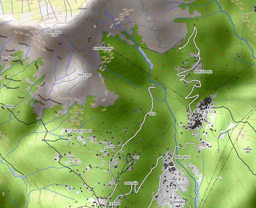
Map

The Walk: Note - this a continuation of the Breglia to Rifugio Menaggio walk
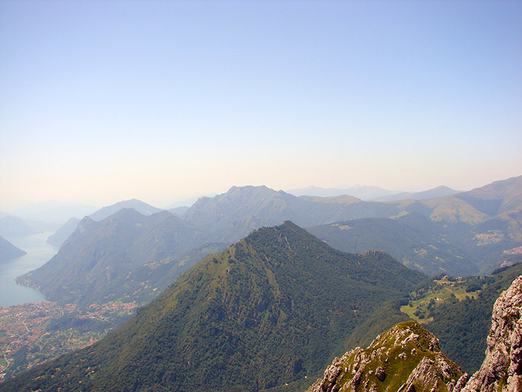
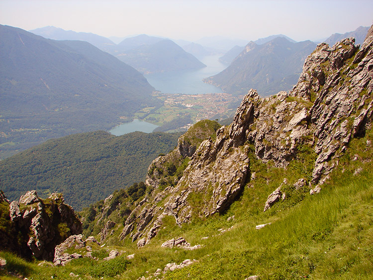 The view to Lake Como on the climb to Pizzo Coppa
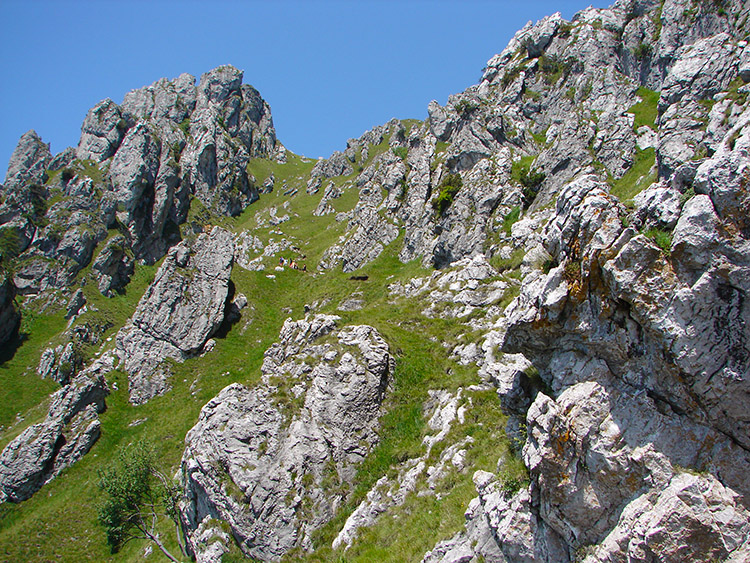 The trail up the southern slope of Monte Grona to the summit
Reading the walk description from Breglia to the Rifugio you will note that my wife Lil accompanied me. She did not take part in this section of the walk having elected to wait at the Rifugio while I proceeded on the climb to the summit of Monte Grona. Since we had arrived to stay in Grandola Ed Uniti I had always looked up to the magnificent jagged peak of Monte Grona. It towers above the area and is an awesome sight. There were bigger mountains in the further distance but in my eyes none as majestic. It was a simple decision once I had looked at the summit from the apartment. I just had to climb to the top.
 A fantastic rock obelisk on Monte Grona
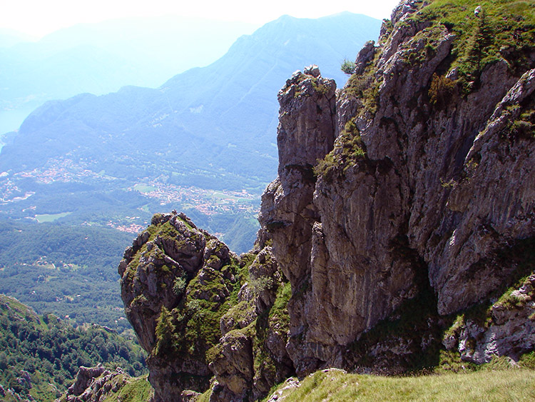 Looking down from Monte Grona to Grandola Ed Uniti
And so on leaving my wife to relax at the Rifugio with the fantastic views I proceeded on my short but epic journey to the top. I had two choices facing me, either by Via Normale a one kilometer route by La Forcoletta or by Via Direttissima a steep trail up the exposed south face of the mountain which would provide stupendous views of Lake Como, Lago Di Piano and Lake Lugano. There was no question as to my decision even though the Via Direttissima is not recommended in the winter snow. Fortunately it was summer then!
 Looking back down to the track from Pizzo Coppa
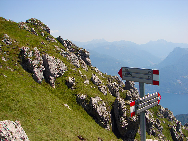 Signs at the junction of Via Direttissimo and Via Normale
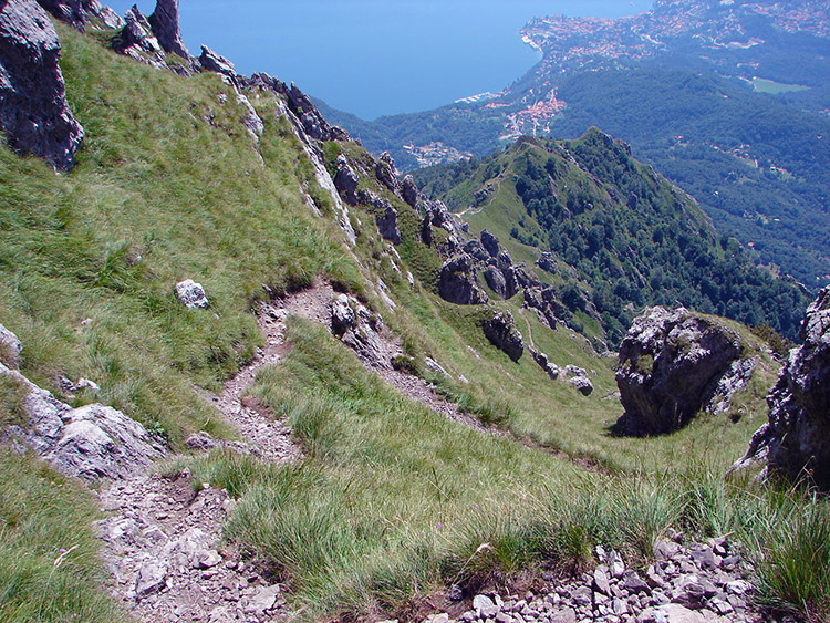
The climb started tough and steep and was never to cease. Direttissama was an apt description of the path although there were the inevitable hairpins as I eased my way strenuously up and up the mountain. I took time to photograph and film the route for prosperity and the breathers to take out the camera or Handy-cam were much needed for it was really hard going in over 30 degrees heat. Nevertheless the pain was worth it for the views I were taking in were sublime. Firstly the climb up to Pizzo Coppa along an exposed east sloping path provided fantastic views down to Breglia, Plesio and Lake Como. Yet they were nothing to the view awaiting me once I reached Pizzo Coppa.
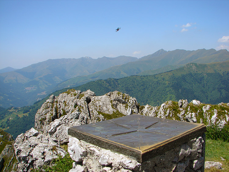 Monte Grona Summit
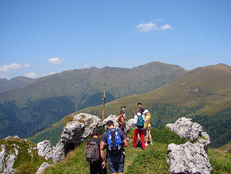 Hiking group at the Monte Grona Summit
At Pizzo Coppa everything to the south opened out in front of me. For this first time I could see Lake Como and Lake Lugano without moving. I could see all the way down into the pass from Menaggio on Lake Como to Porlezza on Lake Lugano. I could see our apartment in Grandola Ed Uniti in the haze way down below. I could see mountains north, south, east and west. Moreover I could see the track descending steeply down the south slope towards Ponte and back to Plesio. And of course I could see my path ahead, up the south slope of Monte Grona on a westerly bearing. The exposure on the path made my knees quiver a little but there was no going back. Not a chance.
 The view south west from Monte Grona
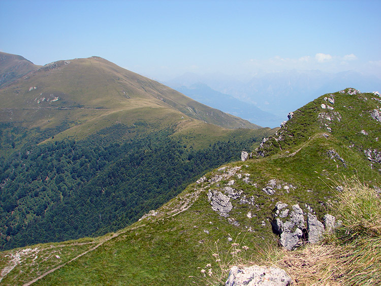 The view north west from Monte Grona
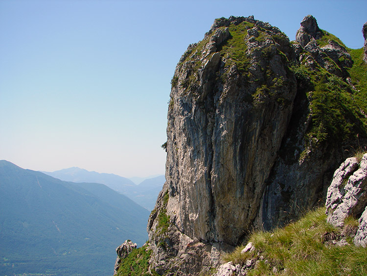
I climbed slowly, carefully, cautiously and warily. Despite my apprehensions I climbed in complete awe of the scenery around me. The rock formations were utterly fantastic as I trust is shown in the accompanying photographs. I always enjoyed the forced breaks to take in air to enjoy them. In some fissures mountain goats clung to the sides. On seeing them I knew I was on a mountain. And the sight of them was reassuring as I was alone during the climb. It seemed all the other walkers I had come across at the Rifugio had taken Via Normale. This was to be validated soon enough. After a few more stops and a short simple via ferrata I exhaustedly reached the top Via Normale path and trudged to the top pinnacle. Another simple cable assist took me to the summit and it was only here that I reacquainted with people for there were a few groups of fellow walkers enjoying the spectacle with me. It was hazy so the longest distances were obscured but on a clear day from here the views include the Prealps, the three lakes (Como, Lugano and Piano), the peaks of Monte Bregagno, Legnone, Pizzo di Gino, Grigne and distant peaks of the Alps from Monviso to Bernina. I have read it is also possible to see the Po Valley all the way to Milan. Not today though. Anyway, I stayed for a while taking in the views but I did have to get down back to the Rifugio and to Lil who would soon be getting anxious.
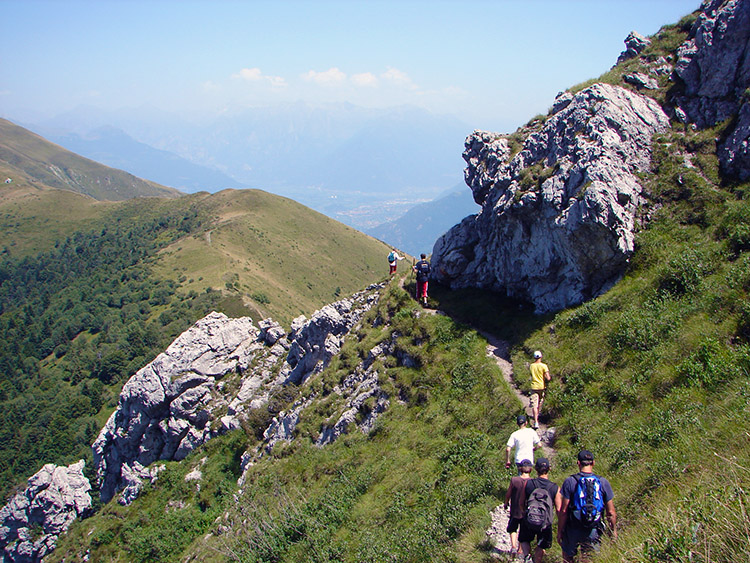 Hiking back down with new walking friends
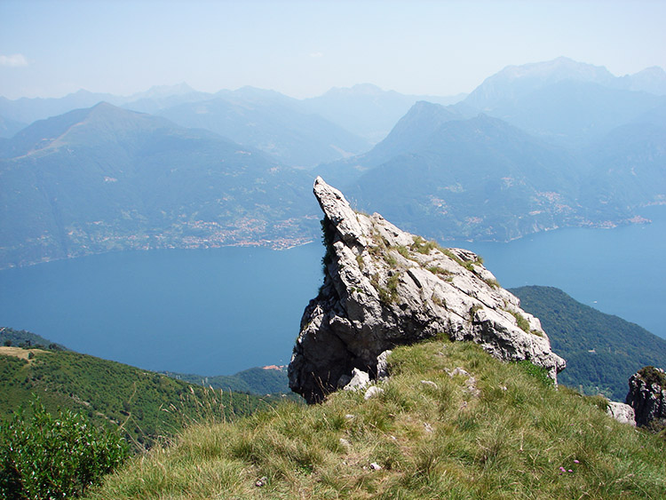 To the point
I headed back by the Via Normale to La Forcoletta and the Rifugio. As I set off so did a group of five German walkers. They proved to be good company. The descent was sometimes as tough as the ascent just done. Not on the lungs but certainly on the legs and more so on the concentration. At one point on a steep section of descent my looking down disorientated me and I actually felt a little dizzy. I was forced to stop for a minute. It was a little unsettling as it had never happened before, but I soon came around and luckily it never happened again. After my dizzy spell I was back to normal pace and often had to stop for my Teutonic colleagues. Despite the delays I soon spotted the Rifugio and a while later safely back with Lil for the descent to Breglia. I was away from her for two hours and although I love her company to bits they were two of the most memorable hours of my walking life. All thanks to the majesty of Monte Grona.


