Mullerthal Trail
The Mullerthal Trail is a 70 mile (112 km) long-distance hiking network in Luxembourg’s "Little Switzerland," renowned for its dramatic sandstone rock formations, narrow mossy gorges, and dense forests.
Google Maps Open Source Maps| Statistics and Files | ||
|---|---|---|
| Start: Echternach | Latitude: 49.813707 | Longitude: 6.421280 |
| Distance: 70 miles (112 km) | Climbing: 2,500 metres | Walk Time: 6 Days |
| GPX Route Files 1, 2, 3 | Google Earth File | About the Trail |
| Statistics | |
|---|---|
| Start: Echternach | Distance: 70 miles (112 km) |
| Latitude: 49.813707 | Longitude: 6.421280 |
| Climbing: 2,500 metres | Walk Time: 6 Days |
| GPX Route Files 1, 2, 3 | Google Earth File |
Suggested Map:
Summary:
The trail consists of three main circular loops, each offering a distinct landscape:
Loop 1 (37 km): Focuses on cultural highlights and varied landscapes, including the Sauer valley, orchard meadows, and the historic town of Echternach.
Loop 2 (39 km): Considered the "core" and most spectacular loop, it passes through the heart of the region's rock formations, including the Wolfsschlucht (Wolf’s Gorge) and the Hohllay cave.
Loop 3 (38 km): Characterised by romantic stream valleys and historic castles, such as Beaufort Castle and the waterfall at Schiessentümpel.
Typically each loop of around 23 miles (38 kilometres) is completed in two days, through strong, endurance orientated hikers can complete each loop in one go. However, to enjoy the fascinating sights of the trail and the particular highlights of each circuit, the two day per loop approach is favoured.
Essential Information:
Difficulty: Generally rated as Hard or Difficult due to steep sections, narrow rock crevices, and significant elevation gain (over 3,100 metres total).
Start/Finish: Major hubs include Echternach, Berdorf, and the village of Mullerthal.
Cost: The trail is free to access. Notably, all public transport in Luxembourg—including the buses and trains serving the trailheads—is free of charge.
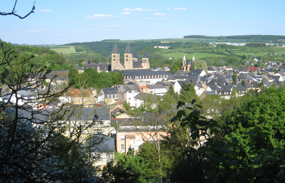 Echternach
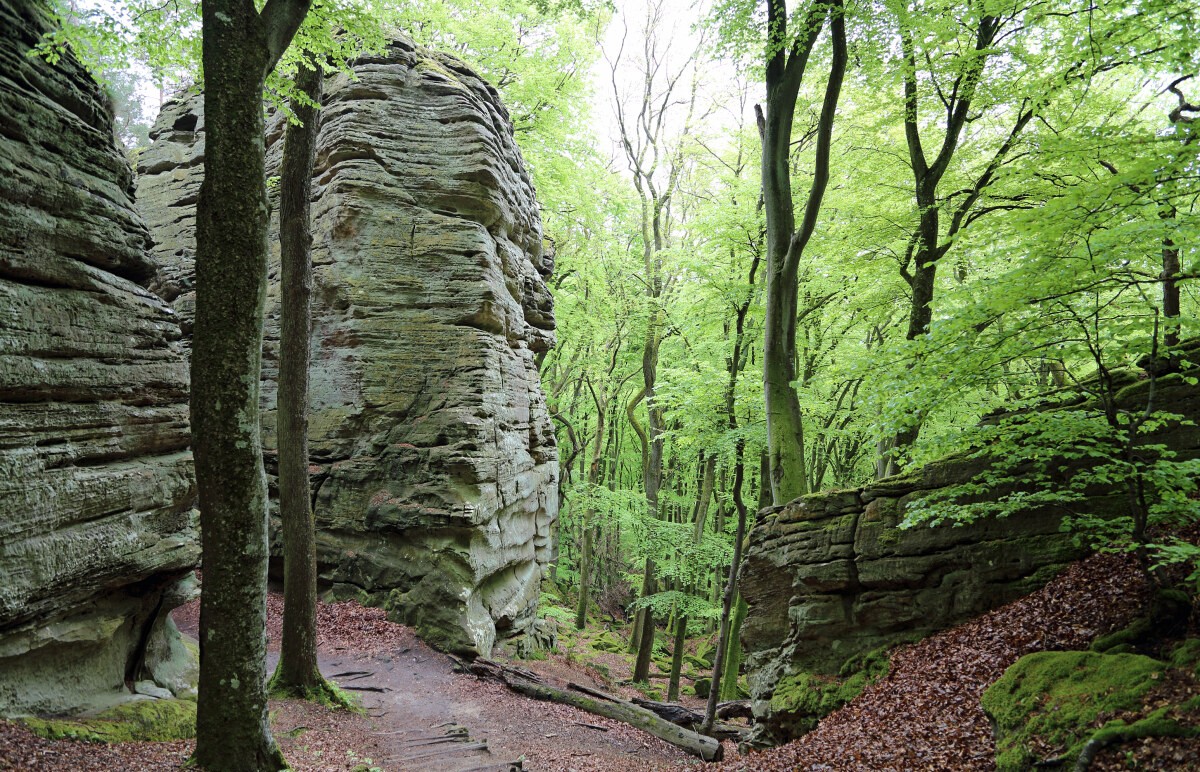 Rock formations near Berdorf, Mullerthal Trail
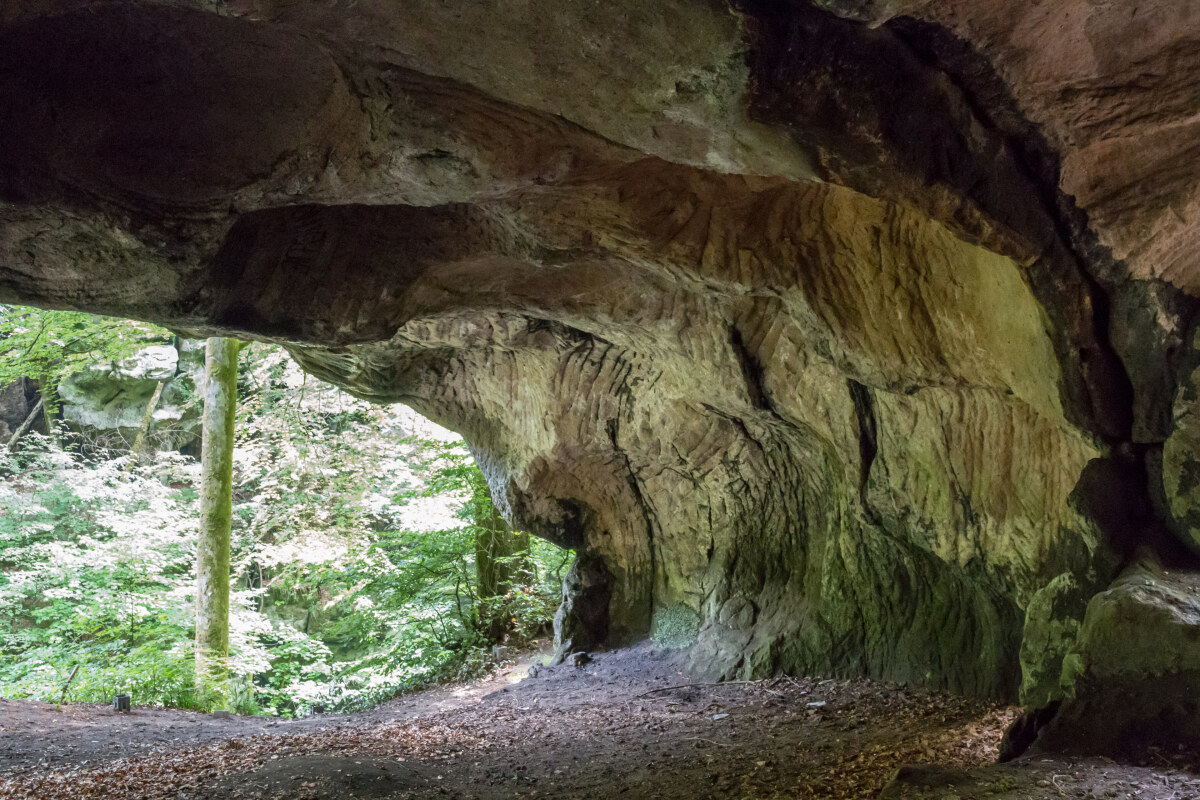 Rock cave on the trail near Berdorf
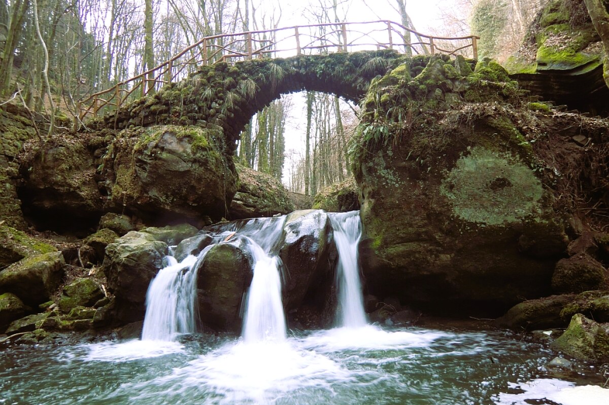 Schiessentümpel Waterfall
Loop 1 (37 km): Focuses on cultural highlights and varied landscapes, including the Sauer valley, orchard meadows, and the historic town of Echternach.
Loop 2 (39 km): Considered the "core" and most spectacular loop, it passes through the heart of the region's rock formations, including the Wolfsschlucht (Wolf’s Gorge) and the Hohllay cave.
Loop 3 (38 km): Characterised by romantic stream valleys and historic castles, such as Beaufort Castle and the waterfall at Schiessentümpel.
Typically each loop of around 23 miles (38 kilometres) is completed in two days, through strong, endurance orientated hikers can complete each loop in one go. However, to enjoy the fascinating sights of the trail and the particular highlights of each circuit, the two day per loop approach is favoured.
Essential Information:
Difficulty: Generally rated as Hard or Difficult due to steep sections, narrow rock crevices, and significant elevation gain (over 3,100 metres total).
Start/Finish: Major hubs include Echternach, Berdorf, and the village of Mullerthal.
Cost: The trail is free to access. Notably, all public transport in Luxembourg—including the buses and trains serving the trailheads—is free of charge.
EchternachRock formations near Berdorf, Mullerthal TrailRock cave on the trail near BerdorfSchiessentümpel WaterfallPictures, courtesy of Wikipedia
Useful Links:
Official Site
Thru' Hiking
Mullerthal Region
Feedback and Suggestions: To suggest a link for inclusion on a this page please complete the Walking Englishman Feedback Form. Thank you.


