Pateley Bridge, Coldstones, Greenhow Hill and Ashfold Side
This walk is a lovely wander around the Pateley Bridge area. It is also a fascinating history lesson. The walk starts in the town and takes us to the lovely Fishpond Wood near Bewerley. We then head west over deep green meadows covered in swathes of buttercup and vetch. Eventually we arrive at the edge of Coldstones Quarry at Greenhow. Coldstones is a working quarry with accommodation for a viewing of modern quarrying techniques should you wish to visit. Our walk takes us past the quarry and round Bewerley Moor to visit old lead workings at the disused Cock Hill and Providence Mines. There are lots of information boards at the mines to read about the history of lead mining in the area. After the history lesson on mining our walk returns to Pateley Bridge via Ashfold Side. It is a super walk that is full of interest throughout and a must for connoisseurs of our industrial heritage.
Google Maps Open Source Maps| Statistics and Files | ||
|---|---|---|
| Start: Pateley Bridge | Distance: 9.0 miles (14.5 km) | Climbing: 404 metres |
| Grid Ref: SE157655 | Time: 4 hours | Rating: Moderate |
| GPX Route File | Google Earth File | About Pateley Bridge |
| Statistics | |
|---|---|
| Start: Pateley Bridge | Distance: 9.0 miles (14.5 km) |
| Grid Ref: SE157655 | Time: 4 hours |
| Climbing: 404 metres | Rating: Moderate |
| GPX Route File | Google Earth File |
Ordnance Survey Explorer Map (1:25,000)
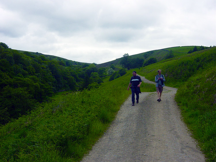
The Walk: I did this walk on a lovely early summers day in 2004 in the company of Dave and Stewart. On the drive home after the walk Stewart said "We are so lucky to live in this part of the world, the fields and trees are so green. It's beautiful". I couldn't agree more for the walking in Yorkshire is second to none, especially in the summertime. I could understand his euphoria for we had just walked in wonderful countryside and in 10 miles we had walked through woods, over meadows, pasture and moor. We had encounters with lots of animals, some wild, some domesticated. We had also visited industrial sites of long ago and some more recent. We had just enjoyed a fantastic four hours walking. It all started with a cuppa in Pateley Bridge before assembling on the bridge in town which crosses the River Nidd.
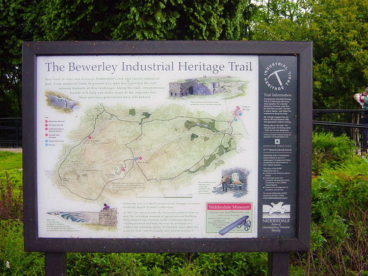 Bewerley Industrial Heritage Trail
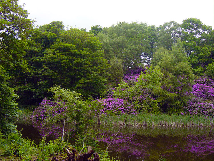 Beautiful Fishpond Wood
After refreshment we made our way over the bridge to the starting point of the 'Bewerley Industrial Heritage Trail'. After reading the sign telling us about the sites we would come to on the walk we set off by climbing steadily up the B6265 road for a few yards before turning left and walking through Bewerley Village. The designated trail misses the village and takes a path over Sugar Hill to the side of Fishpond Wood. Don't do it! Walk through the village and turn right along the first lane you come to. Follow the lane, due west for about 200 yards until you reach a sign pointing into the wood. This takes you through the wood past Fishpond. It is an essential detour for the short walk is super and the only woodland part of the walk. We arrived at the Fishpond and were welcomed by the most beautiful array of blossoming rhododendrons. We stayed a while by the pond and took in the exhilarating spectacle of colour. It was a spectacular sight and put us all in a wonderful mood for the walk to come.
 Haver Garth
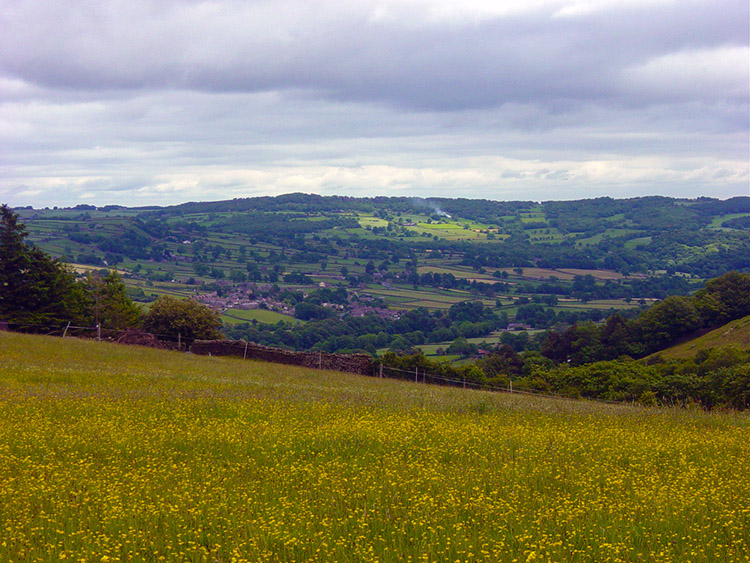 Meadow of brilliant yellow
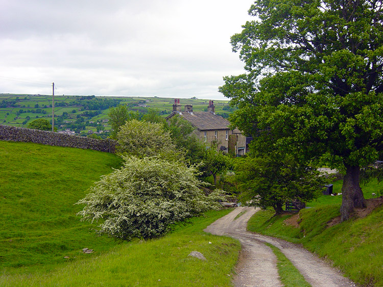
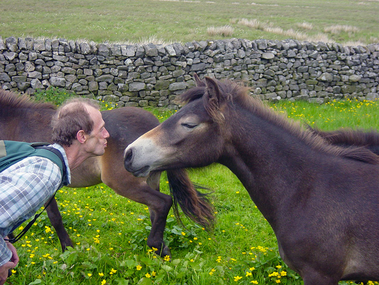
After a few minutes we left Fishpond Wood and rejoined the trail. Immediately we were into our second joy for the meadow fields we were now in were covered in flowers. There were colours everywhere set against the deep green background of the grass. There were yellows, pinks, blues and reds. The fields reminded me of younger days before intensive farming took the colour out of the fields. Meadow flowers of all types have been welcomed back to this area of Nidderdale and it was a joy to walk in fields so colourful. Of the types I knew buttercup and vetch were everywhere. We ambled through the wild meadowland and made our ascent to Moor Houses via Haver Garth and Gillbeck Farm. After Moor Houses we left our colourful path behind and crossed a metalled road to join low moorland fields. The colours were sparser now for we were making height and on the approach to the edge of Coldstones Quarry. The trail guide informs us that it is possible to visit the quarry and see the working from a visitor gantry. We stayed on the path and took a rest near a tarn. As we did so a pair of Plovers signalled their disapproval of our presence by flying over and screeching. A nest of their chicks must have been nearby and so after a noisy couple of minutes we moved on and they quietened. Soon after our break we crossed a quarry road and came across the second information board of the Heritage Trail. This informed us we were now near old medieval mine workings. Mounds are still evidence of this industrial past which began in the 10th century under the control of the Byland and Fountains monastic houses. We inspected a mound of old activity and moved on to Tewit Farm. On the approach to the farm we crossed a paddock where we had a lovely friendly meeting with a family of moorland ponies and a couple of goats. After spending time with them we then reached Tewit Farm and crossed the Greenhow Hill Road into Galloway Pasture.
 Hello there
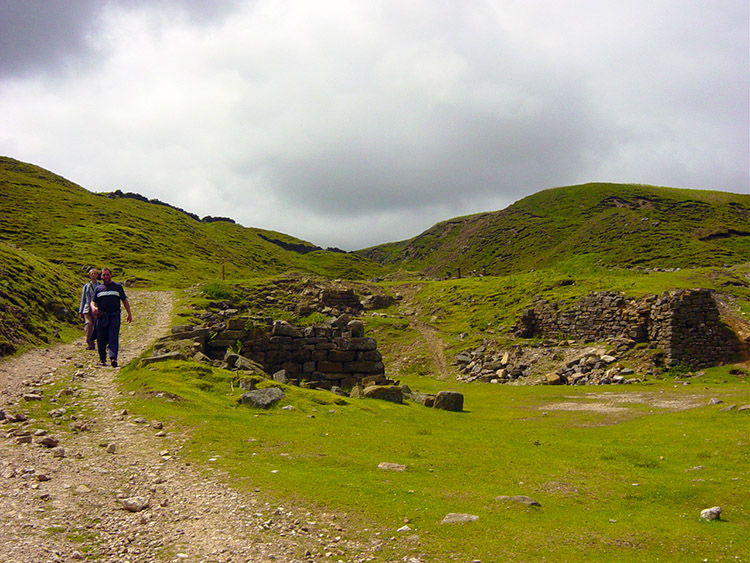 Cock Hill Mine Workings
Galloway Pasture led us to the highest point of the walk near Greenhow Hill Top. There was a shock for me waiting in the deep grasses of the pasture. I was walking serenely on just ahead of Dave and Stewart when all of a sudden there were screeches and a Grouse leapt up in front of my eyes. Almost immediately there were more flutters in all directions as young grouse scampered off in all directions. I stood still until all calmed and only after a time did I attempt another step. Then as I put my foot down another young grouse ran off alarmingly. I must have been on or very near a nest. I was so relieved I had not trod on one but by the sound of their alarm I must have come pretty close to doing so. Dave and Stewart arrived on the scene wondering what had gone on. They were slightly amused as it always seems to happen to me. After composing myself we made our way over the pasture past a host of old mine shafts and crossed the B6265 for the second time and made our way onto Cock Hill. This led us down to the disused workings of Cock Hill Lead Mine. The mine had huge reserves of lead ore and was one of the most important mines in the area in the early 1900's. The mining area is stark and eerie now but once home to washing and crushing facilities, Blacksmith's workshops and smelting works. The dereliction is a poignant and humbling reminder of the past working conditions that people endured to provide us with the essential resources needed to build this country. I read the two information boards on the site and while doing so I thought about the severity of the conditions in which the miners worked. It was a lovely summers day today and the sun was out. I have often worked in this area in awful conditions during my days with Yorkshire Water. All I had to do was to locate burst water mains and organise their repair before restoring the water supply. That was tough work when it was stormy as it often is up on the moor and I did not have to go underground. The miners of Cock Hill all deserve our utmost respect. They certainly have mine.
 Providence Mine Workings
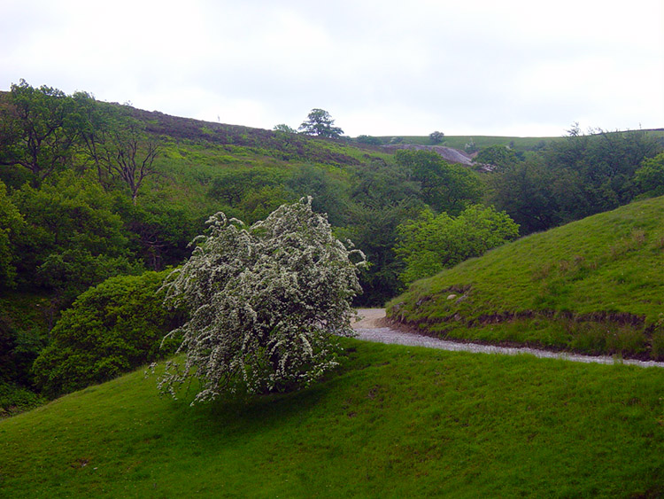 Spring Blossom
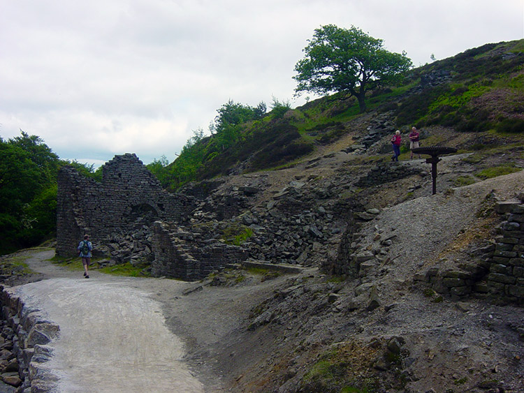
From Cock Hill Mine we walked along Brandstone Beck for a short distance then climbed up a bridleway to Near Hardcastle. This took us to the Nidderdale Way (SE121657) where we turned left and walked a short distance to our final industrial site Providence (or Prosperous) Mine. This mine is set in a wonderful location by Ashfold Side Beck and not as exposed as Cock Hill Mine although I am sure working conditions could be austere here as well. There is much more in the way of old derelict buildings probably due to the more sheltered site. It is a site to explore as many walkers were doing so when we arrived. The beck was rust red with iron colouring, clear evidence of the rich iron sources around the site. It is just a shame about the new wooden bridge which is a substantial but unnecessary eyesore on the site. The totally adequate stepping stones it has replaced over the beck were much more in keeping with the character of the place. 'To whoever built the bridge - an error in aesthetics'.
 Ashfold Side
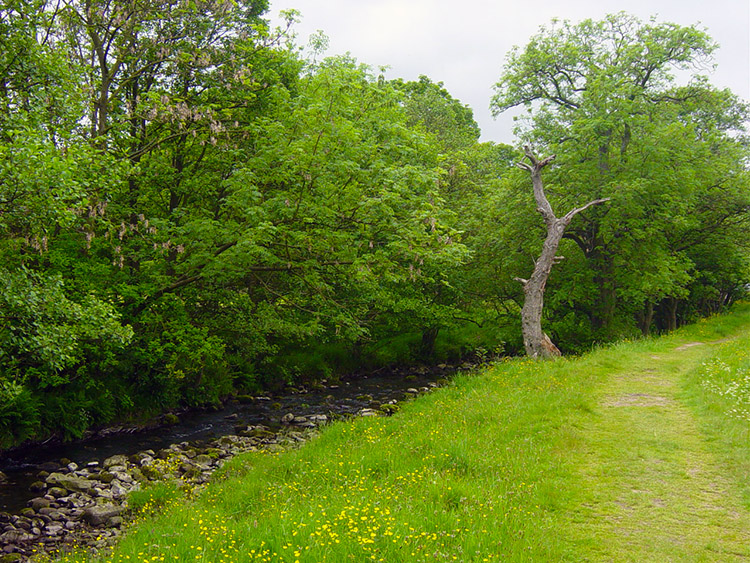 Nidderdale Way to Pateley Bridge
After surveying the mining site for another time (I always do when I visit here) we moved on over the wooden bridge, might as well use it, and followed Ashfold Side to Low Wood. As we were now on our return to Pateley Bridge we were obliged to walk though the largest of Caravan Parks that nestles by the side of the beck for quite some time until we emerged into open land at Corn Close. We then made our way across fields to the side of the River Nidd and enjoyed a short walk back into Pateley Bridge. The three of us were now a little weary but glad of our super walk. As Stewart was to say on the way home "We are indeed lucky to live in such wonderful surroundings".


