Brimham Moor, Riva Hill, Hartwith, Summerbridge, Smelthouses and Brimham Rocks
The Hartwith Heritage Walk is a delightful circular walk in the heart of Nidderdale. You can start from almost anywhere on the route which is steeped in history as you walk on paths that have been used for 100's of years. You will walk through woodland used in the Iron Age and with luck you may just find the unique 'Adams Ale' rock.
Google Maps Open Source Maps| Statistics and Files | ||
|---|---|---|
| Start: Brimham Rocks | Distance: 7.8 miles (12.5 km) | Climbing: 284 metres |
| Grid Ref: SE208646 | Time: 3-4 hours | Rating: Moderate |
| GPX Route File | Google Earth File | About Brimham Rocks |
| Statistics | |
|---|---|
| Start: Brimham Rocks | Distance: 7.8 miles (12.5 km) |
| Grid Ref: SE208646 | Time: 3-4 hours |
| Climbing: 284 metres | Rating: Moderate |
| GPX Route File | Google Earth File |
Ordnance Survey Explorer Map (1:25,000)
The Walk:
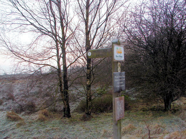 A signpost points the way from Brimham Rocks
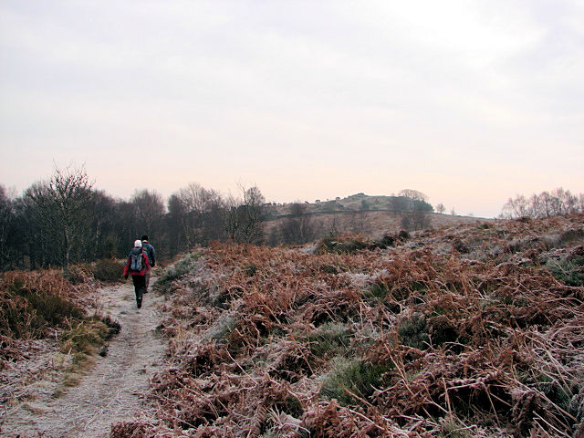 Walking east to Riva Hill
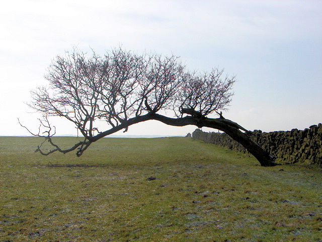
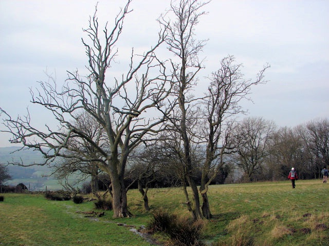
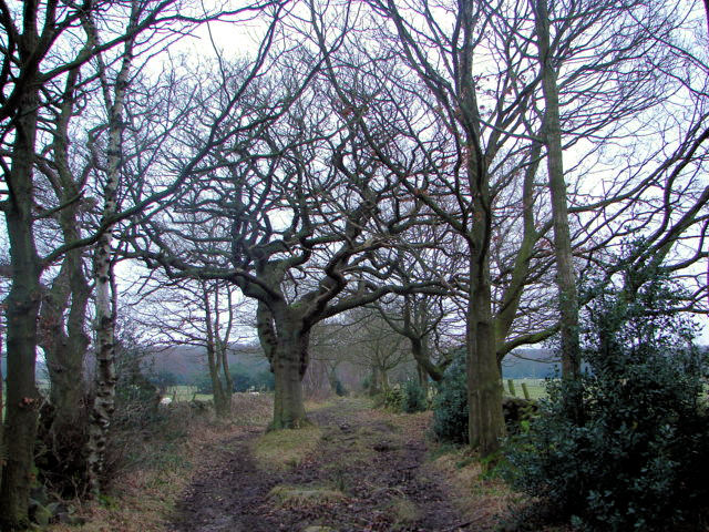
Winter walking has its attraction and although the flora is dormant there is much to admire. For example you've often heard the adage "Can't see the wood for the trees". Not so in winter, trees take on a special attractiveness as the limbs and branches are open to strict examination and as you'll see from some of the images from this walk there is much beauty to behold that for 7-8 months of the year is hidden behind a thick leafed canopy. On this lovely walk me and my walking companions Dave and Leena spent plenty of time staring at the trees. Not that the trees were the only thing to see, we had lots and lots of special moments on the history steeped Hartwith Heritage Walk.
 Walking south alongside Monk's Wall
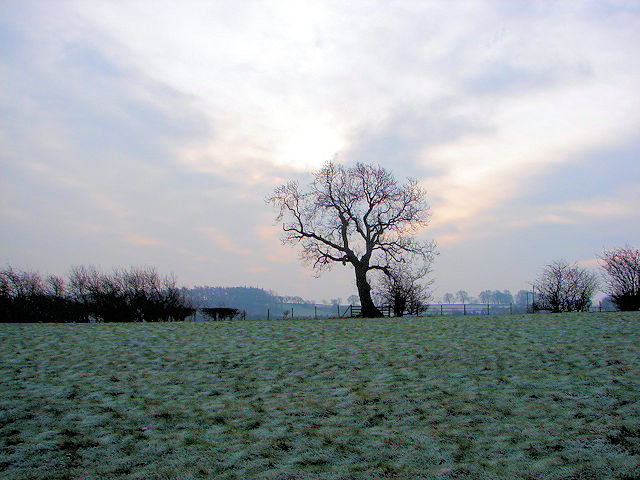 Rural Nidderdale near Brimham Lodge
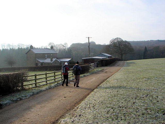
Hartwith which means 'stag wood' lies central in Nidderdale and was once part of the expansive Fountain's Abbey estate. The area has a long history of human habitation and there is much evidence found while doing the walk like Iron Age enclosures to be found in woodland that we walked through during the walk. Anyway, that's to come. Let's get going shall we. After kitting up in the National Trust car park at Brimham Rocks we headed east across lush open moorland towards Riva Hill. There had been a good deal of frost during the week so walking was good and firm with no strength sapping sinking into boggy ground. Just as well, this walk is not the toughest but as we had set off from the highest point there was some work to be done at the end. We reached Riva Hill and circled round to the north. Riva Hill is a Bronze Age site with carved rocks, the first of many meetings we were to have, some past and some present.
 Ambling towards Spring House Wood
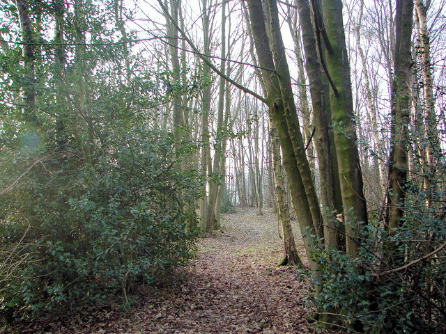 Spring House Wood
After Riva Hill we turned from east to south and tracked down a bridleway with on our left hand side the Monk's Wall. the wall has a particular characteristic of large boulders, or orthostats providing it with a solid base. A past encounter indeed and after Monk's Wall we headed to the first two very present meetings. First was telecommunications masts that were crammed into a field close to Brimham Lodge. Unsightly but not problematic. The next certainly was for after Brimham Lodge we entered a field a 50 yards on we stopped dead by an unmarked electric fence. Leena nearly walked straight into it with two wires, one at chest height and the other a belly height waiting to give the unsuspecting a nasty shock. the fence was unbroken and erected clearly across the public right of way. We all removed our rucksacks and crawled under the obstruction. Complaints were to be made. After overcoming our barrier we headed on across lovely rural Nidderdale to Spring Wood, the first of a number of delightful woods on the walk.
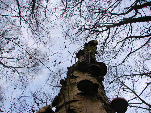 Fungi Tree
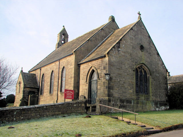 St Jude's Church, Hartwith
The next stage of our Hartwith Heritage Walk took us over open fields to the small hamlet of Hartwith. During this section we crossed our first field with sheep in. They kept their distance, as sheep do when strangers are amid them. Hartwith consists of a chapel, a school house (more like the cottage it is now) and a church. A few distant farms completed the quietest of villages. In the churchyard we viewed a few of the gravestones, poignant reminders of the past. Some were old indeed with words spelled like here lyeth and layed. After Hartwith we walked west past Prospect Farm to an old disused quarry. Then we entered another field with sheep in. Then the fun began.
 Fallen Tree near Prospect House, Hartwith
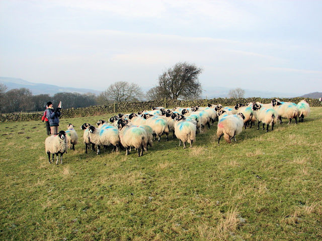 A flock of sheep pose for the camera
The sheep in the field were some distance away from us as we started to cross. Dave was closest to them and he was first to notice that they looked upon us in a curious manner. In on time at all they started to climb the field towards Dave and so he took the opportunity to photograph them. I snapped him doing so. Then we continued on across the field. Just as we did so mayhem broke out and the entire flock came right to me. These things happen now and again when out walking and that is one of the reasons I love it so much. It is clear they thought we had food for them, alas all we had was our own meagre provisions. After the Carry On Sheep moment we dropped down from fields to the Ripley to Summerbridge Road at Dougill Hall.
 Seeing the wood for the trees
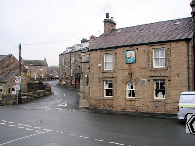 Flying Dutchman, Summerbridge
The section of the walk from Hartwith to Dougill Hall had been a detour from the official Hartwith Heritage Walk as we had planned to walk from Dougill Hall to the bank of the River Nidd and cross some stepping stones before walking alongside the river back to Summerbridge. Unfortunately at Dougill Hall the path was gone. Noticing our confusion the owner of Dougill Hall came to tell us the council had given up maintaining the path as some of the stepping stones had washed away and they were not going to replace them. I wish when they did this kind of thing they would change the blooming maps. Slightly let down we followed the road back to Summerbridge to rejoin the official trail. (Note: Due to this fact the route shown on the map between Hartwith and Summerbridge and the track files available for download show the best permissive alternative which avoids walking alongside the B6165)
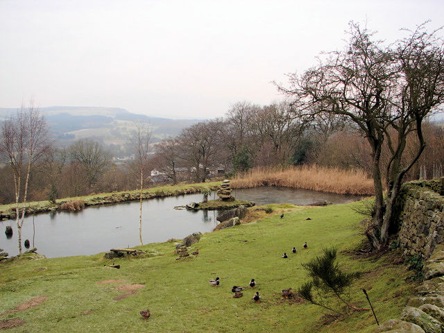 Pond near Old Spring Wood, Summerbridge
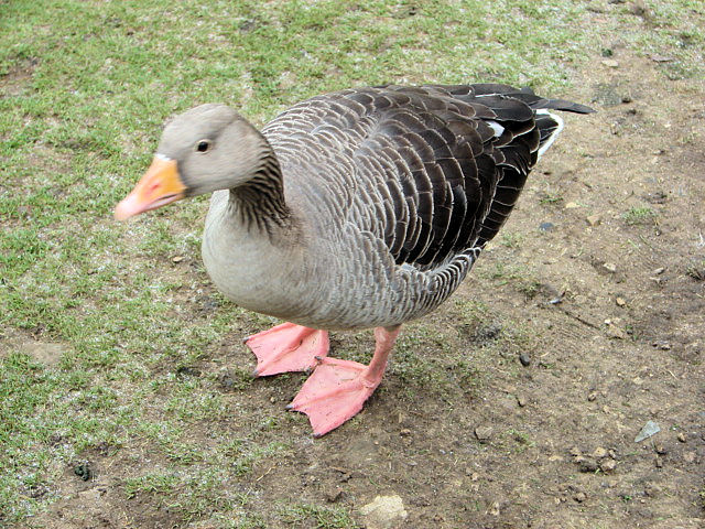 Friendly Goose
We stopped for lunch in the centre of Summerbridge and after refuelling we made our way up on the steep ascent of Hartwith Bank before leaving the road to enter Old Spring Wood. On entering the wood we passed a lovely man made pond which was richly used by Ducks, Moorhen and Geese. After spending a little time with the animals we walked through the beautiful woodland that has been managed since the iron age. In those ancient days the wood was used for grazing stock. Later on in medieval times it became a hunting ground, part of the 'Chase of Nidderdale'. now it is a quiet serene place. Most appropriate considering the sublime setting. After Old Spring Wood we walked though the smaller Braisty Woods before tracking down the quiet road towards Smelthouses.
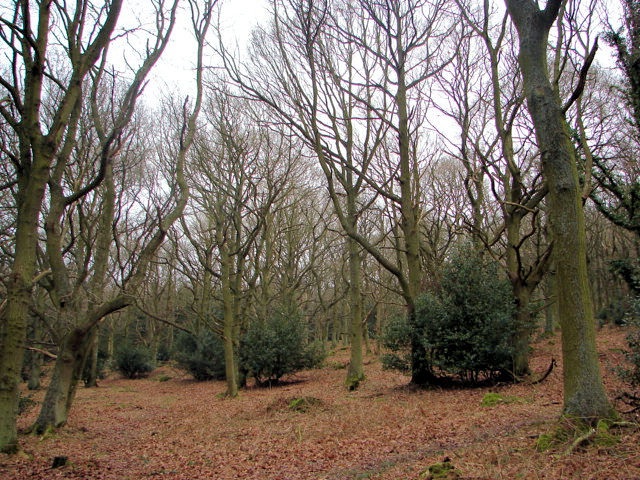 Old Spring Wood, Summerbridge
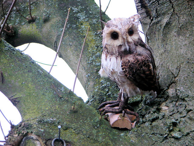 The Owl
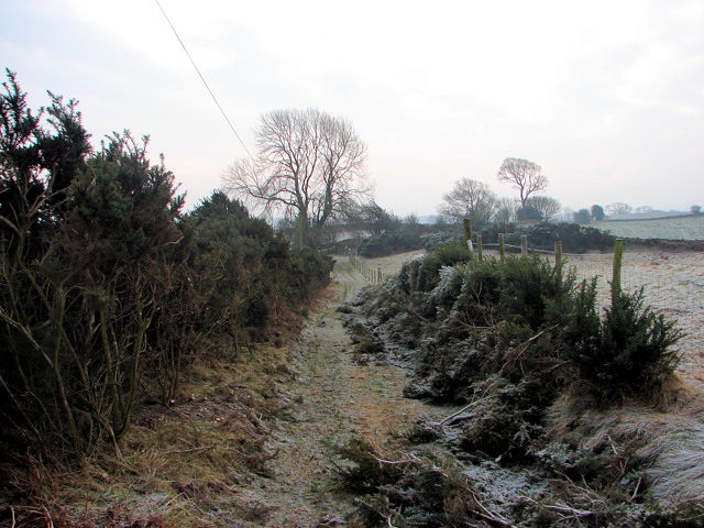
Just before reaching Smelthouses we cut right along a bridleway to Low Wood House which led us to the final and the toughest part of the walk. This final section was a sapping 100 metre ascent along Monk's Route, one of many in the area which was used by monks to access their estates.
 High Wood Bridleway, Brimham
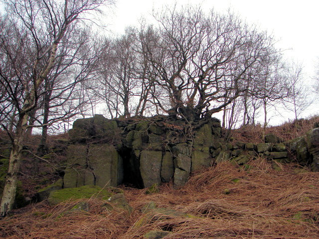 A cosy nook at Brimham Rocks
We were all a little jiggered now and so resisted the option of detouring on a track to the 'adam's ale' rocks where a boulder is carved out with Adams Ale as the spring water emerges from underground. Next time perhaps but for this walk we were done and after Monk's Route we emerged on the road just south of Brimham Rocks car park. We had enjoyed, as usual, a special walk. Heritage indeed.
Note: Some paths on this walk are not clearly marked, especially sections off the Hartwith Heritage Walk route. Navigation and map reading skills are recommended.


