Great Timble, Ellarcarr Pike, Lippersley Pike, Gawk Hill Gate and Timble Ings
This walk is predominantly across course moorland where finding yourself off track will involve a tough stomp to get back on line. However, the route follows good well used paths leading over the moor so staying true will provide a great day out and most likely you should have the moor much to yourself. I often walk these moors and most times I come across other walkers but not many. From the moor the walk leads into the managed woodlands and plantations of Great Timble Wood. Here it is best to keep to the used paths and tracks as well as the ground is rough off line. The end piece of the walk at Timble Ponds is a welcome spot to dwell and rest a while in the splendid nature scene.
Google Maps Open Source Maps| Statistics and Files | ||
|---|---|---|
| Start: Lane End | Grid Ref: SE 17044 53091 | Distance: 7.0 miles (11.2 km) |
| Time: 3-4 hours | Climbing: 235 metres | Rating: Moderate |
| GPX Route File | Google Earth File | About Blubberhouses |
| Statistics | |
|---|---|
| Start: Lane End | Grid Ref: SE 17044 53091 |
| Distance: 7.0 miles (11.2 km) | Time: 3-4 hours |
| Climbing: 235 metres | Rating: Moderate |
| GPX Route File | Google Earth File |
Ordnance Survey Explorer Map (1:25,000)
The Walk:
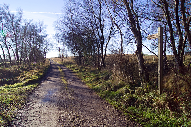 Following the left hand track after Timble Reservoir
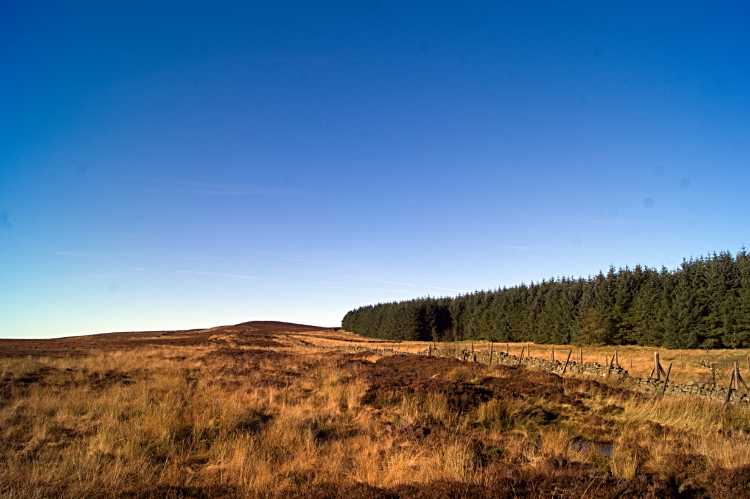 High Badger Gate path to Lippersley Ridge
I love the chain of moors nestled between the Wharfedale and Washburn valleys to the west of Harrogate. North to south they are Rocking Moor, Kex Gill Moor, Blubberhouses Moor, Beamsley Moor, Middleton Moor, Langbar Moor, Denton Moor, Askwith Moor and Weston Moor. I have walked them all and I never fail to enjoy walking on them. Especially as they are quieter than the more familiar ones nearby, such as Ilkley Moor, Embsay Moor and Barden Fell where Simon's Seat always attracts the crowds. For this walk on a late November day I chose Blubberhouses Moor as my objective, in particular the south half which nestles next to Timble Ings Wood which I always planned to visit. That would wait until the end though, my first aim the open moor. It was a cold crisp day and the sky clear over 200 metres high which meant I was clear of the fog hanging in the lower valleys. I had travelled through it down by Fewston and Swinsty reservoirs on my way over from my home in west Harrogate and risen above the cloud by the time i reached my starting point at the crossroads when Lane End Farm is just to the west of the village of Timble. Walking nostalgically down the lane past the closed potable water reservoir which was on my beat as a water board inspection in the 1980's, I was full of beans looking forward to the walk in the brilliant sunlit day. As with late November the sun was low and not shedding much warmth at all but it still brightened the lane I walked and then the moor as I steadily climbed to the indistinct summit of Ellercarr Pike. Here I looked at the familiar view of rich brown moor to my left and dark green of plantation woodland to my right. I never tire of it. In between a dead straight line path pointed my walk on the High Badger Gate path to Lippersley Ridge.
 The house at Ellercarr
 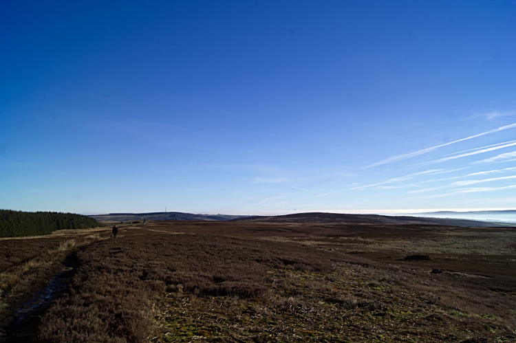 Norwood Edge and fog hanging in Wharfedale
I had started out late, inspired to walk while listening to the weather forecast over breakfast and therefore by the time I had walked the first mile to Ellercarr Pike it was already afternoon. All was still as I looked over to the two remote houses at Ellercarr. A winter pond had formed in front of the nearest house which is not there in summer. At Ellercarr Pike I had climbed the first fifty metres of the constant one hundred metre climb from the start to Lippersley Pike. The second fifty metres would be gained following the High Badger Gate path which I now followed. Climbing on the three hundred metre line I looked east to the Norwood Edge Transmitter above Washburn valley which now appeared clear of the early morning fog. However, even in the height of this short winter day fog was still hanging in the Wharfedale valley further south. Otley and Ilkey were down there, probably fated to be fog bound all day. A shame, it was brilliant up here. The sun was at its highest in the sky this day and that was not much and as a result the sky was the deeper blue of winter. White jet streamers were vividly clear in the sky. The vapour trails can clearly be tracked long after the aircraft that made them has disappeared from sight at this time of year.
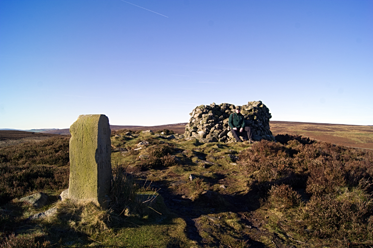 Cairn standing on Lippersley Pike
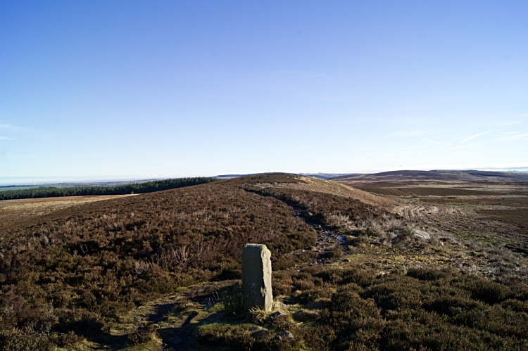 The path leading to Gawk Hall Gate
I reached Lippersley Pike at a quarter to one in the afternoon, a little over one hour into the walk. A large round shelter cairn stood on the summit ground. I bet a few people have sheltered in it on cool windy and inclement days. That was no necessary today. It was cold but it was still with hardly a breath of wind. Near the cairn was a standing stone which was inscribed, reading 'II KF 1767'. A writer called Grainge wrote in 1871 "The cairn is an ancient marker along the boundary line marking the townships of Denton and Great Timble". Possibly, I think it as likely that it was a shooting estates boundary marker as many are on these moors. In fact boundary stones are regularly placed in a straight line all the way from Lippersley Pike to Gawk Hall Gate and continuing on to Round Hill which is a possible addition to this walk if you are feeling chipper enough. Next on this walk though, while walking on the path from Lippersley Pike to Gawk Hall Gate I arrived by another standing stone, not a boundary stone this time. This one is an old milepost reading "12m to Rippon and Ilkley 3m". It was near the milepost when I reached the high point of the walk, Gawk Hall Gate, at 335 metres.
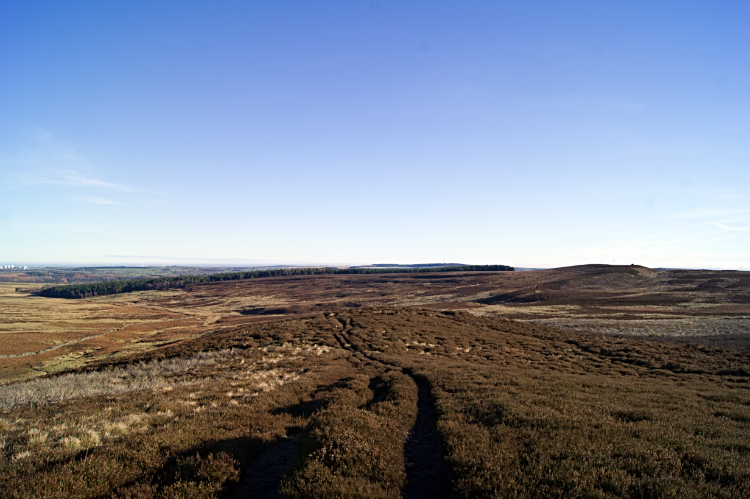 The way across Sug Marsh
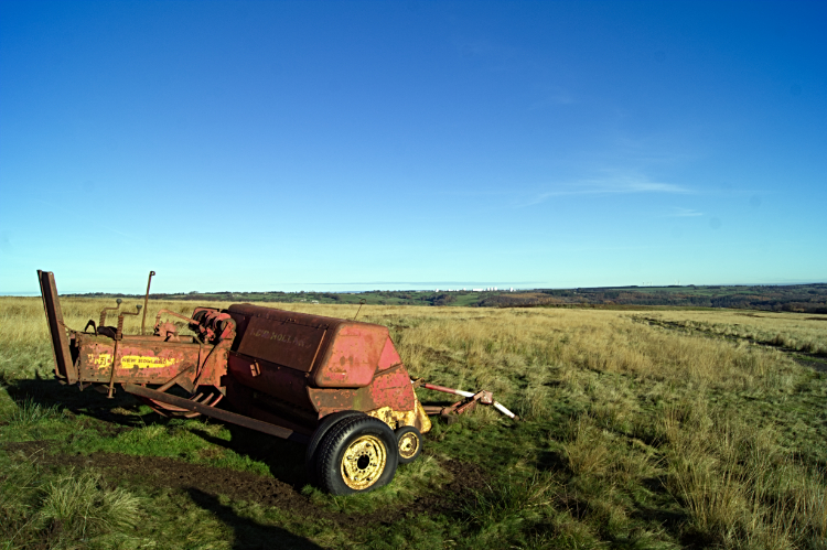 Hay baler on Blubberhouses Moor
It was downhill for a while now, on the moor at least and until I reached the woodlands of Timble Ings. The first half mile of descent was on a path to be kept on as either side would spring me into the mossy and boggy ground of Sug Marsh. Here the heather was thick and course and patches of sphagnum moss were not to be toyed with. The marsh led to more firmer ground made so by people from another land. I was now following the roman road on Blubberhouses Moor which I had last stepped upon during a Fewston Reservoir, Blubberhouses Moor, Kex Gill Moor and Washburn Valley walk about ten years earlier. I remembered passing the 'No motor vehicles' sign on the previous walk as I walked by this time and I recalled seeing the Eagles Stone marked on Ordnance Survey Explorer maps but I could not recall seeing the Hay Baler I next came to be the side of the roman road. It seemed in an odd place but there was wispy high grasses on the firmer ground around the piece of farm machinery. Even in late November so perhaps there is a use for it up here in spring and summer.
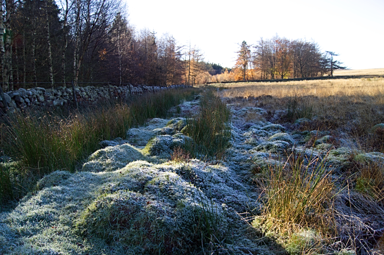 Frost stays where the sun does not get
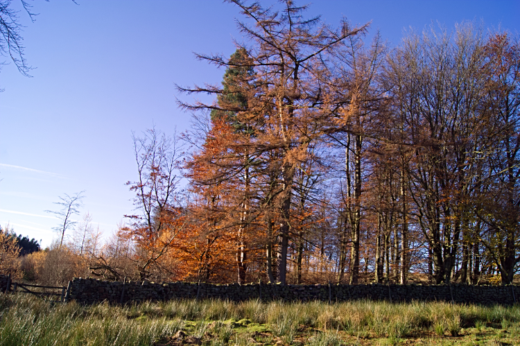 Entry point to the golden woodland of Timble Ings
Just after passing the hay baler I left the line of the roman road, following the path marked on the map but not showing on the ground to roach the map marked place giving entry to Tingle Ings Wood. The mossy ground by the drystone wall edging the woodland was still frosted. Very little sunshine gets to thaw this patch of ground in winter. Finding entry into the woodland at the marked spot was not to be found so I tracked west along the wall to reach a gate giving me entry. Hence the S shaped route wandering on the map and route files. The sheltered trees of the woodland were still holding on to their last leaves of the year, all now in their last seasonal colour and glistening a golden brown in the sunlight.
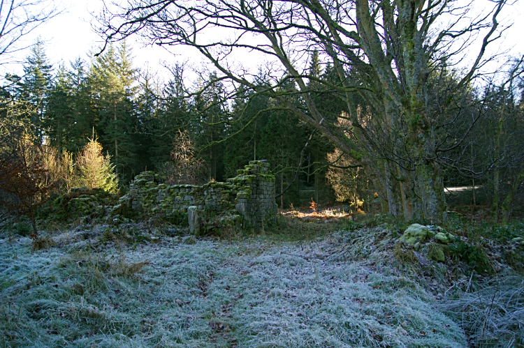 Derelict buildings at BSs near Gill Becks
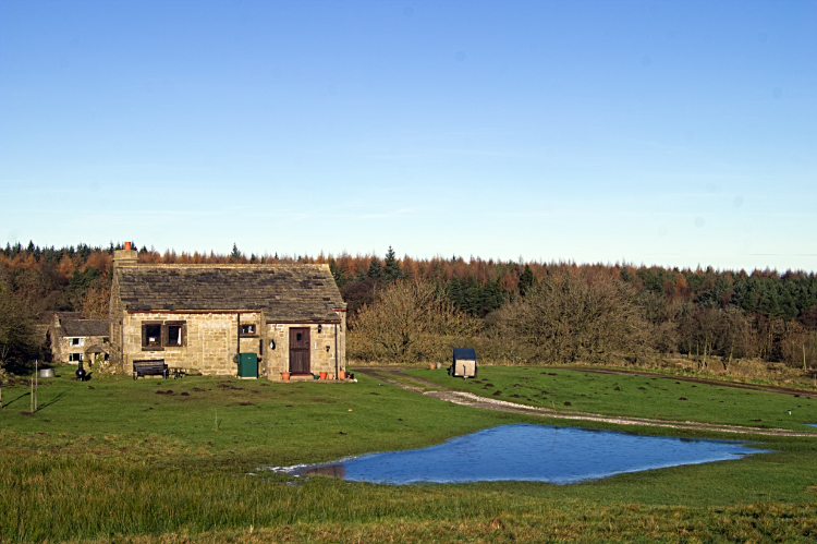
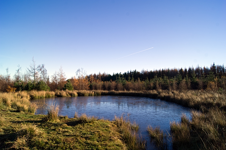 Timble Ponds
Within Timble Ings I followed an avenue, not really a path, but negotiable. In the effort to find a good path or true track which should be there as the map showed. It was not too long and never really difficult to find as I happened upon a substantial scattering of derelict buildings at the point marked BSs near Gill Becks on the Ordnance Survey Explorer map. There is no indication as to what they once were but it is clear they were substantial. There appears to be a main house and out buildings. Perhaps a forest keepers home? From the derelict buildings I followed the good track leading west and then south through the main managed forestry plantation to the Timble Ponds which are the result of a wildlife conservation project by Yorkshire Water. These upland ponds are popular by local wildlife enthusiasts. Timble Ponds are particularly rich in Dragonflies. Not that any were to be seem at this time of the year though I am sure their nymphs will have been busy growing under the water. After passing the ponds I followed the track back to where I had forked off at the start of the walk, past my old work reservoir and back to the car. It had been a great winters day walk.


